Ranking: 4/5 Awesome views await you on a clear day from the High Divide Trail, where you will spend most of day 2, gazing south at impressive ice covered peaks on Mt. Olympus, and its attendant glaciers. Both days you will camp in nice locations near lakes, and Lunch Lake will provide dinner if you bring a fishing pole! Bear sightings are almost a given, as they graze on the hillsides filled with huckleberries. This is one of the best loop hikes the Olympics has to offer, with a variety of things to see and do!
Difficulty: 6/10 The hike itself is not particularly strenuous, and the trails are well marked. A spectacular example of using slab rock for stairs awaits you as you descend into Lunch Lake Basin from High Divide trail, so trail maintenance is also great. Covered toilet facilities also exist at both lakes, a rare departure from most backcountry camps. What might be the most difficult thing, is securing your reservation on the dates you desire!
Getting there: On I-5N, heading into Tacoma, take exit #132 to S 38th St., then keep left at the fork, and follow the signage for 16W Gig Harbor/Bremerton. This will all be about 1.1 miles. Merge left to continue on 16W, and go 27 miles. As you round the Sinclair inlet near Bremerton, highway 16w turns into WA-3N. Follow 3N for another 25 miles, then turn left onto State Route 104W, to go over the Hood Canal Bridge. Stay on 104W for 15 miles, then you will take a slight right onto the ramp to highway 101N, and stay on 101N for 36.5 miles to downtown Port Angeles. NOTE: To do this hike, you will have to pick up a permit, so, at this point, begin to look to take a left onto Race St, which will become Hurricane Ridge road, which will take you to the Wilderness Information Center, to pick up your permit. Return here, to continue driving instructions. Continue through town on highway 101W for another 28.8 miles, then turn left onto Sol Duc Hot springs road, and go 13.8 miles to the end of the road, where the parking lot and trailhead will be.
Permits: A reservation is required, for camping between May 1 to September 30. Go to the Olympic National Park Wilderness Backpacking Reservation site, then find the link to Sol Duc/Seven Lakes Basin/Mink Lake area for available sites. The Reservation link is at the bottom of the page.
Maps: TOPO Maps that you can make online, of course, or another great resource is the Green Trails Map, Seven Lakes Basin, Mt. Olympus Climbing #133S
Lightning. Thunder. Torrential downpour. Not the hallmarks of weather one hopes for at the beginning of a hike, but this is what it looked like Friday morning as we met at my house. Looking at the Doppler radar on the NOAA website, though, was cause for guarded optimism, as it showed all of the Olympics moisture free! The inundation just seemed to be here in the central sound. Which poses the question: Where does one go to avoid the rain coming down in buckets, heralded by thunder and lightning? Why, the rainforest of course!
Early morning drives prove to be the best time to avoid traffic, and the drive to the Olympic National Forest WIC station proved to be light, even though the wipers were on all the way to Port Angeles, when suddenly, the clouds seemed to part, and quit their best efforts to pummel everything existing below. In an hour, after getting our permit, we’re at the trailhead, at the end of the Sol Duc River Road.
Day 1.
9.3 miles, 4759ft gain/1800ft loss.
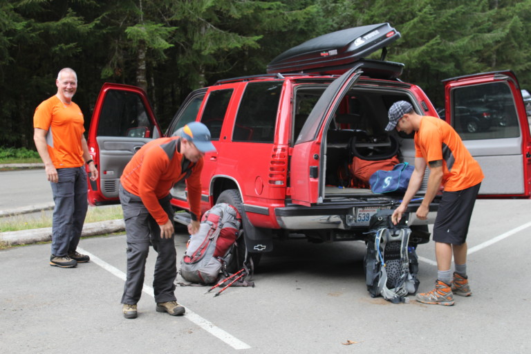
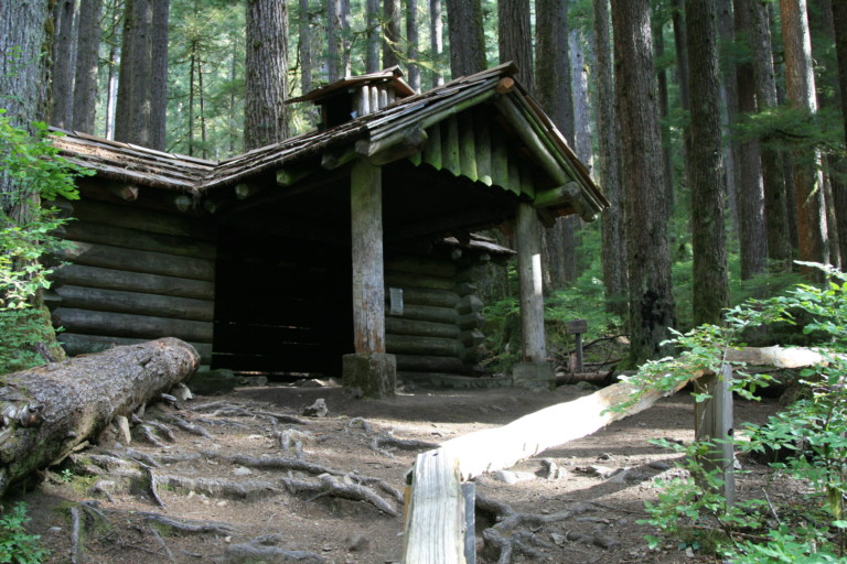
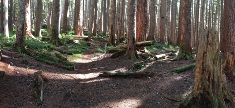
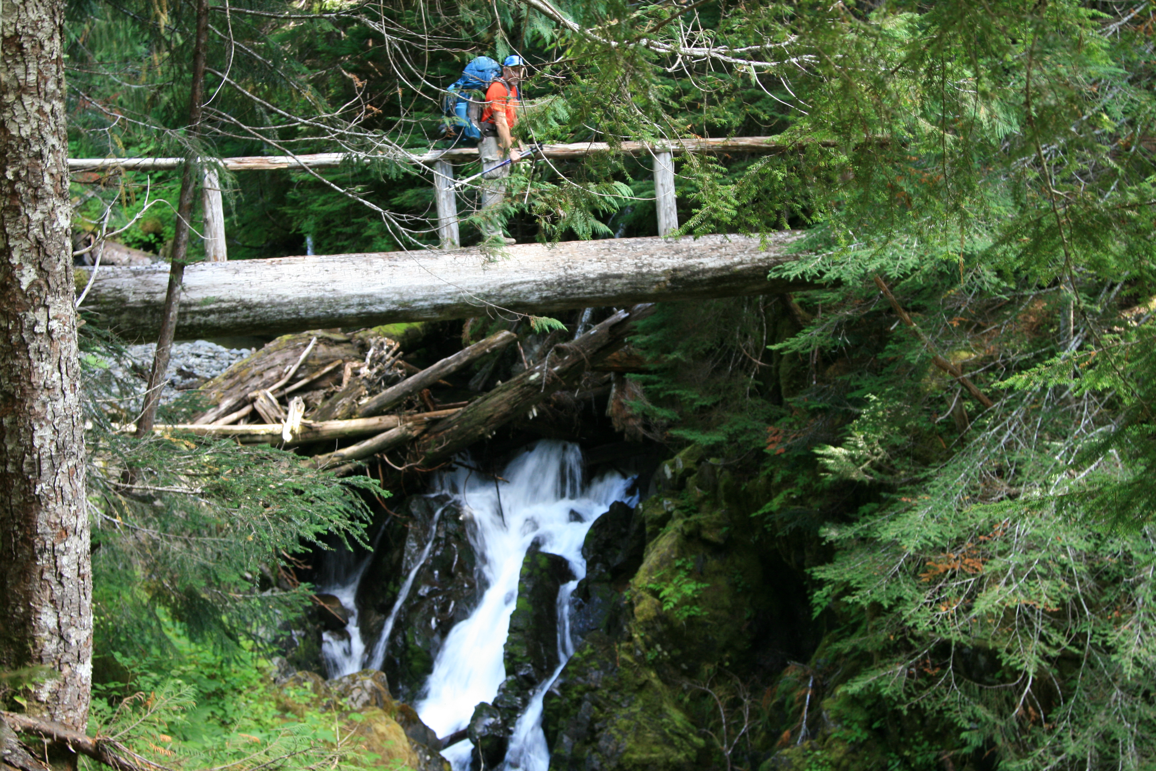
Brian, Dan, Greg, and I pile thankful out of the truck, ready to stretch cramped legs and get going, and we do just that at around 9:30, under gray but improving skies. Are we going to dodge the moisture bullet? For now, it appears the answer is yes. There are only a handful of cars, so we’re sure the rain has kept most of the day hikers away. We start this 3 day, 22 mile loop on a veritable superhighway of a trail, wide enough in places for 3 to walk abreast over fairly flat forest floor, under old growth giants. The first mile is like this, all the way to the Sol Duc Falls viewing platform, one of the better forest walks I’ve ever been on, a shining example of the best a rainforest has to offer. At our junction to the 7 Lakes basin, is a shelter that reminds me of an old fairytale, an unexpected log cabin in the heart of a shadowed ancient forest. Surely a nice place to get out of the rain. The trail continues through the old growth, always within earshot of the Sol Duc River and it is an impeccably maintained path, flat, smooth and stair stepped when needed.
“Yeah, you know the guy with the size 14 home wreckers?”
I’m fairly certain that there is a hornet/wasp hotline where information is exchanged, and the fact that I was the only one to emerge unscathed from our last trek, did not go unnoticed. “Yeah, you know the guy with the size 14 home wreckers?” Well, if you see him again, make sure he gets the message that his big feet are not appreciated…”
Barely an hour into the hike, a lone gunman, a sniper of a hornet, delivered the message…Retribution for having missed all the fun last week….Thanks for not letting me wallow in remorse for feeling left out…
“… white veils slipping through moss covered rocks into small pools at their base…”

As the trail skirts the river here, there is an occasional drop in the narrow slot the river runs through, which creates small waterfalls. We stop at a couple that are particularly photogenic, white veils slipping through moss covered rocks into small pools at their base. The waters gather speed again as they leave the relative calmness of the hole, turning white again as they follow braided paths through jutting rocks downstream. One is of particular girth and height, and surely often photographed, as the trail provides a pull out to a viewing point for pictures.
The miles pass quickly over such easy terrain, as it moves gradually upwards, towards the final crossing of the Sol Duc. It’s a single log bridge with one rail, over a canyon that is at least 20 feet off the river below. Once across the bridge, there’s a nice flat campsite under the ever present old growth, and proves to be a good place to stop and take a quick break to power up before beginning the more insistent grade ahead. From the river, it heads up through smaller trees, switch backing up towards Sold Duc Park, and the campsites scattered about here. It’s near the campsites that we surprise a small covey of grouse, and one stands still just a few feet from where we’re standing on the trail, making soft cooing calls. She never runs or takes flight, allowing us an opportunity to take a few snapshots of something besides trees and running water…
“…to be on the look-out for the bruins…”
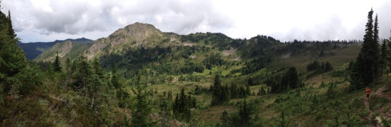
I’m surprised by the amount of campsites, and there are many along this stretch of trail, through the old growth, below the point where fires are permissible, at 3500 feet. Finally, the large firs and cedars begin to give way to the smaller alpine firs and more diminutive cedars, growing in small clusters here and there. The open areas in between are hilly meadows. Free of the trees near the 8 mile mark, we can now see the ridge line, sweeping short grass fields line the slopes all the way from the bowl to the top, interspersed with small stands of fir. It’s along these slopes as we near the lake that there are also large clusters of huckleberries, now ripe, and the size of large blueberries. They are ripe and sweet, and it’s worth the time to stop and taste the fruit. We’ve been told that these large fields of berries are favorite foraging spots for bears, and to be on the look-out for the bruins, as there are almost daily sightings of them, harvesting the juicy berries.
“…open views across the valley we just came up, Dan spots the bear…”
Finally at the lake, we see our first ranger, and after checking our pass, we find out we’re the first ones to show up for the day. Perfect! We explore the possibilities, and we find what we think to be the best site, perched on a knoll above a small tarn above the lake. It’s surrounded on the north and west side by trees, cupped around the site like a large protective hand, the site is large and flat, accommodating 2 tents easily. It’s from this high vantage point, with wide open views across the valley we just came up, that Dan spots the bear. We watch if for some time, wanting to get pictures, but the video camera is the only thing that can really reach out and bring it close. Hope the video turns out…
After setting up camp, it’s time to wander back down to little Heart Lake for water and a few pictures. True to its name, Heart Lake is indeed shaped like a heart. It’s small and shallow, surrounded by grassy meadows that run out steeply from its banks, uphill to the ridgeline. There is a ranger station here, and a completely enclosed outhouse, with door and a roof! An unusual and welcome sight in the backcountry. As it’s fairly open here around the lake, it appears it may be a necessity, on order to keep the area as free of waste as possible.
Greg whipped up another culinary masterpiece, using freeze dried beans and a nice, delectable gravy style sauce to smother them in, which went well with the mashed potatoes and noodles.
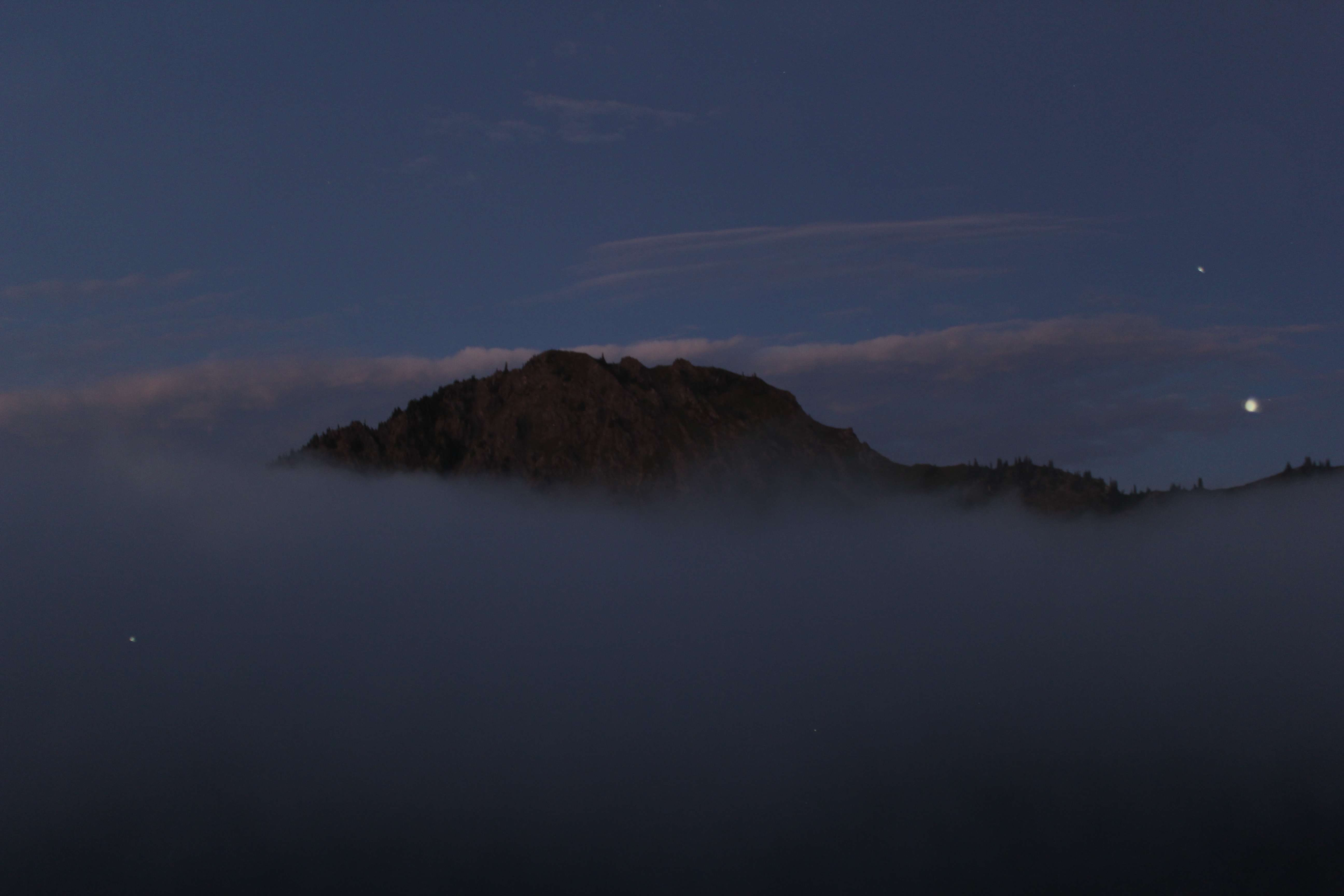
The later it got, we kept watching the low clouds drift over the edges of the ridge line above us, creeping lie witches brew down into the valley, occasionally even engulfing our knoll, but never for long. Then, it would clear and drift back in again, like the ebb and flow of the tide.
Night now and we enjoyed our favorite libations, whiskey sours for the 3 of us, and wine for Dan. We spend the rest of the night before turning in reminiscing of trails hiked in the past, and the experiences shared, as well as just catching up on what’s been happening in each other’s busy lives. Time moves by so quickly…