Ranking:2/5 I struggled to give this a better rating, but in the end, I felt for all of the effort expended to get to the few places that were worthy to see, this was the best that I could fairly give. Lots of trudging on this one, and the few times you were able to see Glacier Peak, and some of the distant snow capped peaks to the west, didn’t really make for one of those hikes that you could classify as one to remember…Lake Sally Ann is a small lake, not very many viable campsites, and just not that scenic, I didn’t think…
Difficulty:7/10 There is simply no avoiding the fact that this is a long hike, lots of miles to get to a few vantage points where you could see.Yep…If you have read some of the other posts, this begins exactly the same way, so thought it fitting that I leave this description the same….Lots of trudging long miles just to get to a view…And the brush….Whacking your way through brush that at times was head high, getting stung with nettles, and raked by blackberry thorns, well…Not high on my list of things I like…The trails are fairly easy to follow, so that’s one plus…
Getting There: From Leavenworth, follow US-2W 15.5 miles to Coles Corner, and turn right onto 207N, and go 10.5 miles around Lake Wenatchee, and the road bends left and becomes Little Wenatchee River Rd, follow this for another 6.1 miles to NF 6500. Turn right, and go 6.3 miles and then road becomes 65 Rd. Stay straight, and continue on 65 Rd to the end, another 2.8 miles to the end.
Maps: Green Trails #144 Benchmark Mt, or create a MyTopo map of the area.
Permits: NW Forest Pass, or equivalent for parking at the TH.
Cady Pass, Lake Sally Ann, to White Pass GPS added 9-25-17
We have not explored the Glacier Peak Wilderness much, due to road and trail washouts, fires, and the like, so we scheduled this one early in the season in hopes of mitigating some of the fire season problems, and we couldn’t have planned it better, as it’s a warm, sunny weekend for picture taking.
Greg and I leave from work, pack up and head out for the trailhead at 7:00am. We decide on the route over Blewitt Pass into Leavenworth as it seems nowadays, there is so much traffic anymore on all the major roadways leading into and around Seattle, that I-405 in the morning sounds like a really bad idea.
“…or you might get your teeth rattled out…”
As it was, it was still close to noon by the time we arrived at the trailhead…What slowed us down some was the last 2 miles are over dirt road, that you better not be in a hurry to get over, or you might get your teeth rattled out…
Day 1
9.7 miles, 2985ft gain/577ft loss, fitbit steps: 26,154. The trail starts out nice and wide, as trails tend to do, close to the start, then after about a mile, it narrows down as it leads you through an old growth forest on fairly flat terrain. Under the tree canopy, it’s in pretty good shape until it reaches a clearing, usually a result of crossing wide avalanche chutes coming off the ridgeline to the north. Then, it’s a slog through deep brush, complete with Buck fern, Devils club, Salmon berries, grass, stinging Nettles and the like, all doing their best to
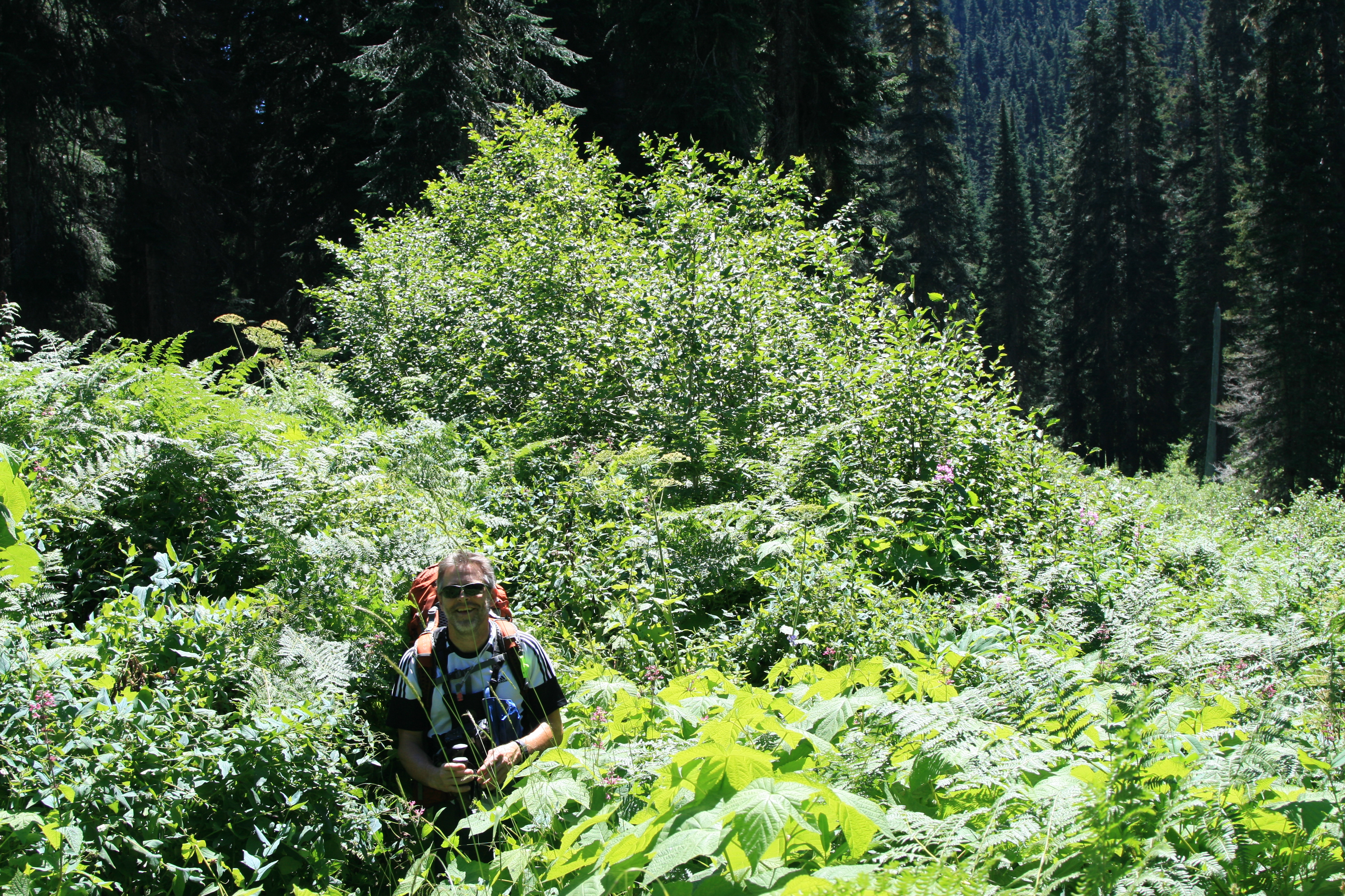
slow you down.. We counted at least 10 such snarls of brush along the Cady creek trail, that are in dire need of being brushed out…
” It was trail therapy, watching chunks of vegetation fly as I hacked at it with my poles…”

“the real fun begins, cause it’s all uphill now, with lots of downed trees!”
We reached a creek crossing and see our first people, a pair of dayhikers heading back to the trailhead. “You’re the first people we’ve seen all day!” she announced. After the amount of bushwhacking we’ve been doing, it’s little wonder that we are, most sane people probably would have bailed after the first couple sessions of brushcapades…After a few more exchanges, she tells us as we cross the creek, “the real fun begins, cause it’s all uphill now, with lots of downed trees!” Gee, could she have been anymore cheery?
Greg replied, “Good, we’re looking forward to it!” Which garnered a look that told us she thought he was completely off his rocker…
“One way is not too bad, the other is Armageddon!”
Have to admit, though, she was right. The trail did begin an insistent uphill, over many downed trees. In places, the trail was pretty rough and in need of some attention, but not hard to follow, except for a brush section or two…at mile 5.47, we reach the junction with the PCT, and good signage here points the way, and as soon as we step onto the trail, we’re greeted by a trail crew member. “Hi, “she says, “which way are you headed?” she continues, “One way is not too bad, the other is Armageddon!” We both look at her thinking the trail up wasn’t in that great of shape, still, we point uphill, hoping that Armageddon is behind door #2….”Ah, that way is Armageddon!” So named, she tells us, because of the amount of downed trees in the trail. And, she adds with just a touch too much enthusiasm, as if that bit of good news just wasn’t enough to brighten our day, “it’s pretty steep for the next mile and a half, as you’ll probably gain another 1000ft!”
“Oh, perfect”, we mutter, then thank her for this little tidbit. Did I forget to mention it’s about 90 plus degrees out, and we haven’t slept since yesterday?
We talk for a few minutes longer, thank her and her fellow crew members for their hard work, and continue our slog uphill to Armageddon…
Sure enough, there’s lots of blowdown, and we clamber up, over, under, and around the carnage. I believe we’ve created a new Crossfit routine, called the “weighted pack obstacle dash till you puke”….Ok, I didn’t puke, but that doesn’t mean I didn’t feel like it….
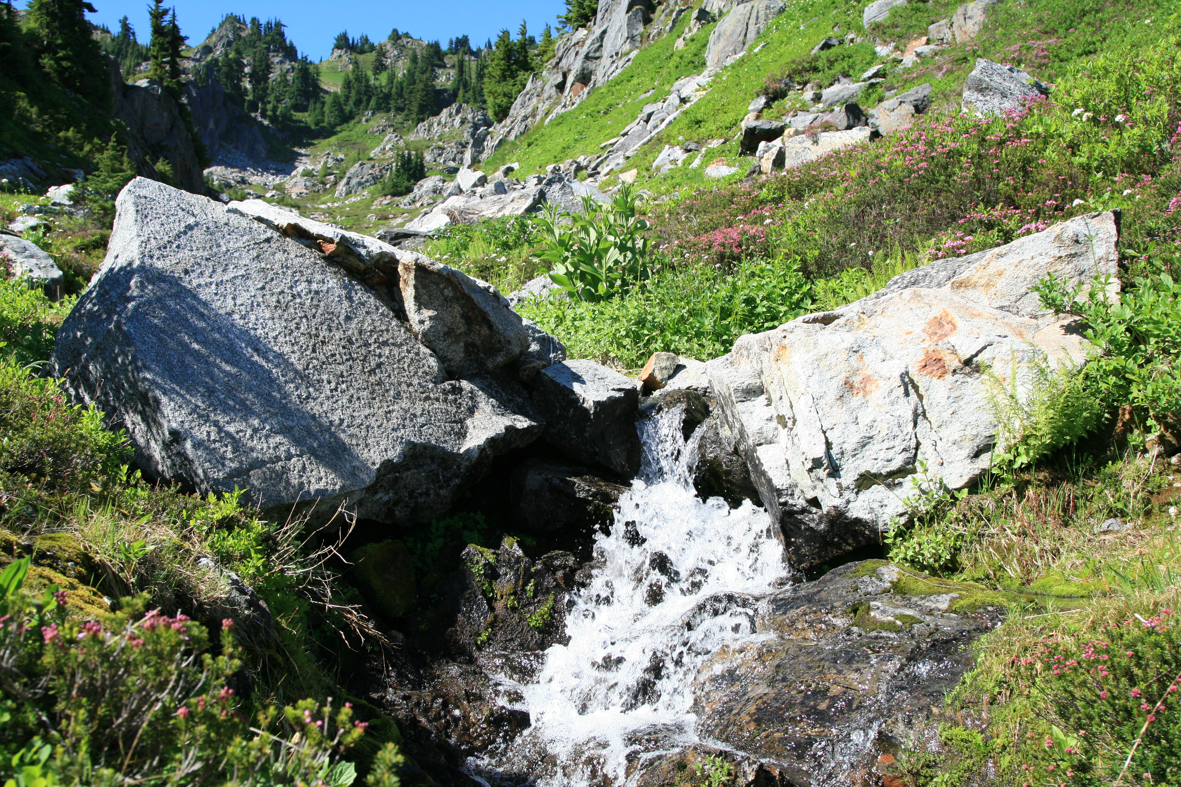
The trail continues up and up for another 1.8 miles until the forest begins to thin, making room for open hillside meadows, at about mile 7.3. Lots of color in places, bright pink heather dots the grasses, mixed in with lots of Huckleberry and Mountain Ash. Purple Lupine, purple Aster, yellow Daisies, and a few other white and yellow flowers help to fill out the color spectrum. Finally, we can see opposite ridgelines and the snowcapped apex of Glacier Peak off in the distance. The rest of the way to Lake Sally Ann is like this, open meadows with sparse copses of trees dotting the steep hillsides.
In the distance, as we get closer to the lake, we can see many jagged peaks covered in snow, and they fire the imagination. I wonder what their names are, and if there are trails that will take us closer, for they look intriguing, to say the least, snow still covering their flanks, and sheer rock walls rising up above the green ridges that lead up to them…Once returning home, I look on the map, and see that indeed, there are trails into these peaks, as we’re looking west to Monte Cristo and Columbia peaks, to name a few. Places we have been before, I’ve just never seen them from the east before…
“Are we there yet?”
By mile 8, legs are weary and feet and back have had enough, and I feel like the 8 year old in the back of the family station wagon… “Are we there yet?”
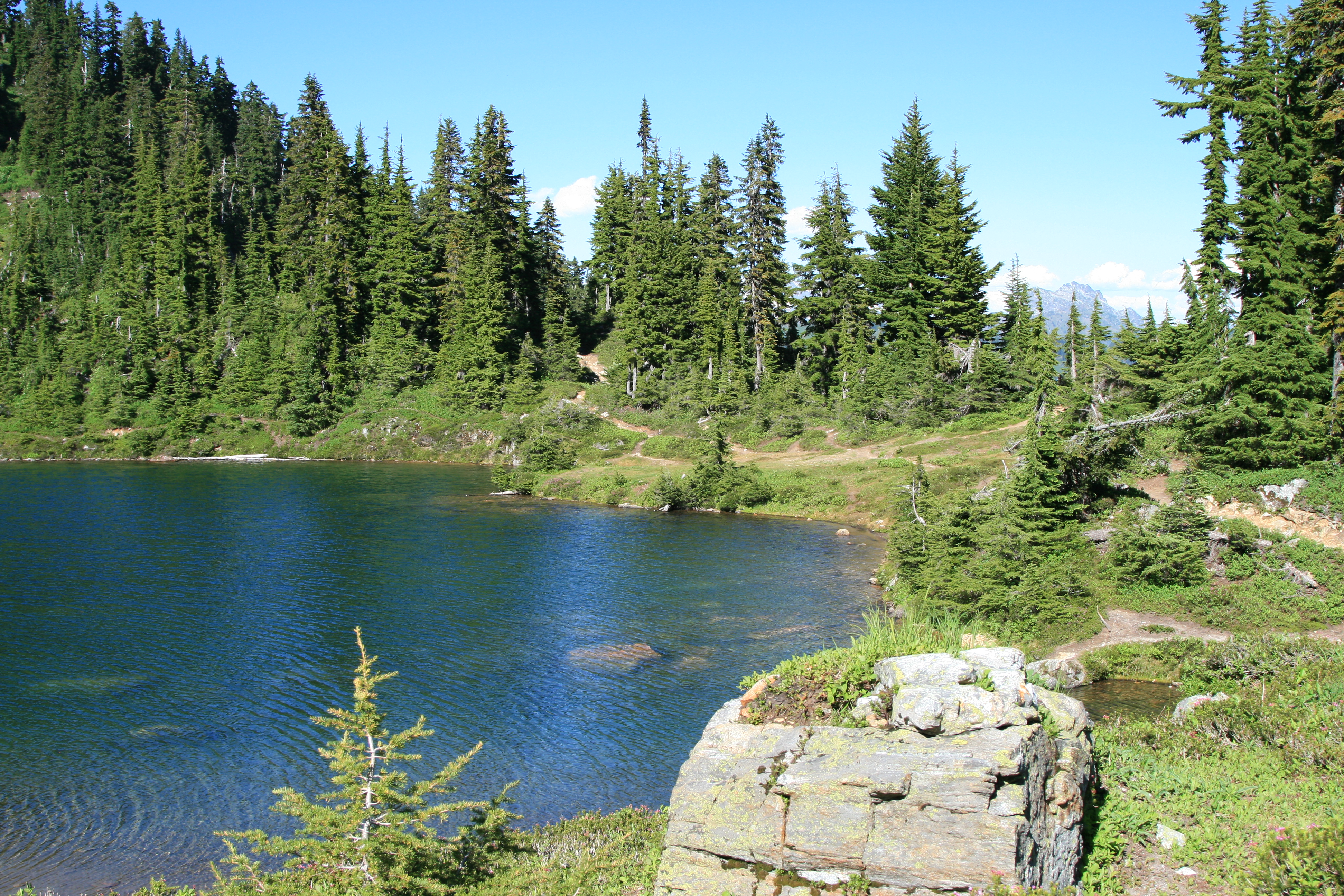
Finally, prayers are answered and we roll into Lake Sally Ann around 4:30pm, and I can’t get the pack and boots off soon enough…We lounge around for a bit before starting dinner, letting our bodies uncoil before heading down to the lake. The wind is blowing at a good clip, and it’s because of this that we only venture into the lake up to our knees and splash water on our bodies to clean some of the trail grime off. We figure we only have a couple hours of sunlight left and with the wind whipping up the surface of the lake; it leaves you pretty cold when you’re wet.
The lake is a small, blue lake tucked up next to a rock face that juts out from the surrounding hillside and has an outlet stream on its SE bank where there’s a small grassy bank. The PCT continues on along this side of the lake, and because of overuse here where there are good flat places to pitch tents, many of the sites are closed for restoration, which does limit the amount of viable spots close to the water.
“Hey, Spike, these guys are spicy, a little zesty with the nettles…”
There’s also a toilet here, a wood box with a self-closing lid, just down the hill from the banks of the lake. There are actually fish jumping here feeding on the massive amounts of skeeters bobbing above the water’s surface, like huge pulsating bait balls. If only they could feed on the ones here on shore, there are clouds and clouds of mosquitoes hovering; just waiting for a tasty snack of hiker…We’re sure that they’re drawn to us, as having walked through the stinging nettles seems to have only been seasoning… “Hey, Spike, these guys are spicy, a little zesty with the nettles, try one out!!” Needless to say, they’re bad…
After dinner is done, a few nips of Fireball (I’m sure only adding to our tang for the little bloodsuckers) and we roll into our bags, done for the night.