Day 3
9.7 miles 2307ft gain/2249ft loss. At least, last night, we didn’t get rained on, only for a few minutes while we were preparing dinner, so we wake up to a mostly dry camp. Eating and packing, we head out on Trail #697 towards the junction with the Bell Pass trail, and it’s mostly downhill along the outlet stream from Doreen Lake through large, old growth forest.

Right at .9 miles downhill from the lake, we reach the junction that turns right, with a nice, new sign, which says “Pioneer Camp” that away. So, I decide it might be a good idea to find out what Pioneer camp looks like, spaces, etc. for this trip report, and take off down the trail, sure it’s just around the corner, as there is no mileage listed on the signpost…And, I keep walking, for a good 5 minutes, before I see the trail head across the creek, and up the opposite side…
“…it’s no longer discernible where it might have once ended, so don’t bother looking for it…”
Well, I figure that the camp must be at the other end of the trail, not near the junction, so I head back to Dan and Eric whom are waiting for me. It’s not until I get home, that I see on the Mt. Baker Wilderness map that is almost 3.5 miles down this trail to Pioneer camp, which is indeed at the other end, where road #12 ends at the trailhead…The trail continues slightly downhill another .2 miles to the junction with the Bell Pass trail, #603.3. Turning left here, the trail heads uphill, and, according to the TOPO map, it shows road 12 ending on the Bell pass trail, just as it rounds a ridgeline .17 miles from the junction…Well, I’m here to tell you it doesn’t…And, as I’m sure it used to long ago, it’s no longer discernible where it might have once ended, so don’t bother looking for it.
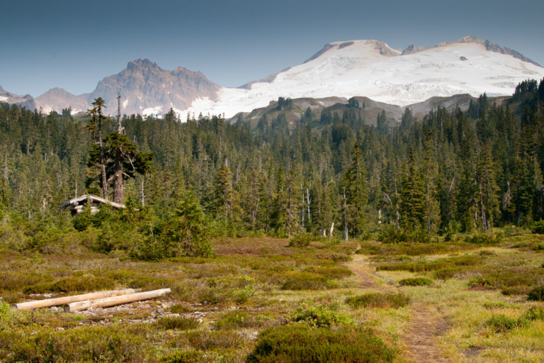
The Mt. Baker wilderness map I alluded to earlier also shows a minor gravel road leading here…Once you round this ridge, You can see the forest change, from damp, brushy, and green to a more arid forest, thinning brush, and more bare rock as the trail hugs the ridge here, and it continues like this for about a mile, before the forest changes once again to large old growth and denser underbrush until you reach pretty little Bell Pass at 3.4 miles, and 3935ft elevation.
There’s not much to see at the pass, other than a small meadow, with a marshy bit of water sitting in the middle. It’s flat for a short distance, and seeing as how you’re at a pass, you would think that it would be downhill on the other side, but it’s not. In fact, you will ascend another 738ft in the next 2.5 miles to Mazama Park once again. It’s mostly through old growth forest, with occasional openings along the rocky cliff ridge line that lead to Park Butte that allow views across the Ridley creek valley to Mt. Baker. It’s clear once more, so we get good views during the occasional clearings.
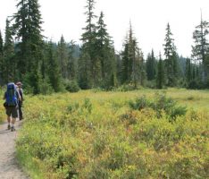
we’re disappointed to see that the smoky haze is still obscuring distant Twin Sister’s peaks…Back downhill now from the pass for about a mile, where we will turn right on the Park Butte trail, the shortest of the two trails at this point back to the car. It’s only another 2 miles down and a 1000ft of loss to the parking lot, and along this trail, we run into several day hikers, taking this shorter route to Cathedral Pass, and Park Butte.
“…I heartily recommend the hike to Mazama camp, though…”
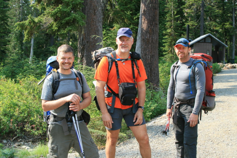
We’re all happy to be at the car, and dump packs after a long days hike. It’s been a worthwhile hike, with views that would have been outstanding if not for the constant fog and smoke that seemed to plague us throughout our journey. Also, if you intend to retrace our route, I would advise doing it soon, for the lack of travelers on the Ridley Creek trail will certainly lead to its being overgrown, to the point that it’s no longer discernible. There’s really not that much to see on this portion of the trail, anyway, and the only reason that I could see for keeping it open, is to be able to complete a loop hike as we did. I heartily recommend the hike to Mazama camp, though, and using this as a base camp to explore the region, namely Railroad grade trail that leads you to the very edge of the ice on Mt. Baker, and of course, the expansive views you will get if you make the journey to the top of nearby Park Butte.
I am happy to report that Ridley Creek trail has been re-established with a log with handrope over the river and newly placed logs spanning a few of the creeks down low. I go up this often, yesterday being the most recent trip up to the ridge above Mazama Meadows.
Thank you for the info,hopefully, people planning a hike here will read this, thanks so much for writing! Always good to hear from someone with boots on the ground!!