Ranking: 3/5 It could have been better, if not for the smoke, fog, and the 2nd day of the loop being a bit of a let down, as most of it was a downhill forest walk on a little used trail with not much to see other than trees. The first day’s views are spectacular, and if one used Mazama Park as a base camp, there would be much to do from there, hiking up the Railroad Grade to the glacier, and heading up to Park Butte to take in the awesome views.
Difficulty: 7/10 Getting here is no real problem, and one can see from the parking lot that this is a pretty popular trail. The main trails up to Cathedral Pass and Mazama Park are well marked and maintained, and the grade is medium up to the pass. From Mazama park to Elbow lake is the challenge, as the trails are NOT marked, and should be considered “unmaintained” to the Nooksack River Crossing. Great care should be exercised when crossing the river, as there are no footbridges, and year to year the trees that might be there for a crossing, may not be there the following year. Also, there is limited camping at Elbow Lake, only two good spots that we could see.
Getting there: Take I-5 north to exit 230, for WA-20E, towards Burlington/Anacortes/Skagit Airport. Follow WA-20E for 23.1 miles to Baker Lake Road, turn left, go 12.2 miles to NF-12, turn left, go 3.5 miles, and turn right onto NF-13. Follow to the end, 5.2 miles.
Permits: Northwest Forest Pass, or equivalent to park at trailhead, self-register at trailhead.
Maps: Green Trails Map #45, Hamilton, but the best map we found for this is the Green Trails Maps Mount Baker Wilderness climbing, #13S. It’s more expensive, but worth it, as it has the most accurate info on this area, better than TOPO, which we found to have some glaring holes for where the trails supposedly were…And, its waterproof and tear resistant!!!
Another weekend, and it looks as if we are gonna get lucky on the weather again! Eric Campbell, a friend of Dan’s will join us on this 3 day trek that will be a figure eight loop, that will do the “joining” of the loops over Cathedral Pass, near Park Butte. Hence, the name Cathedral Pass Loop…Calling it the “Scott Paul trail to Cathedral Pass, down to Mazama Park, then to Ridley Creek, to Nooksack, back to Elbow Lake, Bell Pass, back to Cathedral Pass, then the shorter leg through Schriebers Meadow” Loop just seemed too wordy…Even for me….
We strike out early, wanting to beat the traffic through Seattle as this will begin as a long road trip, just a little over 3 hours. We leave around 4 in the morning on Friday, and after collecting everyone, the drive is mostly in the dark. I keep us in the dark when I miss the I-5 interchange off of I-405, and we take a scenic tour of Everett…Still in the dark, with navigation instructions via Dan’s phone, the journey continues on I-5 north until we reach our cut-off at Sedro Wooley…Can’t believe I missed the on ramp, I blame it on it still being dark outside…
Day 1
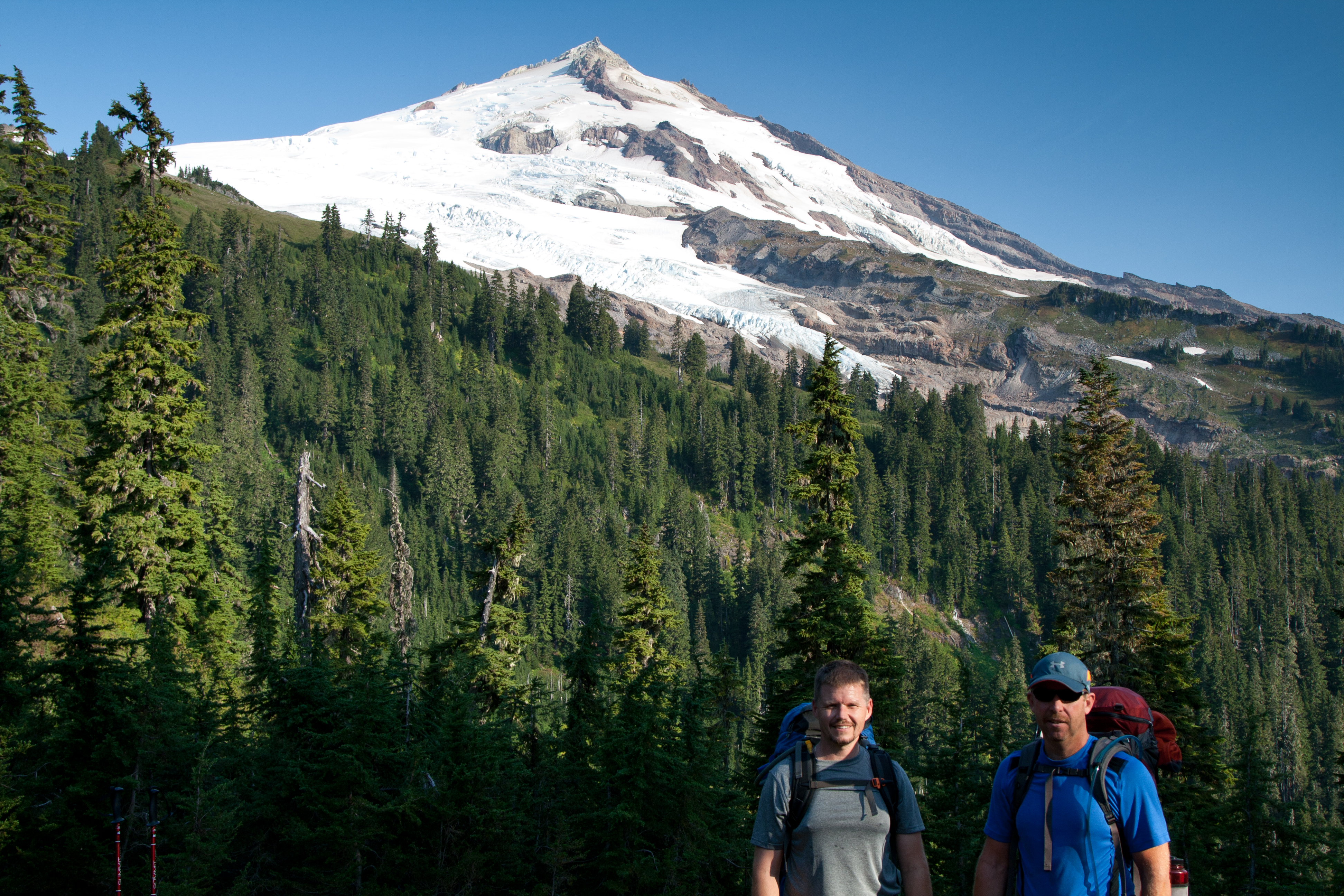
Eric and Dan at the parking lot, pre-sweat…
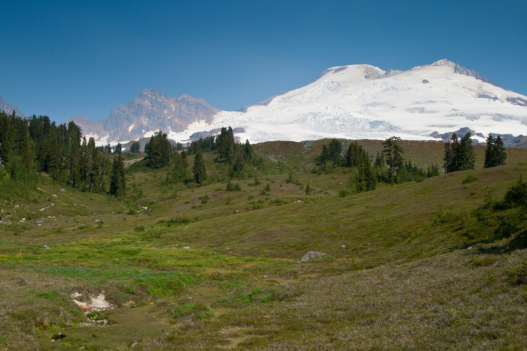
8.1 miles, 2900ft gain/1879ft loss. We reach the trailhead around 8, and are on the trail around 8:30. The first leg takes us onto the Scott Paul Trail, and it winds easily uphill through old growth firs for the first 2.46 miles, and you gain approx. 1250ft of elevation to your first good viewpoint of Mt. Baker. It’s an awesome point to stop and take pictures here, as the mountain looms directly north of this vista point, the massive Squak and Easton Glacier snowfields glimmering from top to bottom in the morning sun.
“…The sun keeps the temperature warm for the remainder of the day, evidenced by the constant sweating…”
The guys stop to take in the view of Mt. Baker at our first viewpoint
The Twin Sisters across the Railroad Grade
To the northeast, we can barely make out the shape of Mt. Shuksan, a jagged ice and snow covered peak in the North Cascades Natl. Park. I say barely make out as the current fires that seem to be engulfing a large section of eastern Washington, are providing a smoke screen that hazes distant vistas, much to our dismay. I can only hope that the fires are soon contained, for everyone’s sake. Seems to have been a particularly bad year for them…Still, the views of Mt. Baker are clear and not a cloud is in the sky! The sun keeps the temperature warm for the remainder of the day, evidenced by the constant sweating…
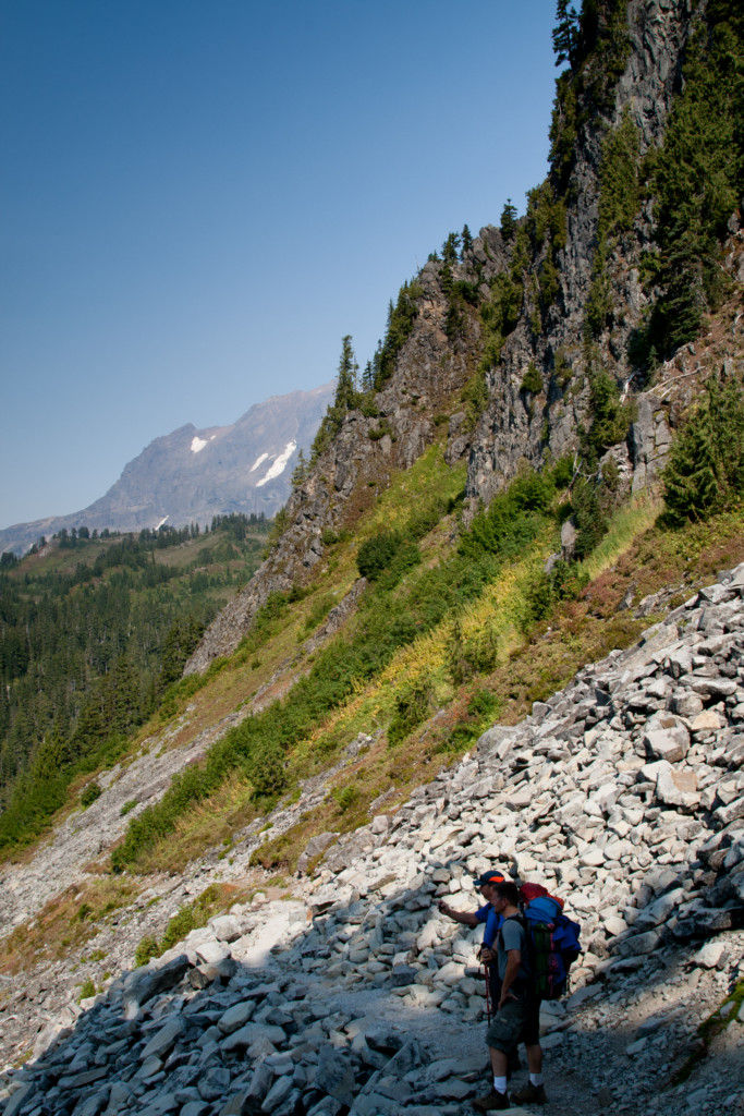
From this viewpoint, the trail ducks back into sparse trees for about three tenths of a mile, then out into the open, as it wanders uphill in zigzag fashion along the base of the Metcalfe moraine field, a jumbled mass of boulders that have piled up on the southern slopes of the mountain, to your high point along the 5200ft mark, this will be at mile 4. The slopes here are barren above covered in the large volcanic boulders, and below you, vegetation clings to the sandy and rocky soil, creating scenic slope side meadows that the trail winds above.
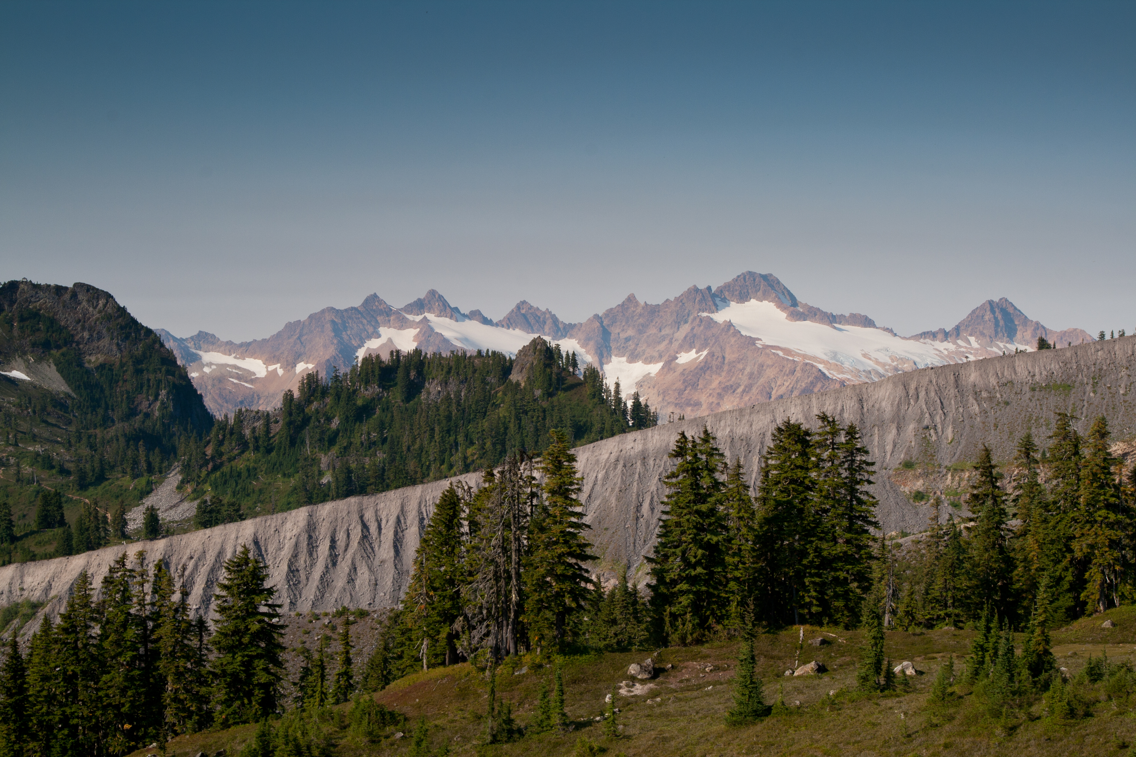
“…looks like a stark concrete wall, cutting a solid line across the skyline…”
At the run out of the Metcalf Moraine field, trees and meadows flourish
Looking further south, fog has filled the valley floor below; allowing only the very top of tree covered hills and ridgelines to poke above, making them look like small isolated islands floating in the clouds. All very scenic and open, for the next .75 miles from your high point, and then you will follow the trail down a ridgeline and across the deep wash between ridges at 5.2 miles in. It looks like an old river bed, probably from the years of spring melt that must surely rage through these parallel ridgelines, and the one opposite, as seen from the ridge, looks like a stark concrete wall, cutting a solid line across the skyline. Also, from this ridge, as you look across the top of this straight line, you can see the distant Twin Sisters range to the southwest, an impressive collection of towering, jagged peaks with glaciers at their bases.
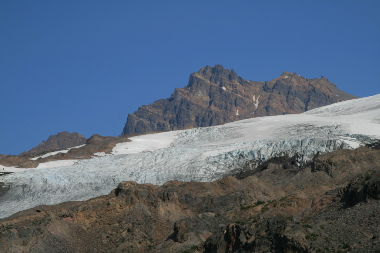
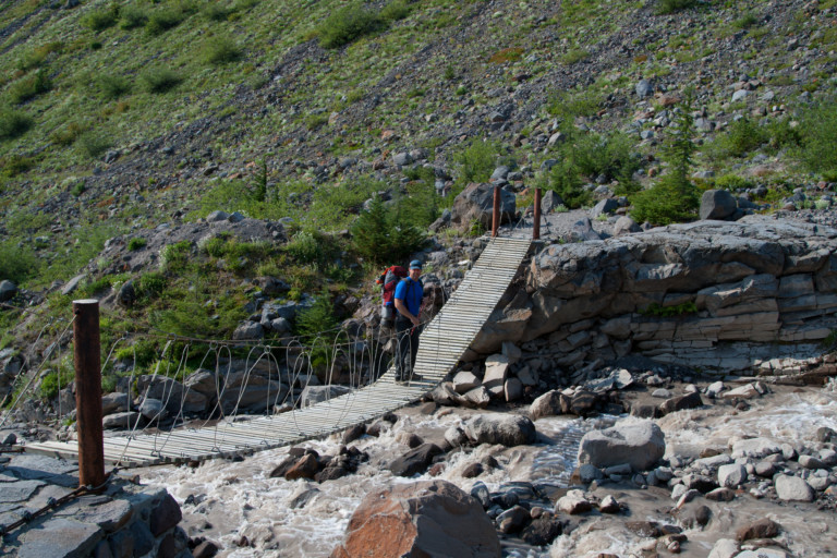
The pathway continues through the scattered boulders and rock, and leads you to a swinging cable bridge, (I say swinging, for that’s what you will do as you walk out onto its planks, grab ahold of the cable wire ways, and hang on!) Once across, you will angle across its slope, continuing your downhill trek. Looking back up mountain, the views of Lincoln Peak and Colfax Peak are now close, looking like reddish fortresses of rock in the smoke hazed distance.
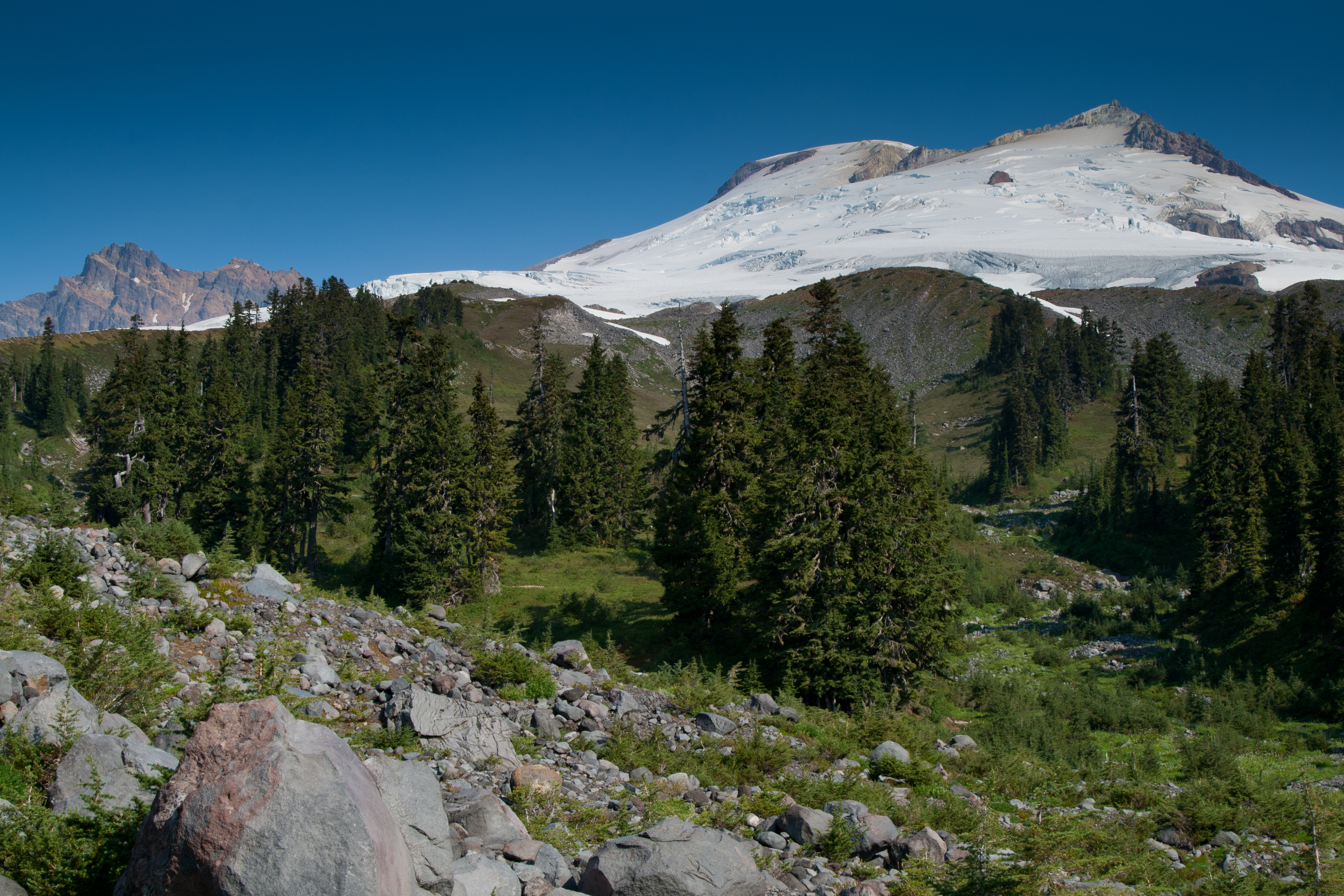
Easton Glacier with Colfax Peak in the distance
“… and stone steps leading up through the green meadows like a massive zipper installed across the land…”
Dan crossing the swinging bridge, below Railroad Grade
As you crest the end of the ridge, you will once again head into the trees, and follow a well maintained and wide trail to your return trip junction with trail #603, at mile 6.18; the sign marks the way to Park Butte. Here, you will want to veer right, and continue uphill. As you continue uphill, it’s not long and the trees once again fade, and you are out into open meadows, complete with a smattering of wild flowers still blooming late in the season.
The large, open meadows run uphill to meet the mountain, very scenic and surprising this close to such a snow and ice covered behemoth. At mile 6.6, you will see the railroad grade sign, and stone steps leading up through the green meadows like a massive zipper installed across the land. It fades from sight as it goes up over the rise and disappears from view. In less than a quarter mile, you will now reach a large flat meadow, with a small snow melt pool at its end, like the deep end of a deserted pool still holding water at the end of the summer. Looking up from the bottom of this flat meadow area, to the west, you can see the rocky top of Park Butte, and to the right of this, craggy Cathedral Crag.
“… It looks as if Cathedral Camp is dry, as it’s situated here at the base of the crag…”
Huge meadow views uphill to Mt. Baker, and Colfax Peak
The trail winds upward to gain the saddle between the rocks of Park Butte and Cathedral, on the right you will see signage directing you to Cathedral Camp. This is at mile 7.14. By now, we’ve been out in the open for hours, the sun doing its best to either melt us or scorch us, not sure which. Surprisingly, this late in the season, it’s very warm, and we’re all close to running out of fluids. Sure will be good to get to camp, and drop our packs. It looks as if Cathedral Camp is dry, as it’s situated here at the base of the crag, no water here, it’s not until later that we find the source of its water; a couple pretty tarns are further up the trail to Park Butte.
There’s also the water running out of the small snow field there at the end of the valley, shaded by the imposing shadow of the Butte, but who knows though, if it would be there year after year…The decision is made to continue down into the Mazama Park valley, and look for a campsite, then we can explore the top of Park Butte, and its lookout tower.
Heading down Cathedral Pass, to Mazama Park
The trail heads down steeply along the base of Cathedral Crag, zigzagging back and forth across its base through the large boulders and scree that has calved off the sheer rock face above. along this trail, you can look out over the park shelter and meadows below, then across forestland to the impressive peaks and pinnacles of the Twin Sisters range. If it weren’t for the smoke, this would truly be a postcard view. Even with the smoke, we have to stop and take pictures, hoping to show family and friends just how scenic this area is.
“…I unfurl my one man tent, stretch it out across the tent pad, and stand up and look in stunned disbelief…”
Mazama Park, the shelter visible in the meadows.
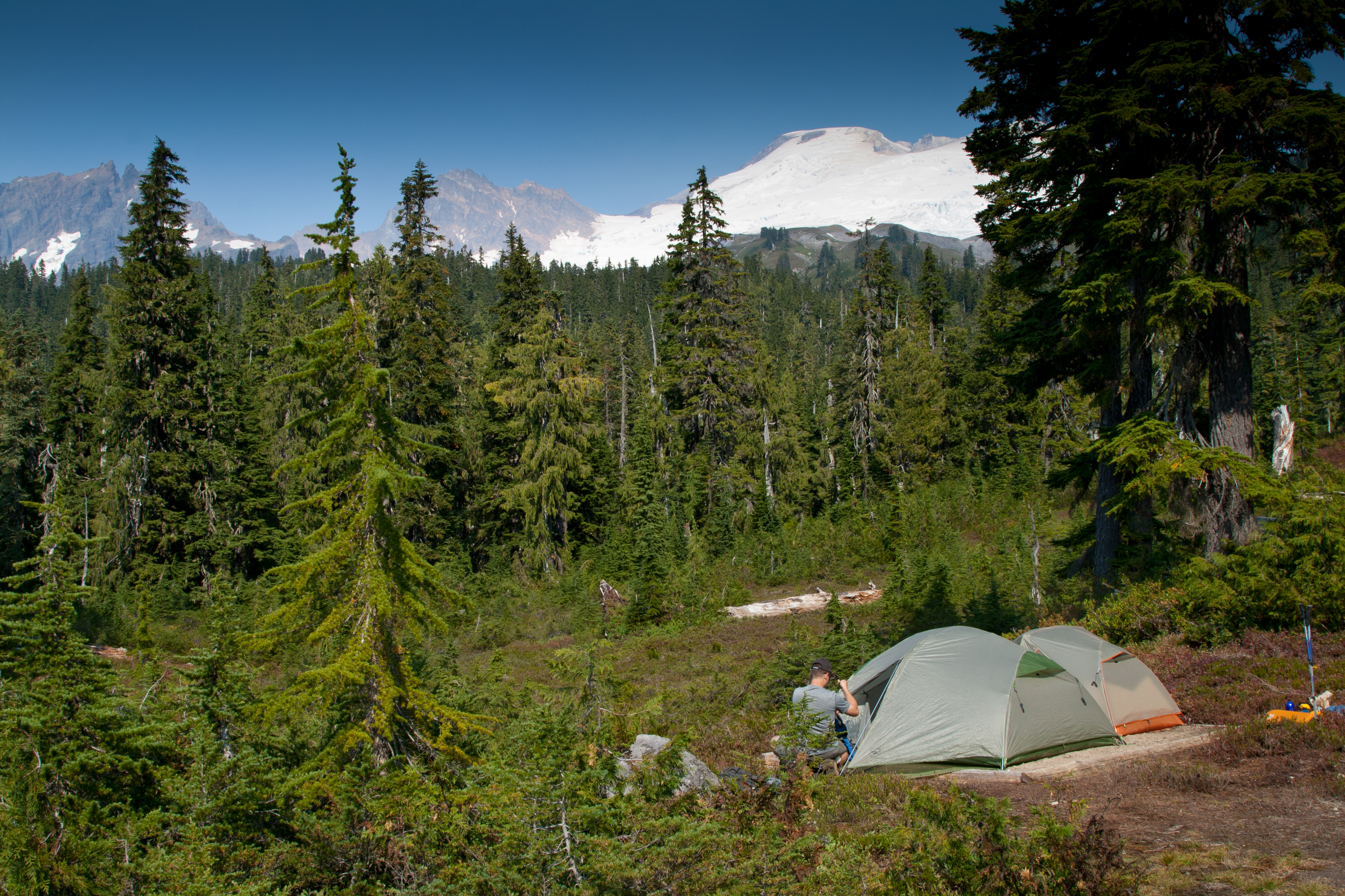
Finally, we reach the meadows of Mazama Park, and below the nice shelter here, (a large log lean to, enclosed on three sides) are several new tent pads created just for pitching a tent! Dropping packs at a tent site, I unfurl my one man tent, stretch it out across the tent pad, and stand up and look in stunned disbelief…The pad is too short for my one man! Sure that I’m suffering from being out in the heat too long, and I must be imagining things, I try moving it 90 degrees, then diagonally, then, just give up, and holler at Dan and Eric, “Hey! This tent pad is too short! How about yours?”
Camp at Mazama Park, with Mt. Baker, Colfax and Lincoln peaks
Truly, I can appreciate all the hard work that went into their construction, for they’ve bordered the pad with logs and filled the space with nice dirt, but…There’s no way short of cutting off a foot of material that I’m going to get it to fit…Curses! I wander about, looking at the other ones, and they too, are too small to fit my tent. If the logs were even with the ground around them, it wouldn’t be a problem, just stake the tent out beyond the logs, and good to go, but they sit above ground, making it difficult at best to stake out the tent. Dan and Eric are having the same problem…I look at the last one in the line, and this one looks promising! It’s nearly twice the size of the others, and with a little creative cramming, we’re able to get both tents staked out on this pad. Nice! Again, I would like to say thank you for the hard work from the trail crews, it’s clear to see that they went to a lot of effort to make these, and it’s not often you see pads this well-constructed anywhere…
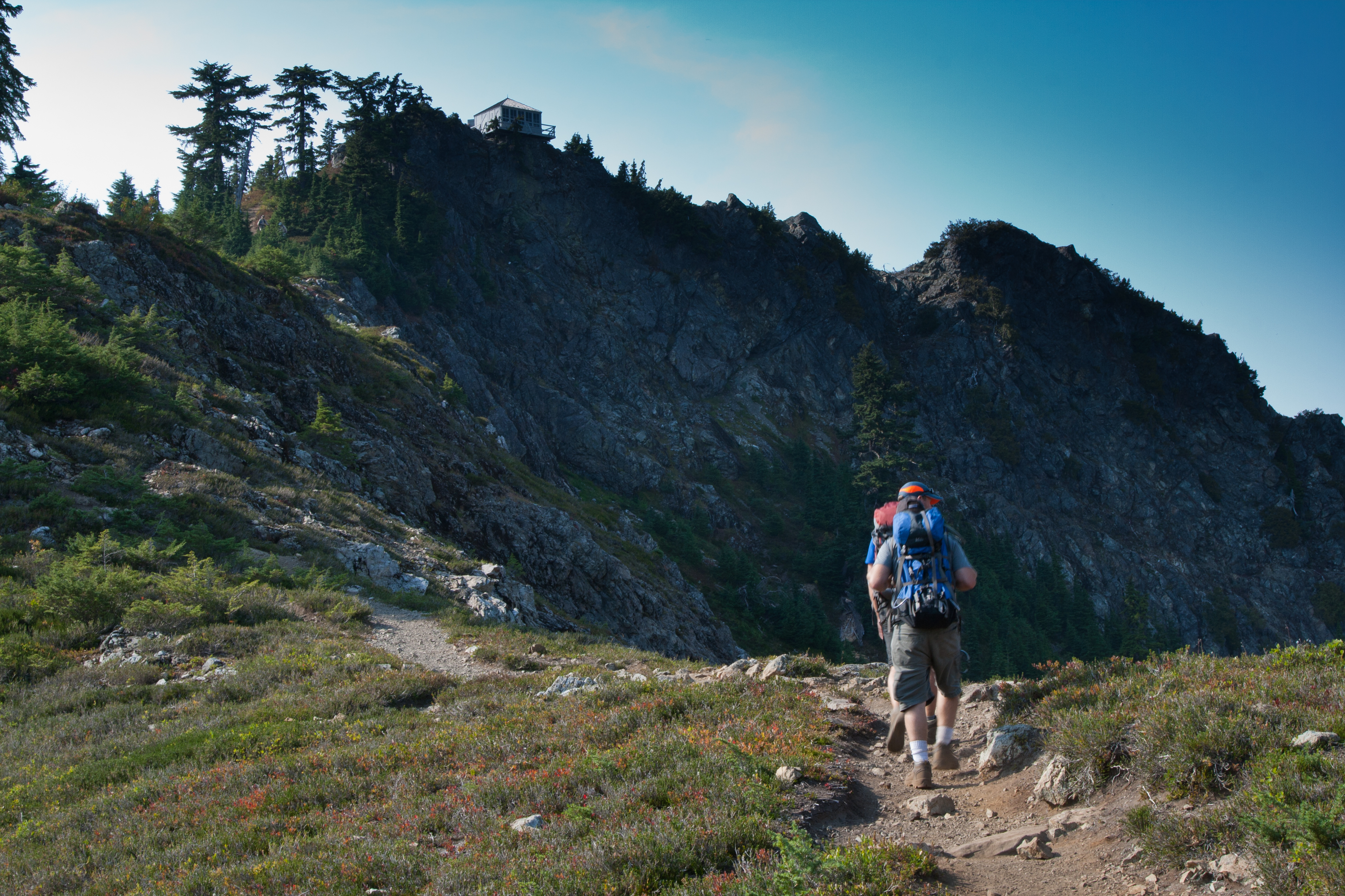
On the way to the Park Butte Look out
Camp up, we found a small stream just south of the shelter in wash that provided us our water, and after filling up, we ventured uphill to Park Butte, to see what we could see. It’s just a little over 1.65 miles one way to the top, and about 1200ft of elevation gain, so it’s a welcome relief when you reach the top. The lookout is a white single room lookout, windows all the way around built right on top of the rock here, so there’s no stairs to climb. A railed platform rings the structure, and the door is open, so we’re able to walk inside and peer around.
There’s a double bed here and cooking utensils, and instructions on how to use the stove, how to get water, etc. Pretty cool, but I think I’d rather camp down at Mazama. There’s a constant stream of people heading up for the day to view from the porch and the view is spectacular, too bad the smoke is now mostly obscuring the Twin Sister’s mountain range. It’s no wonder that they built the look out here, for it has a commanding view of everything in 360 degrees from its perch. We sit for a while, take in the views, and eat a quick snack before heading back down.
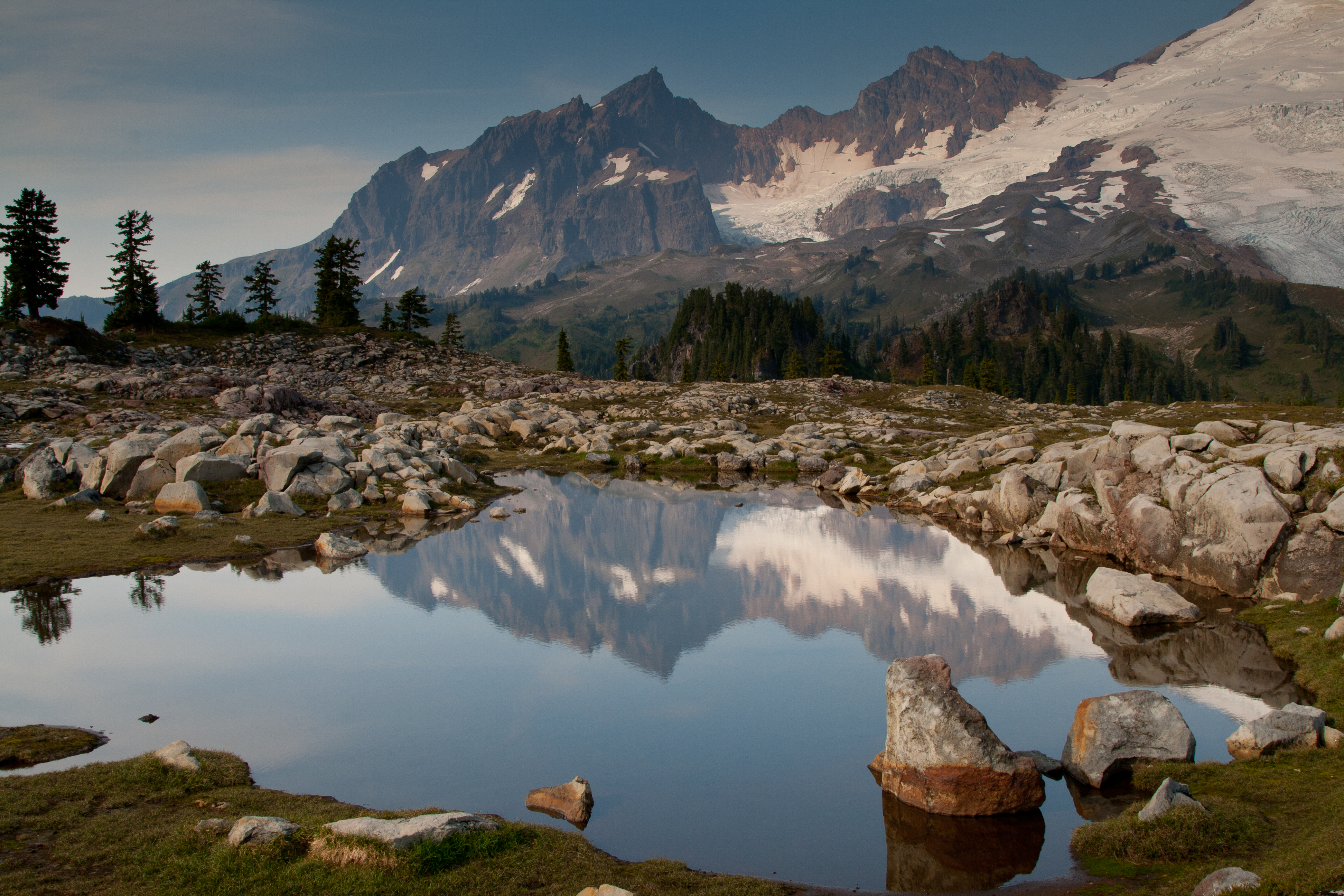
There’s a flat bench below the butte top, and across this flat, are rounded granite boulders, gnarled and cracked from the ages, scattered about the grassy meadows here, very reminiscent of something you would see in the Enchantments. Off the trail about 200 feet or so, are two lovely shallow tarns that make for perfect mirror reflections of the distant crags of Lincoln, Colfax, and Mt. Baker, nestled in between the boulders.
Reflections on the tarns on the way to Park Butte
“…So far, this hiking season, we’ve seen the fewest bugs of any year, and we’re grateful for being kept off the menu…”
Back on the trail, we return to camp, and settle in to make dinner. Eric brought summer sausage, and since I also brought some for our meal, we have an abundance of meat to gnaw on, yum!!! That and cheese go well with the Parmesan Noodles, sausage, and mashed potatoes. We finish just in time, as the fog that has been enveloping the valley that we must drop into tomorrow, is creeping up the hill, until just as we finish dinner, it covers us, blotting out any chance for seeing stars tonight. Darkness sets upon us, and we climb into dew covered tents. One great thing to note, though…No bugs!! So far, this hiking season, we’ve seen the fewest bugs of any year, and we’re grateful for being kept off the menu… That night, it would rain for about an hour, not what I was hoping for, or expecting…Another good reminder that the weather around mountains is difficult to predict…
I am happy to report that Ridley Creek trail has been re-established with a log with handrope over the river and newly placed logs spanning a few of the creeks down low. I go up this often, yesterday being the most recent trip up to the ridge above Mazama Meadows.
Author
Thank you for the info,hopefully, people planning a hike here will read this, thanks so much for writing! Always good to hear from someone with boots on the ground!!

I am happy to report that Ridley Creek trail has been re-established with a log with handrope over the river and newly placed logs spanning a few of the creeks down low. I go up this often, yesterday being the most recent trip up to the ridge above Mazama Meadows.
Thank you for the info,hopefully, people planning a hike here will read this, thanks so much for writing! Always good to hear from someone with boots on the ground!!