Day 2
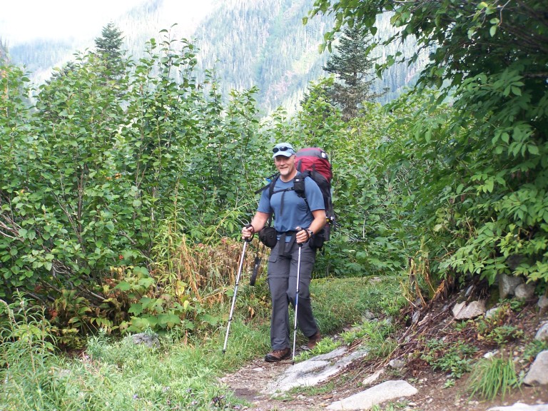
4458ft gain/2283ft loss. 11.72 miles. At least we get a bit of a break from the rain, and it stops in time for us to pack wet gear to the truck. It’s then that I realize I’ve made a bit of a mistake. Usually, I bring the clothes that I’m going to wear on the first day, in a bag, to be changed into on the morning of our hike. Well, that bag seems to be missing my clothes! In my rush to get out the door on time, I forgot to pack the first days clothes. And, these were expected to last for 2 days, so now, I’m left with two shirts and one pair of pants. On summer days, this would have been fine, but on a hike when we expected to get wet? Near tragedy, in my mind…So, I pack my jeans and socks that I wore here, not what I had in mind, but they would have to do…
On my first load to the pick-up, I open the door, and mutter, “Greg, we’ve got a problem..” It seems the mice here are unrelenting! Our bag of goodies, (and breakfast!) had already been sampled by another mouse, and he was still going to town on our groceries when I opened the door. I was able to see him move from the bag to the seat, and with a smack of a trekking pole, he was rendered ready for burial. Made us wonder just how many more of the little creatures were still lurking about. I looked in our plastic bag, and all was ruined…There wasn’t a thing left unsampled, he even got into our Doritos!!! Perfect. Another bag of food headed for the dumpster, and we didn’t even get a taste!
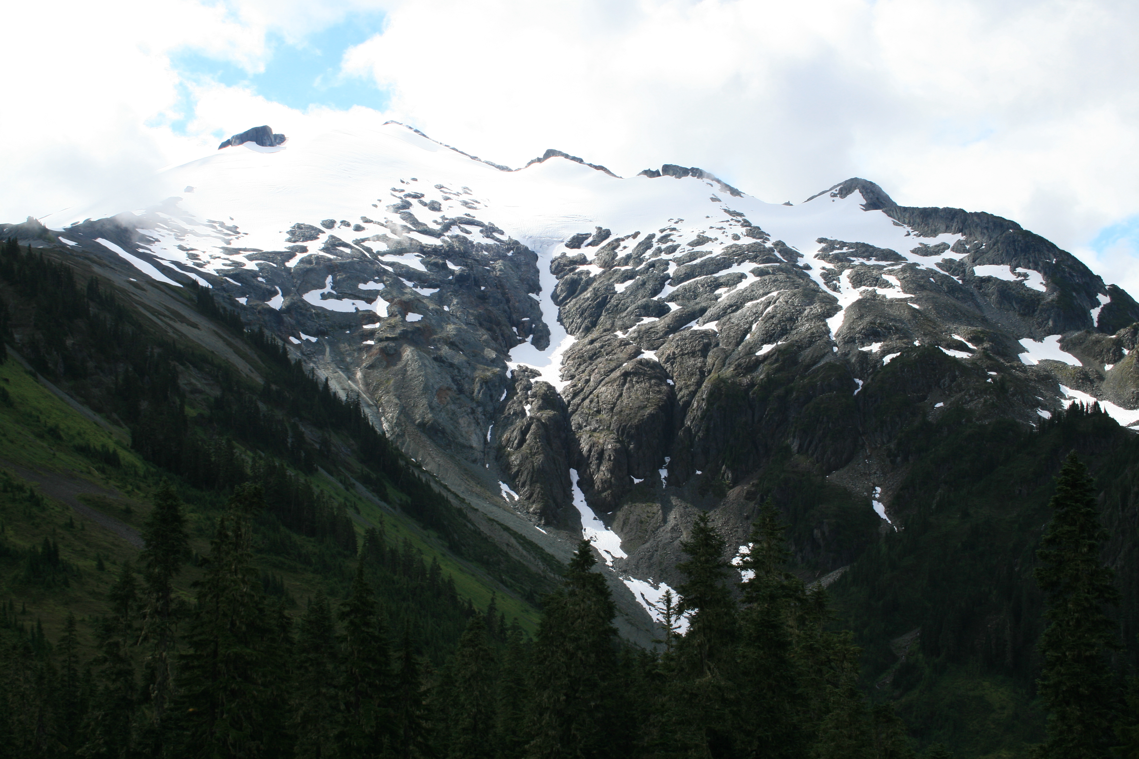
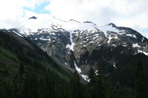
Mouse infested campsite behind us, we arrive at our trail head at 8:30am, ready for a big day. The skies look uncooperative, gray and misty, with the threat of rain. I sure hope the weather clears enough so that we can get some pictures taken! The first mile or so is fairly flat, and it allows us to bomb along at a quick pace. As the incline increases, it’s still moderate, but now the view is towards the south, as the Nooksack Range looms large in our sight, bare glistening granite walls shine in the few rays of sunshine that reflect off the rock.
The tops of the granite peaks aren’t visible, as the cloud cover is thick and low, hiding the tops from our line of view. Melting snow runs in long, ribbon cascades down the granite, creating a spectacular show of waterfalls. The roar from the falls echoes across the creek valley, to our side. The way up is a steady incline along the valley walls, and is cut through the steep talus fields created by slough-off from Granite Mt. above, overgrown with vine maple, just now starting to turn scarlet as fall rapidly approaches. You can feel its bite in the air.
As we near the end of the valley, before turning steeply upward towards Hannegan Pass, we get some clear shots of Mt. Ruth, dominating the end of the valley, covered in permanent snow fields. From here, it looks fairly straight forward to summit, and from Hannegan Camp, located just below the pass, it looks readily accessible. For now, we’re content to continue our upward and onward slog. Once at Hannegan Pass, there is a confusing array of trails and signs, running everywhere! “Toilet” here, “Trail closed” signs there, and not a one pointing the way towards Copper Ridge, or Boundary Camp, the next expected campsite! Weird.
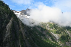
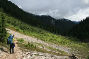
So, we wander to the right, uphill, towards what looks like a way onto a ridge line, and run into more trails running everywhere, just not the way that we had hoped…Looking at the GPS, it’s clear to see that this is not the way to Copper Ridge. The only bonus to all of it is, if we had not wandered up here, we would have missed the chance to see impressive Mt. Shuksan, and its spires and jagged peaks, looming up out of the dark cloud cover swirling around it. Back on trail, we head downhill, towards Boundary camp, and the left leg of our loop. From here, it’s a walk through old growth forest, with not much to see, the trail continuing it’s upward trend.
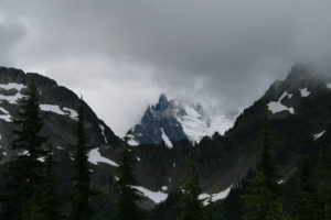
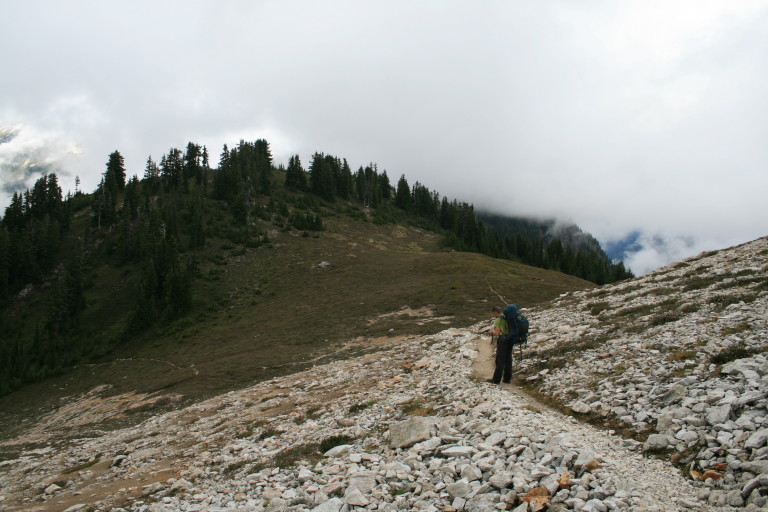
Finally, we reach ridge line, and through the ridge top meadows, we are able to see…Virtually nothing. Crap! I was hoping that we would be able to see more, but the clouds refuse to let us get a good peak at the mountain tops for most of the way to the Lookout. On a rare occasion, we get glimpses of icy topped Mineral Mountain, across the Chilliwack River basin. Just before we start the ascent to the Lookout, (for that is what it is, over 700ft up in a short distance), we can see a massive vertical drop off of the east side of Mineral Mt., covered impossibly in trees! It seems incredible that such a slope exists! This drop off, with the leading edge of Easy Ridge, creates the Easy creek drainage that feeds the Chilliwack River.
“We peer in at the dry abode of the lookout, like waifs left out in the cold, peering through store front windows at the warmth and dryness of those more fortunate than we…”
The fog surrounds us as we zig-zag to the top of this rock pile to reach the lookout station, and the rain is now settling in. The shutters of the lookout are up around the windows, and I find great relief in huddling under their outstretched wings, providing some protection from the wet. We peer in at the dry abode of the lookout, like waifs left out in the cold, peering through store front windows at the warmth and dryness of those more fortunate than we. Where is the ranger? We can see a sleeping bag laid out on the bed, so there must be someone here. There, through the mist, comes a figure, and it’s the ranger, showing up within minutes of our arrival. We say hello, and the first thing she says to me is, “You’re wearing shorts”…As if I had absolutely no common sense at all…I find it hard to argue with that logic.
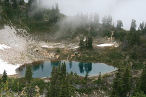
She invites us in to take a look at a working lookout, and I welcome the chance to be somewhere dry, even if only for a brief moment. Once inside, we look at some of the old instruments they used to use for fire spotting, and she offers some hot tea. She also assures us that there are some incredible views from here, clear into Canada as well, but it’s hard to imagine with visibility limited to about 100ft or so…A remark, or two, is made about how steep it is up that last incline to the lookout, and she agreed, calling it, “ranger training hill”…We thank her for the hospitality, and continue downhill towards our campsite at Copper Lake.
Freezing in the off and on again rain and wind, we make our way to the lake shore, and look for a suitable campsite, one where we can pitch not only a tent, but a tarp, allowing us a dry staging and cooking area. Finding a site that will do, camp gets pitched and not a moment too soon, for the rain begins in earnest. Donning dry clothes and rain gear, I feel almost human again. I’m no longer wearing shorts…A quick journey to the lake shore to pump water for dinner, does not go unrewarded.
“…Trust me, after an 11.5 mile day in this weather, flavored cardboard would have been tasty…”
Within minutes, it starts raining, and hailing, making loud staccato ticks on the surface of the water. Perfect! Good ol’ North Cascades…This does nothing to brighten my mood. Water bottles filled, we head back to camp. Huddling under the tarp, we prepare dinner, and have an awesome feast! (see the recipe page to be added…) I will call this one, “Summer Sausage in Parmesan Noodles, with zesty mushrooms!” How’s that for a title??? Trust me, after an 11.5 mile day in this weather, flavored cardboard would have been tasty…During the night, in the warm confines of the tent, we are assailed once again by rain and hail, pelting the outside of our little shelter. North Cascades, baby…