Ranking: 4/5 Hard to beat a trek that has it all like this one, in a mere 3 days, so what would have made it a perfect 5? Well, for one, that last days 3.4 mile death march uphill through trees, with a whisper of a trail to follow…That pretty much knocked it out of contention for a “perfect” 5, for me…Other than that, the views here are spectacular, you’re able to see all of the major volcanoes on this route, as well as rarely treaded ground in the alpine reaches of the Goat Rocks, and camp next to a glacial lake at the base of the high point. We saw herds of mountain goats, elk, and walked along some of the best trail the PCT has to offer. Good campsites with abundant water, as well. What more to ask for?
Difficulty: 10/10 Although I might have had some qualms about ranking this trek as a perfect 5, I have none when it comes to giving it top honors for difficulty. The aforementioned uphill slog on that last day for starters…Then, there is the time spent off trail, finding your best route over all of the obstacles that you will face, like steep and loose rock, snowfields, and treacherous boulderfields to name a few. The distances covered will surely tax ones stamina, again, especially that last day. Hope for the bridge to be put in to reach Scatter creek camp, and maybe this won’t be such a strain!
Getting There: For now, Drive to Packwood, WA and continue on US-12E for 27.5 miles up and over White Pass, and turn right onto FR 1200/Tieton Reservoir Rd, the visible brown sign says, “Clear Lake Recreation Area”. Follow this road for about 3 miles, then take a left to stay on FR 1200 to drive around Clear Lake and follow for 2 miles. Now, go right onto FR 1205 and follow for another 2.7 miles. Turn left on FR 742 and take a slight right on FR 1204 and go 6 miles to the Section 3 Lake TH. Before reaching the TH, though, we noted that at 3.1 miles, the road “Y’s”, take the right going uphill. This road is very rough!
Eventually, if they ever get the Miriam Creek Bridge repaired on the North Fork Tieton Rd #1207, I would strongly suggest going in this way: Head up the North Fork Tieton Rd #1207 to the end, at Scatter Creek, and then start here ,and then go counter-clockwise. The advantage is that heading North off of Old Snowy, you can easily peak-out on Ives Peak, and find an easy way down from the ridge to cross the valley over to Cold Lake. Plus, the monster uphill we took to get back up from Scatter creek to the TH will be DOWN, not a mindless slog UP…Just sayin’…
Maps: Green trails #303 White Pass, and #335 Walupt Lake. .Or, create your own using TOPO maps.
Permits: Northwest Forest Pass or equivalent to park at TH, self-register at TH.
Goat Rocks Traverse Added 7-17-17
Finally, a trip 3 years in the making is going to happen. It all started as I was sitting on top of Gilbert Peak where it was dreamed up in the first place. Last year, our attempt was blown out before it even started, as the bridges to the original beginning were washed out in January of 2011. To this date, the Miriam Creek Bridge on the North Fork Tieton Rd #1207 is still washed out, 2.4 miles up the road that leads to Scatter Creek CG. Which brings me to the second point. In a mad scramble to re-route our beginning (at the last second of course. Why do something ahead of time, when you can wait right to the end to do it?) I chose to start instead at Section 3 Lake Trailhead and go over the top of Bear Creek Mountain to begin our traverse. So, that’s where our journey began…
Day 1
8.48 miles, 2486ft Gain/2119ft loss.
Gray skies. If only they would stay just gray and not deposit the wet stuff, we’d be happy. But it wasn’t to be the case. By the time we got to the trailhead, it started raining. Lightly, at first, but by the time we were geared up and ready, it became insistent enough for all of us to don raingear. Not what we’d planned.
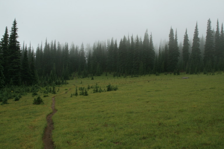
The trail begins well maintained, and passes through several grassy meadows, and it was at one of these meadow crossings we caught a glimpse of a bounding white tail buck. As he was exiting stage right, we all noticed he was probably the healthiest white tail we’d ever seen, no doubt due in part to the abundant grasses here. Within the hour, the rain lifted, allowing us to stow the rain gear, but the heavy gray clouds did not, and amidst swirling wind, the gray draped the surrounding ridge line and the top of Bear Creek Mountain, like a heavy wet blanket.
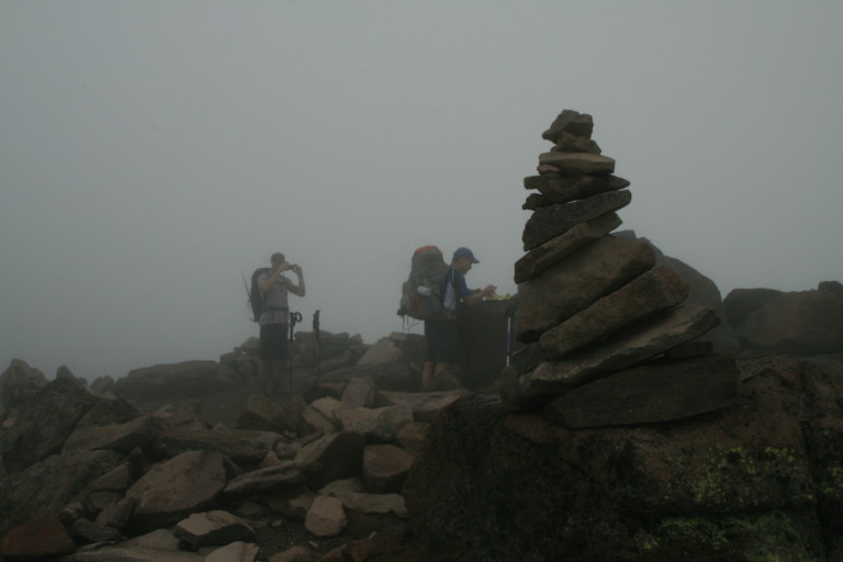
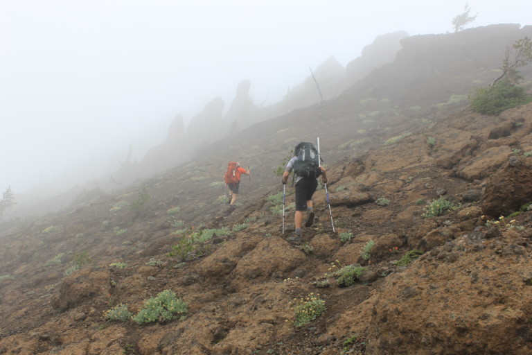
The trail meets up with another junction that leads back east, in the direction of happy voices that we have been hearing since we broke out into clearings here at the base of the mountain, at 2.84 miles. We never see the people whose laughter and loud voices they belong to, but continue to hear drifting upward through the gathering fog. An old weathered signpost points the way upward towards the top of Bear Creek, and the ascent up becomes nothing more than a game trail as it climbs steadily up another .85 miles with 827ft of elevation gain, a pretty steep jaunt. Once on top, at 7315ft elevation, we were surprised to see a summit register in a white PVC tube! It’s too bad we’re unable to see anything, as the thick clouds refuse to budge, swirling around us here on top. Visibility is less than 75 feet, and since we’re planning on all off trail travel for the rest of the day, it is not a welcome sight.
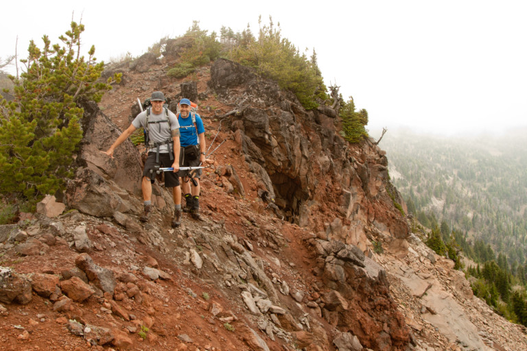
Thankfully, we’ve pre-plotted our expected route on a Garmin GPS, so we leave the mountain top, and pick our way southwest along the rocky ridgeline. Small wind-blown firs dot the ridge, stunted by the constant wind no doubt, and thankfully, we don’t have to beat through them too often, as they’re wet and grabby.
“…it’s like trying to negotiate a skate park walking on ball bearings…”
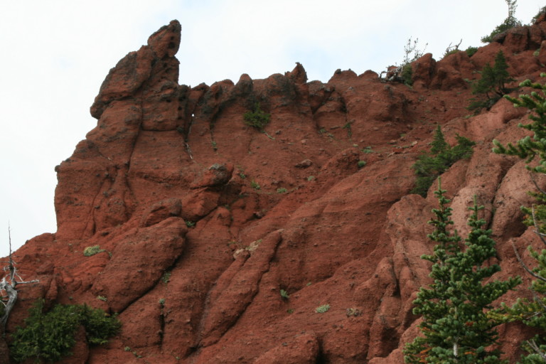
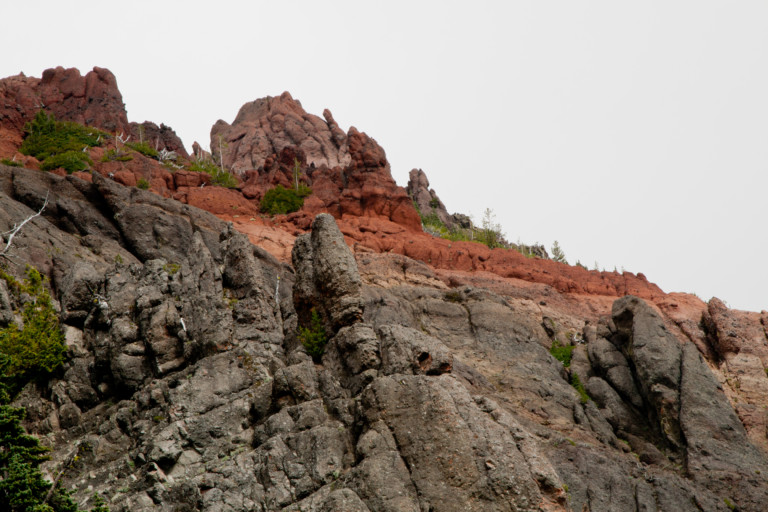
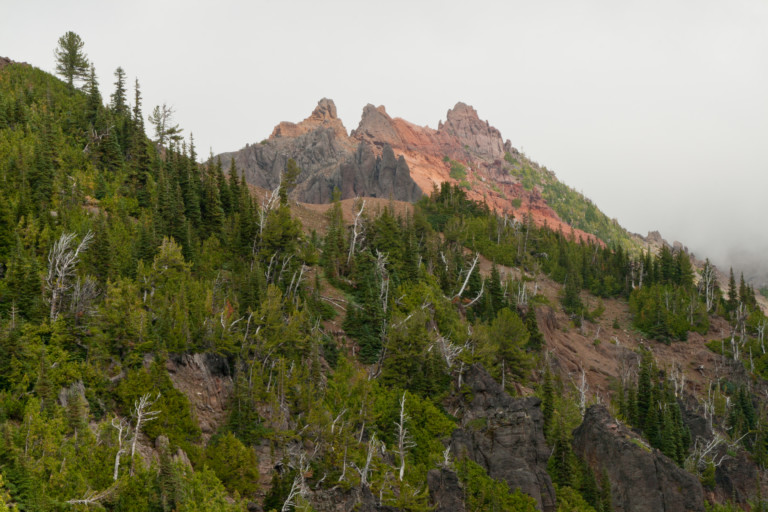
It’s a pretty straightforward hike until we approach Devils Horn at mile 5.2, when the loose shattered granite gives way to terrain that looks like Martian soil, red clay mixed with small aggregate that looks as if it’s turned to concrete. Everything is welded together with this red mixture and it makes for good purchase underfoot…That is, unless there is other loose rock on top of this red concrete, then it’s like trying to negotiate a skate park walking on ball bearings. I slip several times, once ending up on my butt.
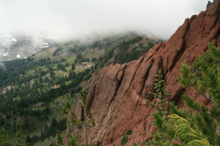
It’s still difficult at a distance to see the horn because of the clouds but once we’re near its base, there’s no mistaking it. A large deformed looking red spire standing crookedly on top, reminds me of one of those termite mounds you would see in the Australian outback, just on a much grander scale. We look to see if there is a safe passage near its base, but there isn’t, just a large thin ridge running downhill from its base, making a wall that forces us lower. Once around its base, looking back, we can see it clearly as the clouds have lifted, the red horn stands prominently on top…
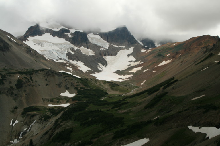
Still heading downhill, we happen across a well-defined trail that we follow a little ways that seems to lead upwards towards the horn, at the 5.7 mile mark. It’s short lived, however, and once again, we’re on our own, side-hilling across loose rock, and small tufts of grass growing in the rocky soil, providing some side hill relief. After hours of crossing on the same side, your ankles and edges of your feet grow tired with the hill always being on the same side. Little by little as we continue our way southwest along the ridge, the low clouds seem to be lifting, allowing us to see further than we have all day. At 6.4 miles in, we come to a grassy meadow in a flat, like a pass and stop for a few moments below a boulder field. From here we get our first glimpses of Gilbert Peak, its top still shrouded in swirling gray clouds.
“… a spectacular waterfall that eventually feeds two more small lakes…”
The side-hilling continues, until we reach the scree and talus fields below Tieton Peak, and as we traverse the rock strewn hillside, the valley that leads up to Cold Lake at the base of Gilbert Peak spreads out before us. What an amazing view! Looking SW towards the hidden peaks your gaze travels down a U shaped valley with a small stream carving its way down its length. The waters help feed increasingly green meadows, sparse clumps of alpine trees making headway up the barren slopes and as the stream approaches a bench, there are more trees and bright green meadows. Then, the flow cascades off the edge, creating a spectacular waterfall that eventually feeds two more small lakes. These sit in a bend around the receding ridge on the side opposite from where we stand. A painter’s imagination could hardly conceive a more beautiful and perfect scene.
“… two herds of different species sharing the same verdant valley, like a place that time forgot…”
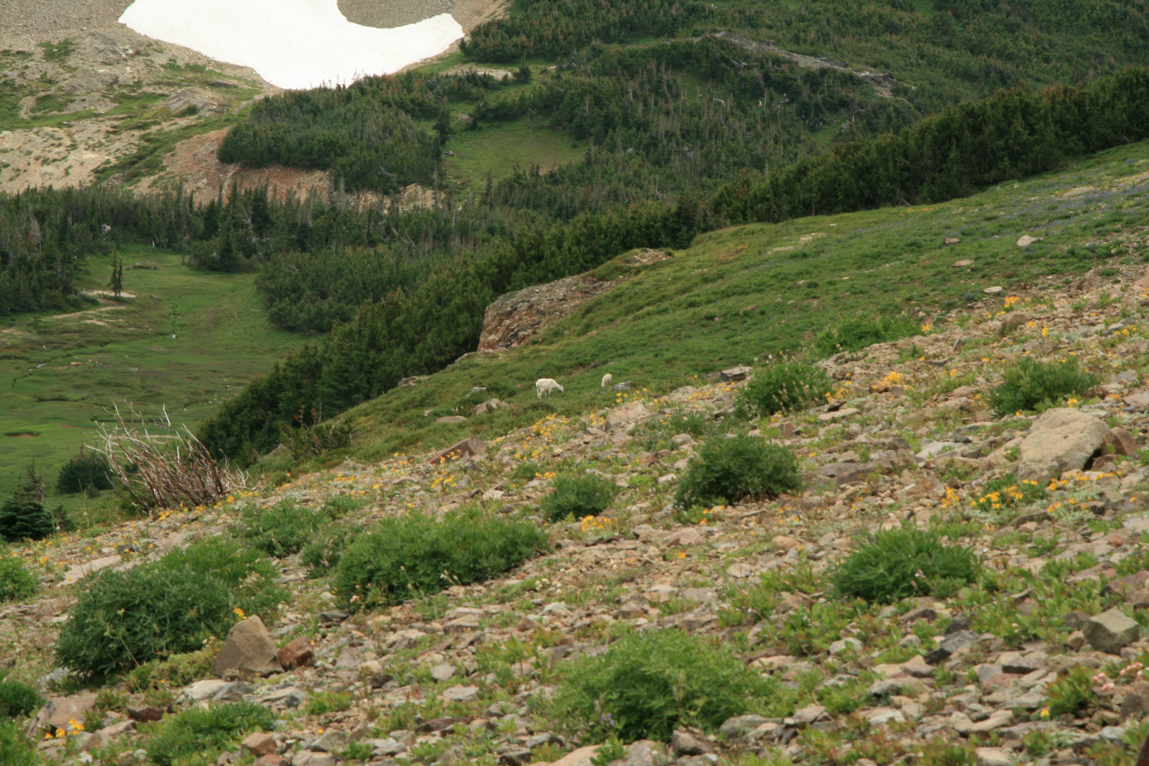
To top it all off, we can see a large herd of elk where the trees grow in thicker bunches, and their keen ears have heard us here high on the ridge above them, as all their heads turn in unison to spy us out. Looking back up the valley to the larger areas of treeless green is a large herd of mountain goats. I’ve never seen a spectacle such as this, two herds of different species sharing the same verdant valley, like a place that time forgot. Try as we might, we cannot get good pictures of the animals as they are too far away, nor can we put the entire tableau in our camera viewfinders. It’s too vast, and after returning home and viewing the pictures taken on the small screen they are pitiful representations of this epic spectacle.
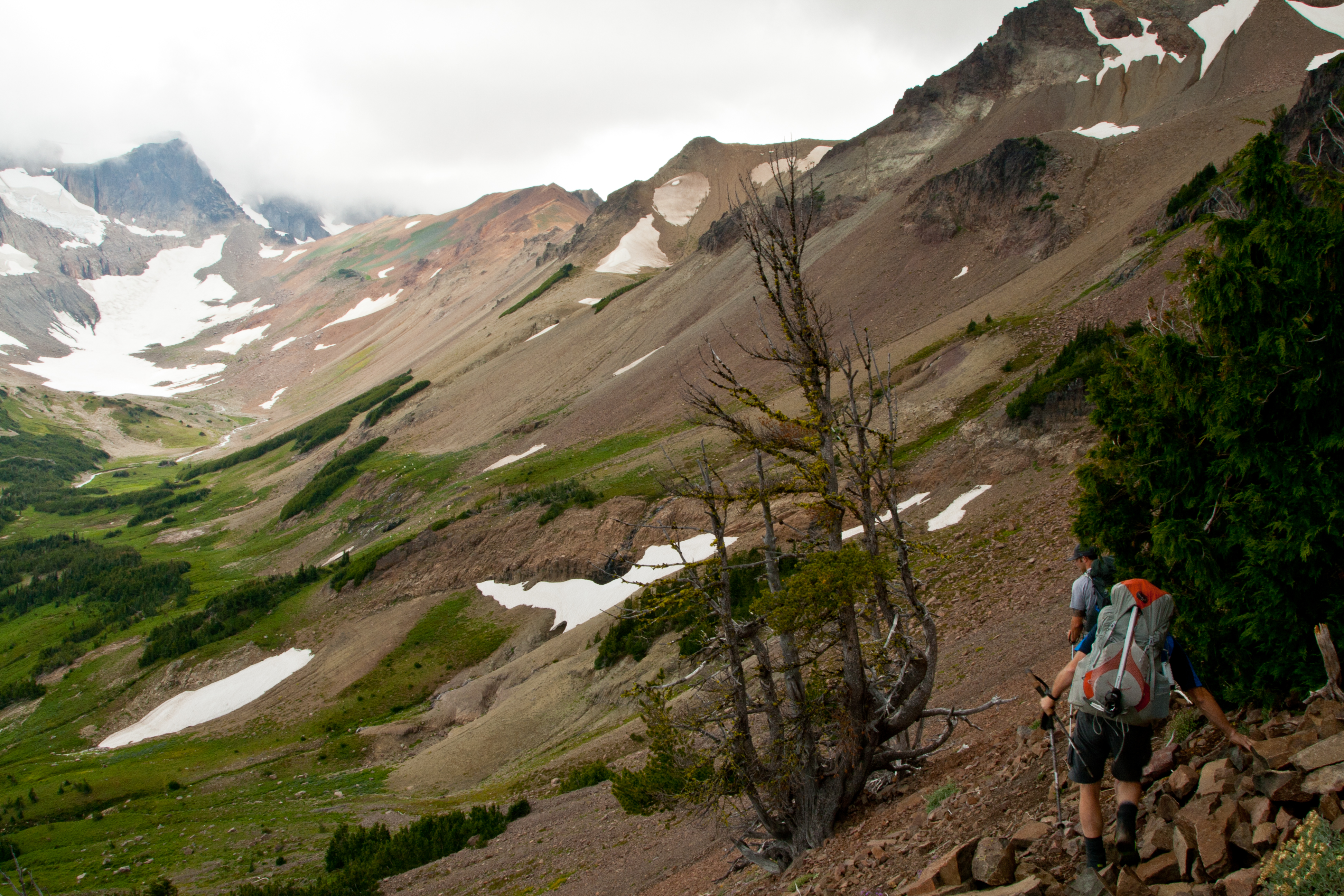
A step or two on the loose rock sends shards skittering downslope, and this is the cue for the elk to move, they take off running as a group between the trees, putting more distance between them and us. The goats now are aware also, but don’t seem as concerned. As we continue our approach into this lush and secluded valley, they all methodically start heading into the high country, accessing the ridge that connects to nearby Tieton Peak, still in no great hurry, just slowly moving higher.
Finally, we reach the edges of the valley floor, and just over a rise in front of us, are a few stragglers, a nannie and her kid, staying as long as possible to eat. There’s a look-out stationed on a large rock outcropping further up the hill, that signals to them it’s time to leave as we get closer, and they all take off running to rejoin the herd that has now disappeared from view. Reaching the stream, it’s easy to see why they like it here. Lots of grass and plants to feed on here on the valley floor.

“…Unnamed on maps, but it’s one of those tribal knowledge things…”
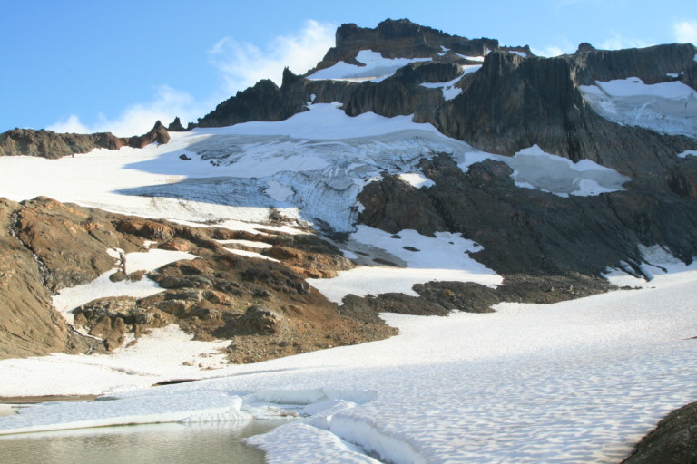
Following the creek upstream, the grassy meadow gives way to undulating rock strewn hummocks, no doubt left by the retreating Conrad Glacier, which hugs the flanks of Gilbert Peak. Now, we’re standing on a nice flat, sandy beach next to Cold Lake. Unnamed on maps, but it’s one of those tribal knowledge things, what the locals call it. The lake sits at the base of a permanent snowfield and the southern tip of the lake has large chunks of the snowfield calved off into the water, with car sized pieces floating in the lake, looking like small icebergs. The water is a muddy brown, no doubt from the recent heavy rains sluicing off dirt and rock, also evidenced by the now dry rivulets that have sluiced deep trenches down the surrounding slopes in many places, all leading to the lake.
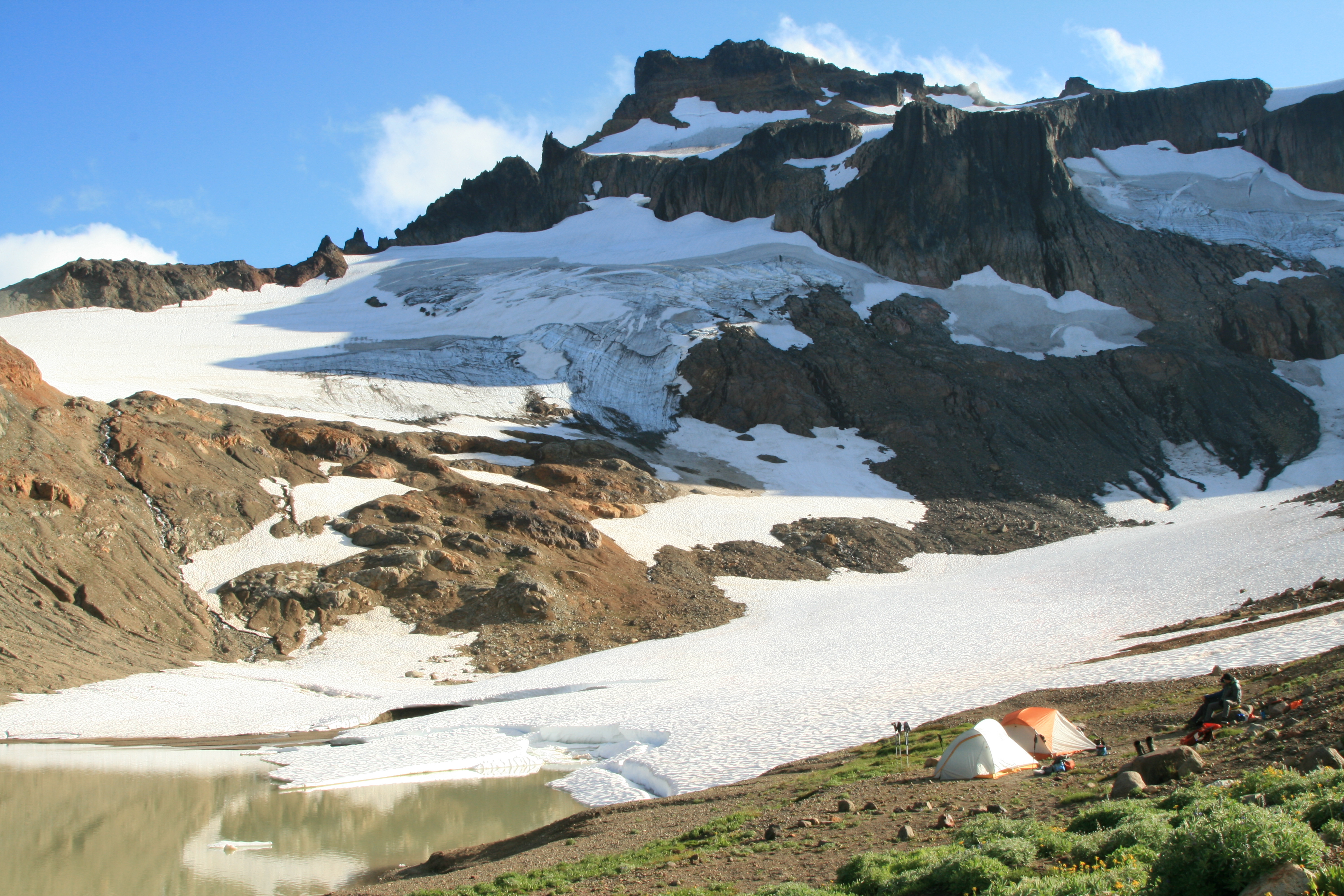
Following the snowfields upwards, to the steep, barren rock that begins the base of Gilbert Peak, highest point in the Goat Rocks, is the blue ice of the Conrad Glacier, broken up by the jagged rock that rises steeply to the heights above.
“…there are no other boot prints or other evidence of another human having passed this way…”
Upon first arrival, looking around at this barren, fantastical image of water, rock, and ice with the peaks disappearing into the clouds above, you can’t help feeling that you’ve wandered into a much higher place of elevation, like in Alaska, or some other as yet undiscovered mountain range. I say undiscovered, for looking around, there are no other boot prints or other evidence of another human having passed this way.The wind whistles over bare rock and ice, producing a low whistling quality that one only hears at elevations such as these, where there are no trees. I love that sound, as it reminds me that I’m above the tree line.
We set up camp, and wander around taking pictures and then sitting and staring at this incredible place we’ve hiked into. It’s hard to imagine having camped in a more majestic, and scenic area.It becomes even more beautiful once the wind blows out the clouds that have been enveloping the peaks and now we can see all of Gilbert Peak above. The sun plays across the ice fields, highlighting the blue color of deep ice. More pictures ensue…
A snow field provides us our water for the evening dinner, a great feast prepared by Greg. This recipe will be included on the site, as it is one of the better meals we’ve eaten. Called Smokey Mac & Cheese Pasta.It employs fresh diced red peppers, onions, grated Pepper Jack Cheese, chicken and Bacon! Wonderful meal, especially along with the view.
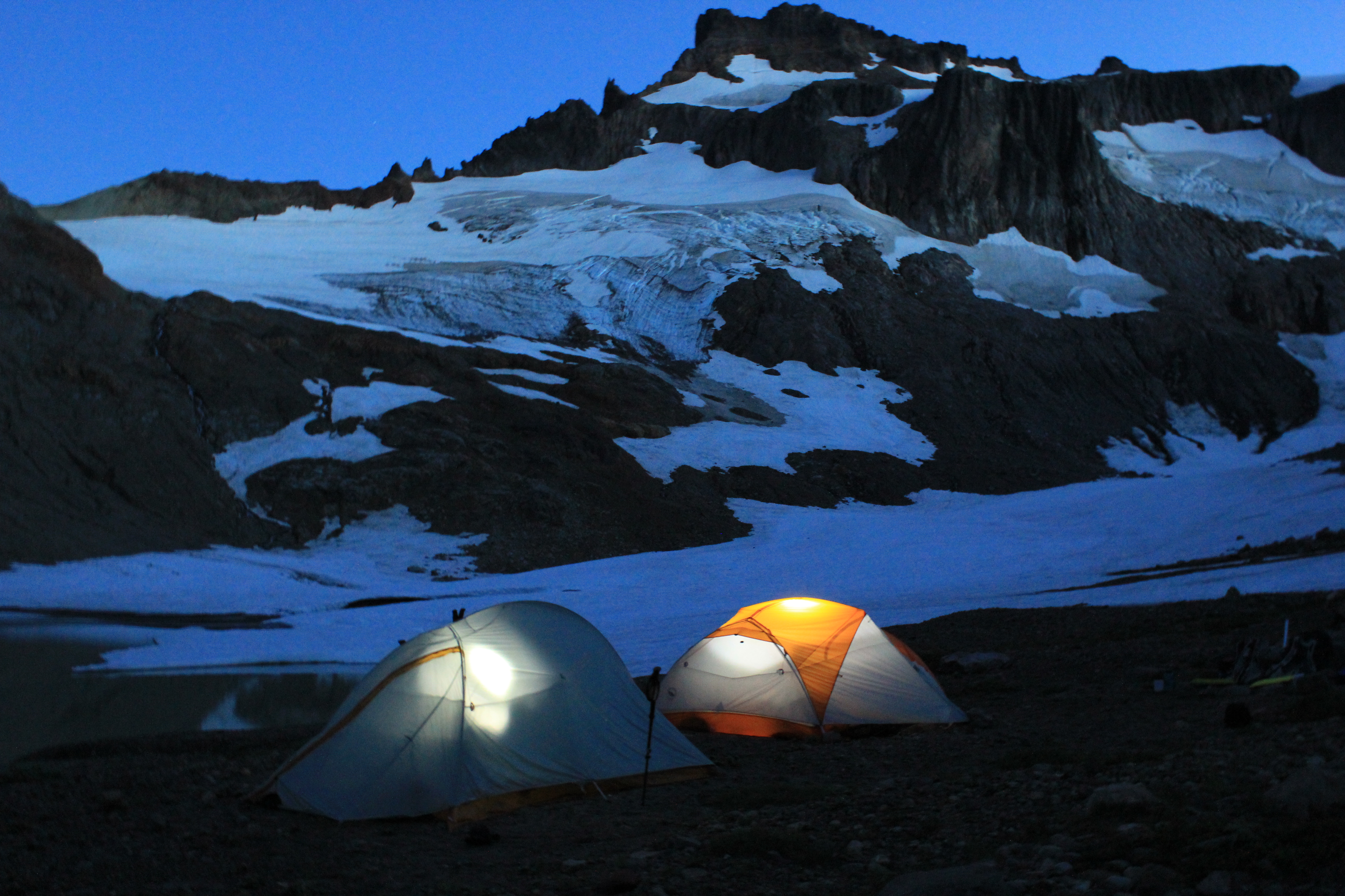
We spend the rest of the night taking pictures and experimenting with lighting the tents to create that glowing tent effect. The stars are bright as we turn in; promising perhaps, clear weather for tomorrow?