Ranking 3/5 Really enjoyed hiking up to Jade Lake from Marmot Lake to see the spectacular blue waters of this lake, just wish we had more time to explore, as the thunderstorms kind of shortened our time here. It’s definitely worth the extra effort to hike up to this pretty lake surrounded by steep rock and snow on all sides. Plus, bringing a fishing rod and bait will net you some quality time fishing from the banks of Marmot Lake.
Difficulty 7/10 Yeah, It’s a solid 7. By the time you reach Marmot Lake, after a 9 mile hike and over 3500ft of elevation gain, you’ll feel it. And, getting to Jade Lake will require some off trail experience. Especially if you turn up the wrong chute going up to the lake. You’ll eventually get there, but by the time you do, you might not want to wander around much. The trails to Marmot are marked well ,except for the slight confusion factor of arriving at Deception Pass, as there are trails running everywhere. Be sure to look for signage here.
Getting there: Head north on I-405N towards Bellevue, and take exit 11 to I-90E to Spokane. Travel 70.5 miles to exit 80, Roslyn/Salmon La Sac. Once off the freeway, turn left, and drive 2.1 miles to your first traffic circle, and continue straight through another .7 miles to the next traffic circle, where you will turn left onto 903N towards Roslyn. Follow 903N through Roslyn and Ronald, for another 16.5 miles to pavements end. You will notice that about 4 miles outside Roslyn that the road becomes Salmon La Sac Road. At pavements end, the road forks, take the right fork uphill, on gravel. This is FR4330, which you will follow all the way to its end another 12.3 miles to the Deception Pass trailhead #1376. You will have to cross a couple streams, so it’s advisable to have high clearance vehicle, or plan on biking the rest of the way, or hiking in. The stream that seems to run year round, the Scatter Creek crossing, was almost 2 feet deep when we crossed in mid-August, and it’s still 3.3 miles from the trailhead.
Maps: The Alpine Lakes Wilderness Map, put out by ALPS, is a good source, and making your own on Topo.com. Also, Green Trails Map #176, Stevens Pass.
Permits: 5$ per vehicle per day, or a Northwest forest Pass or equivalent to park at the trailhead.
Marmot Lake, Jade Lake GPS Added July 2015
August. How quickly it arrived. Seafair weekend in Seattle, so perhaps the backcountry won’t be so crowded? Yeah, right.
Day 1
9.14 miles, gain 3500ft/loss 1960ft.
Before packing our gear for this trip, Greg checks the weather report, and what had begun as a promising report the week before, had now changed to include a 30% chance of thundershowers…Sigh…At least the area wasn’t burning up like a large part of Eastern Washington, which was currently experiencing a fire of historic proportions…
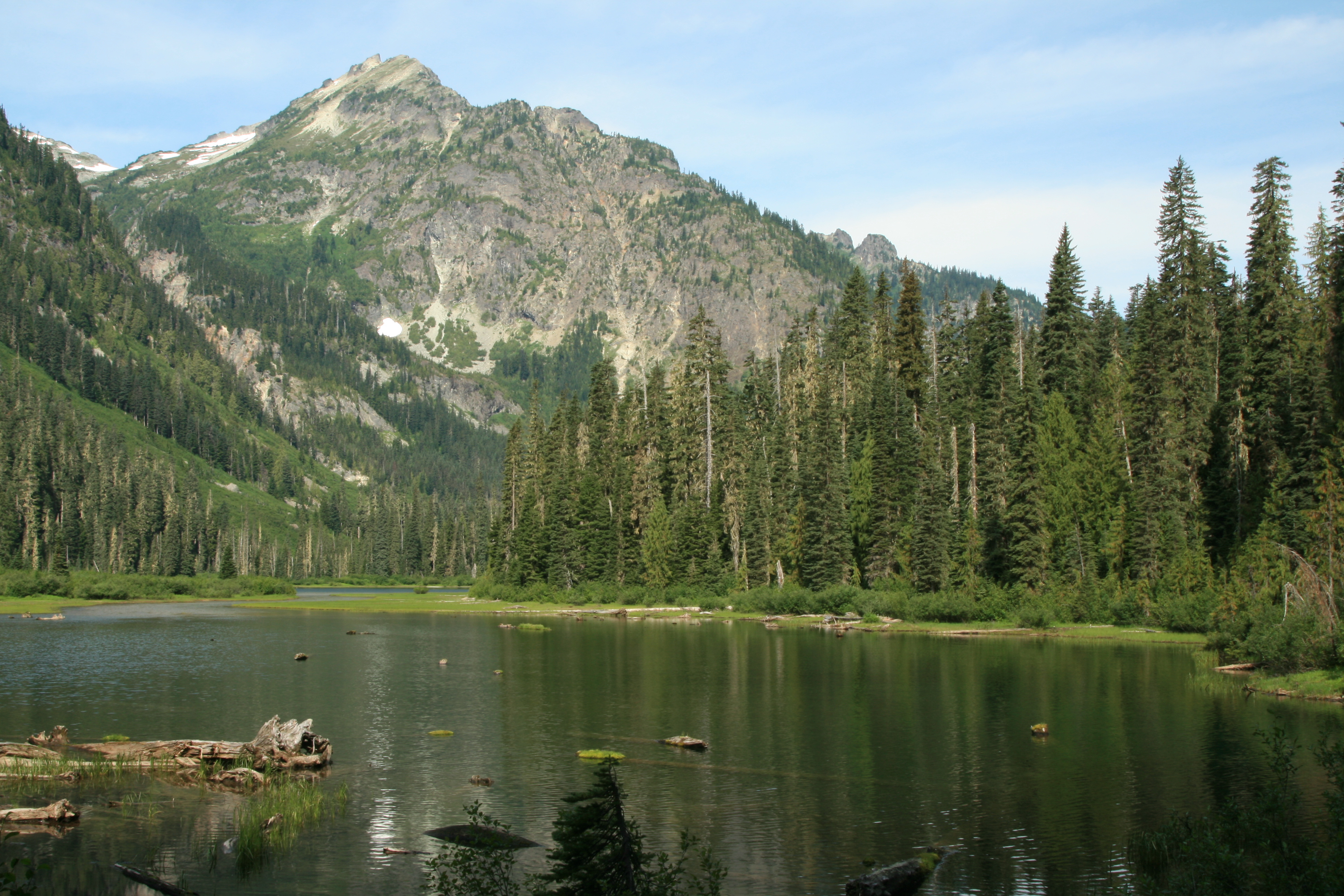
We reach the Deception Pass TH near 9am, and are on the trail by 9:30, under sunny skies. The first 3.2 miles of the trail that run by large Hyas lake are mostly flat and well maintained and heavily used, under a canopy of fir, cedar, and hemlock. There are several stream crossings that feed the lake, and most are crossed by strategically placed rocks. Several campsites dot the shores, and as we pass by we notice about half are occupied. There are also a few unobstructed viewpoints from the trail that offer great views of Cathedral Rock, towering above the west side of the lake like a stone fortress.
Once past the north end of the lake, the trail begins a steady climb up, switch backing at a rate of 700 feet of elevation over .86 miles to a junction that takes you to Tuck/Robin Lakes, which is about 4.35 miles in from the trailhead. The trail from this point begins to narrow some, and becomes rockier in places as it steadily gains elevation. Thankfully, you’re still mostly under the trees, protecting you from the ever increasing glare of the sun.
Finally, at Deception Pass, we stop for a moment to rest and take note of the trails that intersect here, the TOPO map and the map on the GPS unit (also TOPO), do not show the trail that leads sharply left here, almost doubling back on itself towards the south. After merging right onto the trail, a sign here signifies that the sharp left leads to Deep Lake. The trail we need briefly intersects here at the pass before veering off to the left, at mile 5, and there’s a reassuring sign nailed to a tree to verify that this is indeed the way to Marmot Lake.
“…sure hangouts for the bloodthirsty mosquitoes that are now in full force…”

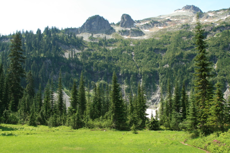
This intersection of trails forms an elongated “X”, with the crux of the crossing being only about 50 yards or so…Even though it’s called a pass, it’s really only a wide flat spot encroached upon by trees, with nothing to see. As you approach the 5.9 mile mark, you will pass a small group of ponds or small tarns, not much more than depressions in the flat spot here, sure hangouts for the bloodthirsty mosquitoes that are now in full force. The distant ridge to the east that hides Jade Lake stands prominently against the skyline, snow still clinging to its slopes, which helps to create a nice reflection off the still waters of said pools of water. This is also another high spot along the trail, at 4760ft elevation.
“…an area devastated by an avalanche, snapping large trees off at their bases like twigs…”
Once past the small lakes, you will head downhill through sparse meadow filled with pink heather and low lying huckleberry, to a small bowl hollowed out at the base of the tall ridgeline we could see earlier. Grassy meadows here create a picturesque foreground against the granite cirque. A small stream flows out from this bowl and after crossing the stream, it continues downhill over a trail built over the jumbled rock of a large and ancient talus field, many of the rocks covered in moss and eons of falling hubris from the encroaching trees. Back into alpine firs and then you reach an area devastated by an avalanche, snapping large trees off at their bases like twigs, and then pushing the jumbled mass over the trail here for at least a hundred yards or so. Needles and branches from the felled trees covered the snow, protecting it from the sun, so there are still patches of lingering snow here, even in August.
“…I say steeply because you gain over 1100ft in that last 1.5 miles!”
Once across the basin at 7 miles, you climb back up the narrow trail steeply to 8.5 miles to reach the cut-off that takes you to Marmot Lake. I say steeply because you gain over 1100ft in that last 1.5 miles! Even after taking the left towards Marmot Lake, you still have some ups to go, and you reach the lake from the junction in another half mile, for a total of 9.1 miles…
“…after the labored sweating hiking the 9 miles to the lake, can hardly wait to shed packs and ply the waters…”
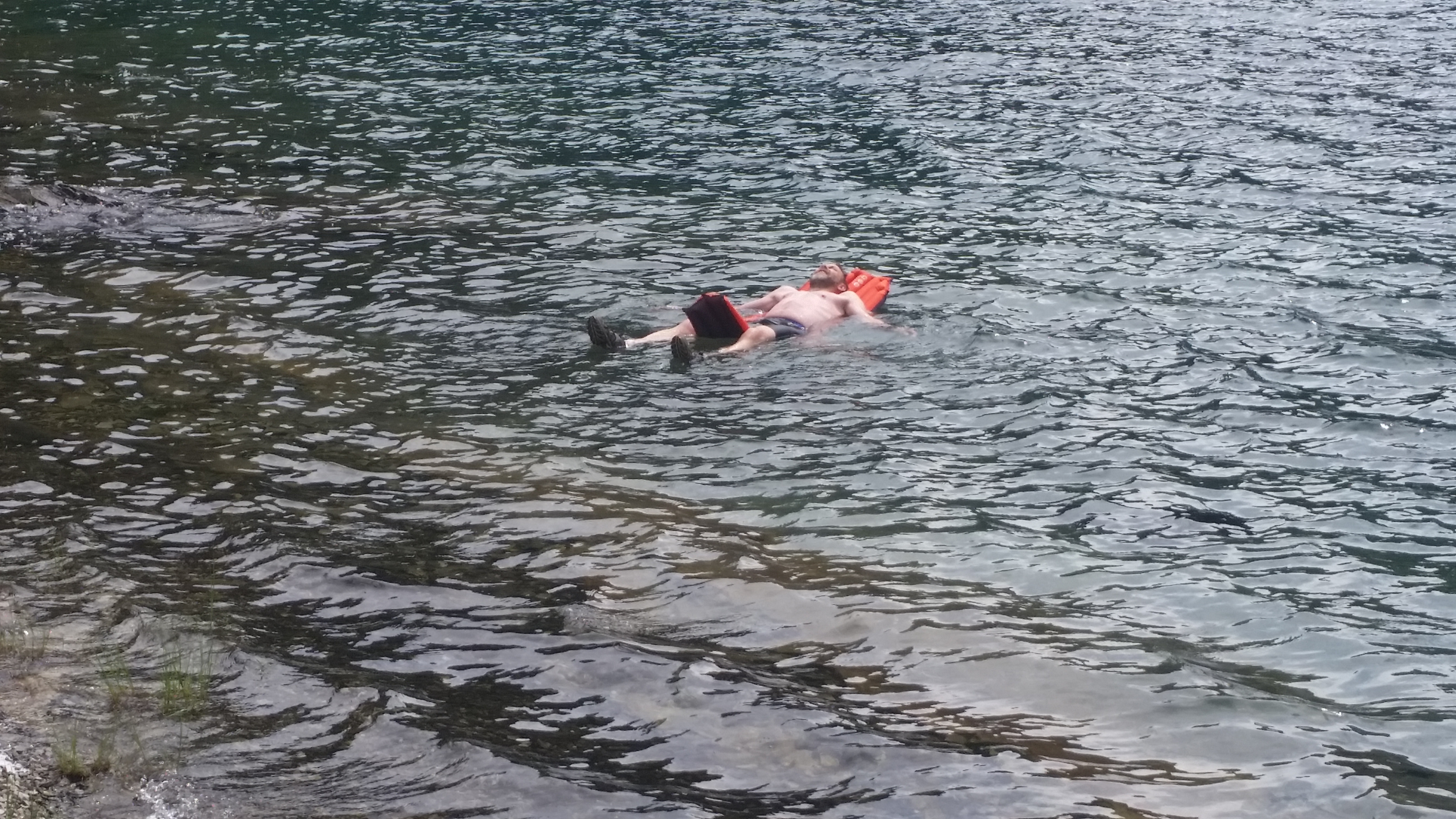
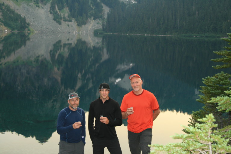
There are several good sites here on the NW edge of the lake, most clumped together in one area. There’s already a couple here, and they have the nicest site next to a large boulder. The shores here are flat rock that slopes gradually down to the water, beckoning us to come to the water’s edge. All of us, after the labored sweating hiking the 9 miles to the lake, can hardly wait to shed packs, and boots then plunge into the refreshing water of Marmot Lake. Greg even takes the time to blow up his air mattress to float with! We all get in and splash about, getting the grime off our bodies, then crawl up onto the bank to let what fleeting sun there is dry us off. I say fleeting, because the warned about thunder storms are pushing large clouds our way, occasionally blocking the sun.
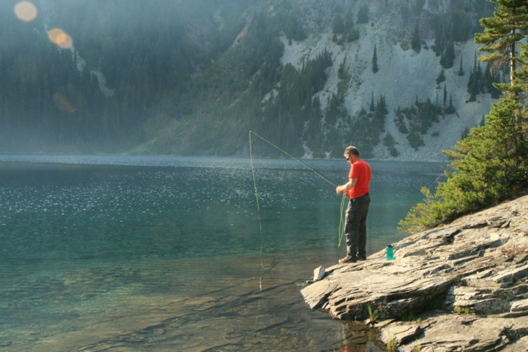
Once relatively dry, Greg tries his hand at fly fishing, as he’s brought his rod and reel, but…The wind that keeps blowing across the lake doesn’t really allow him to get the fly out very far, for its right into our faces.This gives us some free time to chat up our neighbors, Kevin and Kara. They, too, are locals, and we learn a little about them as the afternoon passes…
Dinner is done, and we eat each bite through our mosquito hats. The skeeters are bad here, and occasionally, as you lift up the netting to take a bite, one gets trapped under the hood, so you go through the whole procedure of setting your food down, and trying to squash the intruder under the net. Pesky dang things…After dinner, we watch the sky turn red as a beautiful sunset lights up the sky above the rim of the lakes ridgeline, glowing across the now still waters, the wind having pushed most of the clouds out.