Ranking: 3/5 There is a variety of terrain and options on this hike, including long flat stretches, an old mining town that still exists, beautiful blue alpine lakes, fishing, and rugged granite peaks to admire once you’ve reached the end of the punishing trail…If you are a climber, there are several peaks here to bag, as well.
Difficulty:8/10 The beginning of this hike is easy, for the first 4.4 miles, or so, but once you get beyond the old mining town of Monte Cristo, well…It goes up steeply, and continues it’s rugged ascent until you reach the Twin Lakes Basin. The trail beyond Silver lake is more of a climbers trail, and is not well maintained, and encroached upon with brush. There are a few campsites down at Twin lakes, but on a “busy” summer weekend, you better get here first, as there aren’t many flat spots to find to pitch a tent. It’s a rugged hike, and one that will challenge you, to be sure…
Getting there: Head north on I-5 to Everett, and take exit 194 to US 2E/Stevens Pass highway, towards Snohomish/Wenatchee. Follow this straight for 2.3 miles, then take highway 204E exit, left, towards Lake Stevens. Go about .5 miles, and merge with WA 204 S/State 204 S, and continue for another 2.2 miles. Turn Left at WA 9 North to Granite Falls, and go 1.7 miles. Turn right at WA 92E/Granite Falls highway, and stay on this to the town of Granite Falls, 8 miles. You should see the Verlot Public Service Center ranger station, in town, on the left hand side of the road. Continue east on the Mountain Loop Highway another 19.5 miles to Barlow Pass. This is basically the end of the road, and there’s parking on either side of the highway. Follow the road past the gate on the right hand side, 4 miles to Monte Cristo.
Maps: Use either Green Trails Map #143, Monte Cristo, or create your own detailed map using My Topo software, by going to a kiosk that prints out MyTopo, ( REI has one), or go online, to http://www.mytopo.com/, to order your own specific map.
Permits: You will need to self register at the trailhead, and to park, you will need a Northwest Forest pass, or equivalent permit.
Silver Lake, Twin Lakes GPS Added 11/15/2012
Greg and I journey into the hard to reach North Cascades, once again. The more we see of this rugged place, the more we want to explore it, so, poring over maps, we find an out and back that will cover a weekend, and provide some more challenge. Just how much of a challenge, we were about to find out…
Knowing that an early start would be key, we decide to camp at Gold Basin on Friday, a campground outside the small town of Granite Falls, on the Mountain Loop Highway. There are many campgrounds along the way, but this is by far the biggest, and as we don’t have reservations, we decide to try there first, hoping for more options. It sits along the banks of the South Fork of the Stillaguamish River. There aren’t many sites left, so we’re happy to find one, plop our gear down to stake our claim, and then head into Granite Falls for dinner. We find a nice place to eat at Ed’s drive in, situated in the middle of town, for a burger and shake. Back at camp, we enjoy a nice fire before turning in, ready to hit the trail in the morning.
Day 1
3143ft gain/700ft loss, 9.1 miles. Up and at em! Loading our gear into the truck, we’re out of the camp by 7:15am, determined to get a jump on the day, and drive the remainder of the way to Barlow Pass, where the trail head for Monte Cristo starts. Actually, it’s more of an old gravel road than trail, and it persists all the way to the abandoned mining town of Monte Cristo, about 4 miles in.

The old road here seems to have covered over old rail road tracks, probably for getting the ore out of the mountains, and from town. We notice this where the road is washed out by the river, revealing rusty old tracks suspended in air, as if the road had a skeleton. It’s an easy grade, and we’re almost bored by the time we reach Monte Cristo. There isn’t much to see, as most of the way it’s through forest, with occasional views to distant peaks when it opens to the South Fork of the Sauk River.
…it might have been nice if we had brought bikes, as the long, flat, straight road would have been eaten up in no time on two wheels…
Sometimes, the forest canopy is so dense, that it’s like walking through a tunnel, and the long straight stretches of road seem to vanish to a point in the distance. Also, adding to the oddity, are several old warning signs, telling vehicular traffic to yield to pedestrians and bicyclists. Obviously, they’ve been here a long time, as the bridges and road have been washed out for years. Still, we think it might have been nice if we had brought bikes, as the long, flat, straight road would have been eaten up in no time on two wheels…
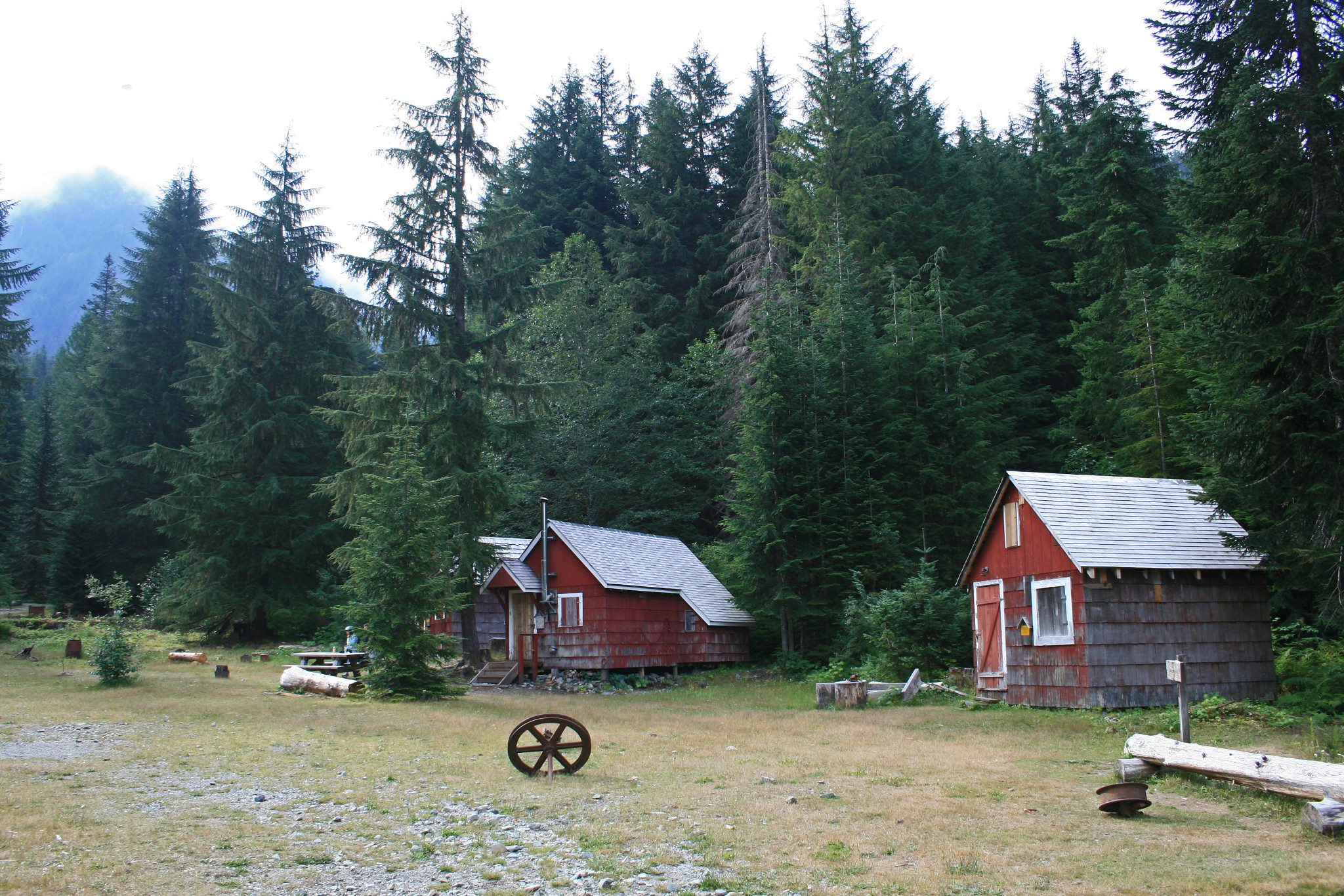
We cross the foot bridge into the last remains of the town of Monte Cristo, and there are still several old buildings left standing here, along the edges of a small clearing. They’re small buildings, and painted red, like the fading color on an old barn, and signage in several places gives you information on what it used to be, like “Power Station”, and “Railroad turntable”, an iron platform that would rotate the engine around. There are about six buildings left, and near the trailhead, is an information bulletin board, that gives you the history of Monte Cristo.
…should have named it something more sinister, like, “Kick the Dog Snot Outta You pass”…
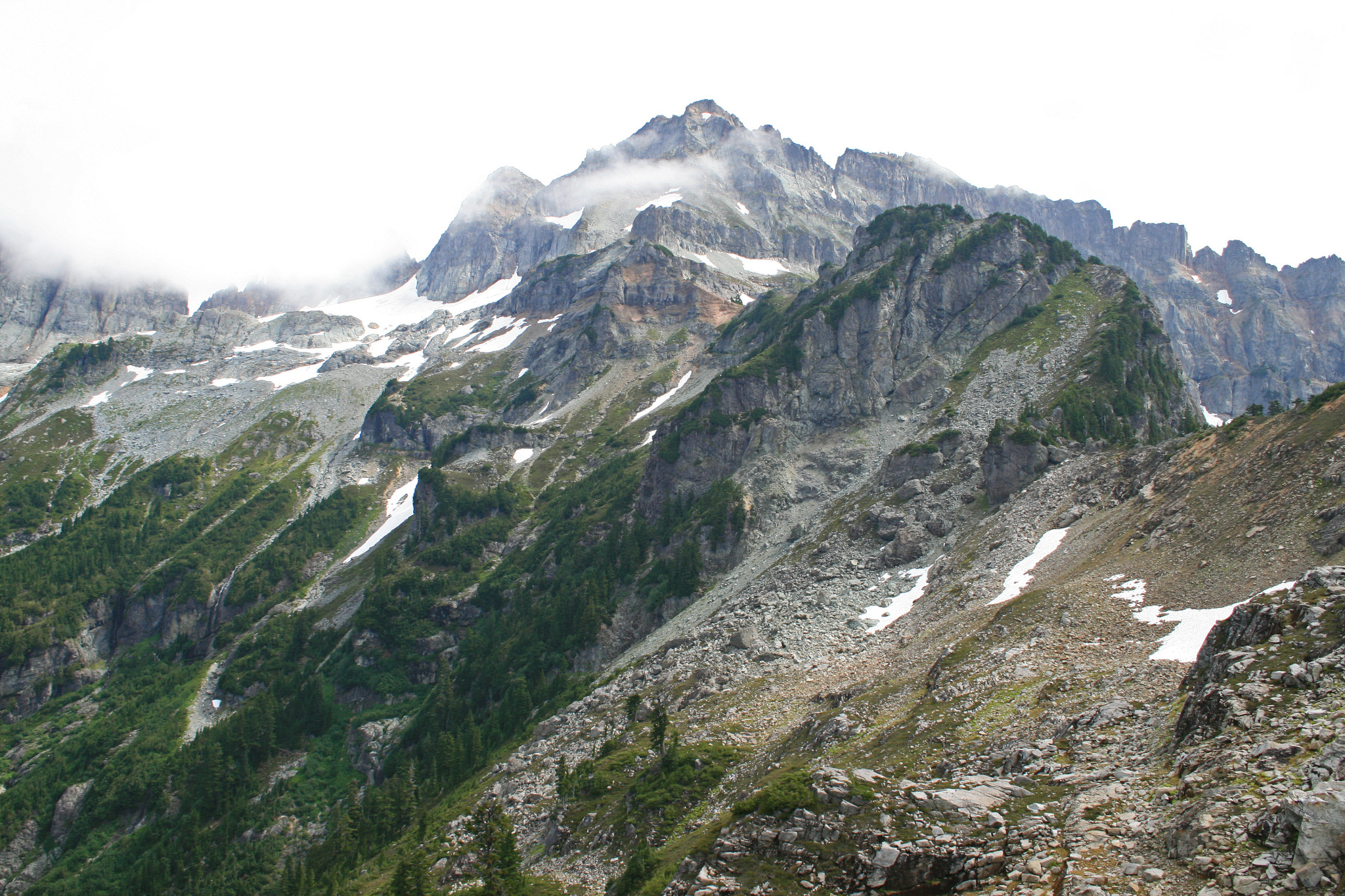
Looking above the tree line, you can make out between the wisps of low clouds, Wilmans Peaks, and Columbia Peak, which is near our destination. Once on the Silver Lake trail junction, the uphill begins. And, doesn’t stop…For the next two miles, it’s a relentless uphill to Poodle Dog Pass. Yes, that name’s correct, and gives you the impression that it’s as harmless as the fuzzy little critter it’s named after, but whomever gave it this odd moniker, should have named it something more sinister, like, “Kick the Dog Snot Outta You pass”, or something equally as malevolent…By the time I reached cute little ol’ Poodle Dog pass, I was ready to pass…Out…That was a buttkicker, let me tell you!
At this point, you have a choice, (besides passing out), of either going to Silver lake, a mere .25 miles down into a bowl at the base of Silver tip Peak, or continue up, along a ridge towards Twin Lakes, our destination for the day. Not wanting to hike down and then back up at this moment, we decide to save it for tomorrow. The trail now continues up along a ridge towards Twin Peaks, a set of small peaks that provide a pass down to Twin Lakes.
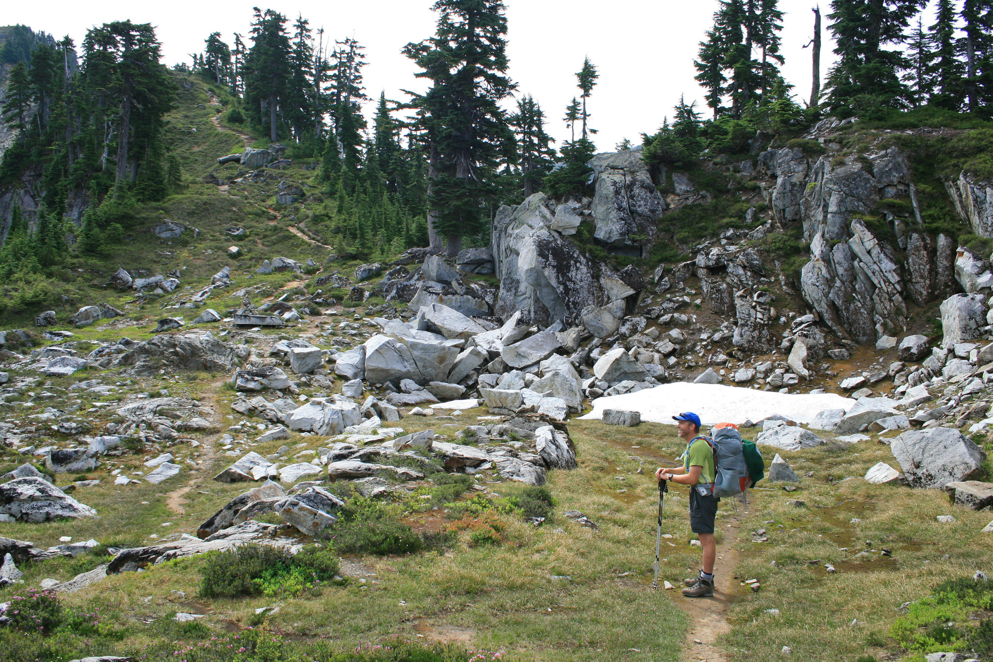
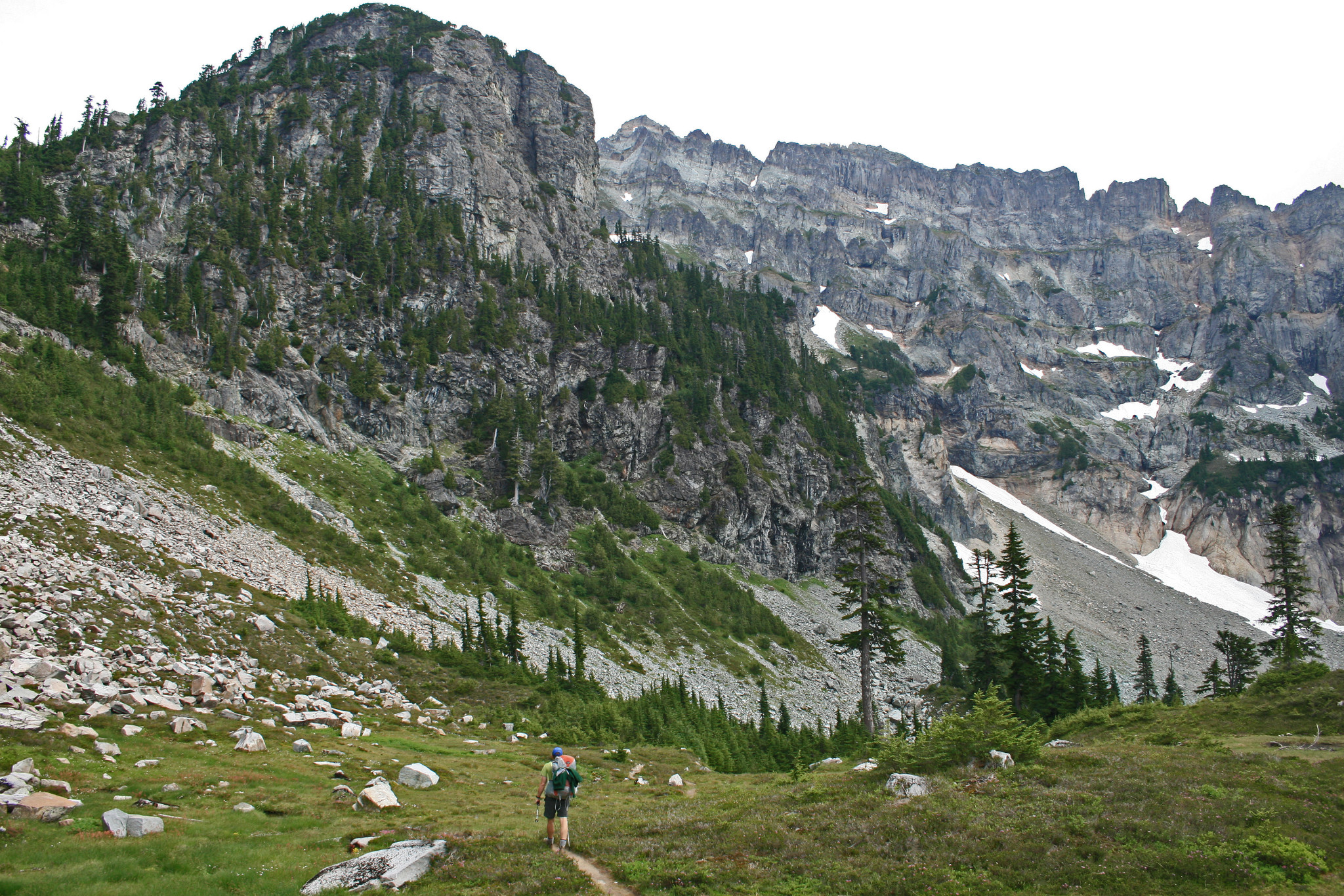
The trail now becomes fainter, and as it follows the ridge up and down, it becomes apparent that there is no trail maintenance beyond here, and that not many people have ventured along this path. After about 1.25 miles, the trail becomes pretty sketchy, more of a scramble than anything else, and reliant on rock cairns and faint sections of trail to lead the way. Now, it’s over jumbled granite, and in a few places, you’re left to grab for handholds, to pull yourself up.
…It’s impossible to suppress a “Wow!” here…
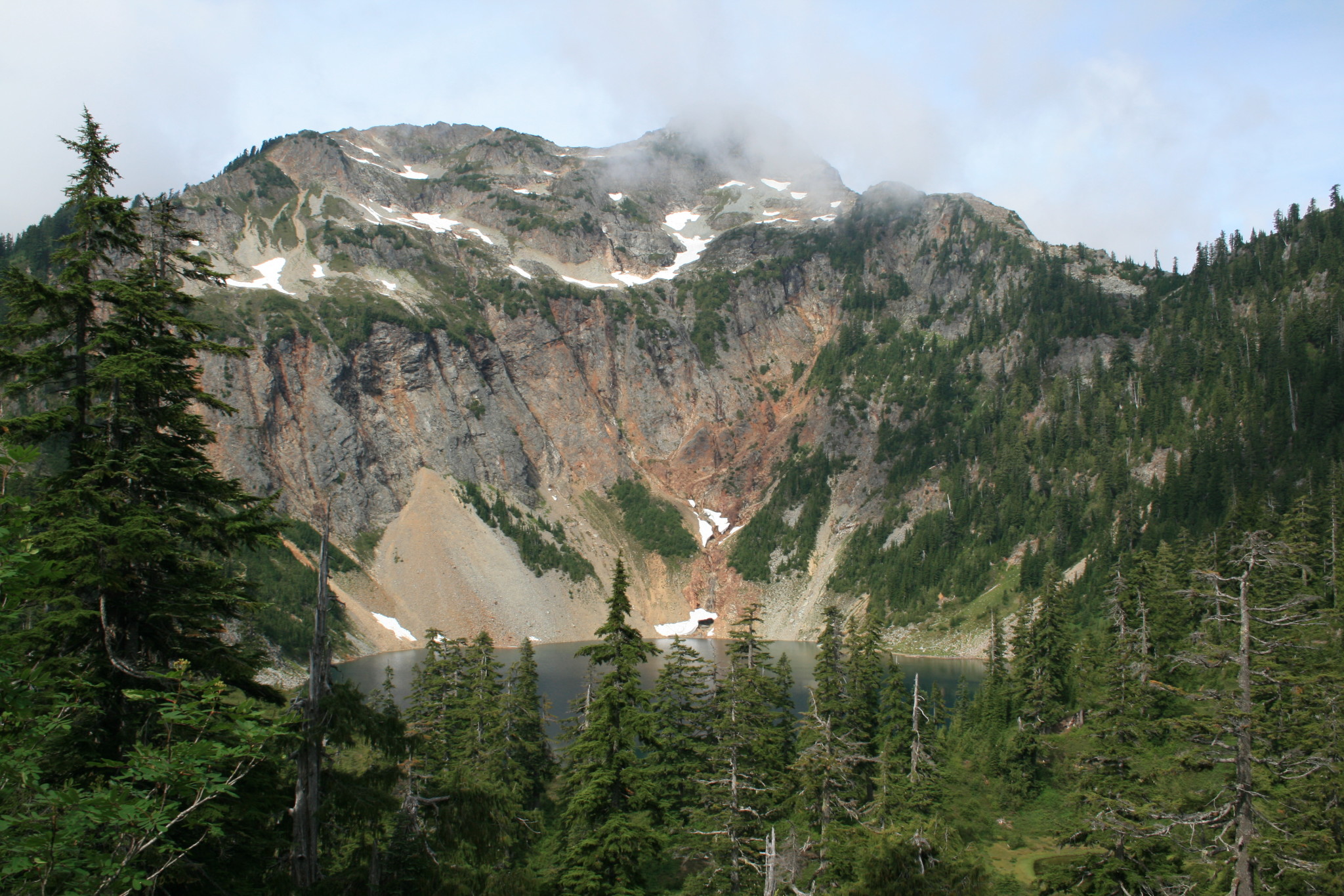
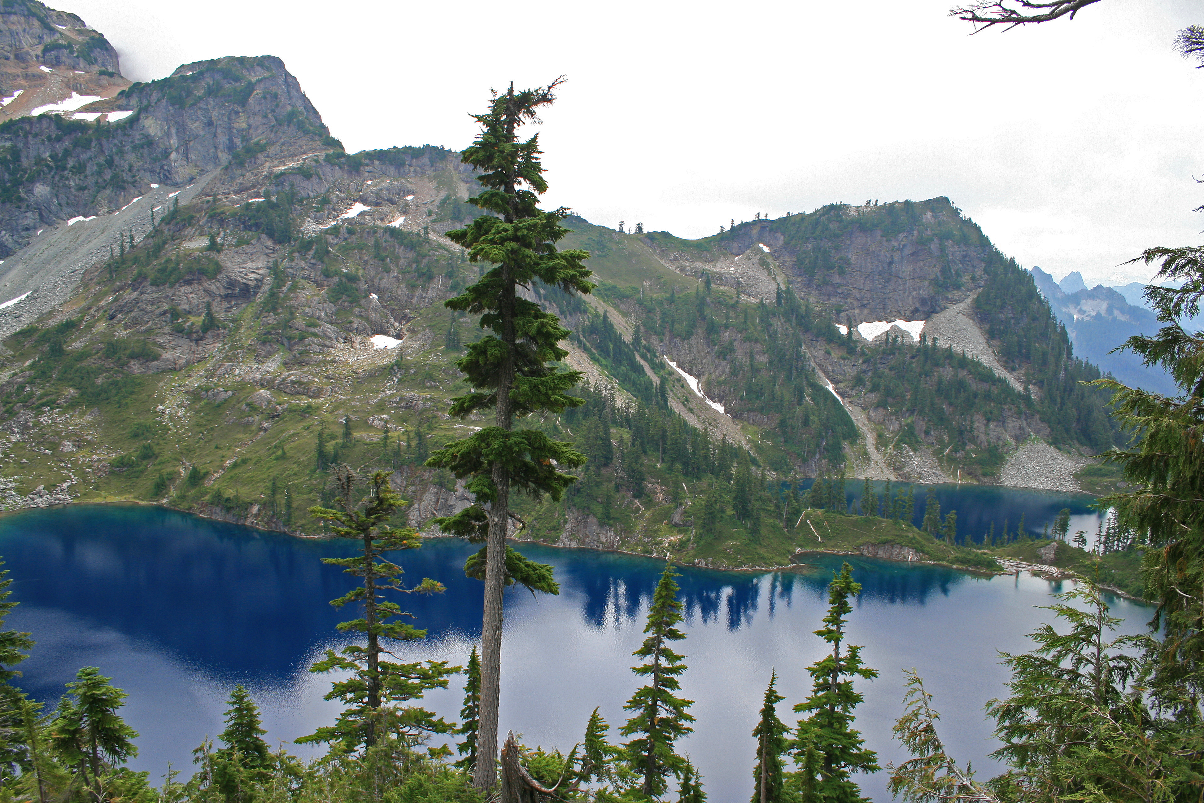
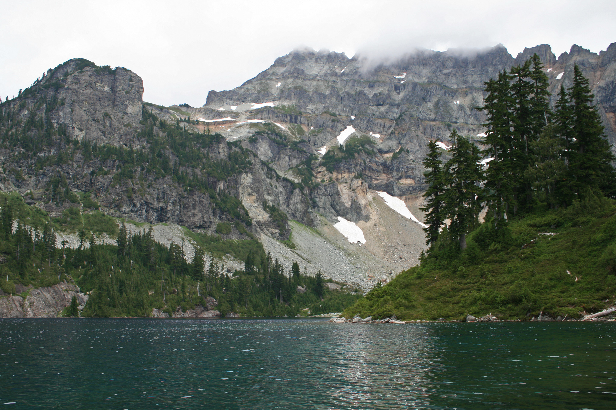
We reach our high point, the pass between Twin Peaks, and get our first view of spectacular Twin Lakes below. It’s impossible to suppress a “Wow!” here, as the blue of the lakes is stunning. It’s deep dark cobalt blue, the depth of blue that words are futile to describe. Both lakes are shining in the reluctant sun, peeking out from behind the constant wave of clouds that roll by, lining up one after the other, as if waiting for their chance to gaze down at these two blue gems. The whole northeastern edge of the lakes are the massive headwalls of Columbia Peak, which forms a massive, sheer wall of granite, that still hides large snow fields in its granite folds.
Not sure I would want the experience of feeling like a spare in a game of ten-pin…
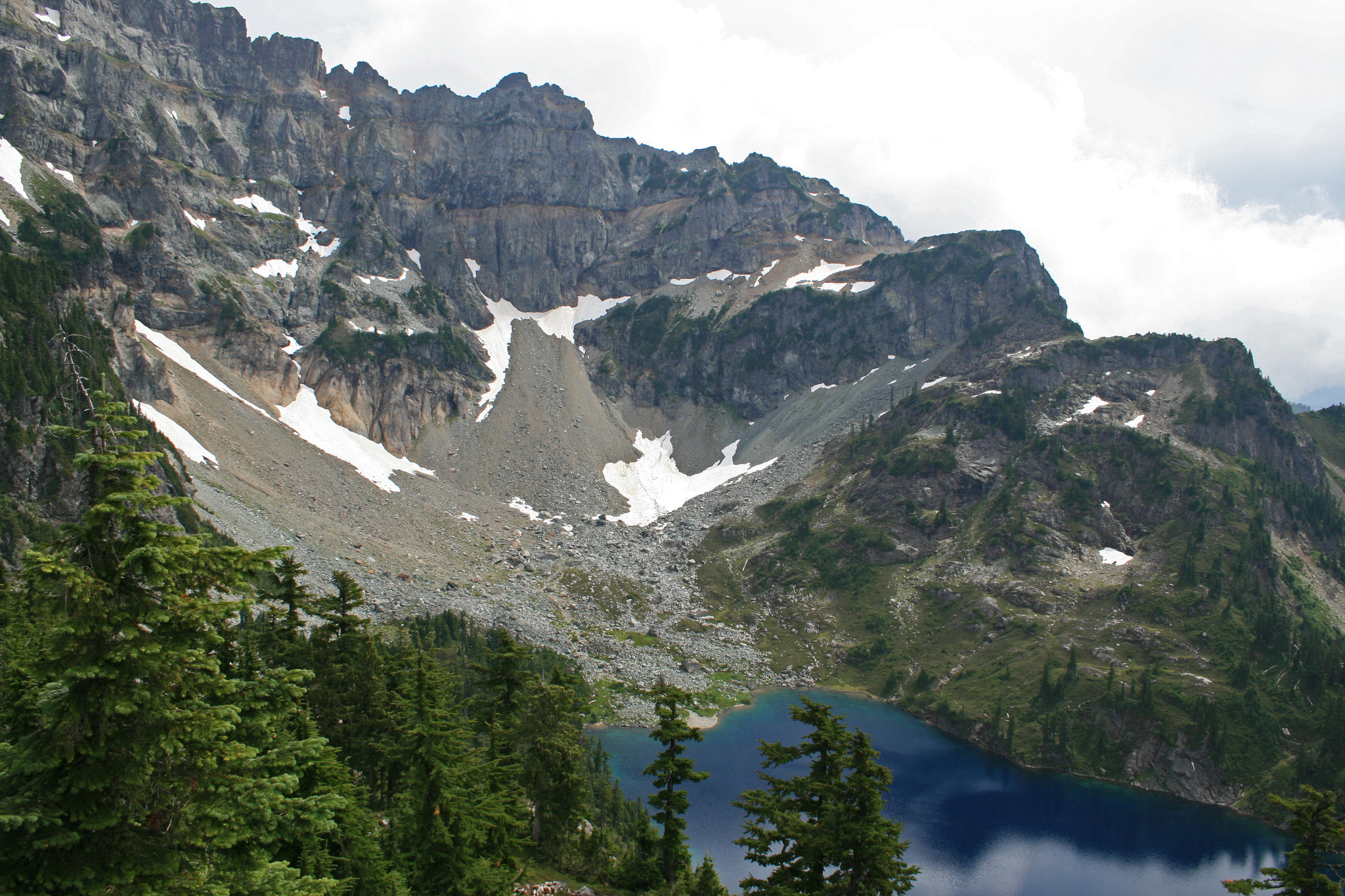
The walls are near vertical, and at the bases of these hulking walls, are large run outs of scree and boulders, many of the rocks are the size of small houses and cars, tumbling all the way down to the lake. It’s at this edge of the lake, dotting the grassy fields among the boulders, that we see several tents. On our way down, we hear the peal of rocks striking rocks, and I wonder to myself, “are any of those boulders are still reaching the lakeshore?” Not sure I would want the experience of feeling like a spare in a game of ten-pin…
As we reach the encampment, we notice the signs for “toilet” and “campsites”, so it must not happen…Often…From high up at the ridgeline, we had a chance to survey the area, and it looked as if there were some open spots between the two lakes, on a narrow stretch of land that delineates the two. We pass through to the far side, and I can hardly wait to see a flat spot to drop my pack at, it seems that for the last 4 and a half miles or so, there’s been nothing of the sort. So, you can imagine my joy, at reaching the spot we had spied out earlier, to find that indeed, there was a flat spot to jettison my pack! I want nothing more right now, than to plop down, and get my boots off, I’m exhausted. It’s still early, so, after a little rest, we decide to wander to the far reaches of this lake, to explore.
…in a small mud flat, someone took the time to create a message with stones, an epithet of wishful desire…
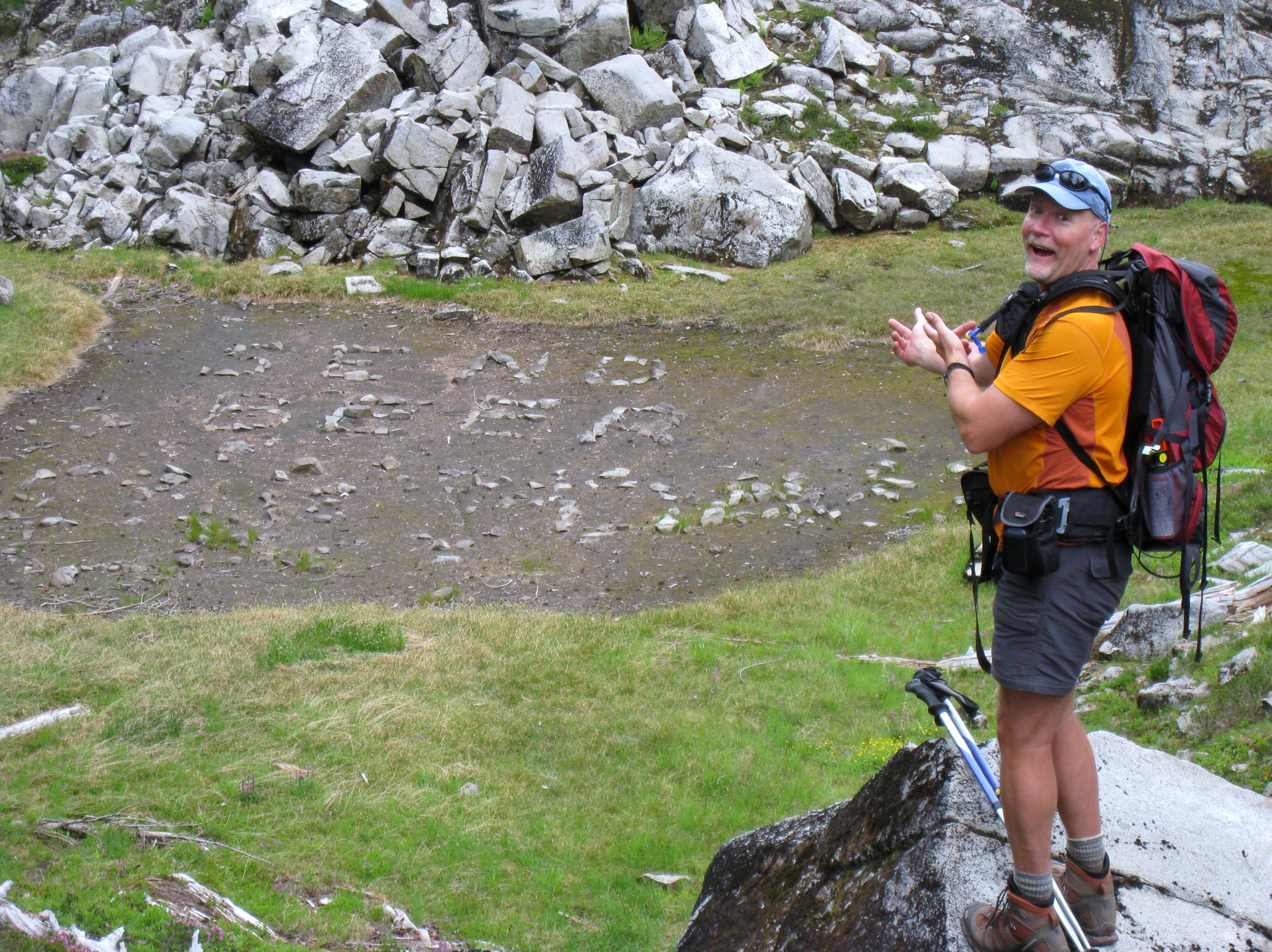
First, we set up camp, and spread our gear out, as if a disgruntled bear had wandered into camp, and scattered everything looking for something to eat…My mother would be proud, or at least reminded, of what my room used to look like when I was the adolescent resident..At the far end of the lake, in a small mud flat, someone took the time to create a message with stones, an epithet of wishful desire, to any passing plane, or helicopter. One that would perfectly cap off a long, tiring, hot day, next to the lake…”Send Beer”…A simple, but heartfelt sentiment, one that I felt I could truly identify with…
We marvel at the crystal blue waters, and how deeply you can see into the lakes depths, the fish swimming near the banks look as if they are floating in a blue sky, the water is so clear…Dark, ominous clouds continue to fill the sky above us, and we decide it’s probably best to head for camp. We’ve taken all the pictures we can, and seen all that our legs feel up to carrying us to, so back we go, to our new home.
Once back at camp, I can tell I’m done for the day. All I can think of now, is to get these boots off, and rest a bit more..Aahh..That feels better, except for a sore hoof. I make my way to the lake to soak it in it’s cool waters, and can barely leave it in for 10 minutes, save some wincing and complaining about how c-c-c-c-oooooold it feels…Greg sits back on the banks with a nice warm, aromatic, cup of joe, watching my self- torture with some amusement…After drying off my foot, and putting on camp shoes, we are visited by the occupants from the other site.
Actually, as there are few places to camp here, the “trail” ( I use that term loosely), wanders through pretty much every campsite here, so its’ more of a “hi, how ya doin’!” type of thing as they stroll through camp back to their site. Dinner. It’s another good one, this time we use the Knorr Italian sides noodle dish, the Creamy Garlic Shells flavor. One package of that, with some chicken chunks that have been sautéed in olive oil with mushrooms, and garlic salt, creates a savory meal. That, and some Roasted Garlic mashed spuds from Idahoan. For dessert? Of course, we would only pick that which would perfectly compliment such a wondrous spread…We had another nutter butter peanut butter sandwich cookie!!! With Tootsie rolls!!! Really, I mean what else would go with that???
Eventually, they met up again, after much shouting and some whistle blowing…
Our hunger abated, we sit back to admire our full bellies…What I forgot to mention, is that as we were cooking dinner, one of the guys from the other camp came back through, asking if we had seen one of his comrade’s that was late returning. Indeed, several hours earlier, on our sojourn to the far side of this lake, we were able to look down to the shores of the lower lake, and spot him, fishing from the banks. He thanked us, and moved on. Eventually, they met up again, after much shouting and some whistle blowing…
After dinner, we had a chance to chat with them, Chris and Scott, as I remember, and watch Scott fish for a bit. The rainbow trout he had were an amazing color, scarlet along the belly, and their backs were blue, making them a very colorful fish indeed. These fish were hungry, and would strike at just about anything, we witnessed him catch and release about 10 in the 45 minutes or so that we stood around jawing…It was then, that Greg and I decided that perhaps, in the future, a rod and reel might be part of our repertoire…We said our goodbyes, and returned to camp, to wash dishes, and settle in to watch the night quickly spread down from the mountain peaks.