Trail Ranking: 3/5 A good trail for wide open views into the crater of Mt. St. Helens, and the surrounding volcanoes in the Cascades. On a clear day you can pick out at least 5! Trail is relatively easy to follow, and you can make a through hike out if it, if you park a car at either end.
Difficulty: 4/10 The greatest challenge, for me, was the oppressive heat, as there were few places along the way to escape into shade. Was not that steep, nor did the terrain really offer that many obstacles. No worries about downed trees here…They’re already downed!
Getting there: From Olympia, head south on I-5 to exit 63, the WA-505 towards Winlock/Toledo off ramp, and turn left after exiting, crossing over I-5. Follow WA-505 for 16.4 miles.
Turn left at WA-504, towards Mount St. Helens, and follow the WA-504 for another 28 miles. This is also called the Spirit Lake highway.
Take the ramp onto WA-504, and follow this for 8.8 miles to the Johnston Ridge Observatory parking lot. The trailhead is in the far east end of the lot.
Follow the Boundary Trail, (or Trail 1) all the way to Norway Pass. Maps: We used the Green Trails Map #332, Spirit Lake, and we found it more than sufficient for this area. Permits: This trail is part of the Mt. Margaret Backcountry, and it will require a Northwest Forest Pass, and a Backcountry camping permit. Backcountry permits are free, but you must apply for one by mail or fax up to 3 weeks in advance, or, in person at the Johnston Ridge Observatory. Check theBackcountry-Mt. Margaret link for more info, and permit application.
Our route for this trip would have us starting at Johnstone Ridge Observatory, and stay on the Boundary Trail, as it winds around St. Helens Lake, Past Coldwater Peak, to our Base Camp at The Dome. On day two, we would keep our campsite at The Dome, and venture further out on The Boundary Trail.
Day 1.
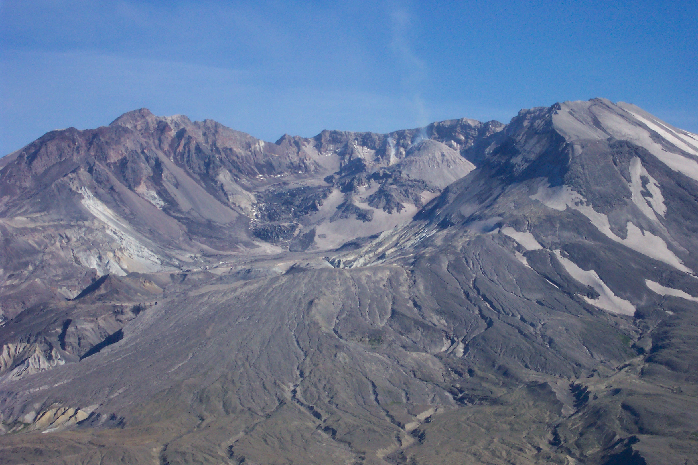
Mt. St. Helens
We started out early from home, hoping to get a good jump on the day, but, due to a slight navigation error, we ended up driving to Windy Ridge on the East Side of Spirit Lake…Unfortunately, we needed to be on the West Side, as the start of our trip was to be from Johnstone Ridge Observatory! Needless to say, we had to backtrack, which put us behind our planned schedule by 3 hours.
We all know the best laid plans sometimes go awry, and the start of this day was to be no exception. We finally arrived at Johnstone Ridge around 6:00pm, not the best way to start an 8 mile hike!
We didn’t reach camp until around 10:00pm, just as the last vestiges of the daylight crept away, so there wasn’t much time for taking pictures or video, as we were on a frantic scramble to reach camp before dark. We hoped that we would have more time to snap pictures and video on the second day.
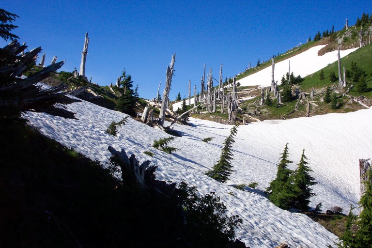
Mt. St. Helens, as seen from the start of the Boundary Trail, Starting at the Johnstone Ridge Side. You can see her smoldering.
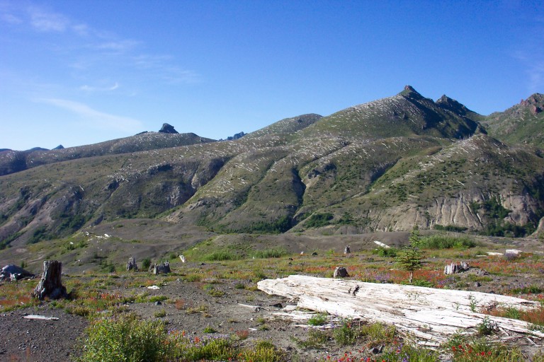
Blowdown from the Johnstone Ridge side
View across the blowdown. Also from the Johnstone Ridge side.
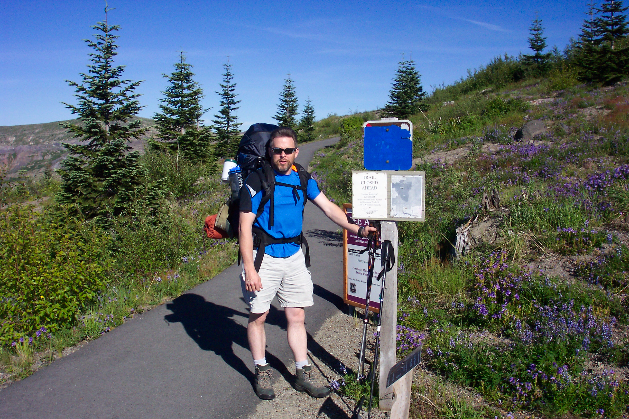
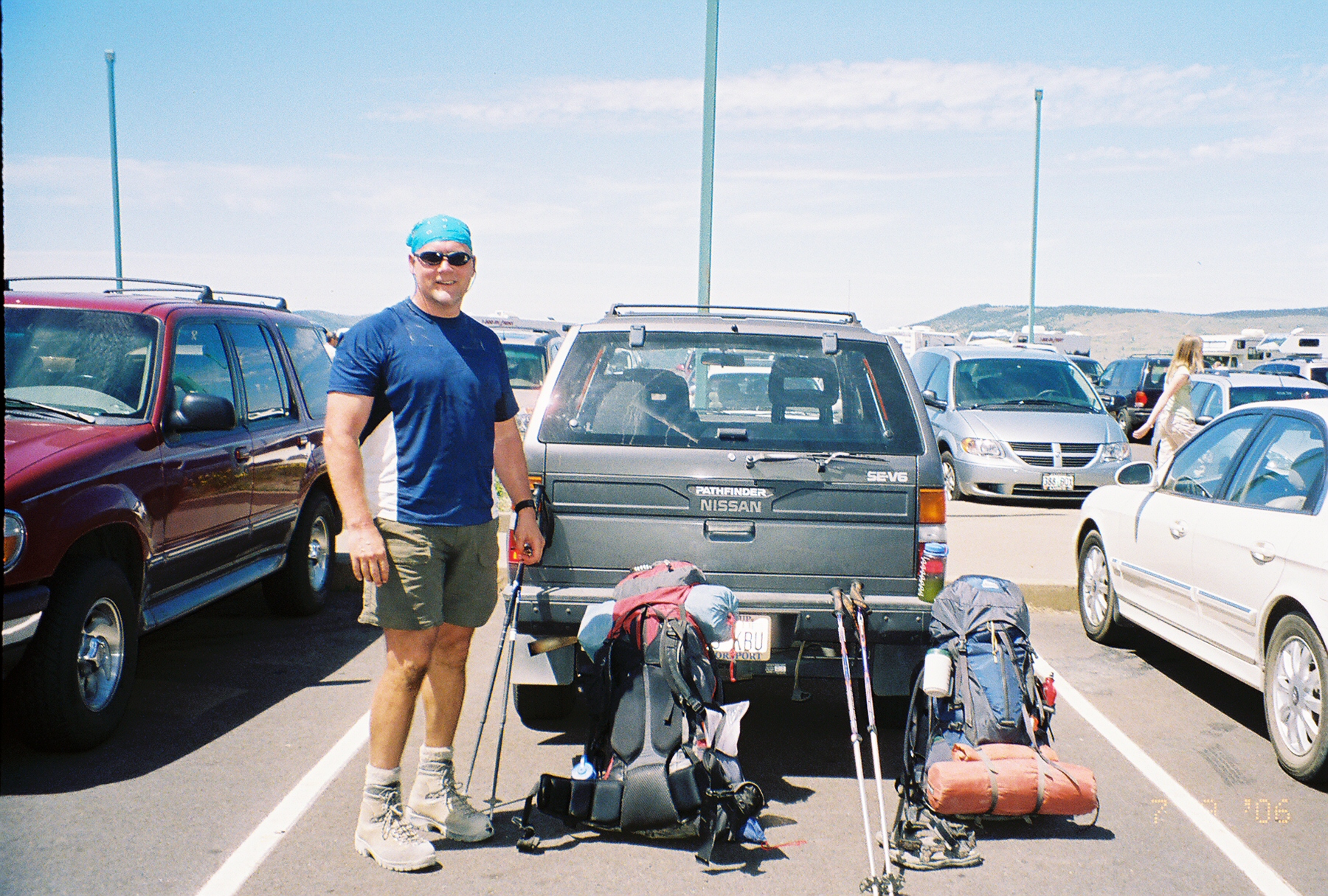
Greg at TH near parking lot
Greg at the beginning…
Day 2.
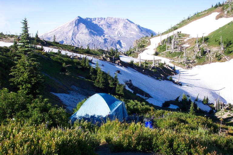
After getting up, we get a chance to see our surroundings in the light of day, and are amazed at how far we can see. We picked a great spot for the night, and decide that we will make this our base camp, and venture out from here, further East along the Boundary Trail. We have the whole place to ourselves, and our source of drinking water is the runoff from the nearby snowfield.
After leaving camp, we travel through close by Mt. Margaret camp, then over Bear Pass, and turn around close to Norway Pass, our halfway point for the day. Along the way, we are greeted by huge views, and many snowfields that require traveling on. At one point, as we stop for a lunch break ,we are able to see most of the major mountains in the Cascades. Mt. Rainier, Goat Rocks, Mt. Adams, Mt. St. Helens, Mt. Hood, and even Mt. Jefferson in Oregon…All under the unrelenting sun. As most of the trees are blown down on this part of the Boundary Trail, I felt as if I was cooking, and kept thinking about how good the snow melt was going to taste, nice and ice cold…
Campsite at the Dome Camp
Snags in the snow near the Dome Camp
Snag’s with snow fields, close to camp.
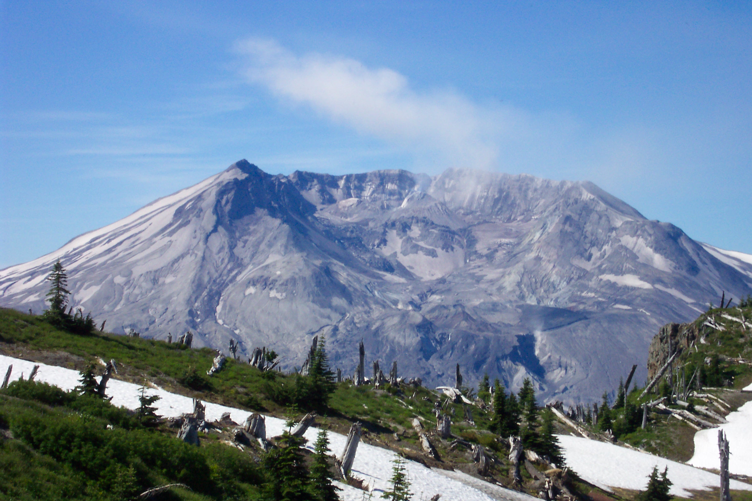
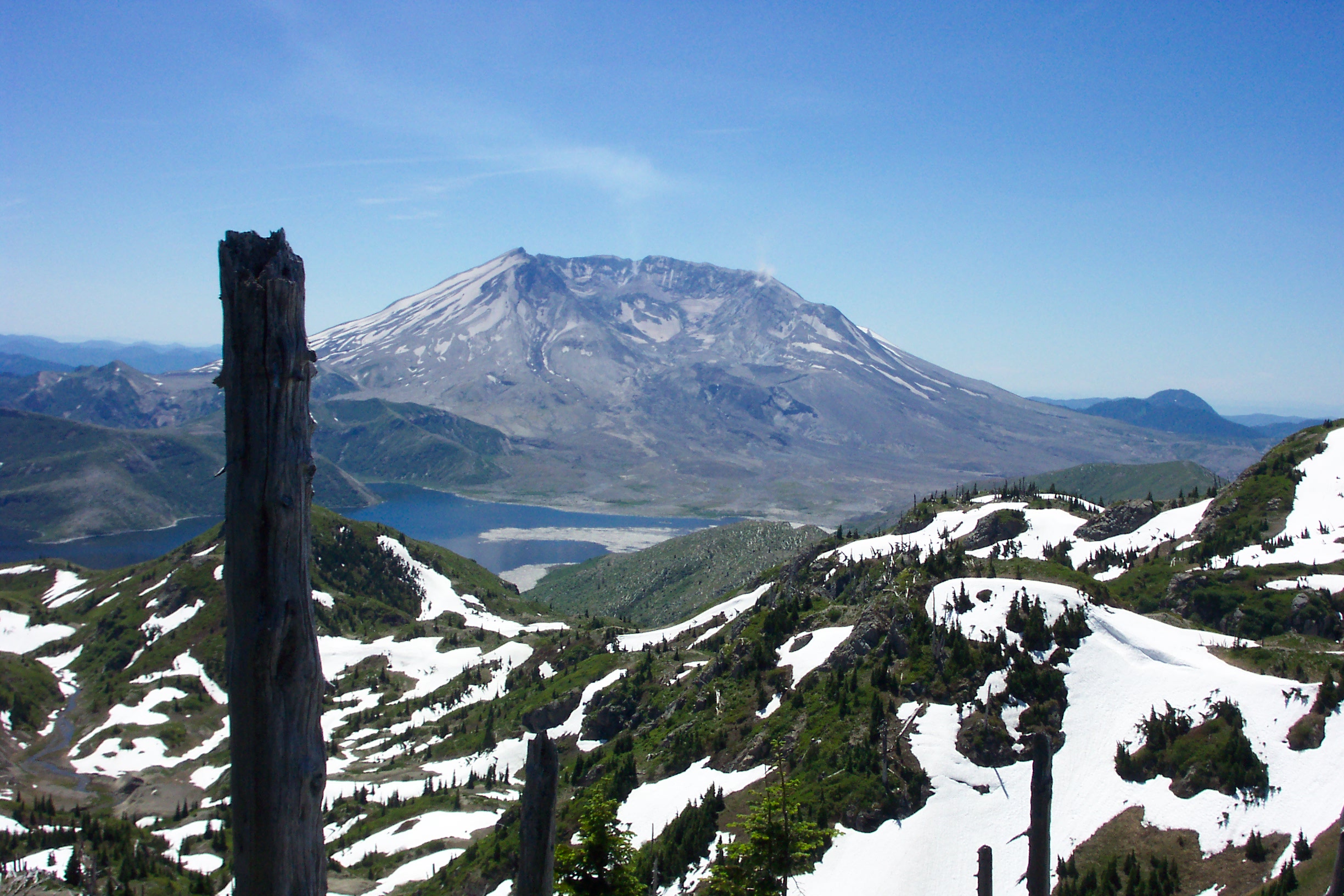
Steam rises from the crater on Mt. St. Helens
Mt. St. Helens, with steam cloud.
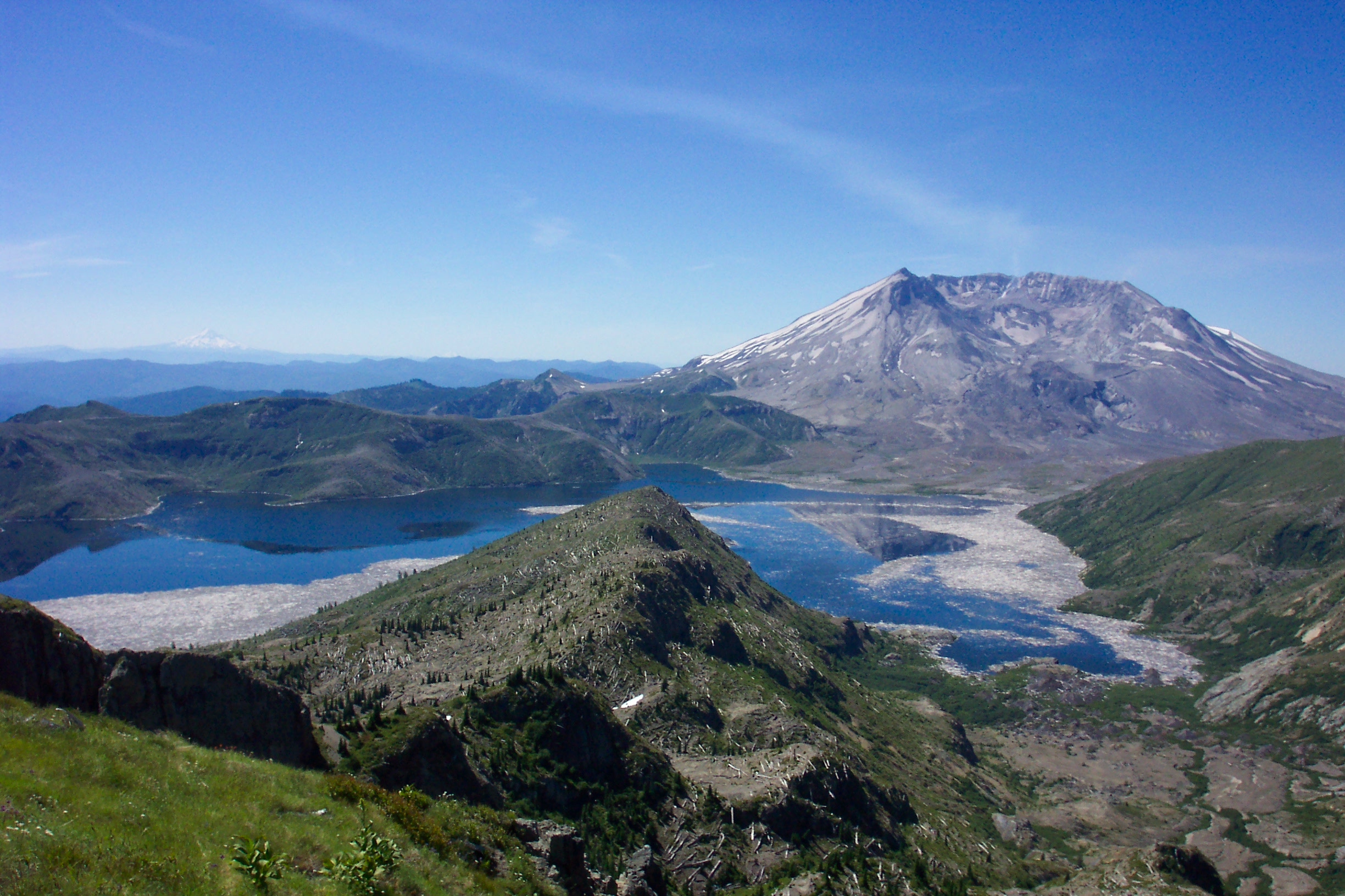
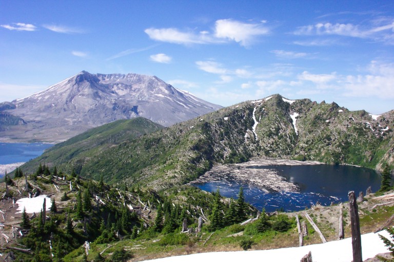
Mt. St. Helens, with Spirit Lake
Mt. St. Helens, with Spirit Lake in the fore.
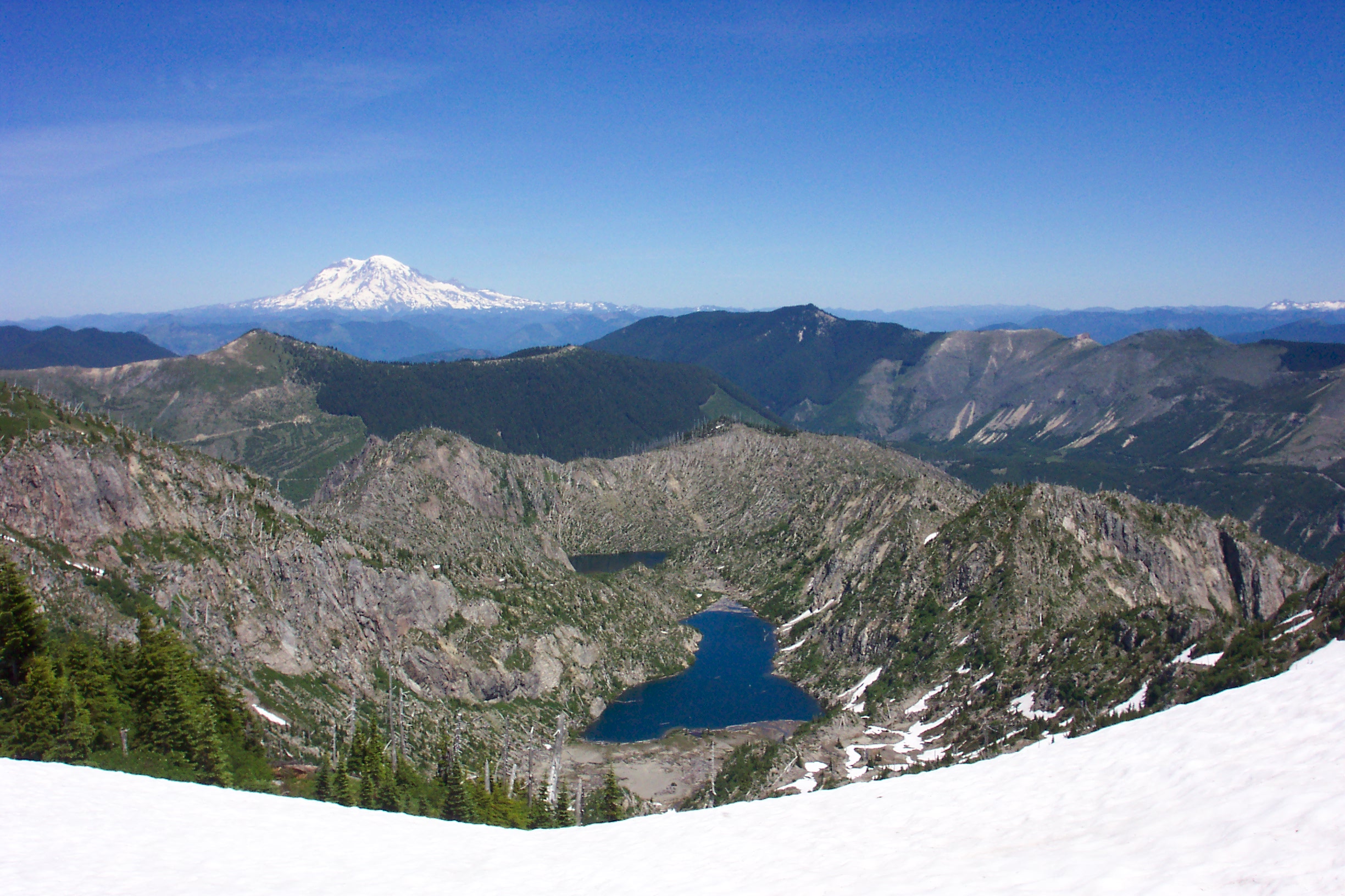
Mt. Rainier, from the Boundary Trail
Mt. Rainier.
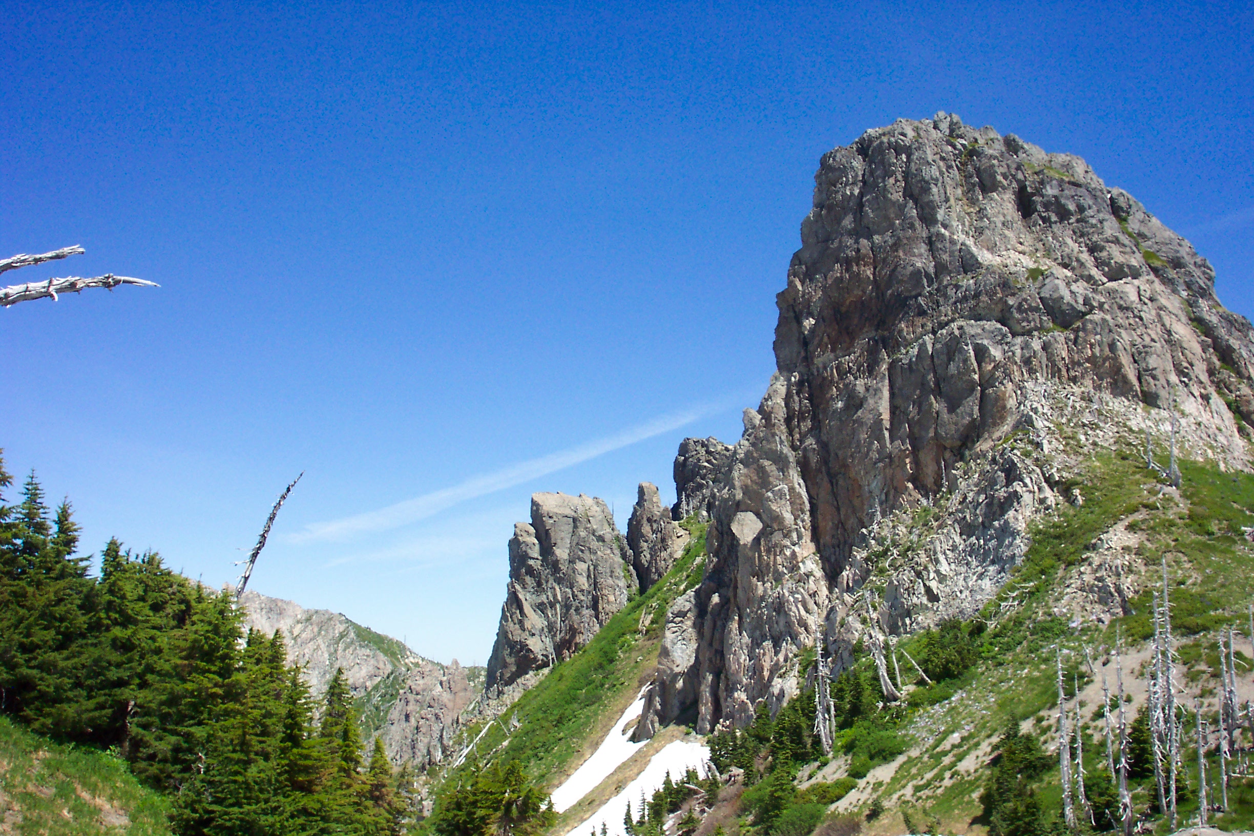
Prominent rock face along the Boundary trail
Prominent Rock along the Boundary trail.
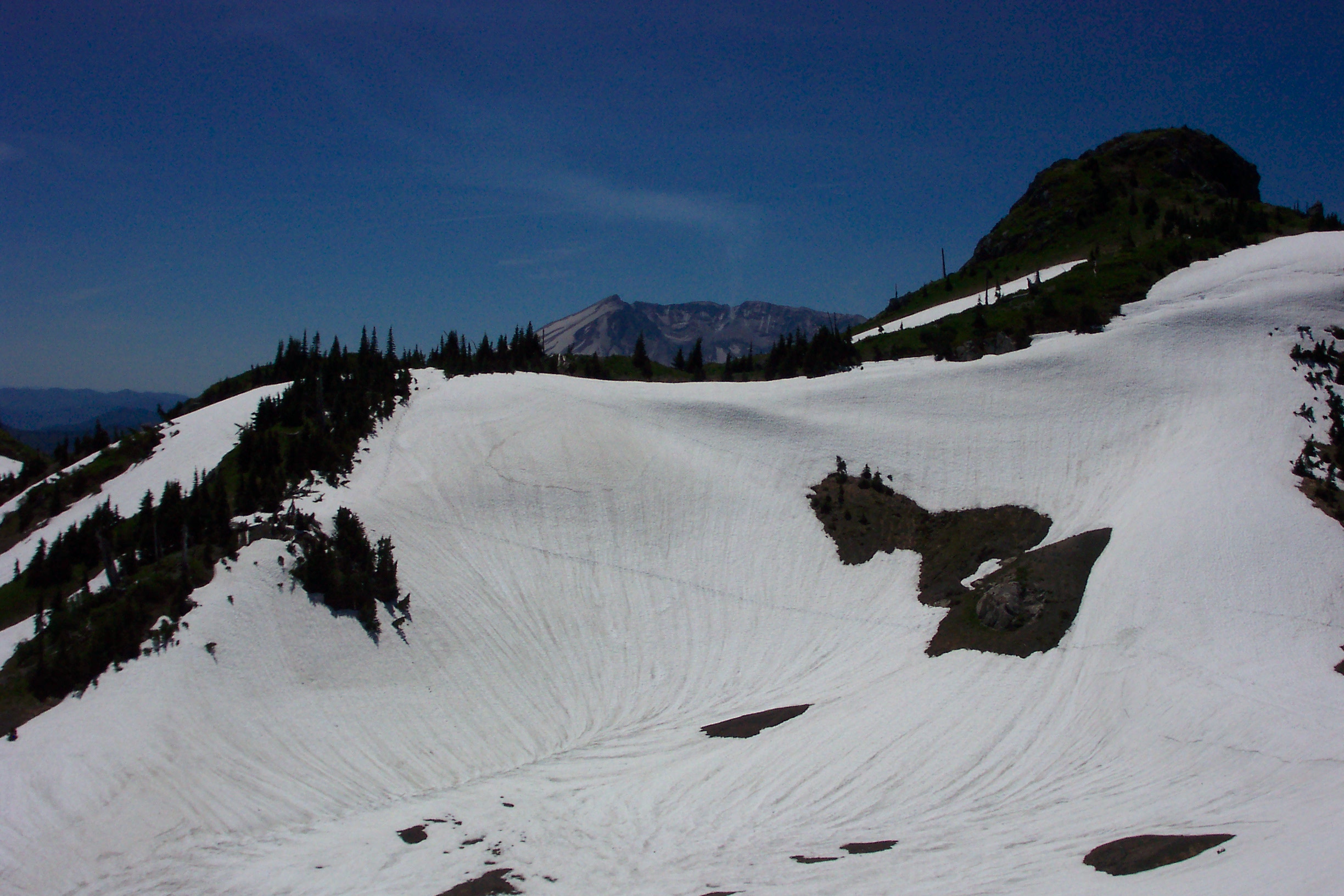
Snowfield to cross on Boundary Trail
One of the many large snow fields that we had to cross…If you look close, you can see a trail in the snow cutting diagonally across. Mt. St. Helens in the background.
Boot Lake, with Mt. Rainier
Looking NNE, across Boot Lake, towards Mt. Rainier, from the Boundary Trail. Somewhere close to Mt. Margaret.
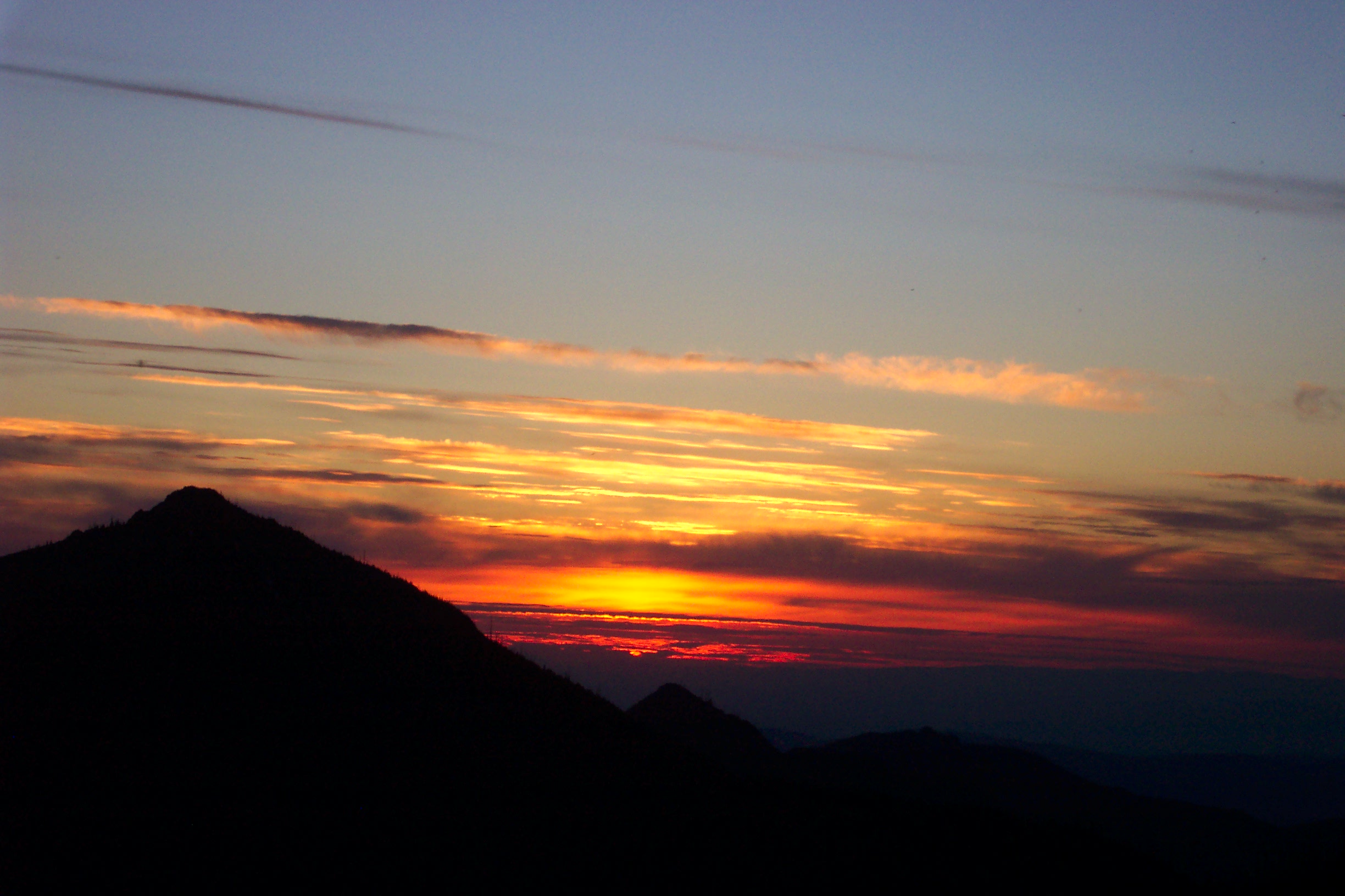
Mt. St. HelensSunset from the Dome Camp
Yep, another view of Mt. St. Helens.
Day 3.
Up and out! As we had to go to work this day, we decided to get back to the car as soon as possible, so that we could have a few hours to sleep before work. after packing up, we head for home under the unrelenting sun. After several hours on the trail, I would stop, and scoop up a hat full of snow, and plop it on my head that was getting fried under the noon day sun.
St. Helens Lake
It would bring temporary relief, but, after passing through the hole in the rock by St. Helen’s lake, there was no more snow, and no more water either, for the 5 mile trudge back to Johnstone Ridge Observatory. The temps for the day were in the 80’s, and I was sure that I was walking across the surface of the sun, or had been stranded out in the middle of the desert!
…At the time, as I was about to fry under the sun, I thought them legally insane…
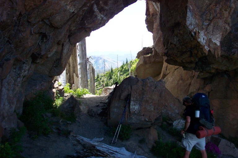
Hole in the Rock, the trail passes right through it. The last welcome shade from the unrelenting sun, before getting back to Johnstone Ridge.
There are no trees for shade, and you are completely exposed to the sun’s constant glare. By the time we got back to the trailhead, I had finished off all of my water, and was near the point where I was going to tackle the next day hiker I saw carrying water! We could tell that we were getting close to the end, when we started seeing more and more people just out for the day, and I was amazed at the amount of casual day trippers we saw NOT carrying any water, at least 2 miles from the parking lot.
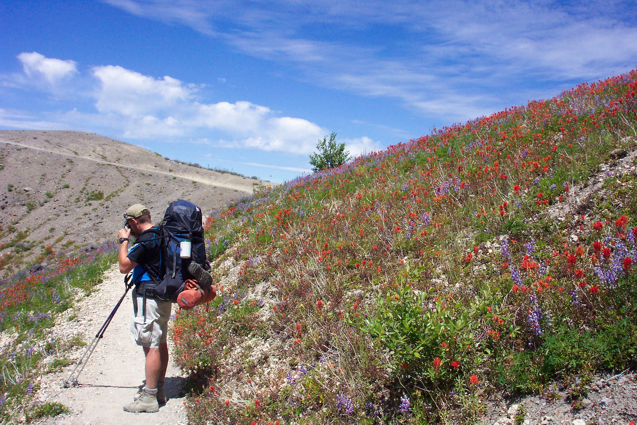
The trail home. Even though it is wide open, under scorching heat, the flowers were out in full bloom. Several large fields could be seen close to Johnstone Ridge. Notice that Greg no longer resembles the pasty white version that started the trail on day 1…
At the time, as I was about to fry under the sun, I thought them legally insane…
There was a lot to see on this trail, especially because the entire terrain had been scoured of trees, so the sightlines where like those above treeline.
Dave back at the car, partially melted
Having said that, I can honestly say, that the best time to take this hike is right after most of the snow melts out in late spring, or fall. During the hottest days of the summer, there really is no way to get out of the suns full on blasting…
I’m sure that you can probably surmise by now, that I am a hot weather weenie, when it comes to hiking in it. I’m a true P.N.W.er, more comfortable in the cooler climes…