Day 2
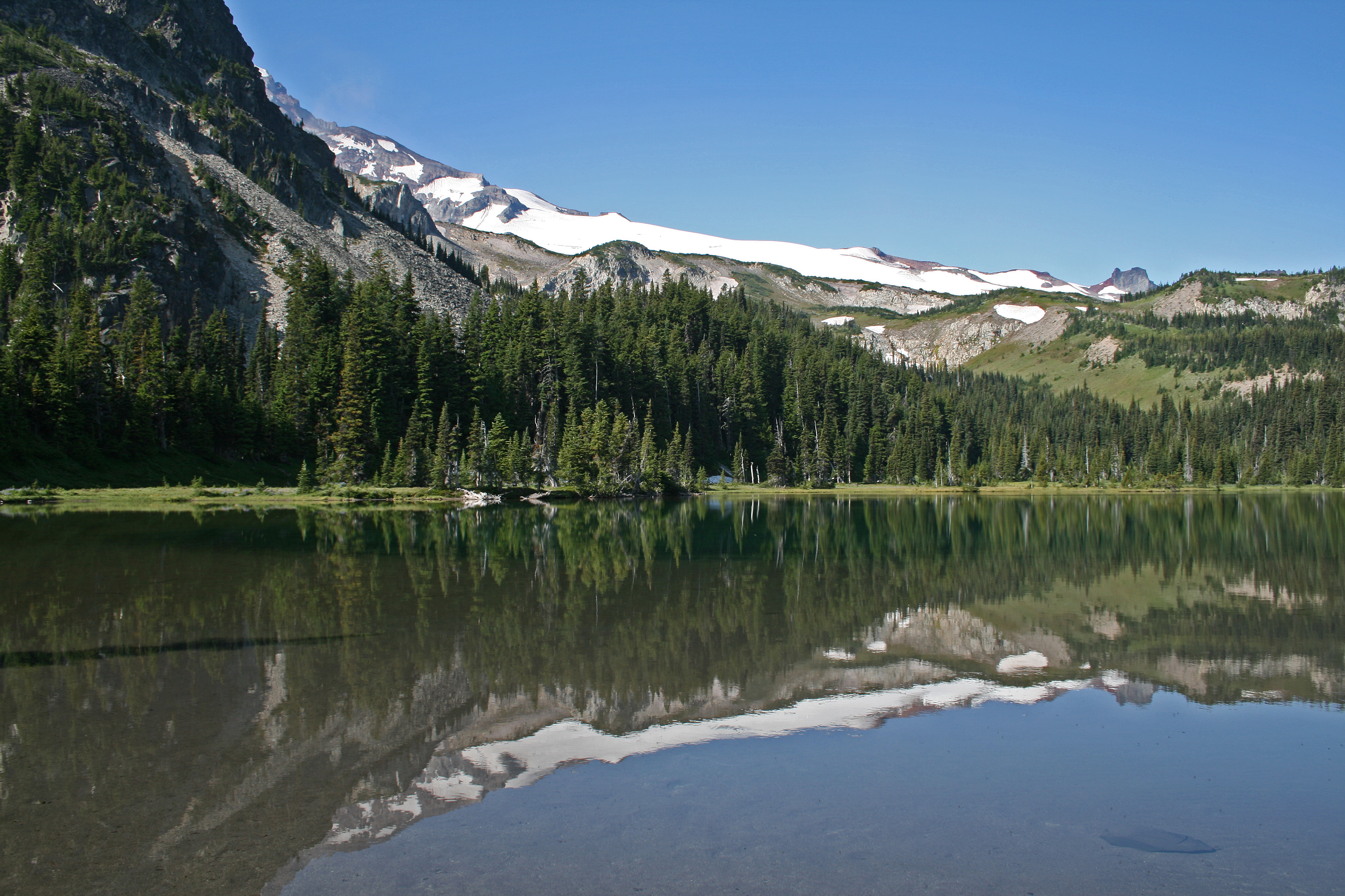
8.39 miles. 2853ft gain/3165ft loss. The morning is nice and calm and the lake’s waters are like glass, reflecting the image of Mineral Mountain, and the edges of Mt. Rainier on its still surface. I’m thinking that they should have called Mineral Mountain Obstruction Mountain for it does a good job of hiding the view of the Mountain behind its shoulders.
As we round the edges of Mystic Lake, we are on the lookout for a large bear, that one of the campers at Mystic said she had been startled by yesterday evening, as she made her way to camp. According to her, she had worked at Glacier National Park for years, and was used to seeing black bears, but she said this one was huge! She said that it scared the…Looking for the right word here…Daylights! Out of her…But, we never saw it; instead we saw the tower like rocks sticking up out of the sides of Old Desolate, the other mountain that sits on the edge of Mystic Lake.
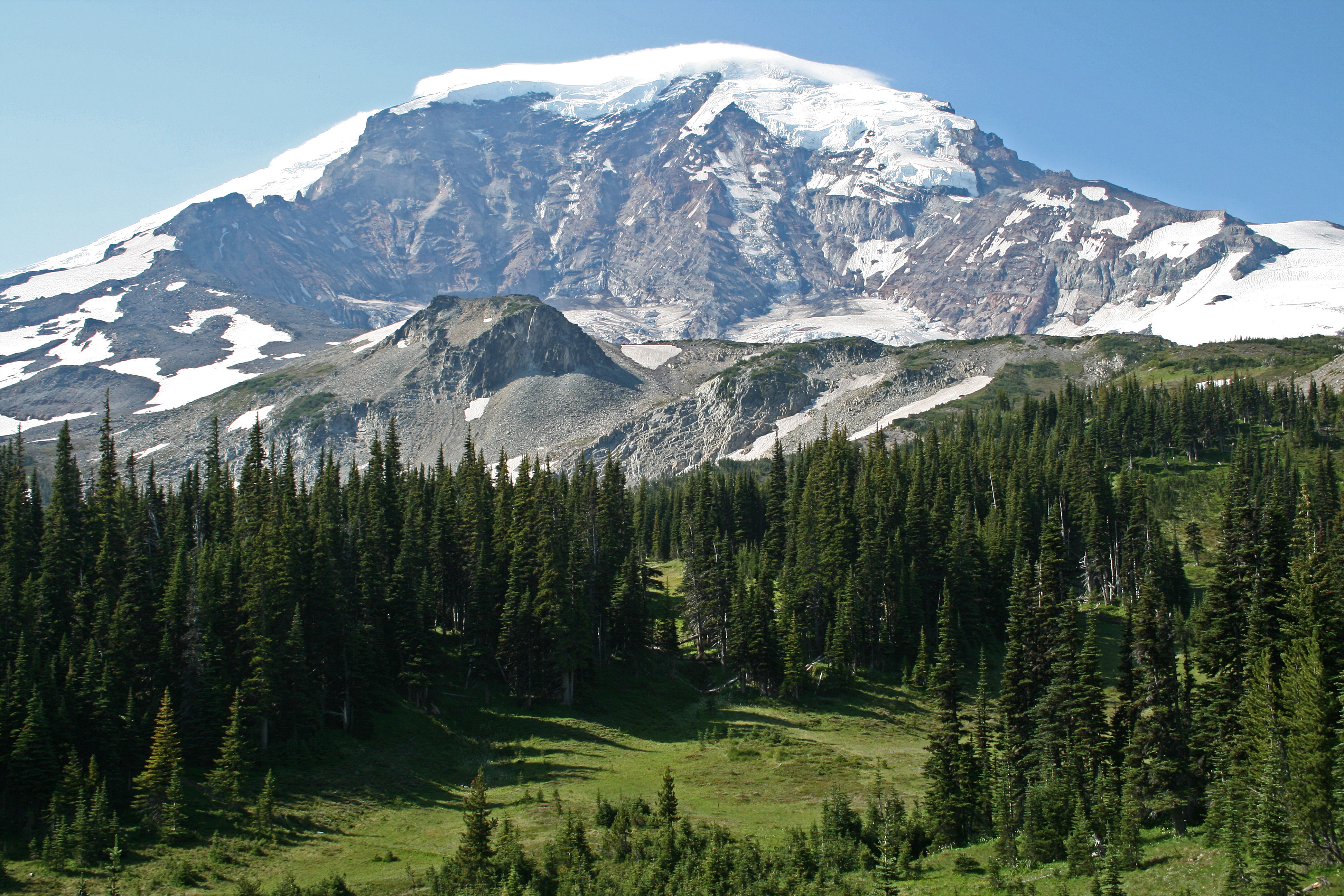
If you look back at the right time, you can still see the mine shaft high on the mountain from prospectors long ago…Once through the meadows surrounding the lake, you start to climb, and as you do, don’t forget to look back every once in a while, you’ll be rewarded with snapshot worthy views of the Mountain, as you escape the blocking efforts of Mineral Mountain.
It’s amazing to think that with all this constant rock falling, that over the last few thousand years, there is a mountain left at all!!
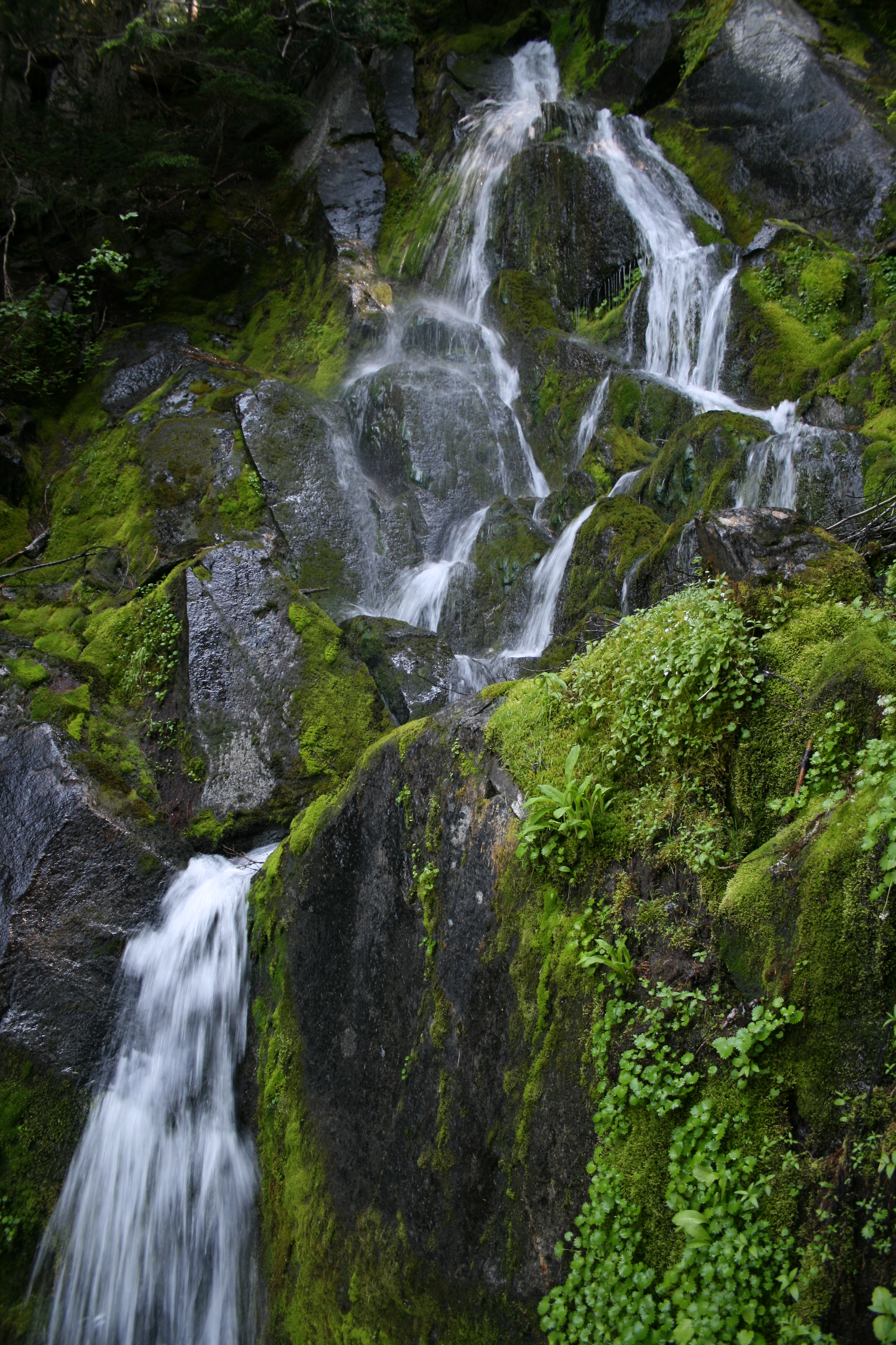
Also, you’ll hear the constant rumbling of rock fall off of the Willis Wall, the prominent feature on this side of the mountain…As you glance back, hoping to see the rocks tumbling down, you will be able to see the telltale dust plumes rising into the air, marking the location of the latest run. It’s amazing to think that with all this constant rock falling, that over the last few thousand years, there is a mountain left at all!!
The next worthy views are reached when you get to Moraine Park. I think it’s worth mentioning, that it might have been just as aptly named Marmot Park, as you are sure to see them running around here, or sunning themselves on the ample boulders scattered along the edge of the park. It’s a beautiful walk through this flat meadow, again framed by the indomitable mountain and surrounding peaks.
At the far end of the park, it begins downhill in earnest, and your knees will wonder when the punishment will end, as you head down, down, down, to Dick Creek camp. The down isn’t over yet, as you need to make it to the bottom of the Carbon River basin. You’re also travelling next to the Carbon River Glacier, the lowest Glacier in the lower 48 states.
…a great reminder to stay away from the snout of the Carbon Glacier…That is, unless you want to get creamed by a falling boulder…
Sometimes, it’s easy to forget that you’re next to a glacier, as the entire surface of it is covered in moraine, even with small trees and vegetation growing on it. But, it’s because of this covering that the ice manages to crawl this far down mountain. At its snout, it too, has constant rock fall, a great reminder to stay away from the mouth of the Carbon River…That is, unless you want to get creamed by a falling boulder…
Not far from the snout of the glacier, you’ll come to the Carbon River Suspension Bridge, a great bridge that spans the gap of the Carbon, that seems to sit forlornly from bank to bank…Used to be another good day hike from Ipsut Creek campground, until the road washed out…Now, it’s quite a jaunt, even if you come down from Mowich Lake. I can remember on summer weekends, that it would take you almost 20 minutes to cross the bridge, because there were so many people lined up to make the crossing. Now, the opposite bank stands empty, seems lonely almost…
Continue straight here, and follow the signage to Windy Gap. The trail continues through old growth forest, following the river for a while, and then…Right after the trail comes to another junction, stay right, to Windy Gap, and then start your switchbacks up and up to Yellowstone Cliffs.
This series of serious switchbacks could aptly be named, “The Demoralizer”, “Breakheart Ridge”, or, if you’re into acronyms, How bout RAO Trial, pronounced “Rawoooo” not unlike the sound heard right before hurling…(Which, naturally, stands for “Really?? Another One???).
Yep, it’s about 2200ft up to the camp at Yellowstone Cliffs, and at times, it seems that it is never going to end. This series of serious switchbacks could aptly be named, “The Demoralizer”, “Breakheart Ridge”, or, if you’re into acronyms, How bout RAO Trial, pronounced “Rawoooo” not unlike the sound heard right before hurling…(Which, naturally, stands for “Really?? Another One???).
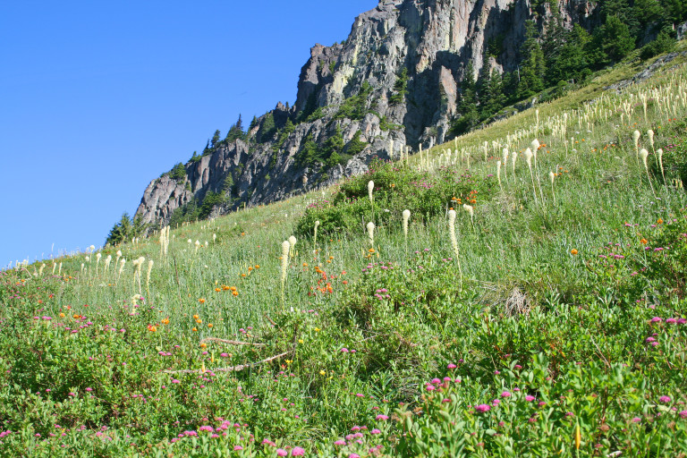
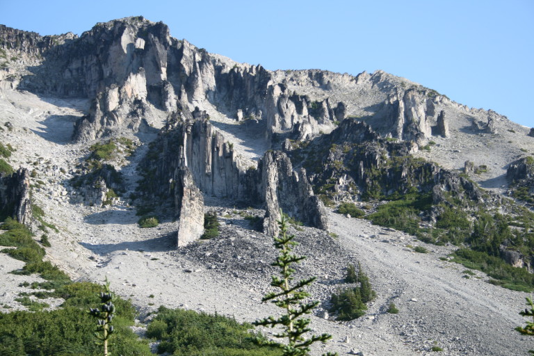
Finally, you break out of the old growth, into steep fields filled with Bear grass that slopes up at a steep angle, to the base of Yellowstone Cliffs. Jagged and steep, they fill the skyline with their jutting prows; huge monoliths of granite, looking like a row of battleships, making you crane your neck to look up at them. There is yellow lichen on the rocks, giving them their names, as well as larger quantities of orange, which brings into question the apropos naming of said landmark.
Somewhere, under all the snow, is the toilet, which we never found. It’s here that Greg experiences equipment failure.
Alpine firs cling to any footing they can find, reminding one of the last vestiges of hair sitting at the base of a bald pate. Once again, we are relieved to reach camp, to shed the weight off of our backs. There are only 2 campsites here, and they both are being encroached upon by mounds of snow, we pick the one that has the largest open area, and set up camp. Somewhere, under all the snow, is the toilet, which we never found. It’s here that Greg experiences equipment failure.

Seems he and the downed tree he was sitting on, had a little disagreement on proper