Day 2
1987ft gain/loss 13.4 miles.
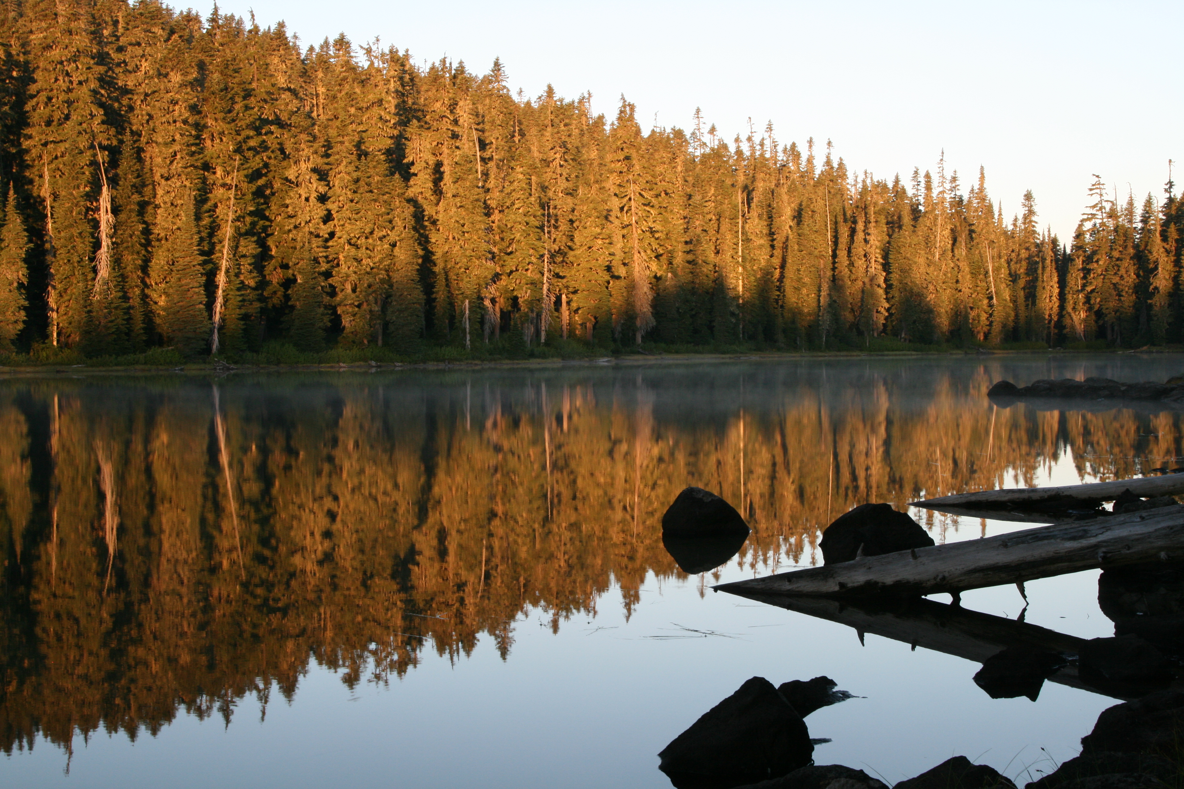
We awoke to the strangest noise this morning, almost sounded like a goat bleating, but I’m sure it wasn’t. Every 10 seconds or so, we’d hear a “baa-a-a-aaah”, then go silent, only to start again in another 10 second span. I couldn’t stand it anymore, so I grabbed the camera and bailed out of the tent. As soon as I did, however, the sound stopped. Never did figure out what it was, so instead, I focused the cameras on the lake, as the sunrise emerged, lighting up the lake in amber and pink hues. Very pretty.
“…as if monkeys were swinging in the branches on the opposite shores…”
Then, our ears were bombarded by more strange noises, as if monkeys were swinging in the branches on the opposite shores. Sounded like a dang jungle here, as whatever type of bird it was making the calls was flying in the tree tops, wailing and caterwauling, only being visible for an instant before disappearing in the canopy again. We listened to them for a good half hour before they went silent, I never got a good look at the birds doing the calling, but neither of us had ever heard that before.
A leisurely coffee and breakfast and we’re ready for the day ahead, and decide to do a big loop hike up to the Twin Sisters Lakes, up and over the top of the high point here, Tumac Mountain, then return back to our base camp. Looked to be close to 13 miles on the map, so we plot our course, and carry only the bare essentials in our packs for the day.
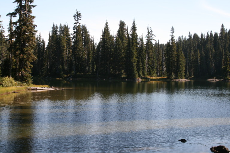
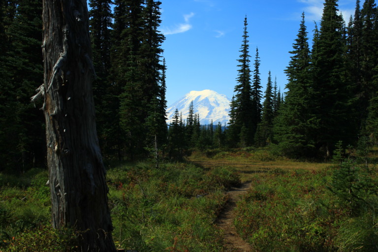
We retrace our steps back the way we came to the PCT, a scant .5 miles, under sunny skies. Looks like the weather is once again going to cooperate with us! Back on the PCT, it’s once again a nice, flat and well maintained tread through sparse forest to Pipe Lake, where there are more campsites. The lake is indeed shaped like a pipe, the main body of water is clear and shallow, with a turquoise tint, and surrounded on all sides by trees. The trail follows along the lake, where it narrows, making up the “stem” of the pipe, looking more like a small river than a lake. In 1.3 miles or so, we make our first trail junction, where the PCT meets trail #44, the Cowlitz trail. We’re only on it for about two tenths of a mile or so, before turning right to stay on the PCT. Lots of water, and smaller alpine firs make up this part of the trail, and at this junction, we get some good views of Mount Rainier, the advantage to being around smaller trees, you can see over them.
Back on the PCT, however, we’re back in the older forest, and again, it becomes a monotonous ramble over pretty flat ground for the next few miles until we reach the banks of Snow Lake, at mile 4. This is one of the larger lakes, and looks like a good place to camp, and the shoreline is pretty and accessible. There are large rocks along the shore, and some small islands with trees on them. We stop only long enough to snap a few photos, to document the fact we had been here, and move on. Again, there are small and large meadows that just open up along the trail, and I’m sure during July and August, they are full of wildflowers. The only real colors we’re treated to now, is the golden color of the grasses as they brown, and the scarlet of huckleberries that hug the ground, still full of sweet fruit. Occasionally, during a photo stop, we’ll bend down and grab a handful of the succulent berries, staining our fingers dark purple in the process.
“…Proof once again that the best time for solitude is after school re-opens…”
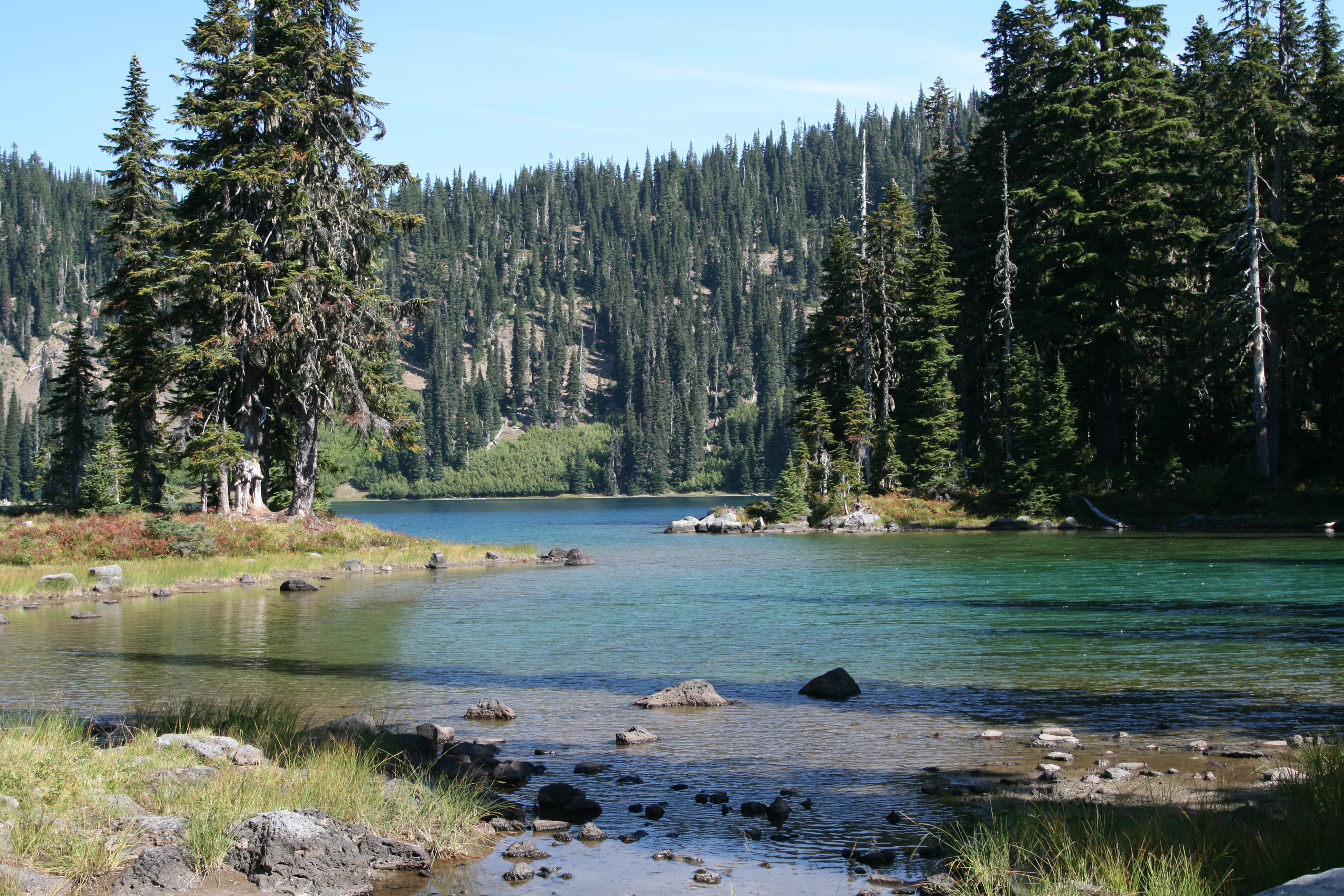
We reach our next trail junction at the 5 mile mark, and our gradual downhill so far, now begins a gradual uphill. We turn right, onto trail 980, to Twin Sisters. There are even more wide open meadows here in this area, and it’s only another mile and a half before we’re at the first of the two lakes, at 6.5 miles. It’s a large alpine lake, here at the base of a small ridgeline, the highest land we’ve seen yet. Deep blue and round, it’s very scenic, and we watch a couple fish the banks near us. We watch them catch one, and it looks perfect for the fry pan! It’s here we decide to stop and have a snack, before the next portion of the journey, and we sit on a log and just enjoy the view and quite before moving on. These two lakes are only 2.2 miles from Deep Creek camp, and we hear that they are quite popular during the summer. Now, the only people we see are the two people fishing. Proof once again that the best time for solitude is after school re-opens.
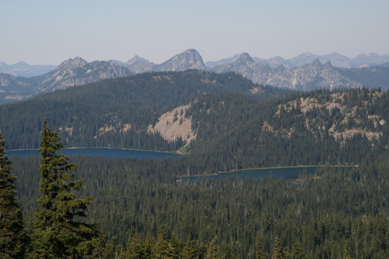
The trail follows the shoreline until we reach the next lake, and there are wide grassy meadows here on the southern banks, with some campsites, and a sandy beach awaits those that camp on this side of the lake. Very scenic here, as well, as its shorelines are broken up by small inlets and large rock outcroppings. Looking SE across this elongated lake, you can see our next destination rising from the forest, Tumac Mountain, a double humped triangular peak. At the far northern tip of the lake, we leave trail #980, and pick up trail 44 again, at mile 7.7. Now, the uphill begins in earnest, the first real challenge for elevation we’ve had yet on this hike, and by the time we reach the top of Tumac Mountain, we will gain about 1120ft of elevation over the next 1.9 miles. Clearly, this is not as well traveled as the other trails, for it is torn up by the water running down the trail, and has been re-routed several times as it goes up over steeper rises, as people and animals avoid the deeply rutted trail probably filled with water early in the season.

Tumac seems to be nothing but a cinder cone, with trees growing on about half of it, and it’s on the volcanic cinder and rock side where few trees grow that the trail zigzags up the mountain, in the open, providing spectacular views north, and west. The top of Tumac is 6340ft elevation, and for us, we reach it at the 9.67 mile mark. From the top, we can see the Twin Sisters lakes below surrounded by forest, and Mt. Rainier to the west, and small bare mountains undulating all along the northern edges of our view. To the south we can see Mt. Adams, and the Goat Rocks, where our original hike had been planned, and the flat forest floor laying before us dotted with small lakes, one of which I’m sure is our lake, we just can’t tell from looking at the map. As this is the high point for the area, here on the summit, are the four foundation blocks that mush have made up a lookout tower long ago. It’s also windy, and after taking our pictures, we make our steep descent down the southern slopes back into the tree line. We pass a few people along the way, and the two that we meet on the way down, we remember seeing from Dumbbell Lake. They asked us if the Twin Sisters camps are full, and we tell them about the only people we saw, which weren’t many.
“…in hopes of seeing something new. One could hope, anyway…”

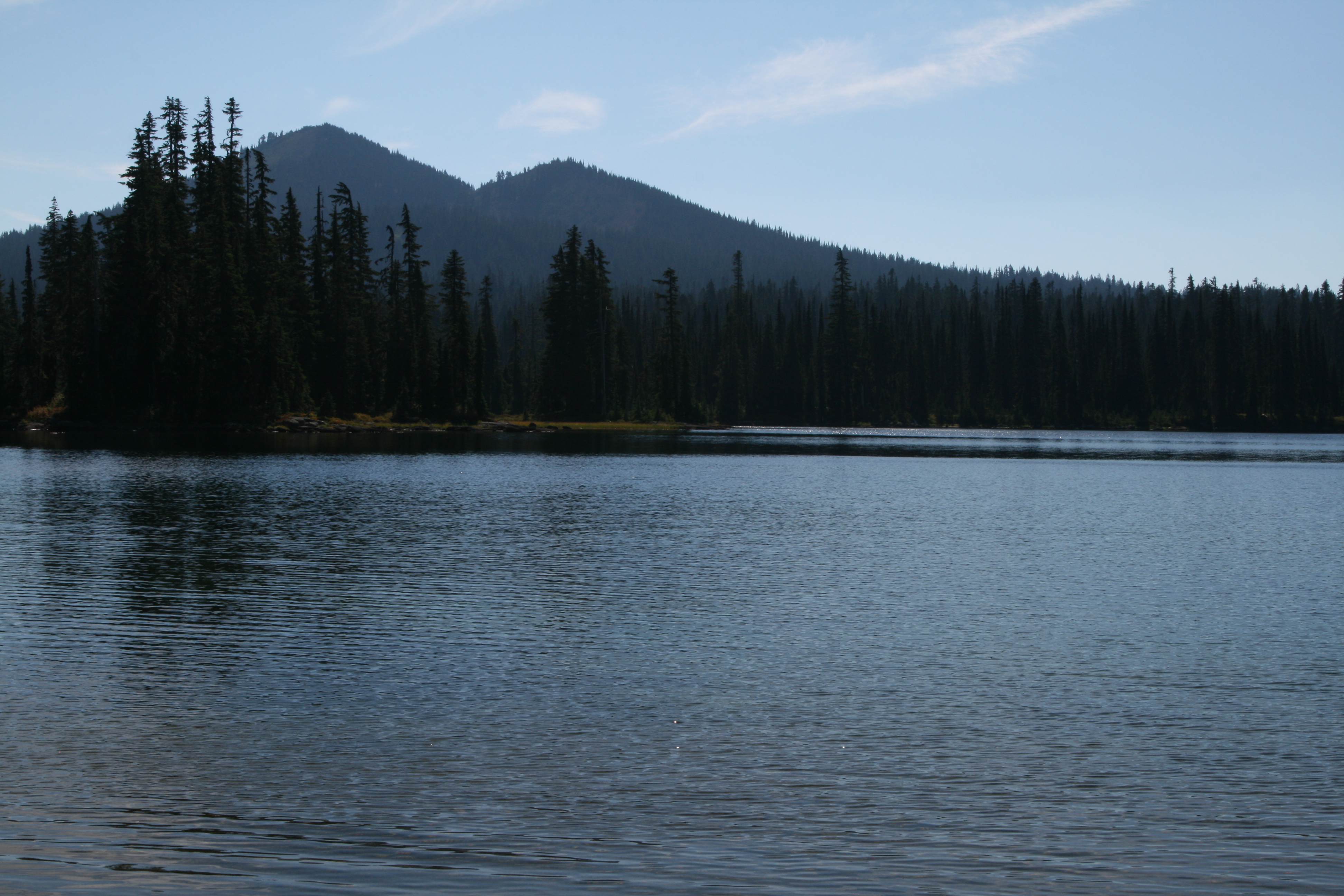
Amazing how things can be different from one side to the next, but on the northern side, there was far more mud, grass, and alpine firs, but on this side, it’s more arid, lots of bear grass, and sparser growing trees, as well as a lot less mud. The trail is still tore up in many places, but not until we get back down into the denser trees, and you can see where the water has had its way with the trail, in the steeper sections. It doesn’t take long, however, before we’re back on relatively flat ground again, at the Shellrock Lake jct, trail #1142. If we had stayed on the Cowlitz Trail, #44, we would have come back to the PCT, the way we had come in this morning, but, we wanted to make a big loop, in hopes of seeing something new. One could hope, anyway. For the most part, this entire loop was in the trees, except for Twin Sisters, and Tumac Mountain. It was warm today, and by now, at the 11.4 mile mark, here at the Shellrock Lake trail, we’re starting to dream about getting back to camp so we can dive into Dumbbell Lake.
Like a horse nearing the barn, we keep our feet moving steadily until we reach our next junction, at 12.35 miles. This is the trail to Long John Lake, from Dumbbell Lake, and it is unmarked at this end. We decide, after all the lakes we’ve seen today, that we really don’t need to see Long John, and head back towards the lake. Again, this trail wanders through more small lakes, unnamed, and some even have fish jumping. Finally, we roll into camp, having covered a total of 13.4 miles, at a 3mph pace! Very fast, by our standards…Neither of us can wait to drop our packs, and boots, to jump into the lake. What a great ending to a hot and dusty day! There’s nothing better than a nice swim in the lake to get cleaned up and refreshed!
“…stored in the camp kitchen is a small vial of garlic salt and Johnnies! How could I forget that was in there?”
The bright sunny day is slowly being infiltrated by clouds, but still remains hot, and after 20 minutes or so, sunning ourselves on the black rocks around the lake, we’re dry. It’s tempting, though, to take another lap in the pool, but instead we focus our energy on preparing a meal, and picking the last batch of Chanterelles for our noodle dish! Yum! Even better this time, as David remembers that stored in the camp kitchen is a small vial of garlic salt and Johnnies! How could I forget that was in there?
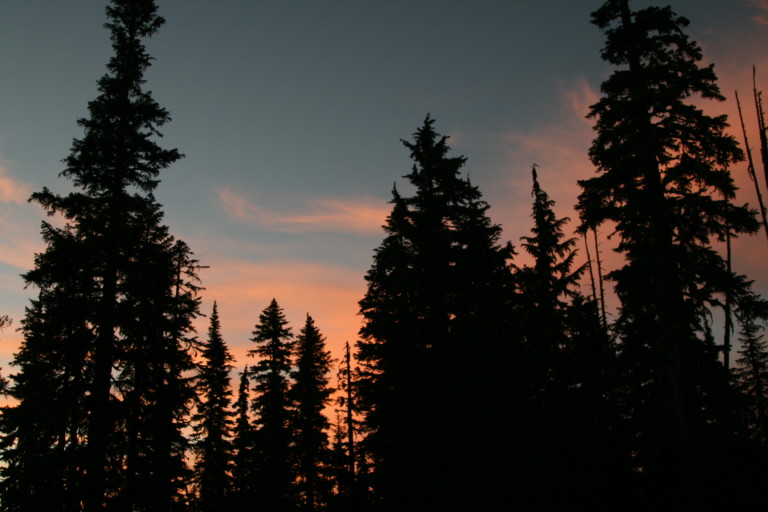
Our neighbors stop by and chat, and before you know it, it’s time for a campfire, and relaxation before turning in for the night. It was an awesome night for a sunset, and right before doing the dishes, we broke out the cameras for some last minute photos before the light disappeared.