Day 2
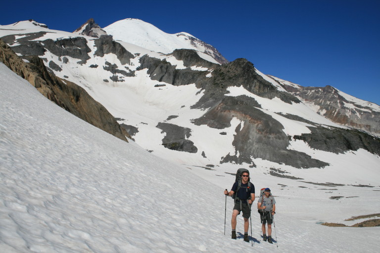
4.1 miles, 1039ft gain, 1865ft loss. Totally Awesome! After clambering out of the tent, we are greeted by a day of crystal blue skies, with no trace of the fog from last night! Perfect! Happy that we are going to have sunny skies and unhindered views, we pack up, and make for Panhandle Gap, our high point on the trail here at 6759ft.
…the only clue that a stream is beneath you is the muffled roar of rushing water…
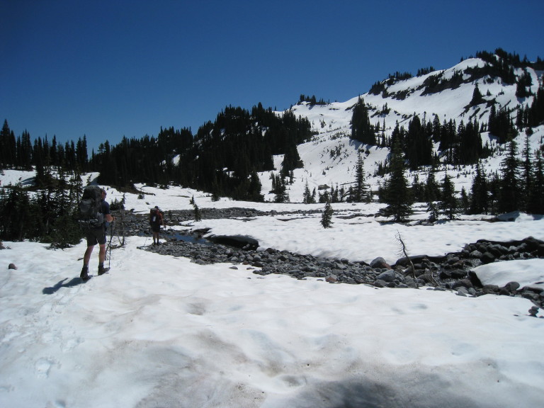
It’s a short slog through the deep snow at the base of Meany Crest, alongside a stream that you can hear thrashing against the rock underneath. On occasion, it rears its head, and the stream seems as if it is trying to escape in those brief moments it becomes unburied, water leaping skyward in spray and foam. Gravity has its way, though, and it disappears into the white void once again, the only clue that a stream is beneath you is the muffled roar of rushing water.
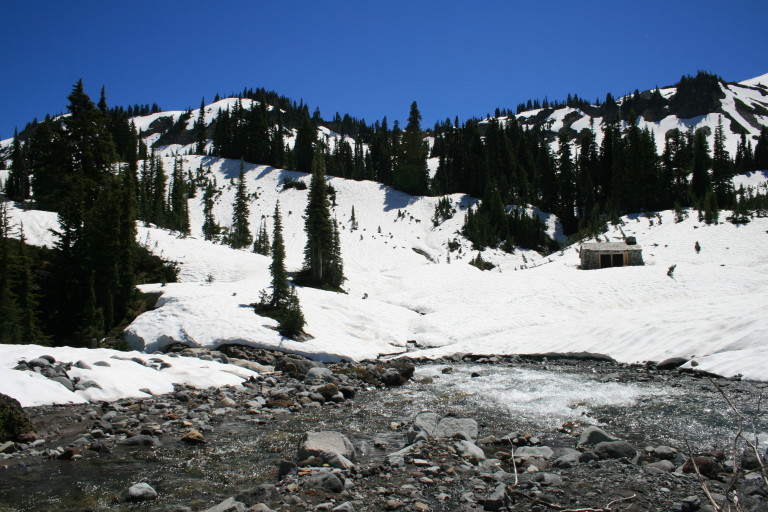
This stream pours off the rock bluffs, and becomes a tributary to Frying pan creek later on down the hill…On the flat here, that gathers the waters of the stream, I remember standing here in 2005, and it was a desolate place, a moonscape, with small piles of glacier tailings, looking as if someone had meticulously placed them in perfect cone shaped piles. No more, as the floor here is also buried under snow, cascades of it draped on every rock face and slope. Totally amazing, hard to believe it’s almost the end of July.
…As the snow field collapses in the middle of this icy tarn, it leaves a circular crack, outlining its outer edges, as if a small iceberg meteor has struck the ground…
There in the middle, you can see a circular depression, with the blue familiar only with ice and water, that translucent light turquoise blue that signals its presence. As the snow field collapses in the middle of this icy tarn, it leaves a circular crack, outlining its outer edges, as if a small iceberg meteor has struck the ground. After circumnavigating the entombed tarn, the trail runs upwards, towards Panhandle Gap.
Here, a large cornice looms over us, like a tidal wave frozen in place. Already sweating from the exertion, but also from the morning heat beating down, helping to melt us, it seems out of place. Once on top, the other side is another Winter Wonderland. It staggers my mind, as my memory of this place was one of dust and rock, around the trail down, and islands of green before reaching the slopes surrounding Indian Bar.
…I get the distinct feeling it’s going to be like an ant trying to escape the taunts of a deviant child holding a magnifying lens…
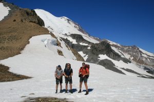
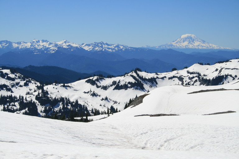
Now, only hummocks of white snow everywhere, as far as the eye could see!!! Truly astounding. With the clear skies, you have incredible sights across the expanse to Mt. Adams, and in the far distance, Mt. Hood in Oregon. We can also see that the Goat rocks are still covered in snow, as well…It’s a good thing we’ve lathered up with sun screen, as the heat seems to intensify with each hour, and there is nothing but open ground between us and Indian Bar. With the reflective surface of the snow, and brilliant sun overhead, I get the distinct feeling it’s going to be like an ant trying to escape the taunts of a deviant child holding a magnifying lens, trying to focus the power of the sun’s rays on its fleeing backside, causing it to burst into flames…
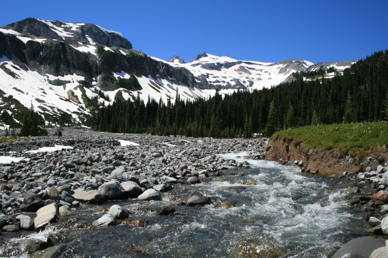
Checking the GPS to make sure that the existing footprints are following the prescribed path, we trudge out across the white expanse. Occasionally, we come across route markers, flags to show the way, but the sun has caused many of them to melt out, and they fall over. We re-plant them as we come to them. Before long, we are at the ridgeline that leads down into Indian Bar, and this vantage point gives us up close views of the many waterfalls that melt out of the Ohanapecosh Glacier, and roll down the granite walls.
What they may lack in volume, the height from which they fall makes for long ribbon like waterways that course down the rock face, eventually melding together, to create the headwaters of the Ohanapecosh River, which flows through the middle of Indian Bar on its headlong way down the mountain. As we near Ohanapecosh Park, to our left, we stop and visit some Wonderlanders, and they too, tell us of the white out conditions on this side of the pass. Guess it was pretty bad here yesterday. That, and some other stories that they have heard about this part of the Wonderland.
It seemed odd to us, that there weren’t that many people on this section of trail, given its popularity, and the fact this was a weekend. Appears that many people were bailing on this section, because of the snow, turning around, and re-joining the trail on the other side of Summerland. One of the unique things about the Wonderland, as it makes a complete loop around the mountain, is the fact that stories heard and experienced are spread from one set of hikers to another, and it’s not uncommon to see people again as they circumnavigate the mountain, passing one another again on their way to trails end. So, what you end up with is a kind of trailside telegraph, of sorts, for information to be spread.
“Oh, you’re going to where the big snow is!” Yep, that would be us…
Because of this, we hear of people falling on the steep snowfields, leaving a garage sale scattered on the slopes, then turning back. That, and attempting the slopes, only to find it’s more than they bargained for, then turning around, or hearing from the ranger the extent of the snow, and deciding that they would rather have a summer time experience, rather than a winter one. Which, leads into what the ranger at Longmire told us as we stopped to claim our reservation for this part of the trail. “Oh, you’re going to where the big snow is!” Yep, that would be us.
Since you have to plan months in advance to get a spot on the trail here, there’s no way to anticipate what the weather, or conditions will be like, so it’s a crap shoot, really. Since the weather was good, there was no way we were going to turn around; it could be a year again before getting the chance to hike through. As we left them, they told us that the trail up and over the Cowlitz Divide was not marked, and coming down through the white out, they marched in circles trying to find the way down. Once again, glad to have GPS….
Tired of slogging through the soft snow, we are happy to finally arrive at Indian Bar…
Nearing Indian Bar, we finally see green meadows, and flowers! The slopes here face the full onslaught of the midday sun, and it’s mostly melted out here, and remains that way until we reach the flats around Indian Bar. Feels good to walk on ground that doesn’t shift, or slide under your feet. Tired of slogging through the soft snow, we are happy to finally arrive at Indian Bar. A quick trip through the camp confirms that all the sites here are still covered in snow, so, either we snow camp, or take our chances at the shelter.
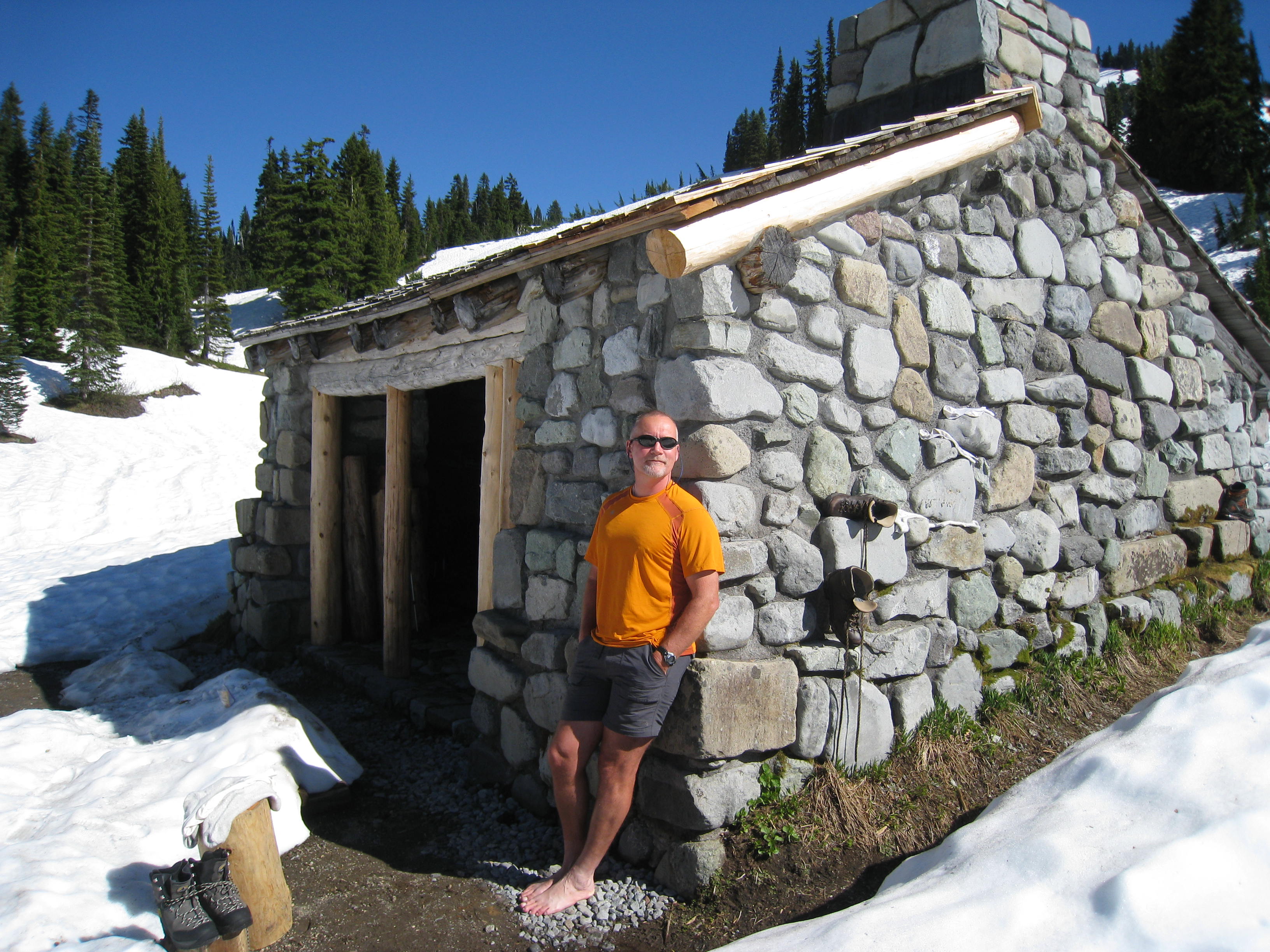
The shelter here is a nice one, and originally, it was built with a fire place, that has since been blocked by the Parks dept., to deter people from trying to actually build a fire here. The floor is a nicely planked one, dry, and there are bunks attached to the sides of the building, upper and lower. There is still around two feet of snow surrounding the building, but it will be a dry place to camp, so we pick our bunks, and then set about exploring the area.
The Ohanapecosh River is crystal clear from the fresh snow melt, and is beautiful, flowing in many ribbons down from the cliffs above. On the shoulders of the cliffs lay the Ohanapecosh Glacier, supplying the fresh melt, and from down here in the basin, the sheer granite walls are massive and impressive, blocking out any views one might see of the mountain from here. But, no matter, as it helps to make this place more different than any other section on the Wonderland, adding its own uniqueness to the “wonder” of this trail. From the side that we came down, there are stands of alpine firs that border open green meadows, and one of the stands of trees seems to form an arrow’s tip, that points to the heart of the river valley.
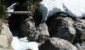
The river causeway is wide, from years of angry torrents, and the bottom is all jumbled rock, most about the size of basketballs. Several different rivulets seem to find their own way down through the piled up rocks, before joining as one to crash over the Wauhaukaupauken Falls, a narrow ravine in the solid rock that gathers the water here, creating an impressive cascade of roiling water. The footbridge to cross is here, perhaps the only secure place to put a bridge, as either side of the granite walls create a perfect footing that cannot be washed away.
…It was awesome to be able to have real buttered bread, I feel the beginnings of being spoiled starting to set in…
The rest of the afternoon is spent filling our memory banks with the spectacular scenery, as well as our digital memory cards. Dinner time and we are treated to another culinary treat from Greg! This time, it’s more of the Knorr noodles, with mashed potatoes, green beans, (yep, he lugged in a can of beans!) and a loaf of bread and butter!!! At least, we found one good thing for the plentiful snow, it makes a great refrigerator. It was awesome to be able to have real buttered bread, I feel the beginnings of being spoiled starting to set in…
Filling our bellies, being somewhere dry amidst all the snow, and having one in a million views staring back at us, all is right with the world…Except for our new bunkmate. A mouse (at least we only see one), keeps us occupied for awhile, as we watch him dart about the shelter, wanting to make sure he doesn’t decide that he likes our bags as well as we do. Before turning in, I make a mental note to check my sleeping bag THOROUGHLY before turning in. I don’t really need a furry foot warmer…While we play a few games of dice, and watch the sun slowly set, Brian spies out a small herd of elk on the slopes opposite us, so we watch them until they disappear from view. We turn in, a full day under our belts.