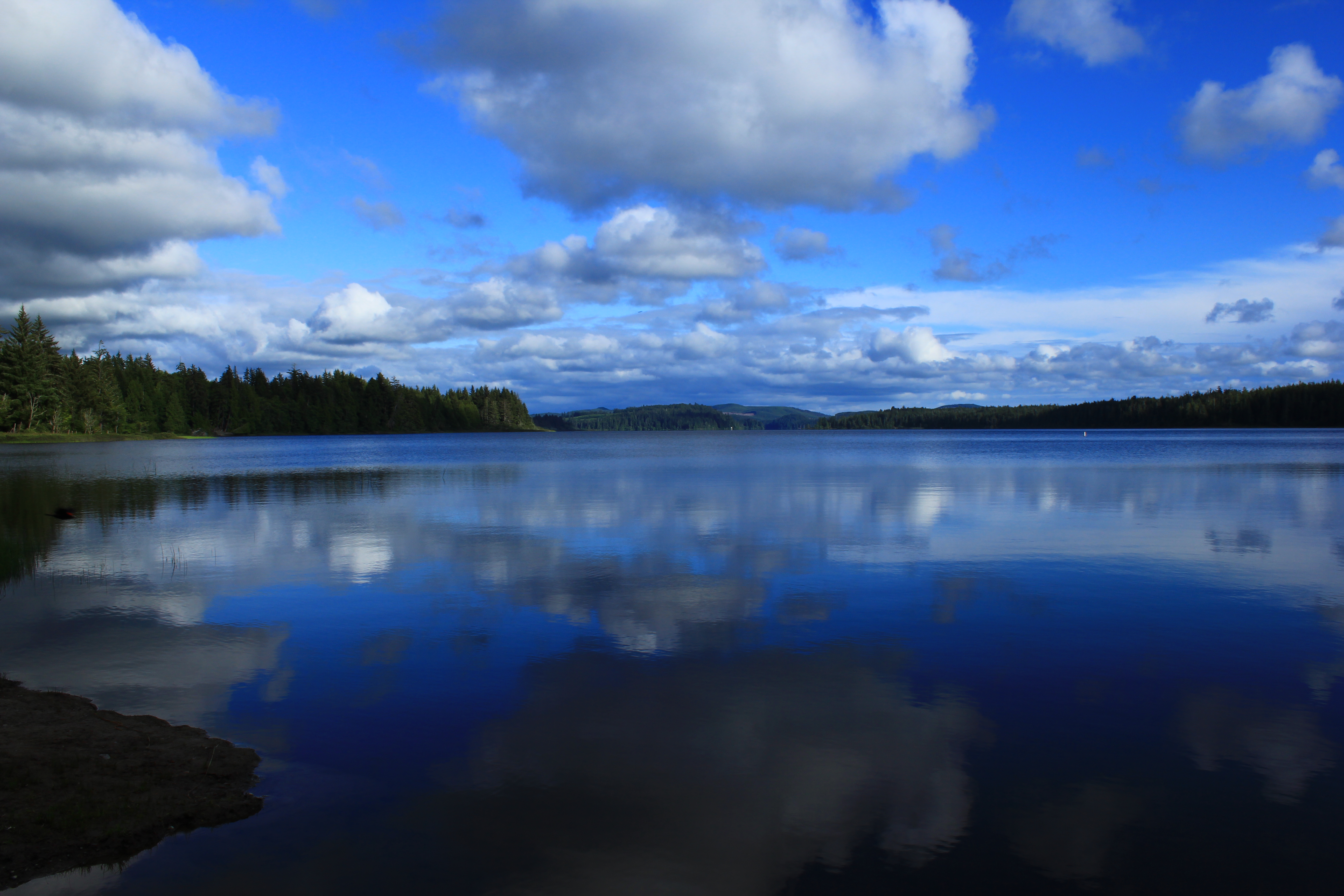
Ranking: 4/5 For a beach hike, there are probably few that are better than this one, for the sheer beauty, isolation, and ruggedness of the Northern Washington Coastline. Lots of scenic seastacks line the beaches, with islands of rock standing just off the shore bristling with gnarled trees, perfect refuges for the many Bald Eagles that inhabit the coast here. Along the route, you will have many an opportunity to get that perfect shot of boiling surf crashing against the many rock formations, as well as small coves that you’re sure would be a stash spot for pirate booty.
Difficulty: 6/10 Sure, it’s flat, after all, most of it’s along a beach, right? Well, there are a few overland routes that require some effort to get up and over, as well as being able to follow a tide table, and know when to stop and ride out the high tide. Which, of course, means knowing when to stop, so you don’t end up stranded high on a rock somewhere, or worse…Some of the beginnings to overland routes are not marked as well as they should be, so again, map reading and route planning are extremely helpful here.
Getting there: From I-5 in Tacoma, head north, and take exit 132 for S. 38th St., and keep left at the fork, and follow signs for WA-16 west, and follow 16W for 30 miles. As you round the Sinclair Inlet between Port Orchard and Bremerton, 16W turns into WA-3N. Stay on WA-3N for 25.1 miles through Bremerton and Silverdale to WA-104W, where you will turn left and cross the Hood Canal Floating Bridge, and stay on WA-104W for 15.1 miles. WA-104W runs out, and you will turn right to join Hghwy 101N. Follow 101N for another 35 miles into Port Angeles NOTE: To do this hike, you will have to pick up a permit, so, at this point, begin to look to take a left onto Race St, which will become Hurricane Ridge road, which will take you to the Wilderness Information Center, to pick up your permit. Return to E. Lauridsen BLVD, and turn LEFT, and follow E. Lauridson BLVD for .8 miles. At the light, turn left onto Hghwy 101W, W. Lauridsen BLVD. Now, you’re back on 101W, follow for another 4.6 miles, until you will turn right onto WA-112W for another 38.1 miles, where you will come to a “T”. Turn right to stay on WA-112W, and continue another 10.5 miles, where you will turn left onto Hoko Ozette Rd/ Ozette Lake Rd, and follow to the end another 21.2 miles.
Permits: You will need a permit and/or reservation to camp at the sites along the beach from May1 to Sept. 30, so check the Olympic Natl. Park wilderness backpacking reservation site for forms/availability. Reservations start being accepted on March 15th, and there is a $5 fee for each reservation for a quota area, non-refundable. The Ozette coast, from Yellow Banks to Point of the Arches is a quota area. Shi-Shi beach is not a quota area, but you will still need a permit to camp there, and we paid $9 for the three of us per night.
Maps: There is a nice TOPO map that you can pick up at the WIC in Port Angeles, when you stop to get your permit, or you can create your own on MyTOPO. Also, don’t forget to get and use your tide table!
Lake Ozette to Shi-Shi Beach Added July 2015
You have to start sometime…And, we figured, that since our usual haunts are probably still buried in snow, what better way to get our legs back under us, than to go hike the wild northern Washington coastline.
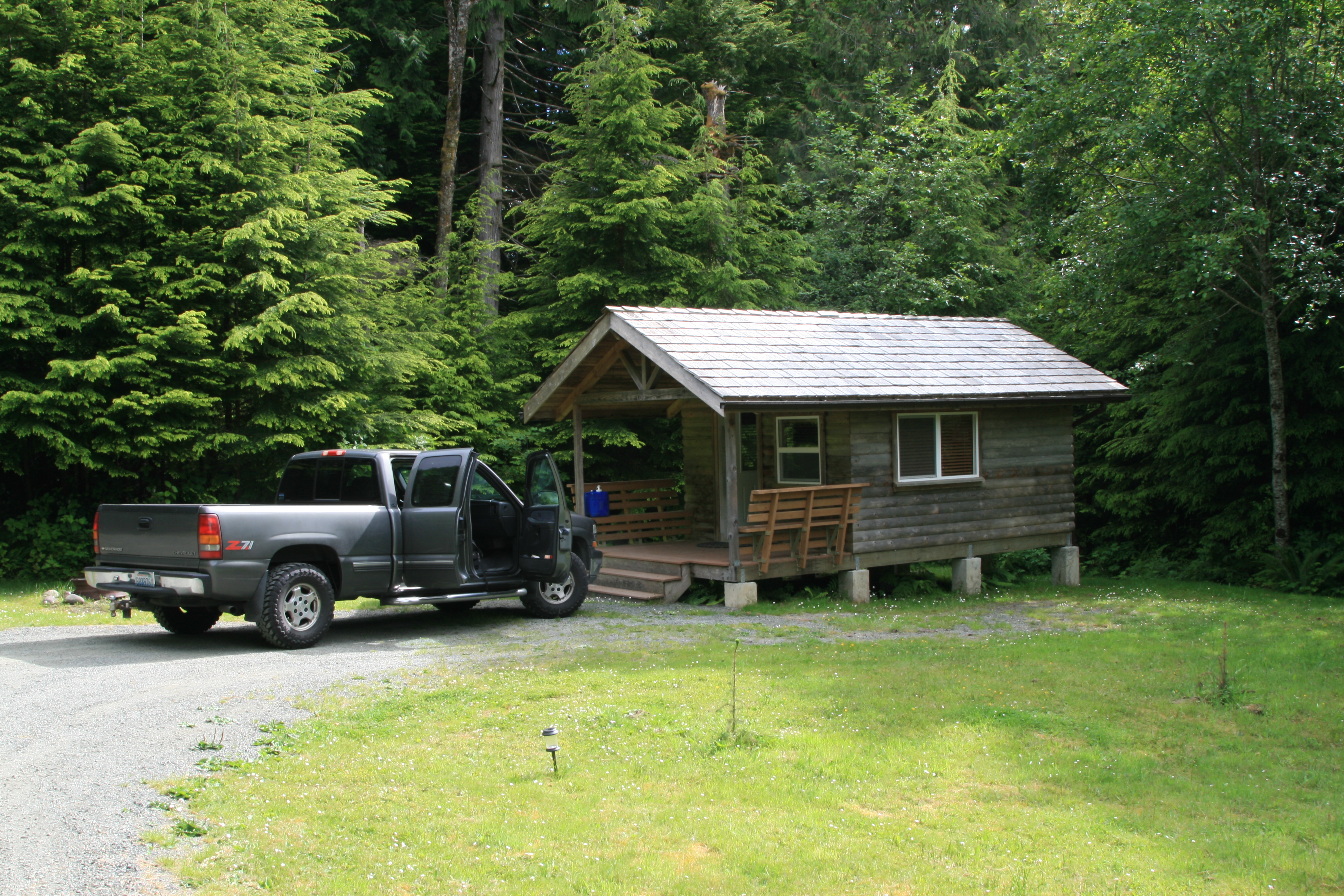
We were unable to secure a campsite at the halfway point on this hike, Seafield creek, so we would have to do a straight through from the shores of Lake Ozette, to Shi-Shi beach. And, since we would have to worry about the tides as well, we thought the best way to start this hike would be to camp at Lake Ozette, to get an early start. When we looked at the weather forecast, and weren’t terribly surprised to see that there was a chance of rain along the coast for that weekend, we decided instead on staying in a cabin at the Lost Resort, right near the trailhead at Lake Ozette.
“…I had to talk him into this…”
We really didn’t want to do an out and back if we could avoid it, so another first for this hike, (for us, anyway) was to secure the services of All Points Charters, a service that would pick us up at the end, and drive us back to our truck at the trailhead. I had to talk him into this, as they prefer dropping you off at your beginning, and then allowing you to walk back to your car, thus avoiding any problems with missing you at the end of the hike, due to tides, or other problems.
After driving to the north shore of Lake Ozette, we pay for our night’s stay at Lost Resort, and check out our cabin. Very nice for our purposes, complete with a bunk bed and a full bed, and electricity for lights and outlets. No running water, but for our simple needs, (a place to get in out of the rain), it suits us perfectly.Dropping gear, we go back to the small lodge, and order a cheeseburger and beer. On tap! They even have Mac & Jacks, a favorite!
One of their specialties, is the fact that they have over 99 different kinds of beer on hand, and we perused their selections in the cooler, and they do
indeed have many types you would not expect this far out.Back to our cabin after a nice meal, we start a fire in one of the fire pits, and enjoy some quiet time before turning in, listening to the fire crackle. Always nice to be someplace where you can enjoy a campfire.