Ranking: 4/5 What’s not to love? Solitude, epic views, challenge, peak bagging, and a warm lake to jump into at the end of the day? I still believe, after having done this one twice now, that this pretty much covers most of the best the Goat Rocks has to offer, and it’s hard to emphasize over and over again how this is one that should be included in your short list.
Difficulty:7/10 . The drive here isn’t bad, only about 5 miles or so of gravel road, and ample parking when you reach the trailhead. The way up towards Surprise Lake is a gentle grade, making it an easy hike for the first 5 miles or so. After that, there will be some route finding skills necessary, and of course, scrambling to the top of Gilbert Peak should only be done by those with some previous experience. Of course, since 2012 the trails now are much easier to follow, and are more established.
Getting there:
NOTE: if you’re using Google, as I’m known to do, pay close attention, as Google will try to route you over roads that are currently blocked off!! Biggest known here, is to get on Rd 1200, then get to FR 1000. If you can do that, its pretty straight forward, but remember, the FR signs here on which road you’re really on will be confusing. Some of the connecting roads are NF750 and NF757 that will be part of this road routing, so be warned! Be sure to plan it out carefully from home, and print out road maps to make it easier on you. Both times I’ve gone to this area, getting here has been more of a challenge than it should be…Gleaned from the Okanogen-Wenatchee Natl. Forest page, for road directions: From Naches, WA travel west on Highway 12 W for about 22 miles. Turn left at Lost Lake Rd onto Forest Road 1200 / Tieton Reservoir Rd and go 4.5 miles. Turn left onto S Fork Tieton Rd / Forest Road 1000 and go 12.6 miles to trailhead at end of road.
Maps: Green trails #303 White Pass, and #335 Walupt Lake.
Permits: Northwest Forest Pass required to park at trailhead, self-register at trailhead register.
Warm Lake, Gilbert Peak Added 8-21-2019
Curses! Foiled again! Usually we miss out on a hike because of foul weather (which usually means rain here in the great PNW) or fire, but the trip we had been planning on for most of the year was cancelled at the 11th hour because of road construction! I always check on conditions right before a trip because of last minute obstacles, and two days before, checked road conditions, and the map on the forest service page for our planned climb said “Open” and was highlighted green. That is, until you clicked on it and read the small print…Then, it said that the road for the entire week was closed so they could work on the road bed! And, on weekends, it was also closed for goat removal!!! Arrrrrggghhhh…They could have at least noted that it was in yellow, which would have indicated that there were some conditions….
So, the trek Kipp, Blair, Joe and I had originally planned on was out the window! Now, a last second re-route was in order. Instead of digging deep and planning on a whole new trip, I dug into the ol’ archives, and came up with a 3 day trip into the Goat Rocks, a fan favorite! (Also, Kipp said he really liked the Goat Rocks, and wanted to see more) so this one seemed like a no brainer…
The new plan was to go to Warm Lake the 1st day, then on the 2nd day climb Gilbert Peak, high point in the Goat Rocks, then, back down to pack up camp, and move over to Cold Lake at the base of the Conrad Glacier, then on the 3rd day back out. Our weather window still looked good, so that was our tentative new plan.
Day 1 2881ft gain/602ftloss, 10.66 Miles, 32,317 steps.
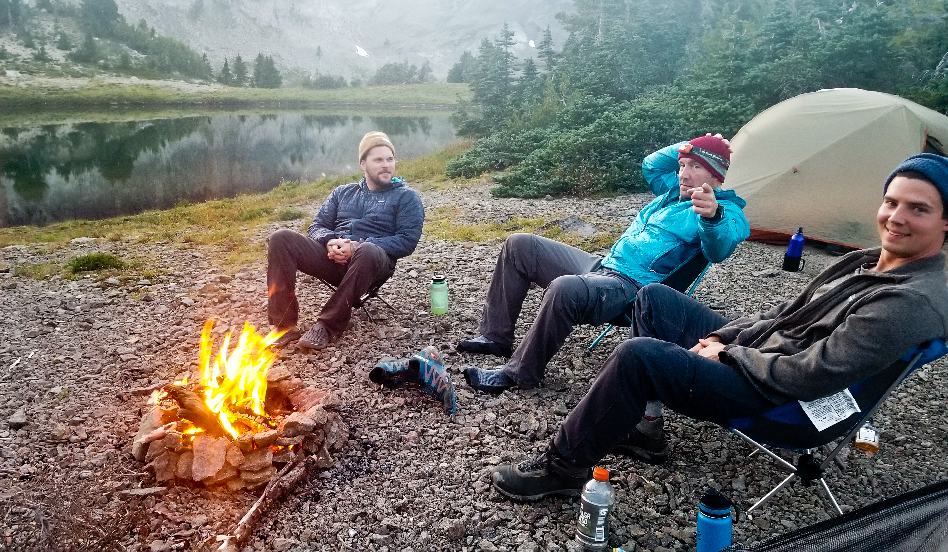
We meet bright and early at Kipp’s house, and load up at dark thirty. This will be the first trip together for all 4 of us, Kipp and I have backpacked together before, but this will be a group of friends that Kipp has put together, so its first introductions to Blair from Enumclaw and Joe from the Olympia area. Welcome guys!!
“…Of course, we trust Google to our navigation, and of course, you can count on Google to route the “fastest” way there, which, of course, led to the confusion of getting led down a blocked road…”
A 4:30am start, and an uneventful trip up and over White Pass, to our turn off by Rimrock Lake. Of course, we trust Google to our navigation, and of course, you can count on Google to route the “fastest” way there, which, of course, led to the confusion of getting led down a blocked road. Sure, that road may have been viable 10 years ago or whenever the heck they had last gleaned the info for roads in this area, but needless to say, washouts of roads and bridges in this area is a fairly regular occurrence, so driver beware!!! After getting turned around a few times on the confusing array of roads here, we found our way to Conrad Meadows, and the parking near the horse camp and a nice pit toilet. Always nice to have facilities to start/or end a hike!
Gearing up, we’re on our way around 8:00am, and after a short march up the gravel road we come to the meadows, through a wide gap in a split rail fence, and follow a well-worn path through the meadows. You’ll see branching trails and two lanes, that “Y” to the left or right, but if you kind of stay to the left, all “roads” lead to the center eventually…If, in doubt, hopefully you downloaded the GPS map and it will show you the way…If not, just be sure to try and keep centered in the meadow on the track that seems to stay that way, and you’ll have no problem finding the right path. The last time I hiked through this meadow, I was watched warily by free range cattle, but this time none were to be seen.
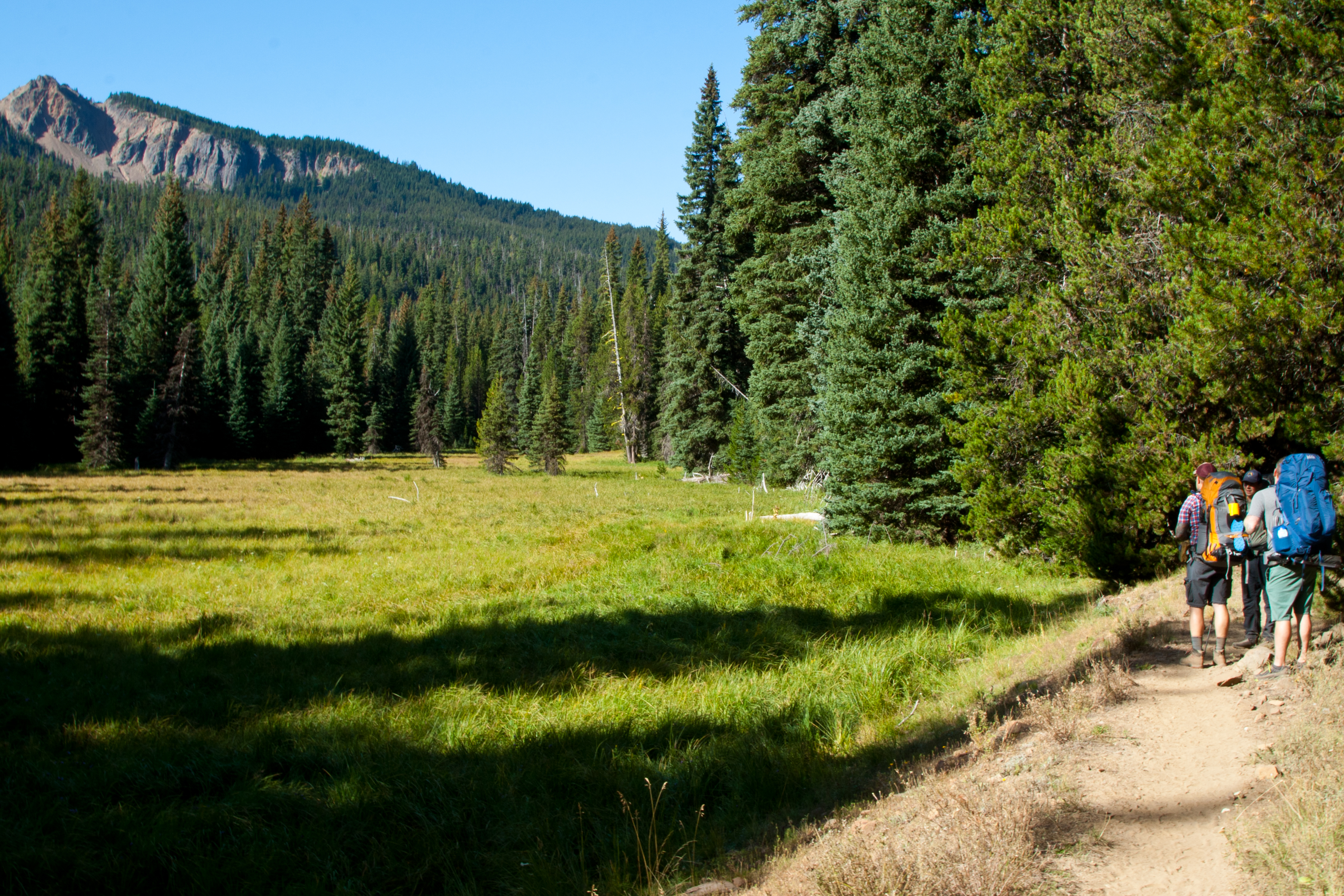
The morning rays light up the grassland here, creating a scenic foreground to the mostly pine forest that crowds the edge of the meadow. In the distance you can see peaks of reddish earth outlined against the morning sky. Once you reach a road that bisects the trail at 1.58 miles, you will take a slight jog left and you should see the trail marker for the South Fork Tieton trail #1120, and the self-register box. From here, the way is relatively flat and easy over dusty trail through the pines and assorted trees.
“…several loose boards are marked with yellow ribbon as a warning that “These boards are loose!”
It continues like this for the next several miles, passing by or through small forest meadows and occasionally alongside the lazily flowing South Fork, looking more like a mountain stream than river at this point. We cross two footbridges, the second beginning to show signs of wear, and several loose boards are marked with yellow ribbon as a warning that “These boards are loose!”
Once across the second bridge, it’s still a well maintained trail of loose dirt, sand and small rocks that is quite dusty and the trailing guy is gonna eat some dust for sure.
At the 4.4 mile mark, you’ll reach the junction where you can decide to turn right or left.
To follow this loop trail that winds around Surprise Lake up along the Klickton Divide, then around the encircling ridge that helps create the headwall for the South Fork, as many small branches are collected and feed its beginnings. We choose the left, as it takes us up by Surprise Lake, and in my estimation, just a little more scenic than the other side of the loop, as the forest seems to be more open, and there are more small meadows to pass through.
Soon, you cross another small footbridge and begin a series of switchbacks at 4.9 miles, but it’s still a moderate uphill, the switchbacks do a great job of taking the steeps out. The trail is still well maintained and easy to follow to Surprise Lake at 6.7 miles.
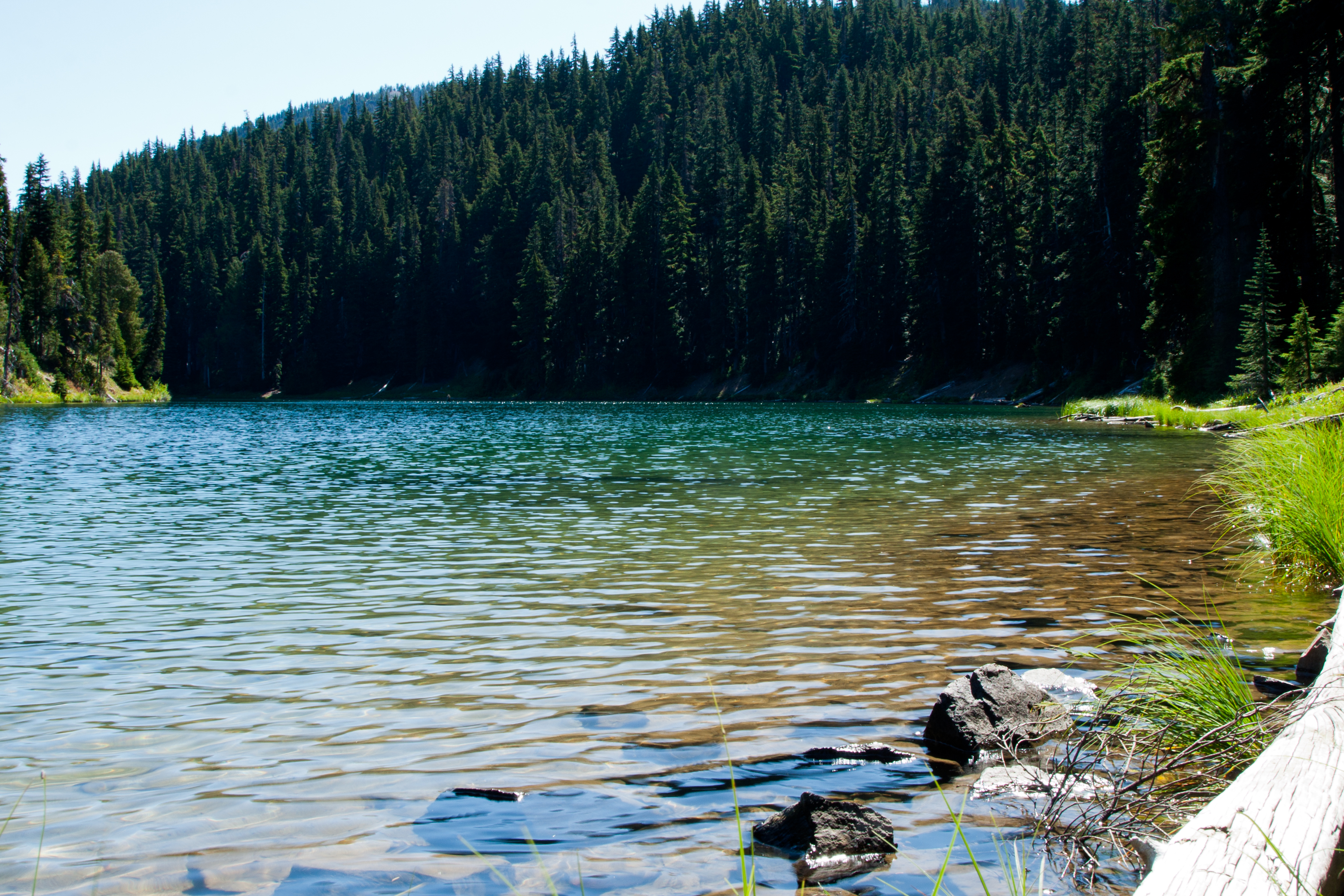
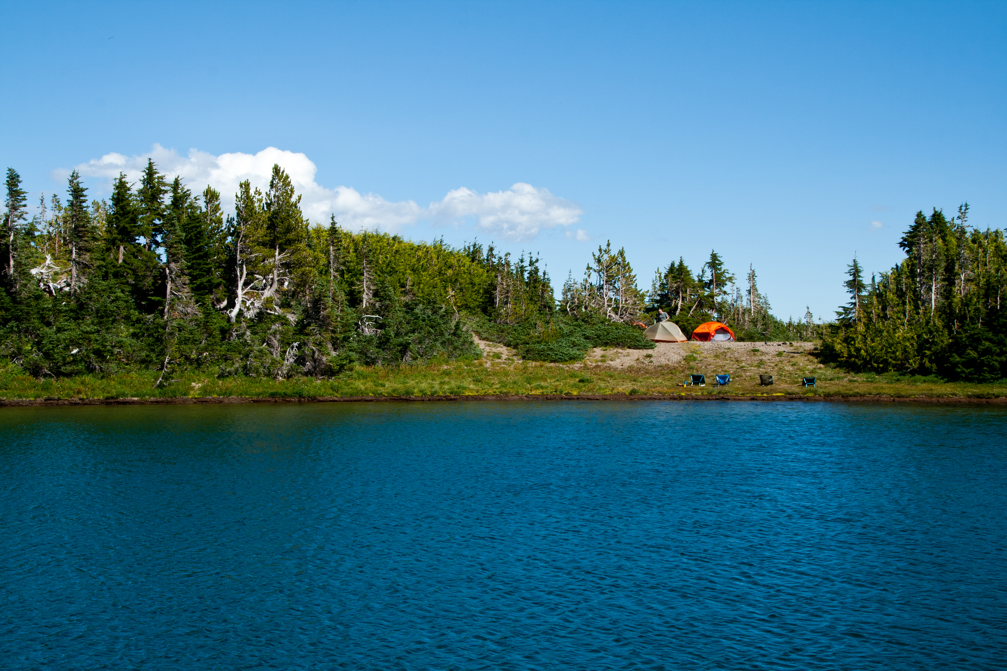
Surprise Lake is an elongated alpine lake at 5260ft elevation, and has lots of great dispersed campsites, the lake has trout and we all thought this would be a great place to bring a small inflatable to float and do some lake fishing for a couple days.
It seems like a good place to stop and rinse the dirt out of your mouth, for sure, so we stop for a few minutes and pound some water and trail snacks while sitting along the shore of the lake.
“…small open hillside meadows are littered with large boulders and rocks that have tumbled from the ridge above…”
Back on the trail, the path continues on easy to follow tread through gradually thinning forest for the next mile and a half, until you’re on the edge of the Klickton Divide, and small open hillside meadows are littered with large boulders and rocks that have tumbled from the ridge above. There is also Indian Paintbrush and Lupine in abundance and occasionally you’ll get sweet whiffs from the sun heated flowers as you walk through these small rock gardens.
The trail now flattens out some, as it follows the contours of the divide, crossing through these pretty hillside gardens and small streams that trickle down from above, which helps to keep the garden green here.
“…Because, who wanted to have to look at the GPS unit, which would tell me exactly where to turn???”
Having done this hike before back in 2012, I could not find any side trail that led up and over the divide in any guide book or trail map, so as I was explaining to the guys as we were getting close that I was hoping that I could remember where exactly it was that I had decided to cut uphill. (Because, who wanted to have to look at the GPS unit, which would tell me exactly where to turn??? We guys just hate having to ask for directions, even if it’s the very thing that we are counting on to get us there! I guess in this instance, lazy knows no bounds…)
Just as we’re getting close to where I had recorded it previously in the GPS, precisely at the 8.09 mile mark, imagine my surprise when I saw a trail cut off!!! I couldn’t believe my eyes! Since 2012, it is now a clearly defined trail. In fact, as you approach this turn off, you can now see the cut in the side of the divide that you will need to follow up. This steep cut is filled with fist sized rock, helping to mitigate trail wash-out I’m sure, but it’s loose, so watch your footing. Once on top, we stop to catch our breath and as we’re standing there, we see two women on horseback, and one rides over to talk. She asked if this was the way back down to Surprise Lake, and we say yes, but it’s steep and lots of loose rock. After a few minutes of talking, she decides it’s better to head back the way they came in, a trail further down the loop. Again, I was amazed, since I don’t remember one being there my first time through. They said they were first going to Warm Lake for the day, and after saying goodbye, we start following them along a well-defined trail, which ended up being a mistake
Once you’re at the top of the divide, where we were standing, the way you should be looking for is to your left, a little southwest. There is no defined trail headed that way, but if you just look for a trail that cuts through the short alpine firs just as the flat here starts to rise up into the dispersed taller trees, you’ll see it. But, back to our folly…
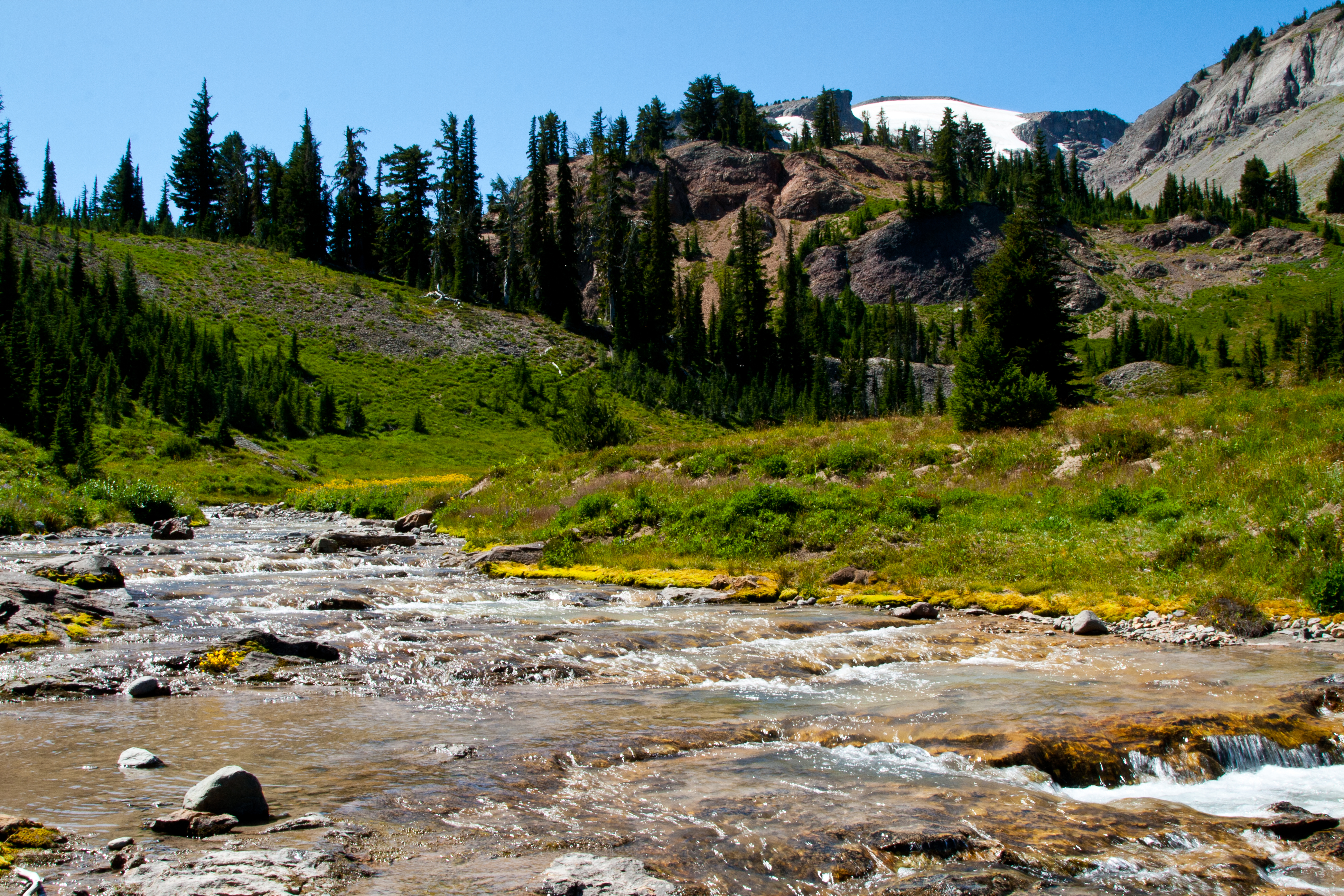
We blindly follow the riders who said they were going up to Warm Lake along the aforementioned well defined trail until it drops down to cross one of the beginning braids of the south fork, and as we watch the riders cross it, then continue along a trail to disappear into the tree line on the other side of the flat the ol’ warning bells go off…I could tell by the direction they were headed away from the position of the lake, that this trail was going in the wrong direction…So, apparently they weren’t going to the lake, so at this point, we turned SW, and started following the creek up…I guess the advantage to taking this little sidetrack was getting to see a pretty little waterfall…
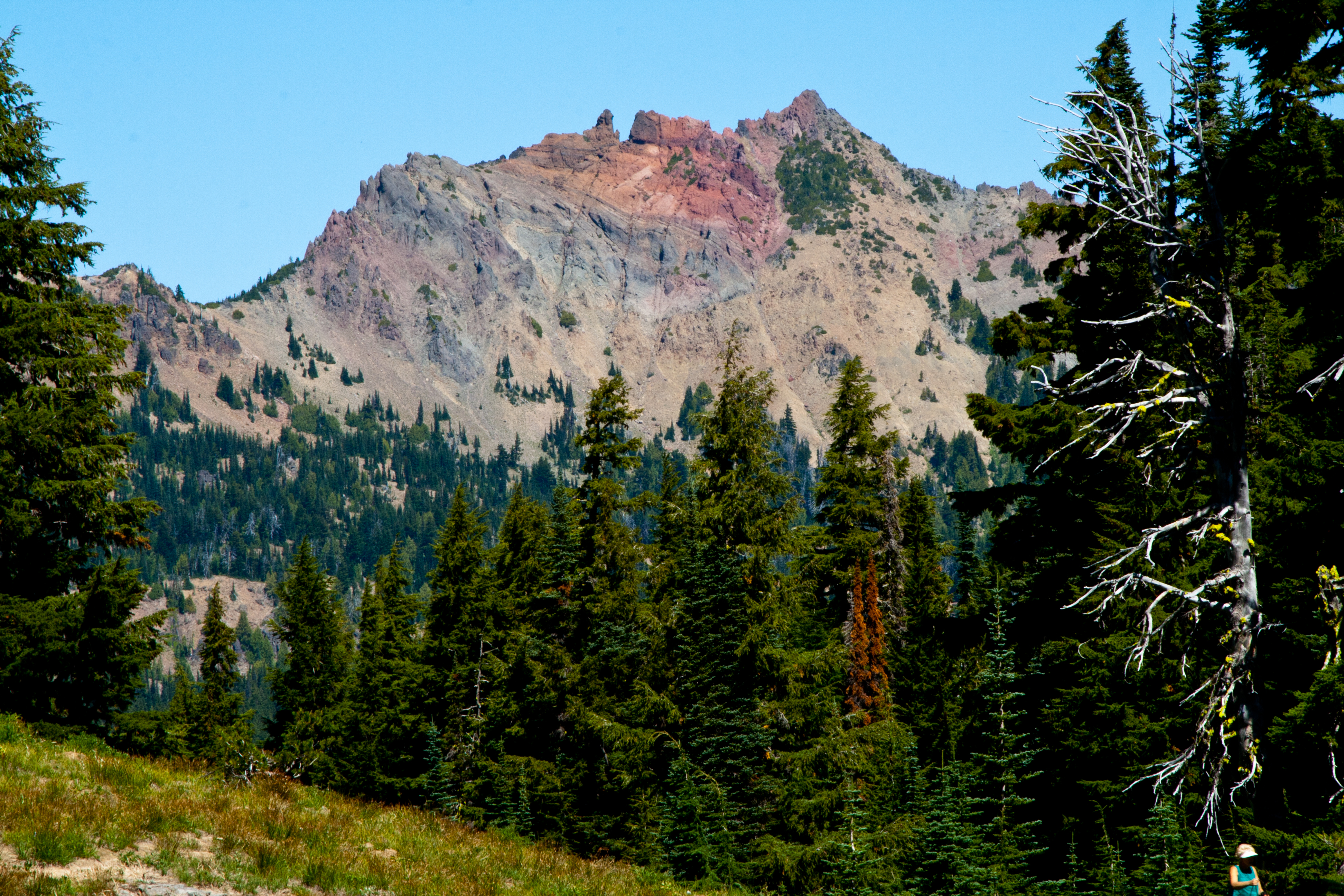
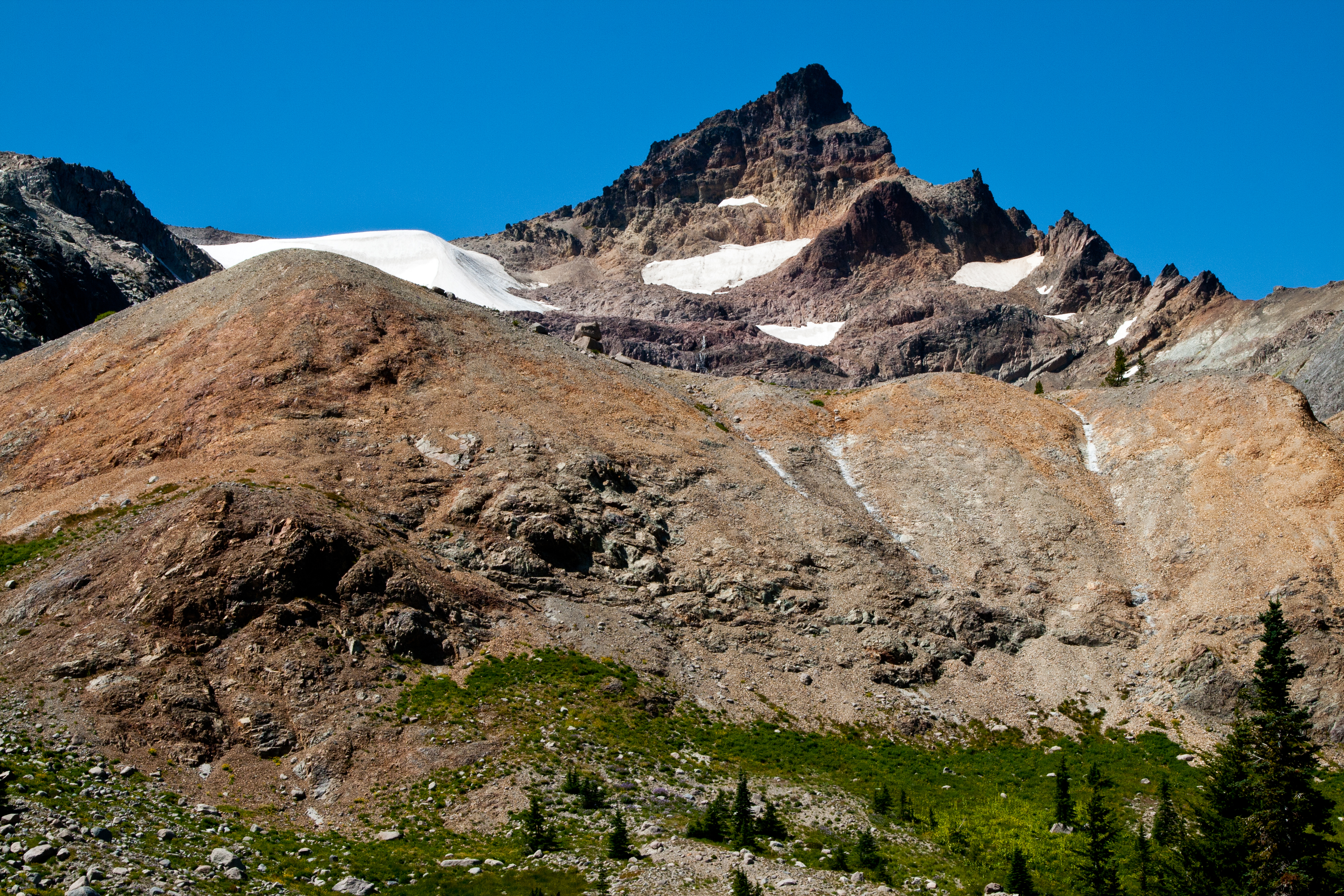
A few pics later, and then we’re on the right track to get to Warm Lake. At this point, I will defer to script previously written back in 2012. “ Finally, as you reach the top of this ridge, the views become fantastic! The forest is mostly gone, just growing now along the ridges, like a Mohawk haircut, and the valley below is green and open meadow, a small stream running down its middle from the snow melting out of the snowfields that cling to the slopes of the Klickton Divide, and the Meade glacier. A waterfall rushes down between pillars of rock, melt coming from the Meade glacier, and can be heard clear across to the ridge you will be standing on, and if you watch, you will get a quick glimpse of it between some trees. Stay high along the ridge until .5 miles past where you turned left to head this way, and it will become obvious that you need to drop down into the valley floor below. Once on the valley floor, the full magnitude of Gilbert Peak is now readily evident, rising up to a massive point above the remains of the Meade Glacier at its base. A massive, black rock wall is off to the left of Gilbert peak, as if it’s constantly in the shadows of the orange and yellow tinted horn of Gilbert Peak. To the right of the high point, is a mound of red hued rock, looking as if it where the sands of time piled high. Very pretty here, but, you’re not at the lake yet. Cross the valley floor, and up a small incline to reach Warm Lake, at 10.3 miles.”
Being a hot day, once we reach our campsite here on the southern shore, all we can think about is getting boots off our hot feet, and hitting that refreshing lake! Before long, we’re all at the water’s edge, getting rid of boots and clothes and washing off trail grime in Warm Lake. Ahhh…So refreshing!
Finally getting cooled off, we sit in soaked drawers, welcoming the afternoon sun as it dries us off.
“…sticking up beyond like a Rhino’s horn above the black rock cliffs of a fortress like rock …”
We have the lake to ourselves except for a couple on the other side of the lake that were clearly just here for a day hike, and after setting up camp, we sit for a while just marveling at the view. Most of Gilbert Peak is obscured except for the very tip, sticking up beyond like a Rhino’s horn above the black rock cliffs of a fortress like rock that blocks the main body of the peak. To the right of this, there is a gap, then you’re looking at the pyramid shape of Tieton Peak, which looks like the bottom pile of sand in an hourglass. It’s plenty to look at, and we’re happy to be here in camp now, relaxing and taking in the view. Kipp and Joe decide to take a short stroll over to a snowbank across the small valley and get some snow for ice cold whiskey sours! A recipe that you can find here on the website, Whiskey Sours…
The afternoon is pretty breezy, but by dinnertime, thankfully it’s died down. Right before dinner, Joe spots a few mountain goats grazing up on the Klickton Divide, and they would be the only large critters we would see on this trip.
On tap is the Smoked Salmon Pasta recipe, with mashed taters, a dinner that goes down easily…
”Pow!” I thought someone had thrown a grenade into the fire!”

We had collected a bunch of firewood and decided to have a small fire. A great way to end the day, around a campfire with a few cold drinks, as there was hardly any wind, so the fire was going straight up into the sky, with very little smoke so it was nearly a perfect fire, until…”Pow!” I thought someone had thrown a grenade into the fire! Embers blew everywhere, but mostly in my direction, like hot shrapnel. I started swatting myself off frantically, arms wind milling like I was fending off a horde of angry yellow jackets. As I’m looking down to make sure I’d gotten them all off, I felt a burning sensation under my chin. Pulling my head up, I can see an ember that had landed near the neck of my shirt, and I quickly flicked it away, but the damage was done…Polyester and hot coals don’t mix that well, and it left a jagged hole, as if a rat had been gnawing at it. While I’m looking down, I spy another glowing ember, this one is on top of my left shoe, just sitting there melting through my new camp shoes! That took a little more effort to dislodge, so not only did it burn through 2 of my laces, but it also left a nice burn on my thumb…
I’m sure I looked comical dancing and flailing about, because I was met with ever so slightly suppressed laughter…Needless to say, after the fire sprayed shrapnel all over me we all moved a few feet back, not wanting to be the next recipient of a lapful of hot shards….
“…the stars reflecting off the surface made it look as if there was a gaping hole in the earth…”
The rest of the night was uneventful, and we enjoyed a cloudless and still night. I have yet to sleep all night without getting up to visit the nearest tree, and when I got up around 2, the lake was perfectly still, like glass, and the stars reflecting off the surface made it look as if there was a gaping hole in the earth so that I could see the night sky on the other side of the planet, an incredible sight, and slightly unnerving, as if I could fall through if I got too close…
Hey there! Do you happen to have a GIA GPS route for this up to the lake?
Hello, Bryce, I have a GPS route only, which is a .gpx file format, I’m sorry, but I am not familiar with the GAIA platform…I am assuming it will use the same format? If you can tell me what it uses as a file format, like the .gpx format, I can send it to you.