Day 3
14.83 miles, 3563ft gain/3527ft loss.
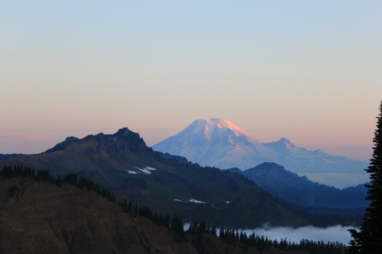
Yep. That’s a long day. Luckily, no one knew that for sure before we started, or they might not have come…Including myself. I mean, I knew it was going to be a long day, I was thinking around 12 miles, which was long enough, but as usual, until boots are on the ground, mapping it on TOPO maps just won’t give you the same mileage results, as it’s hard to trace an exact route, such as followed if you’re walking it…

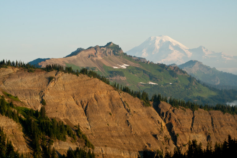
Knowing we have a long day ahead of us, we rise early, and get down the trail. It continues in the open down across this small bench then up and over the next ridge, then switchbacks downhill through forest to the trail junction that leads to McCall Basin, at 2.1 miles. Ahhh….There’s the 2 mile difference! If we had made it to the Basin, then we wouldn’t have had such a long way to go today, but I don’t think we could have coaxed much more out of our tired bodies from the day before, so it’s a moot point now.
The trail continues its downward trend through forest to our next junction at Tieton Pass, another 1.5 miles down, and this is where we leave the PCT and follow another good trail, the N. Fork Tieton Trail #1118 down into the North Fork of the Tieton River. Not much to see all the way here, as it’s all through mixed forest of fir, hemlock and cedar.
We reach the bottom at 8.4 miles, and turn right onto trail # 1128, and this too, is easy to follow to the North Fork Tieton River. As we reach the banks of the river, it becomes obvious this is a river crossing, and we wander the banks a bit to find a good place to cross, for right here, it’s too wide and deep. Turning right, we go upstream another 100 yards or so, and find a place that looks shallow enough, so we shed boots and wade across and it’s actually not too bad, never getting over mid-thigh. Also, the cold water seems to work wonders at reviving feet and ankles that just descended over 8 miles already.
From the rivers banks, the trail gets a bit hard to follow, as it traverses marshy areas and in a couple places got washed out from a previous torrent. Once out of the marsh area, the trail keeps to the ridge a little higher up for a while, making it easier to follow, and it’s not a bad trek until it starts uphill at 10.62 miles.
“…These ideas and more, most unprintable, flowed through my mind, as my body screamed at me to stop…”
We could see along the way that someone at one time or another had actually tried maintaining the trail, perhaps for horses and hunting? But now, it’s little more than a game trail as it fades in and out heading straight uphill. This is the grueling part, and it’s a slog uphill for the next 3.4 miles, gaining 2730ft of elevation. I’m not going to lie, this wasn’t fun at all, and it was a mental, as well as physical hardship to continue to urge the body onwards. I remember looking around, and muttering, “Take it all in, because this is the last time I’ll ever be here again”…Whose hair brained idea was this, anyway??? Someone really outta push that guy out into traffic…These ideas and more, most unprintable, flowed through my mind, as my body screamed at me to stop…
Many times, I just felt like sitting down, and proclaiming that I was done. But, one foot in front of the other, and we made our way to the top! Grueling, man, just grueling, especially after having already put in 10 miles just to get to this uphill part! I had a hard time looking my friends in the eye, as I was afraid to find out that looks really can kill….
Now, it’s a pleasant walk back to the trailhead and car, and as we approach the parking lot, we’re amazed to hear people’s voices and dogs barking! In fact, probably a good half mile from the trailhead, we happen across a baby stroller, one of the kinds that looks like it was made for trails with the knobby tires, but…There’s no baby inside, and no one around, either! We look around and can see no one anyone near. Strange…The parking lot is full of cars, a far cry from how it looked when we first got here. Again, amazed that there are this many people in what I considered a pretty remote section of the wilderness.
Finally at the car, and no flat tire or missing cell phone, (for I in my haste, left it in the center console for all to see, DOH!), we drop our packs, and celebrate a huge undertaking by traversing the entire Goat Rocks range. That, and the good fortune to not have seriously maimed or killed anyone along the way…
“…with much gesticulating and waving around of arms like a crazy man…”
A great experience, even though probably not ever repeated, it would still be nice to one day go again to see splendid Cold Lake, only this time, perhaps from the Warm Lake side. Oh, yeah, and to also have the name Cold Lake added to the maps, so in the future, explanations of where exactly Cold Lake is will no longer require long drawn out directions, with much gesticulating and waving around of arms like a crazy man…