July 15-18, 2005
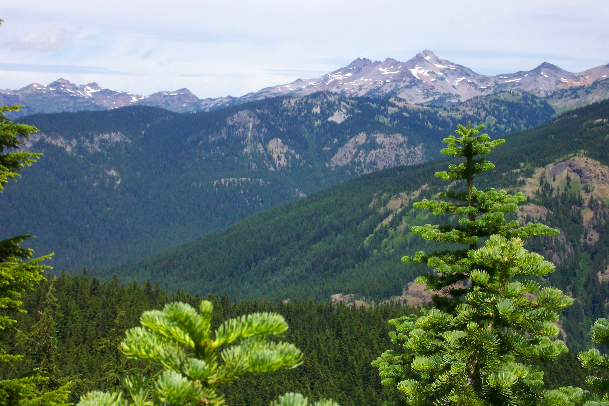
Trail Ranking: 3/5 The views, up close, of the Goat Rocks, and surrounding mountains, like Old Snowy, and the sub alpine meadows filled with wildflowers at this time of year, make for a compelling hike.
Difficulty: 5/10 The most difficult aspect of this hike was trail navigation. At some points, along trail #7A, the Klickitat Loop Trail, as it melds with old logging roads, it makes it difficult to follow the thread. Must pay attention to details here! Other than that, the elevation gain/loss on this trail is ordinary.”

Getting there: From Olympia, Follow I-5 south, and take exit #68, for US-12E towards Yakima/Morton. Turn left, across I-5, and follow US-12 for 61.8 miles. Turn right, onto NFD 21 road and go 16 miles. There will be lots of smaller gravel roads leading off to the right and left, but stay on main road. Take SHARP LEFT to NFD 2160 road. Almost appears to double back from NFD 21 road. Follow NFD 2160 for about 3.9 miles, and you will see the horse camp turnout to your right. Just about a half mile further, on the right hand side, you will see the trail head for trail #121. This is before you reach Walupt Lake. Follow trail #121 counterclockwise to junction with PCT, trail #2000, through the Coleman Weedpatch area, past Sheep Lake, over Cispus Pass to Snowgrass Flats area. Take the #97 trail junction 1 mile to trail #96, and follow to small spur trail #96A. From #96A, link up to trail #7A, and follow it back to trail #121A, which is the other side of the Cispus River, which you will have to ford. Trail #121A is short uphill to road, then turn left and hoof it back uphill on road NFD 2160 to trailhead and car. Maps: We used the Greentrails Maps, #334 Blue Lake, and #335 Walupt Lake. Good maps with mileage indicated between points. Permits: Must fill out a backcountry permit at the trailhead.
DAY 1 Walupt Lake to jct with trail #101
3 days. That’s all, just 3 little ol’ days. That’s what we planned to use, to cover the 30 miles, or so, to make a loop around Walupt Lake, through the Coleman Weedpatch, along the Pacific Crest Trail, hike beside the Goat Rocks, cross Cispus Pass, journey through Snowgrass flats, and end up back where we started, at Walupt Lake…Just 3 days.
We started early on Friday morning, July 15, around 6:30 from my house. Russ was driving, so he stopped to pick me up. Both of us must have went to sleep Thursday night with visions of the hike in our heads, as neither one of us got much sleep. Too excited, I guess…
We reached Walupt lake around 9, or so, and before we even got out of the parking lot, I had our first equipment failure!
Earlier in the week, I thought it a good idea to mount a ¼ x 20 screw into my trekking pole, so that I could mount my camera on the end of it, thus eliminating a need for a tripod.Well, a fine idea, but you really have to have enough brains to remember to EXTEND your telescoping trekking pole BEFORE doing any drilling. Yep, the threaded hanger bolt threaded right into the telescoping part, basically ending it’s career as a telescoping pole.
We were lucky to get it to release. So, good ol’ duct tape came in handy, a few strips wrapped tightly around the top of the middle section, and it kept it from sliding back into the main handle, and then we were ready to go at around 9:20am.
Our spirits are high, as this is what we’ve been planning for months!! It takes me almost half a day for it to really sink in that we’re finally doing it. Just ask my wife, it takes a long time for me to wake up in the morning…
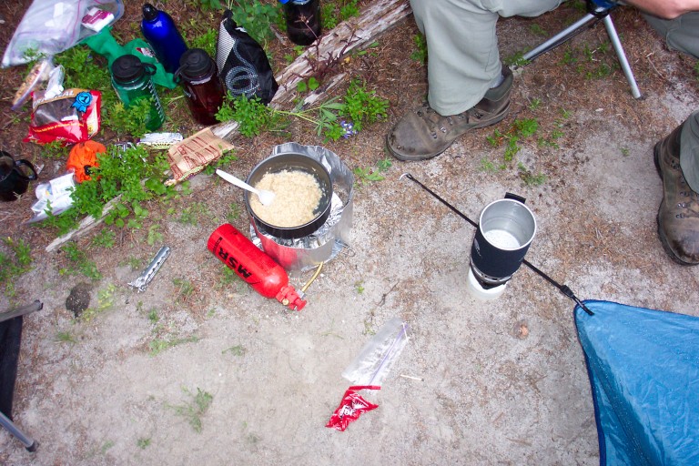
Camp Fare
Aren’t on the trail long, and I find a really nice pair of Bolle’ sun glasses. I’m to find out later, that I too, will leave something valuable on the trail.
The trail that we start our adventure on is trail 121, and it starts with a general uphill slope, smooth dirt and sand, nice gradual climb through the forest, thought it was a pretty trail. Right before we reached the PCT junction, the trail starts up and up. By 11:40, we hit the junction to the PCT. Took some pictures here, it was the first time that I had ever been on the PCT, Russ’s second time.
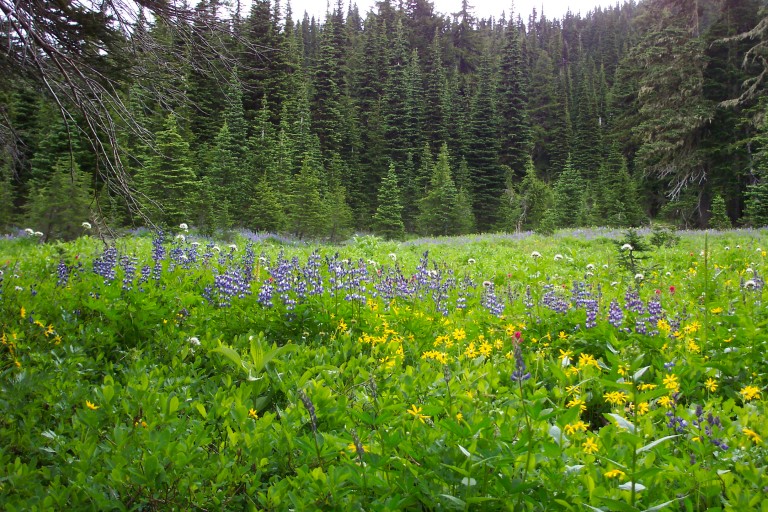
For the next three days, too, we will continue to trek through meadows filled with flowers that smell like expensive perfume, and with practically every color of the rainbow represented.
A watershed moment for me. We are to hike on this section of the PCT for the rest of this day, and most of the second day. I am excited to be here. Within a half hour or so, we are beginning to walk through meadows filled with purple Lupine flowers, which give off a very nice sweet smell. Very fragrant. We will continue to walk through meadows, surrounded by sub-alpine firs, making it all look very park-like. For the next three days, too, we will continue to trek through meadows filled with flowers that smell like expensive perfume, and with practically every color of the rainbow represented.
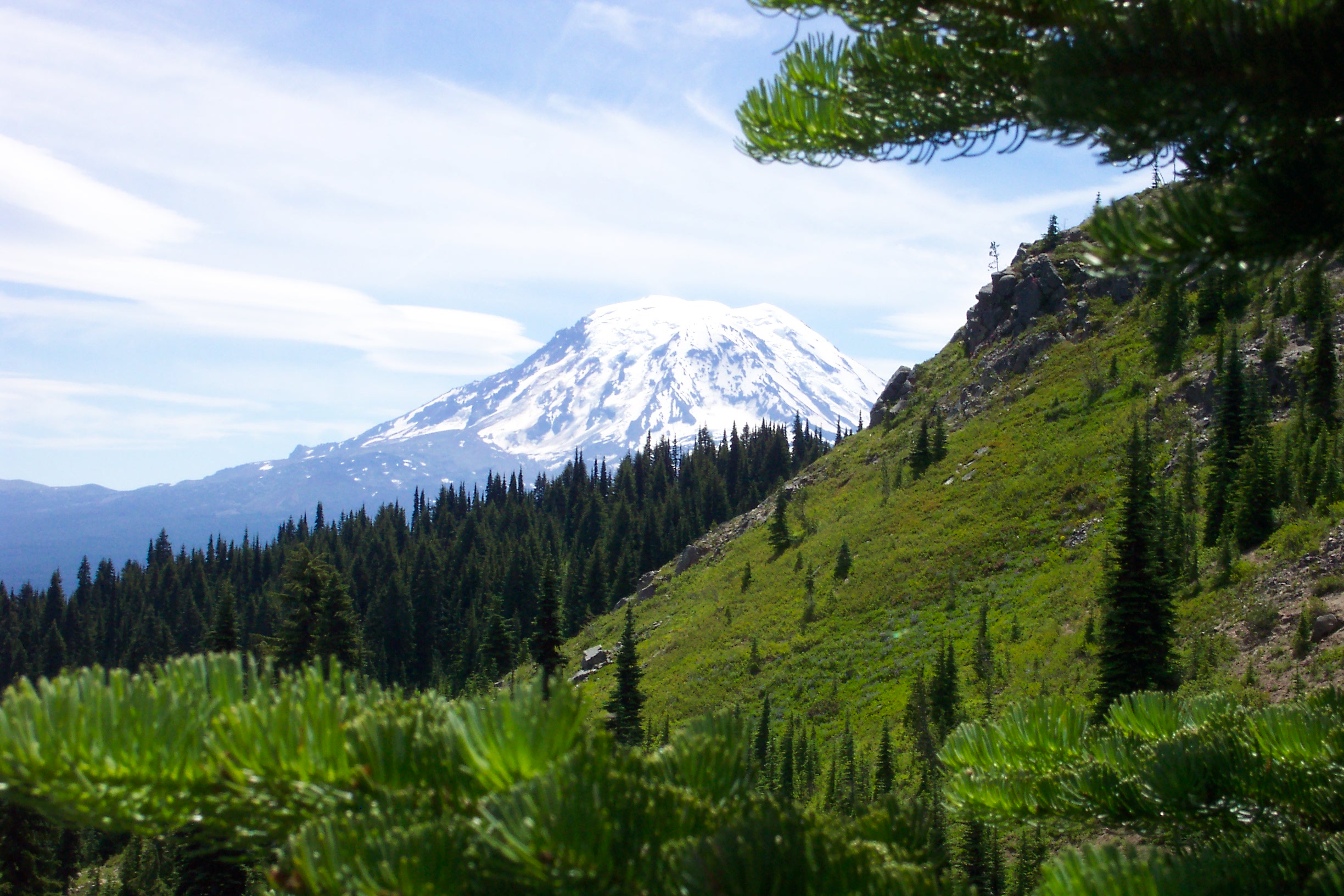
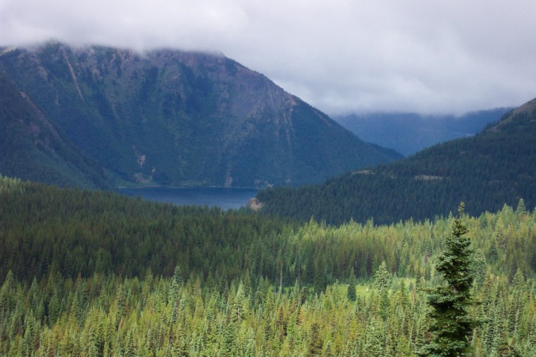
By 12:30, we stop to eat and take in the view. The trail tarries on a ridgeline with an elevation of 5680 ft, and the views here are expansive. To the Northwest, you can see the Mountain, (Mount Rainier), directly in front of us, and below, at 4000 ft elevation, is Walupt lake, and before us are the foothills to the Goat Rocks, and jutting out on the opposite side of the lake from us, is Nannie Ridge. Great place to stop and rest. By 2:15pm, we found our first fresh water for the day, a small stream that crossed the trail. Russ filled up, I thought that I could wait until we got to our first camp site, as, according to the map, there was another stream close by…Wish I would have filled up here!
Finally, we reach the junction to trail 101, which leads back to Walupt lake. This is the place that we had planned to make our camp for the night, and according to the map, there is supposed to be a stream nearby…It was nothing but a stream of dry rocks.
Walupt Lake
We finally reach the Coleman Weedpatch area. Everywhere there isn’t a tree, there is meadow, and, it’s usually filled with blueberries, Azaleas, and Lupine. Everywhere. Sometimes up to your waist. At first, it was so beautiful, but, by the time we got to camp, I was relieved to be done wading through it. The trail is very narrow singletrack, and because of all the brush on either side, there is really no way to make good use of the trekking poles, in fact, it seems that most of the walk, I had resigned myself to just kind of listlessly dragging the poles behind me…
Finally, we reach the junction to trail 101, which leads back to Walupt lake. This is the place that we had planned to make our camp for the night, and according to the map, there is supposed to be a stream nearby…It was nothing but a stream of dry rocks. Well, that was rather unfortunate, where were we supposed to get water? Looking at the map, we decide to head down trail 101, as it shows some small lakes close to the trail, what looked to be less than ½ a mile from our current location. Sure enough, we didn’t have long to walk, and we ran across a small lake.
Did I say lake? More like a pond, than a lake. Still, we were tired, hungry, and thirsty, so decided to camp nearby. We were pretty hesitant about drinking out of that “body of water”…It seemed to be only about 2 feet deep at the deepest section, and there were some ducks swimming nearby. And this is to be our drinking water??? As thirst outweighed further debate, we took the plunge, using the filter to filter out one Nalgene bottle’s worth. Not only was it filtered, but all of the water we took out of this pond, we also boiled to use in our dehydrated meals. Very leery of this water.
The following day, we hear from some hikers, that these are called the “Beaver ponds”. We wonder as to the naming of said ponds, as we saw no sign of any beavers…We wondered if perhaps, it was short for “Beaver Fever ponds”, and begin to question any rumblings of our stomachs….
After setting up camp, we try out our air mattresses, to make sure that they are comfortable enough. They are, as we quickly drift off to sleep. We decide, after an hour, that it’s time for dinner. Once dinner is over, we hang our food for the night, turn in and play dice before settling in to sleep around 10:30pm.
2005-07-15