Day 2.
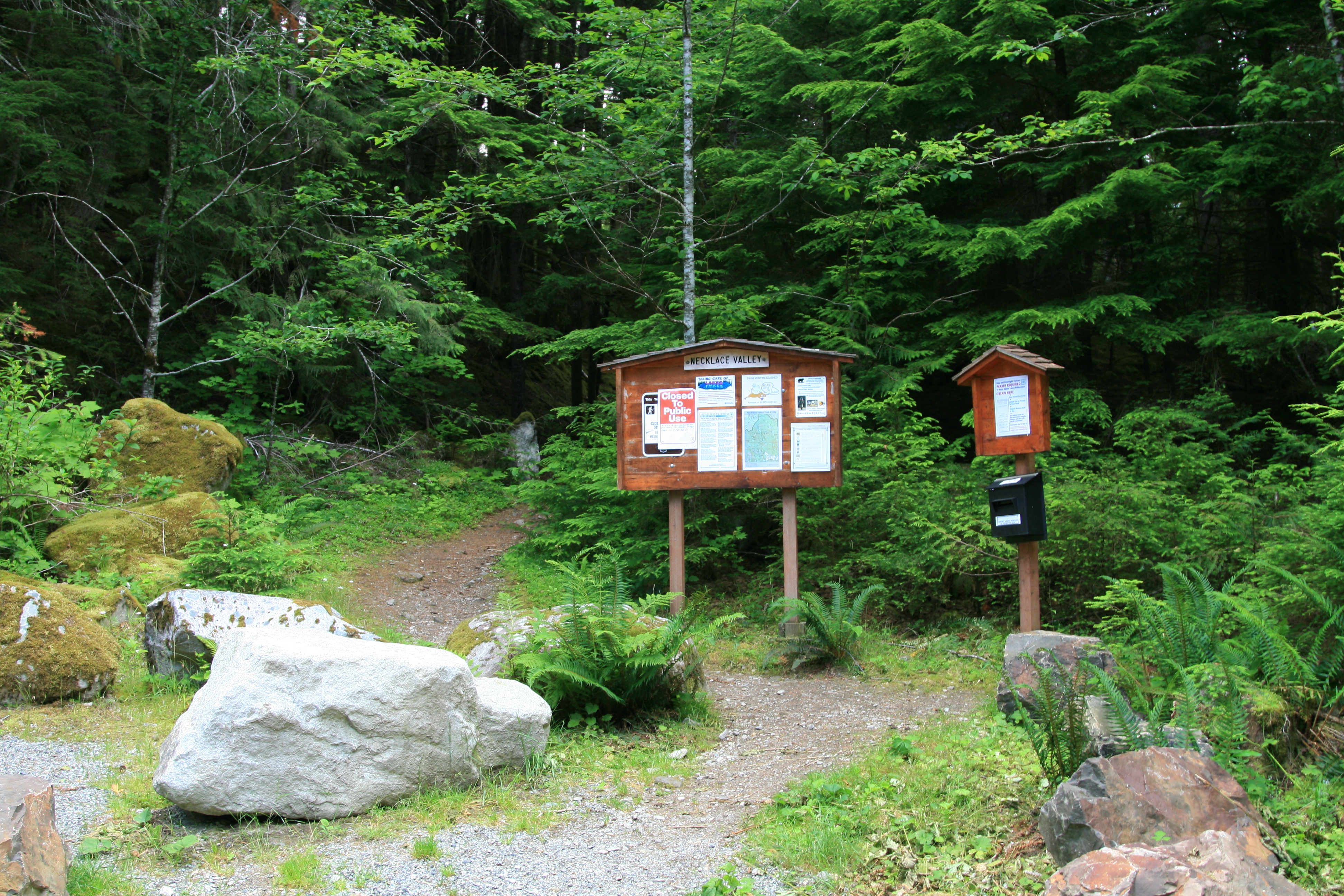
3170ft gain 9 miles. After grabbing a nutritious Bearclaw and Powerade for breakfast, we pack our stuff, and drive the short distance to the trailhead, just a little over 4 miles up FSRD #68 to the trailhead, trail #1062 to Necklace Valley. As we pull up, we notice several official looking white trucks parked in the trailhead parking lot, behind yellow barrier tape, with a sign hanging off the tape. That’s odd, but I thought, “Hmm…Maybe they’re just servicing the bathrooms…”
We pull off the side of the road, right behind another white Forest Service SUV that was also parked on the road. As we start pulling out our gear, I hear Greg say, “Uh-oh, here comes someone”, and the guy that had parked on the road walks up and introduces himself, as the head PR guy for the Mt. Baker-Snoqualmie Natl. Forest Service. Evidently, he’s here to do a piece on the trail crews that are up the trail working from Earth Corps. He hadn’t gone up the trail yet, as he was waiting for another van load to show up. We talk for a bit, and then he asks us if we know why the trailhead has been closed. Well, now, that got our attention. “Uh…Nope, I have no idea.” So, he tells us that it’s closed due to an “aggressive bear” in the area that tore up someone’s tent the night before. By this time, the Earth Corp van showed up, and as they are making introductions with the Forest service guy, they notice that we are still gearing up to go, so a woman with the group walks up and gives us more info.
“…Now, the hungry bruin is sure that all tents hold delectable morsels, and attacks unmanned tents with relish…”
Apparently it’s a young bear, she said, and afraid of people, but it had become food acclimatized from last summer, when someone left food in their tent and the bear destroyed the tent, looking for food. Later, we would find out that someone last summer had left bacon grease in their tent. Now, the hungry bruin is sure that all tents hold delectable morsels, and attacks unmanned tents with relish…Ok, maybe those weren’t the exact words she used, but…She said the Fish and Game dept. had been here yesterday, with bear dogs, trying to track it down, but were unable to find it. Well, it didn’t really sound as if they were telling us not to go, so we took that as a, “as long as you’re careful…”, and crawled under the tape.
“…and now I’m the proud owner of a new star shaped crack in my glass!”
Not before I managed to crack the windshield, though…This is what happens when you’re lazy. And in a hurry… As I was getting ready to lock up the car, I noticed I had left the glove box lid open, and it seemed a no brainer to me, (since I had just gone to the trouble of getting the backpack on, that I reach across the car with my trekking pole, and close the glove box. It was all going well until the pole slipped off the glove box, and the tip of the pole hit the windshield with a sharp “tic” sound, and now I’m the proud owner of a new star shaped crack in my glass! Dang it! Who knew that would happen? Not wanting to try for two, I sighed, shrugged off my perfectly adjusted load, and reached in and closed the glove box. We locked the doors, and climbed under the yellow tape, hurrying up the trail before we hear the sounds of, “Hey, what do you guys think you’re doing?” No one calls us back, and we continue on up trail.
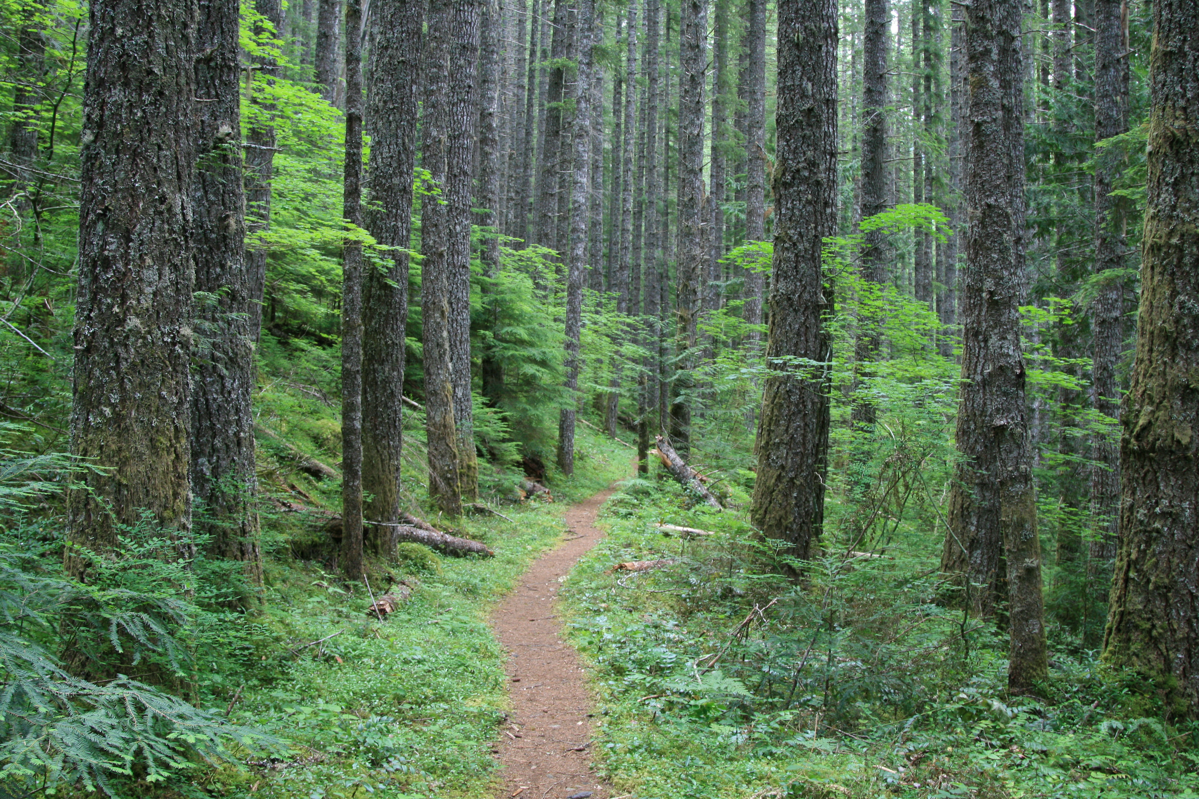
The trail begins in second growth timber, and is very flat, the first 1.5 miles are supposed to be on an old railroad grade, but the only clue that you’re given as to it ever being here, is the fact that it is a nice flat bench cut into the hillside. Ghosts of the past stand sentry on either side of the trail, stumps of humongous old cedars, with springboard notches cut into the sides, some looking like sunken eye sockets and toothless old grins. There are several scattered along the way, reminding you of what helped fuel progress here long ago. After 3 miles of fairly flat trail walking, the trail veers towards the East Fork Foss River, and what was once only faintly heard, now is more insistent, as the river courses over a rocky bed. It’s a river of varying personalities, as here, through large boulders, the river creates rapids that create the rushing sound we hear, and further along the trail, it becomes lazier, flowing over a sandy bottom. Then, as it approaches the hills that lead steeply up, and the small tributaries that flow together to create its headwaters, it becomes more energetic, leaping over jumbled rocks, and eating at the banks that struggle to contain it.
In 5 miles, following this watery chameleon, we reach the end of the flats, and the beginning of the constant ups to come. The trail appears washed out here, and if not for the surveyors ribbon on the opposite banks, across an old log that spans the gap, you would spend time looking for where it wandered off to. Across the log, the way starts up immediately through a large talus slope, which sometimes resembles a trail, as rocks have been moved around to make it easier to pass. After about a 100yards or so, the trail shows up once again, and you continue your steep hike towards the lakes. From this point on, the trial (trail?) rises steeply, for you will gain 2400ft in elevation in the next 2.7 miles over tree roots, rocks, boulders, mud, and occasionally a small stream or two that pass for trail. Lots of high stepping to gain purchase over the jumbled collection of tree roots and large rocks only add to the ways in which this trail becomes a challenge.
“…After cursing the meddlesome maple, I would look downhill, searching for possible remnants of backpacks, shoes, hats, etc., to see if anyone before me had suffered the same fate, with more disastrous results…”
From the first boulder field on this side of the river, the trail is relatively in the open, and only occasionally visits small copses of old growth timber, giving you some shade if you’re on the trail midday. With sun, of course. And, “in the open” means, of course, that there are no large trees. Everything else seems to grow here, and the biggest culprit for entanglement is the vine maple, which in these openings grows in abundance, crowding the trail at every opportunity. A couple times, as we bend over to try and clear the grasping branches that grow over the trail, one of these branches would grab the top of your pack, and not let go until you bent it past 45 degrees, and then, mid step, try and hurl you down the slope. More than once, I almost lost my footing and plunged backwards off the side of the path, towards certain doom. After cursing the meddlesome maple, I would look downhill, searching for possible remnants of backpacks, shoes, hats, etc., to see if anyone before me had suffered the same fate, with more disastrous results. I was sure that I would catch the telltale signs of some brightly colored fabric. Nope. No sun bleached carcasses down there… that just meant, to me that, either I was too tall for this trail, or that no one else was nearly as clumsy.
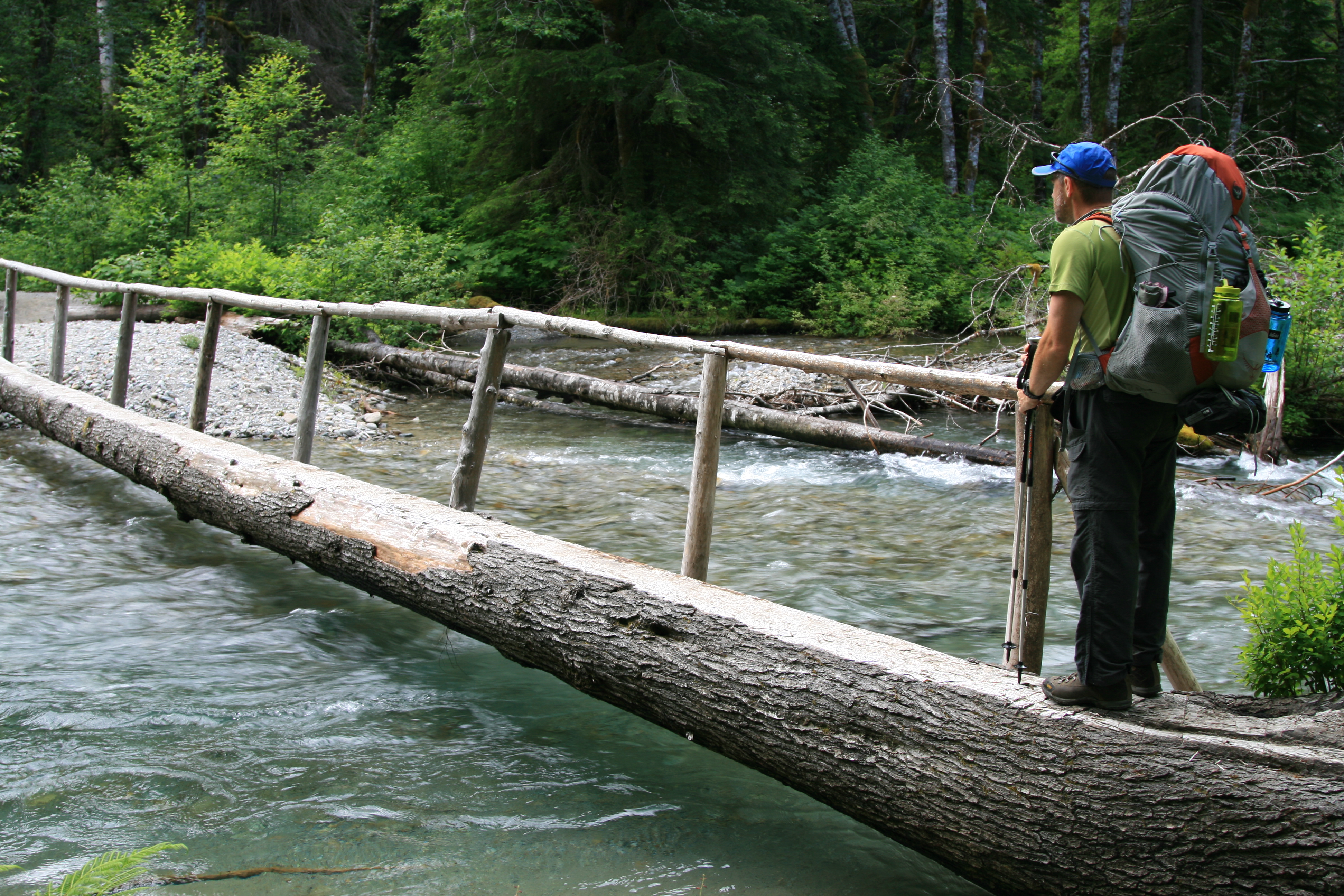
Sighing, partly from disappointment, mostly from increasing exhaustion at fighting brush and my imagination, I limped uphill after Greg. The trail follows one of the small streams that help create the Foss River, and it is a constant low roar, making conversations that are further than 10 feet apart hard to hear. At 6 miles in, you enter old growth forest and the generations of falling needles and branches, have helped to create a nice soft duff on the forest floor to walk on, much preferred to these weary feet. It continues like this, with an occasional short flat spot for you to catch your breath until you reach the Michael Nesby memorial bridge, built originally by the Trailblazers in 1973 in his honor. I believe the original had deteriorated, so a nice new one was built in its place. You will see the memorial placard on a boulder before crossing the bridge.
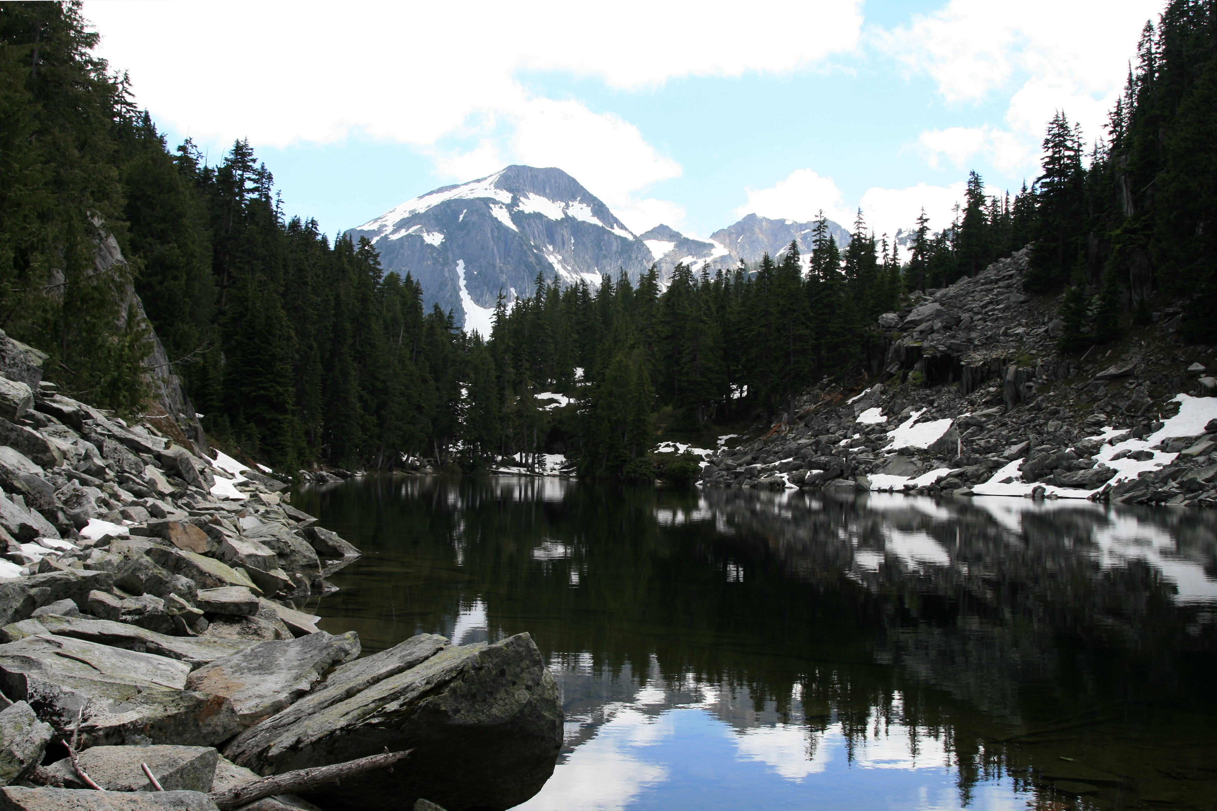
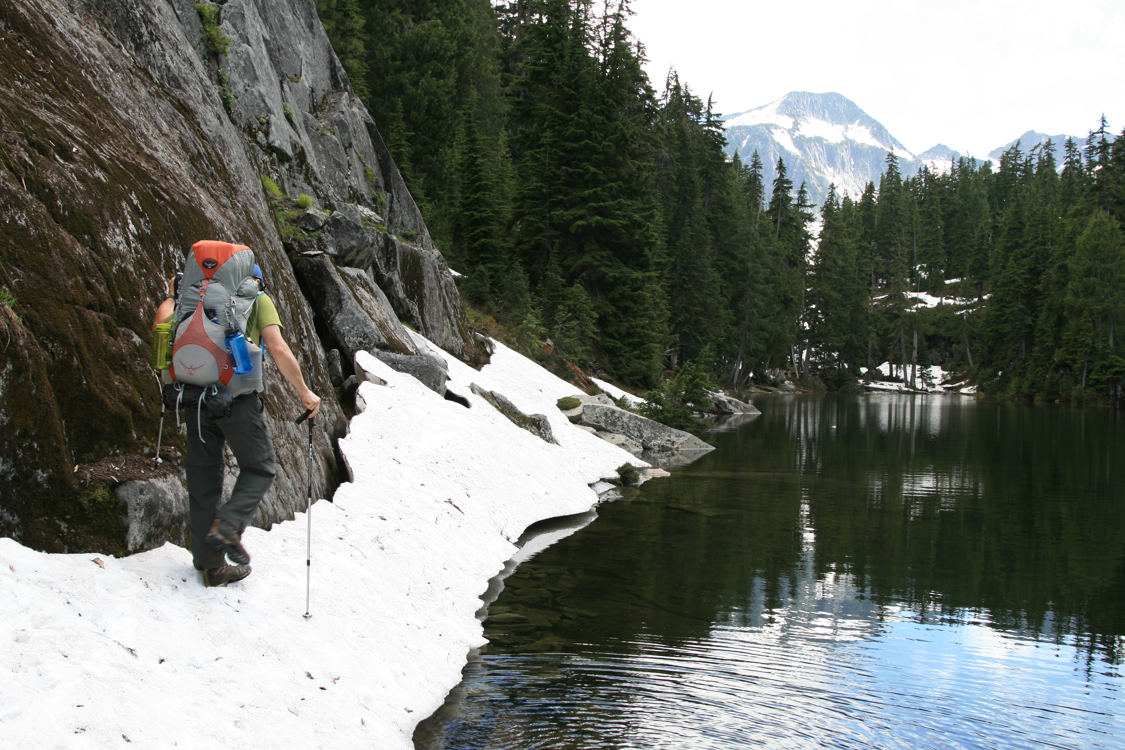
Finally, after another grueling mile, you reach the first of the lakes at 7.74 miles in, and it was easily the most beautiful of the lakes we saw on this trip. Its surface was smooth as glass, and reflected the alpine firs and distant La Bohn Peak which towered over the far tree line. The trail hugs the east side of the lake, next to a granite wall, and the way was blocked by snow that had run up the side of the granite for about 50 feet or so, creating a snow bridge between the lake and the granite wall. Greg nervously stepped onto the snow first, afraid to kick a step in too hard, for fear of collapsing it, which would result in an unscheduled bath. Luckily, for both of us, the snow held, but it looked as if it would not last for long, especially after a few more hot days…From here, the way became more and more snow bound, until finally the trail pretty much disappeared under the white stuff.
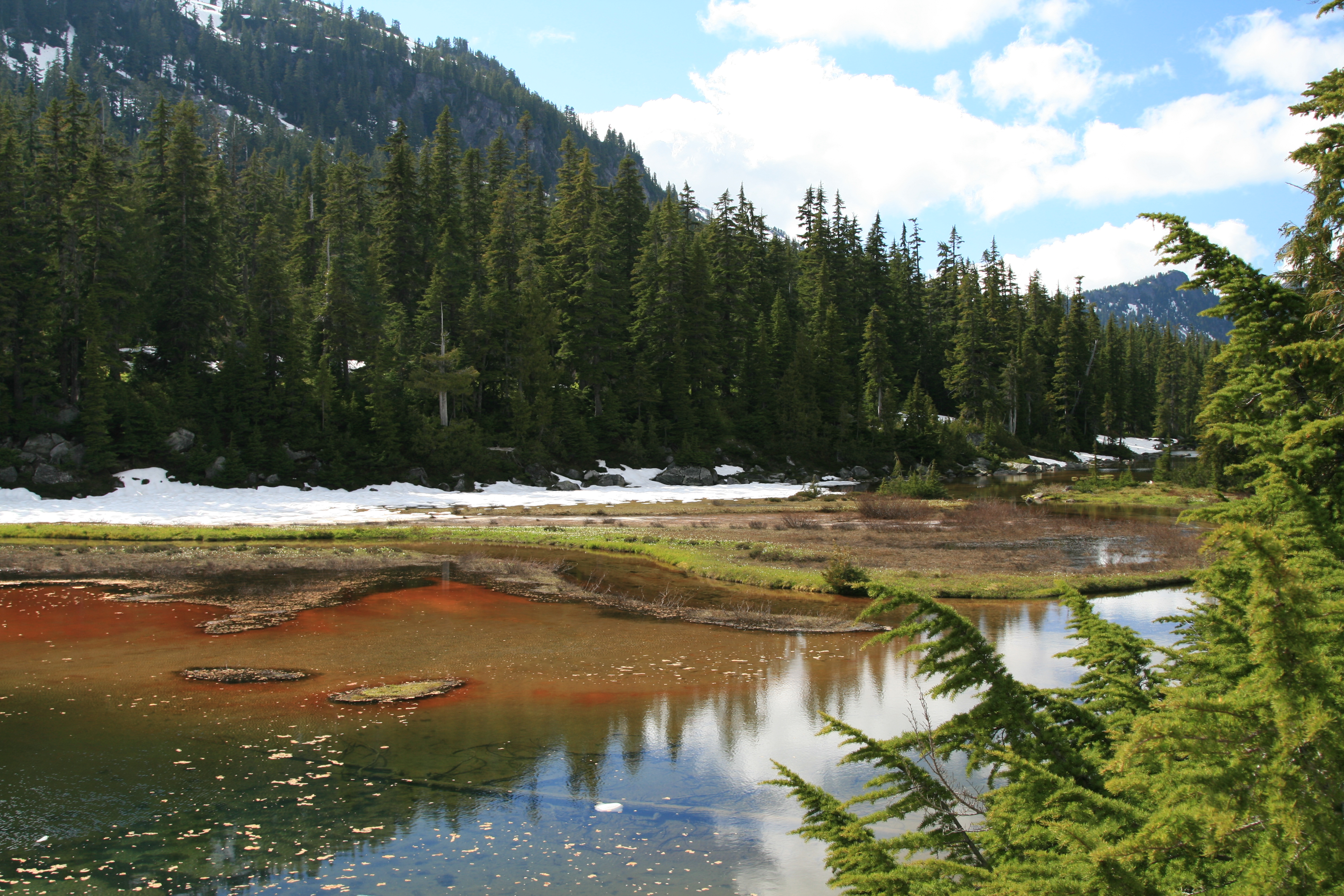
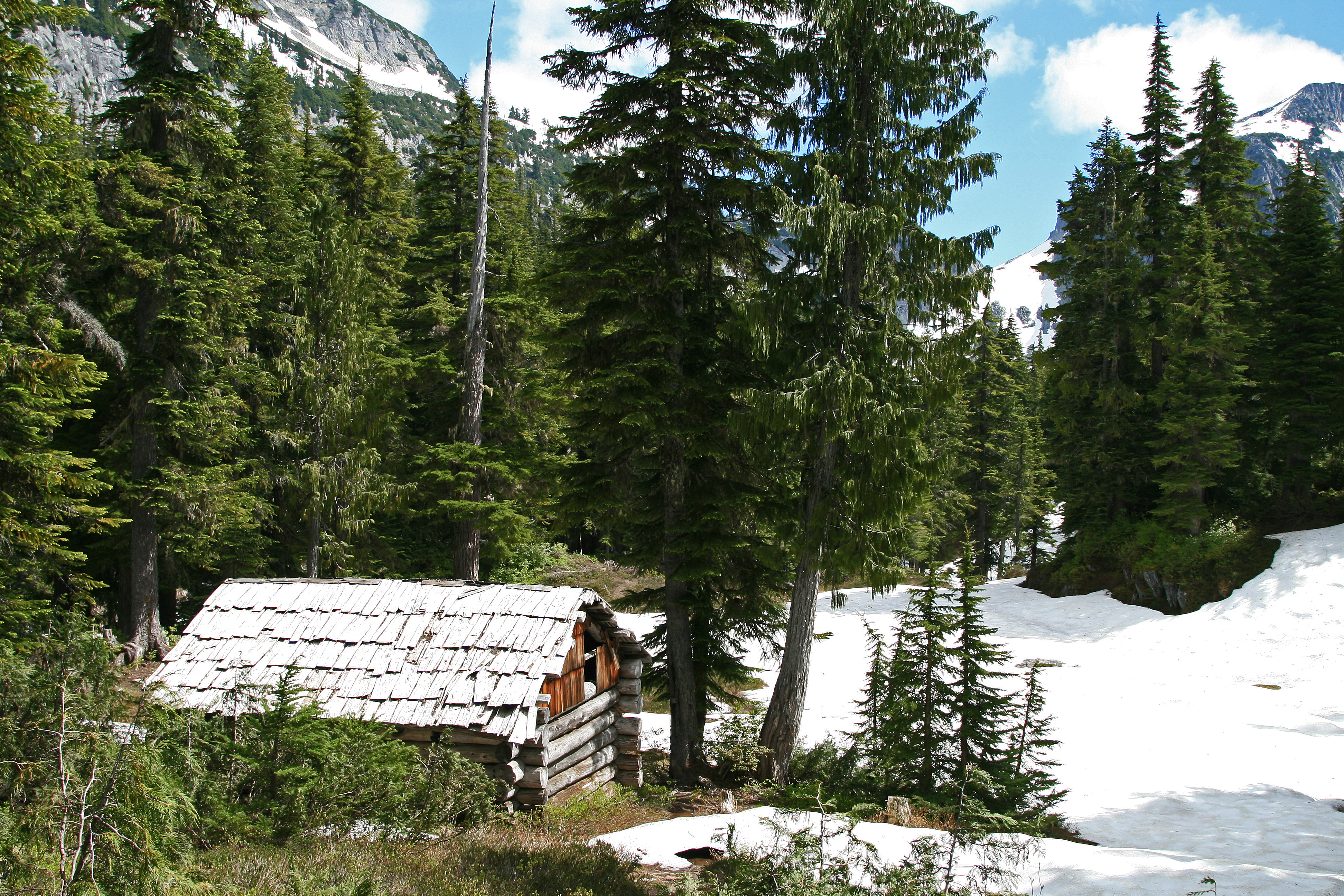
Within half a mile, we reached the Necklace Valley shelter, built in the 50’s, and it too, showed it’s age. Very dilapidated, not something that I would stay in, unless it was an emergency of last resort. Just beyond the shelter we were able to see Emerald Lake, a shallow lake that glowed orange from the accumulated iron deposits, I think. We continue to pick our path up to Opal Lake through small snow fields that after melt out, are probably pretty, small meadows, with small waterfalls feeding veins of water that wind their way down to the lakes. Where the snow is melted out, we can see the clear water running in carved out course ways.
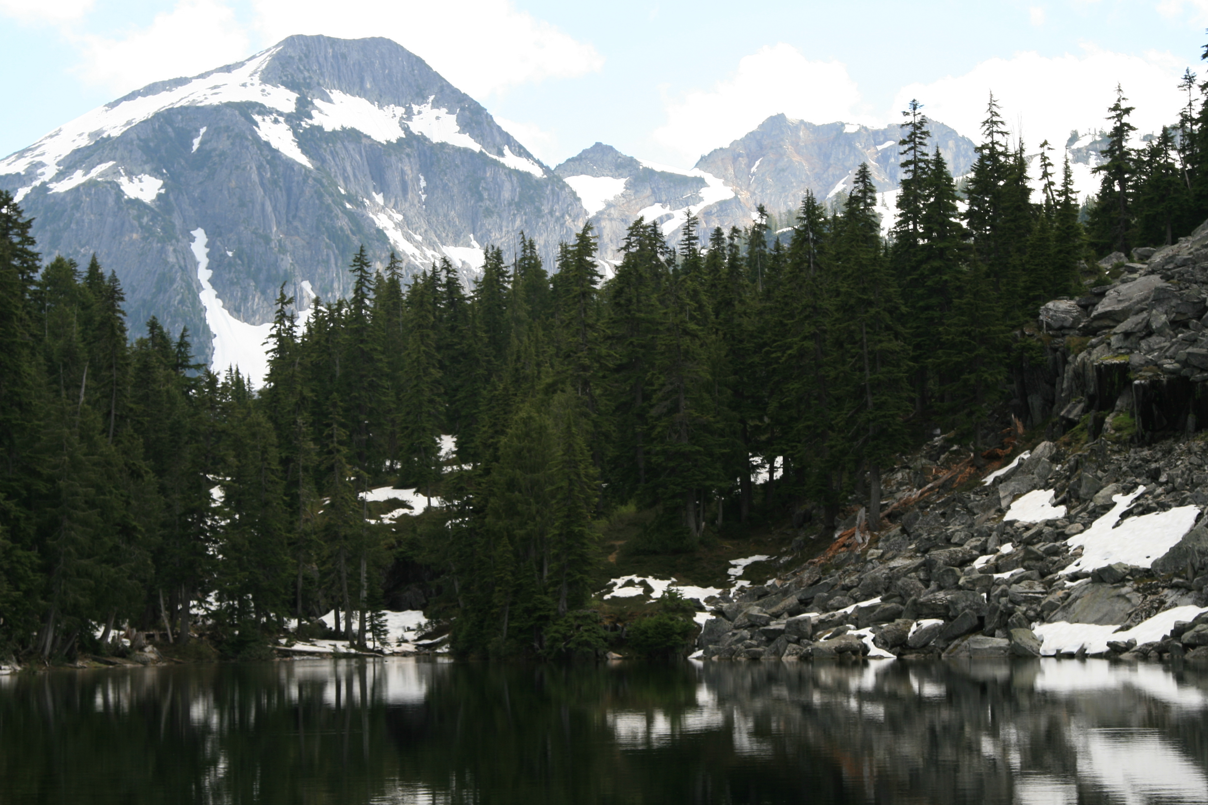
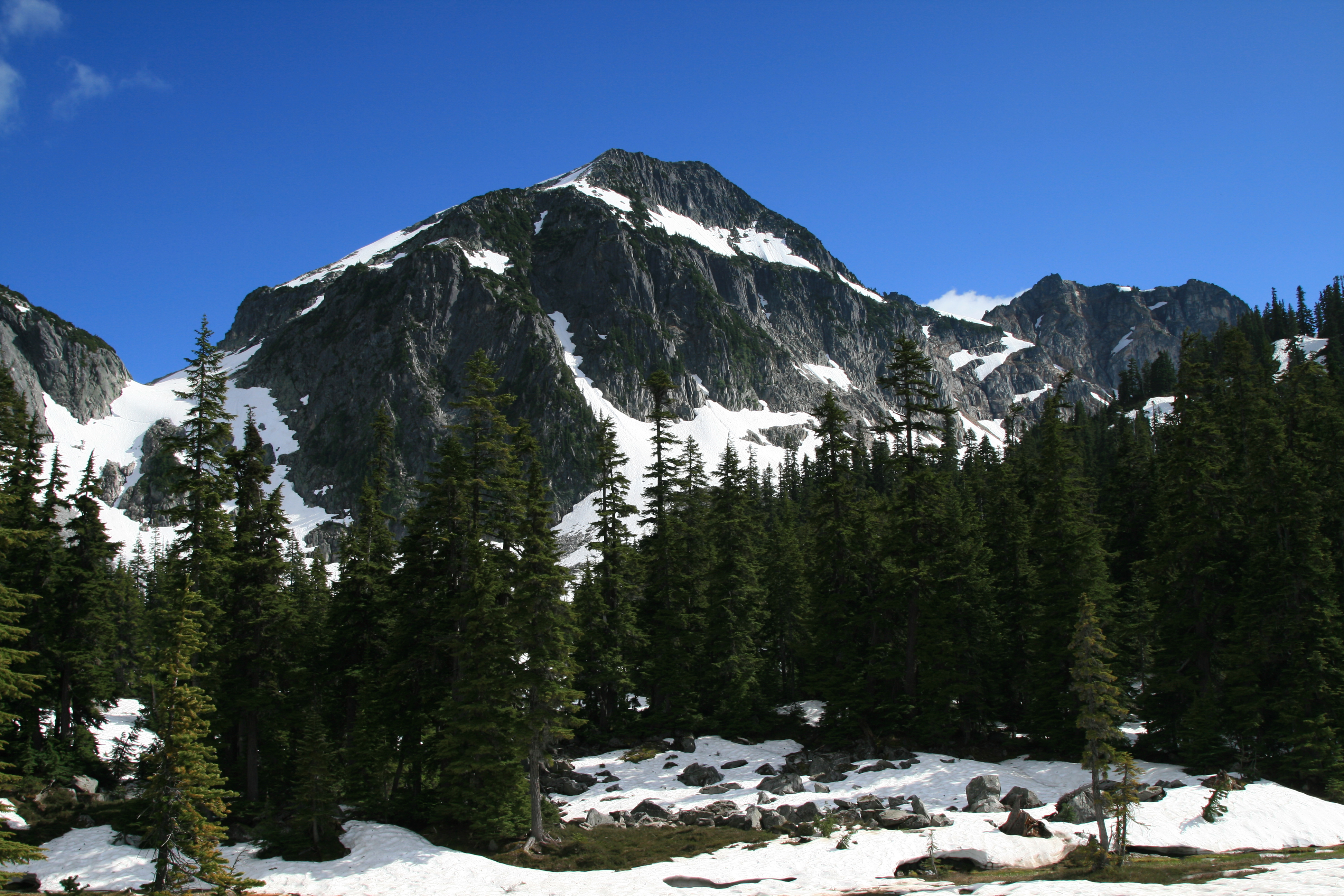
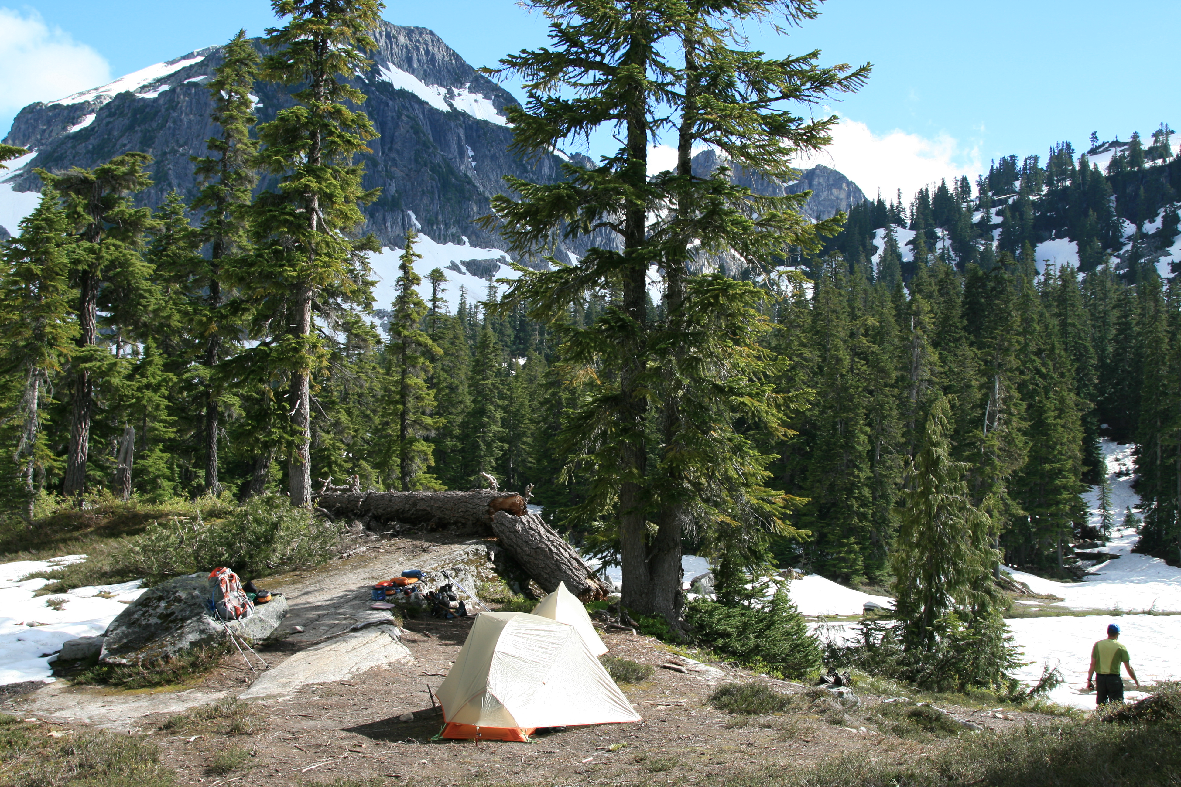
Very pretty, even in their current winter blanket. From the southern banks of Opal Lake, we can see a small spit of land on the eastern banks, between Opal and Cloudy Lake that looks to be bare of snow, a possible site for our camp tonight, so we pick our way carefully through the marshy, snow covered edges of the lake to find a great spot to pitch our tents on the divider between the two lakes. A large campsite, big enough for 3 or maybe even 4 larger tents, a flat rock to lay out on, and incredible views of the surrounding peaks and granite faces. Looking from the site across the southern reaches of the lake, the skyline is dominated by nearby La Bohn peak, draped in snow, it’s right flank trailing off over the ridge that runs from there all the way north to Locket Lake and beyond. The ridge line is also still covered in snow, occasionally being broken up by bands of bare granite, creating interesting patterns of white and dark in the afternoon sun.
To the east, behind the boundaries of little Cloudy Lake, rises a sheer granite cliff that looks nearly vertical, with small outcroppings of alpine firs growing in the small step about halfway up the face. And, pretty much wherever life could find a spot to cling to, trees and vegetation sprout precariously, seemingly impossible to us, as it appears they are growing on solid rock. The dots of green speckle the granite all the way to the top. If you follow this cliff all the way back towards La Bohn Peak, your eyes find a gap between the ridge line, and La Bohn Peak, and it’s this that we hope to use to reach the upper La Bohn Lakes, and beyond. The snow fills this gap, and from here it looks steep, but we figure we’ll have to wait and see when we’re on it, just how steep it really is. We can see large fractures running across the snow field, and we hope that it is all stable. You see, we hope to climb nearby Mt. Hinman, a peak that appears to be scalable without proper climbing gear…But, we’ll worry about that tomorrow, for now, we’re tired and ready to set up camp, so that we can prepare dinner.
Dave was up first, so, lacking the foresight of Greg for trying new recipes, I settled on an old favorite, our Parmesan Noodle with Summer Sausage recipe, with mashed potatoes. Still not bad for trail fare!!! Cleanup, and we sit around talking about the day’s events, and what’s to come tomorrow, and at around 9:00, as it’s getting dark, Greg stares, and says, “look! There’s someone walking over there!” Startled, I turn around, and sure enough, there’s a guy walking with trekking poles, and no backpack across the snowfields at the southern edge of the lake. Did I mention that it was 9:00pm? It was already getting dark, and Greg and I both were amazed to see someone else out here, at night, with no headlamp and backpack…
“…Here’s this stranger striding quickly into the enveloping darkness, by himself…”
Seemed strange, I know that we would not have pulled such a stunt, unless it was an emergency. And, before we could wonder any more at the strange sight before us, he entered the tree line and was gone. I kept blinking my eyes, trying to re-focus, not really believing what I saw, and then with him gone, I started wondering, “Did I really just see that?” We’re nine miles from the trailhead down a steep and rugged trail, we saw no tents or other people other than the trail crew today, and yet…Here’s this stranger striding quickly into the enveloping darkness, by himself…Not what we expected to see way out here. Finally, our eyelids grow heavy, the stars are out by 10:00, and we hit the hay, hoping for clear weather tomorrow.