- Ranking: 4/5 Even after having hiked this trail twice, there is always something new to see or do. There are few hikes that cover the type of terrain, contain so many big views, and are up close and personal to such an iconic landmark as Mt. Rainier. Old growth forests with giant firs and cedars, glaciers, rivers, lakes, meadows, and eye popping views of the rugged Cascades.
- Difficulty: 6/10 Add it up…It’s over 20,000ft of elevation gain/loss in a little over 35 miles, folks…Makes for some big days, but the pay-off makes it all worth it. This trip has it all, from endless switchbacks, blowdown, and river crossings, yet, the trail is easy to follow, and the campsites are well thought out, and provide amenities like good toilets, and bear poles. Signage is also very good, with directions at every bend in the trail.
Maps: We used the National Geographic “Trails Illustrated” map, a water proof and tear resistant map that encompasses all of the park. We found this sufficient for this hike, as I’ve noted before, the trails are relatively easy to follow, and the map shows the locations of backcountry camps.
Permits: You will have to get a permit to camp overnight anywhere in the Mount Rainier National Park, Especially those camps that are located on the Wonderland Trail. March 15th is the date that they start accepting reservations. Please check the website forWilderness camping and Hiking. It should have all the information that you need to plan your hike. Of special Note: The floods of 2006 and 2007 did heavy damage to the Carbon River Entrance, so much so that the road to Ipsut Creek campground is washed out. This is why we chose Sunrise as the point of entry this hike, and your pass can be picked up at the White River Ranger Station, next to the entrance to the park. Right after you pay to enter, you will see it on the right hand side.
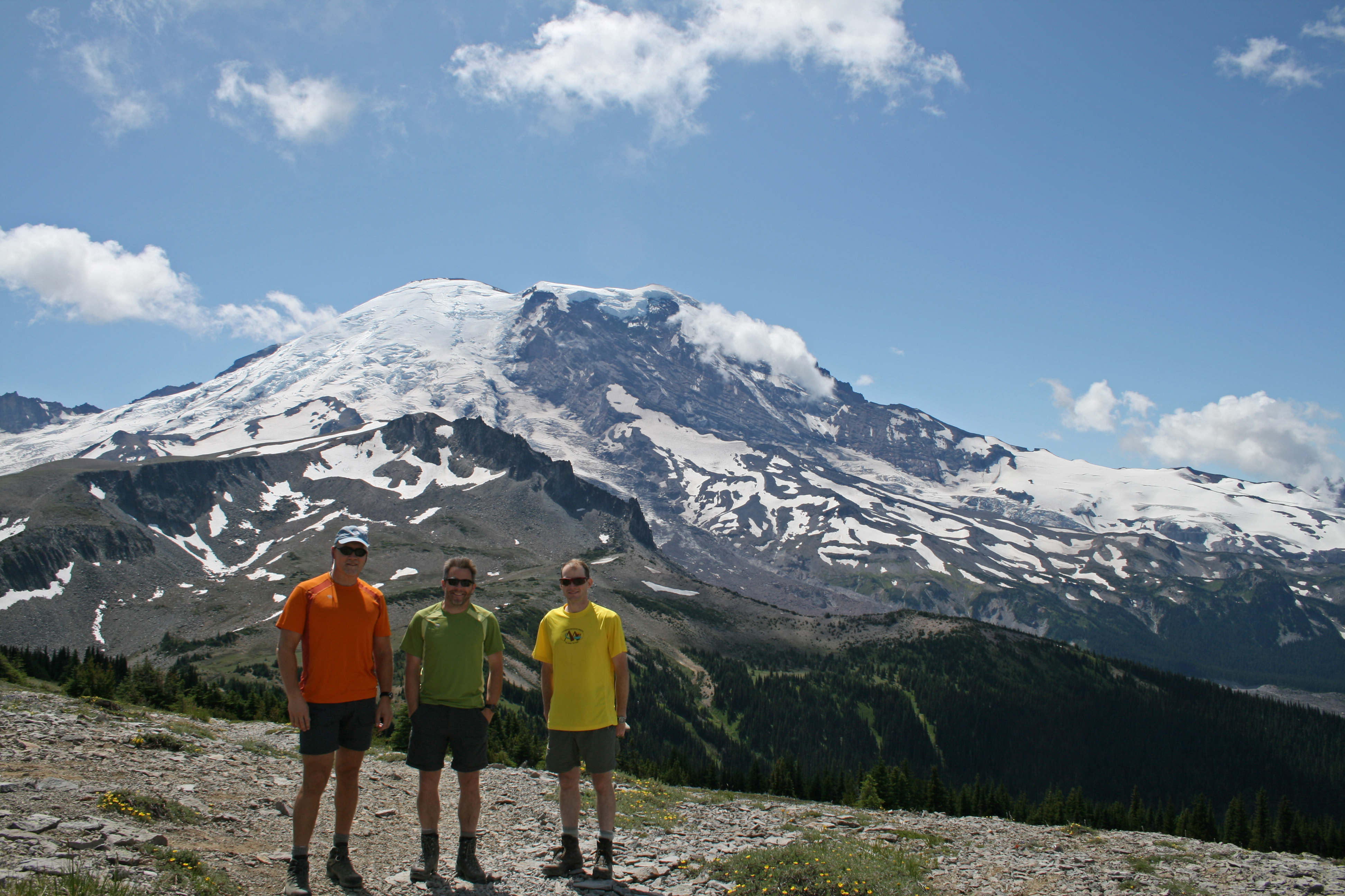
Yes, we’d been on this trip before, but this time, we would go with Ed, Greg, and myself, in an attempt to map the trail for Backpacker.com, with our GPS units. Gotta keep up with the latest advancements!
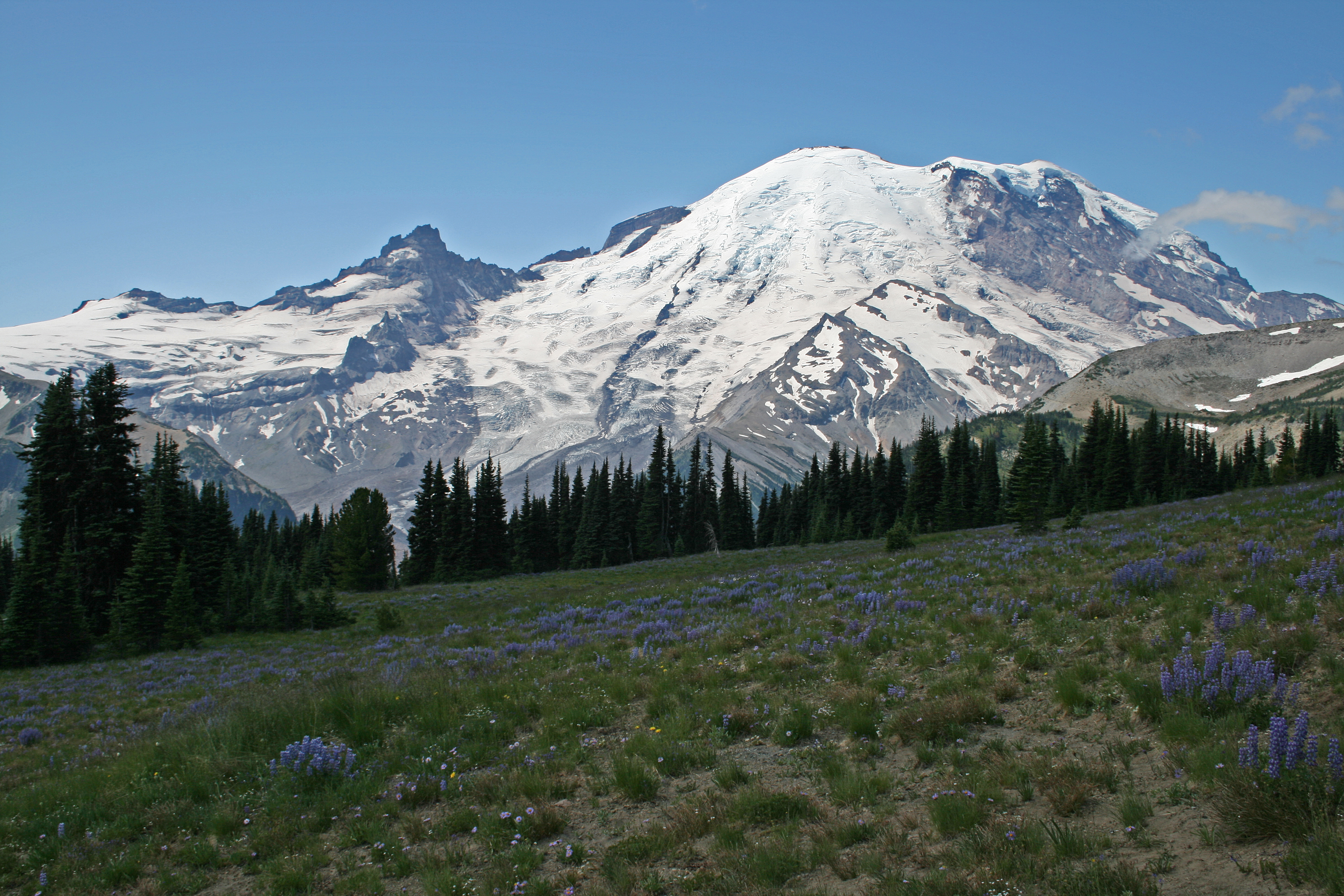
Because of the floods of 2006 and 2007, the Carbon River entrance is no longer viable, as the road to Ipsut Creek Camp is washed out, and though it’s still accessible as a backcountry camp, we didn’t want to add the extra 5 miles it takes to hike in now that the road is gone. So, this time, we start at Sunrise to complete the loop. Nothing wrong with that, as the scenery along the winding road to the high point in the park at Sunrise, elev. 6400ft, is a worthy road trip in itself. Beautiful meadows filled with wildflowers surround the buildings at Sunrise, and the view of the mountain from here is breathtaking, it feels as if you are close to the top here.
Day 1

9.48 miles. 2096ft gain/2938ft loss. We start at noon, and head up to the Sourdough Ridge Trail, which runs East and West along Sourdough Ridge, from Frozen Lake (the Sunrise area’s drinking water), down ridgeline to Sunrise Lake, below, yep, you guessed it, Sunrise Point. Your first viewpoint north from the trail is down into the Huckleberry Creek Basin, sliding off the flanks of McNeely Peak, and the mountains and ridges stretching north into Canada.
…with signs pointing this way, and that-a-way…If you’re not paying attention, its easy here to make a wrong turn.
Seems you can see forever across bunched up peaks, which rise and fall like a disheveled blanket thrown carelessly across a bed. Continue up the trail to Frozen Lake, and a slightly confusing intersection of trails, with signs pointing this way, and that-a-way…If you’re not paying attention, its easy here to make a wrong turn.
For our hike, you must continue through the 4 way intersection straight, following the signage to Mystic Lake, and The Wonderland Trail, which the Northern Loop is part of. The area is relatively barren, and if you look closely, you can see large piles of pumice from past eruptions, reminding you that this area was once the scene of violent volcanic eruptions. Follow the trail downhill to your next junction, which leads left towards Skyscraper Pass, follow the sign that says Mystic Lake, which will be our destination this evening.
The trail rounds the leading edge of Berkeley Park Basin, another beautiful valley resplendent in thick green foliage that carpets the ground, and aromatic purple explosions of Lupine, which right now is in full bloom. The way the alpine trees grow in sparse bunches here, reminds you of a carefully maintained, and well thought out garden…On to Skyscraper Pass, and the views here make this a great dayhike to contemplate.
Beautiful sightlines of the mountain, with its glaciers resting on the mountain flanks, most prominently the Emmons and Winthrop Glacier, which feeds the West fork of the White River, which runs ribbon like down the valley below. We took the time to scramble up Skyscraper Mountain, an easy 15 minute scramble to the top, our high point for this trip at 7000ft. More spectacular vistas await you, so don’t miss this side trip!

Why they call it a creek, I haven’t a clue, for it is as ferocious a tributary as any of the rivers in the park. In fact, it’s waters were churning and heaving, as if full of barely contained rage…
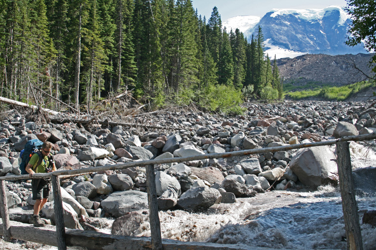
From Skyscraper Pass, it’s several long, lazy, switchbacks downhill through gradually increasing forest to Granite Creek, and the Granite Creek Camp. From there, it’s not long, and you find yourself at the Winthrop Creek Crossing, close to the snout of the Winthrop Glacier. Why they call it a creek, I haven’t a clue, for it is as ferocious a tributary as any of the rivers in the park. In fact, it’s waters were churning and heaving, as if full of barely contained rage, the waters splashing over the now meager looking log laid across the river, the sound of thunder coming from boulders being tossed like playthings in the torrent …
I felt like Mario in the video game, waiting for a Chomp to hurl itself out of the waters below, to whack me off the bridge! Game Over!
Made one a little nervous to cross that bridge, as you could feel the vibration underfoot from the bouncing boulders…I felt like Mario in the video game, waiting for a Chomp to hurl itself out of the waters below, to whack me off the bridge! Game Over! Safely across, we then make our way to the devastation left behind by the recent floods that wiped out the White River crossing. Amazing how much material was moved here, the recently scoured hillsides looked as if I was looking up the side of a skyscraper!
Follow the rock cairns and ribbon here, to find the best way across this boulder strewn area. Soon, we reach Mystic Lake Camp, and claim our spot. There are 6 or 7 sites here, with easy access to water. If you like to fish, there are fish in the lake, and it’s also a great place to take a dip to remove the trail grime.