Day 2
11.4 miles, 3280ft gain/4120ft loss. Fitbit data: 35,247 steps, 332 floors.
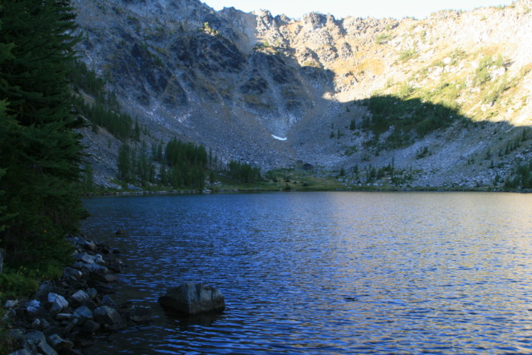
After breakfast, we waited around as long as we could to see if the sunrise would light up the lake basin, for even now, close to 8:00am, sunlight is just starting to reach the upper reaches of the bowl. I see an old sign here on the tree that reminds us we are at Sunrise Lake, at 7300ft, but I’m thinking that name might be a bit misleading…I think Surprise Lake, or Mid-afternoon Lake might be a better moniker…”Surprise! There’s a lake here!!!” Or, “Surprise!!! There’s no trail over the ridge into the basin!”
Bidding farewell to the lake, we decide to hike back up Merchants Basin to crest out on trail #417 at the notch to the east of Switchback Peak so that we can look down into the Cooney Lake Basin, part of the Golden Lakes Loop trail, Then around on trail #1258 to close the loop at the point where we went up and over the rim encircling Sunrise Lake the day before. Originally, we had planned on doing it the first day, but with our time constraints, we had to modify our goals…The second day, we had planned on going out on trail # 417, then head east to join up with trail #424, which would have rejoined the trail at the desolate meadows we passed through the first day, below Navarre Peaks, but of course, that didn’t happen…One of the reasons we decided to take the longer route out, was because on the first day, when we were coming in through the meadows, we never remembered a junction trail, the one we should have seen to close the loop. And, this counter-clockwise direction, seemed more out in the open so we opted for that…
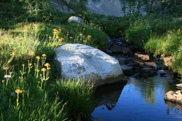
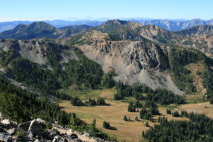
At least for now, the trail is very distinguishable, and easy to follow, as we head down from the lake through trees to cross the Foggy Dew creek, which Merchants Basin is the beginning of. The basin here is also covered in grass lands, and hanging a left, we head uphill through this wide open meadow and top out at the ridge at mile 1.79, and look into the Cooney Lake area. This area is more popular so we see tents and hear people far below. We take a minute to rest as the hike up from where we turned left onto the trail that leads up to here? Well, that was a mere 1.14 miles up with a gain of 1056ft…Steep by anyone’s measure. And, we tried not to think about the other two times we would have to go up and over still to come….
“…I can find no reference to the Summit trail on maps. Summit of what?? Mystery unsolved…”
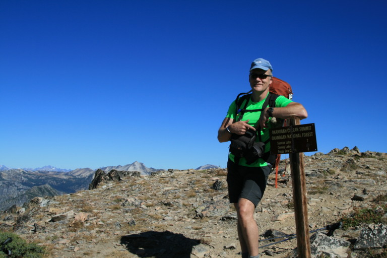
A weathered old sign points out that the Summit Trail is so many miles that-a-way, and it’s not the first time I’ve seen reference to the Summit Trail. Other than the signage around here, I can find no reference to the Summit trail on maps. Summit of what?? Mystery unsolved, we turn left, and end up quickly at a signpost with mileage to Cooney and Sunrise Lakes, before heading down over multiple switchbacks to the meadows below. We continue down over moderate switchbacks in great shape to our next trail junction, at mile 3.5. Here, too is an old weathered sign reminding us that the switchbacks to the top are called Angel Staircase. Having wings I suppose, would definitely ease the journey to the top…We turn left, heading south, and continue to close our loop portion. At least for now, the trail is still dirt and easy to follow, winding downhill a bit through meadows and stands of firs. The occasional shade provided by the trees is a nice touch. Now, at mile 4.67, we’re in wide open meadows, near Prince Creek.
“…but to say that they were jumping would be to give them way too much credit…”
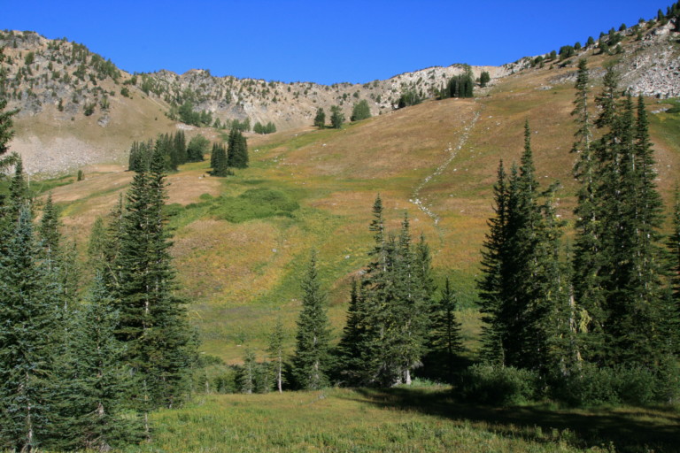
Some of the trail here is muddy as the creek crosses the path. It’s pretty here, you can tell lots of flowers probably were blooming here earlier in the year, but now, the expansive meadows are a characteristic brown. And the crickets!!! As you walk through the grass, fat crickets, probably from gorging themselves silly on the abundance here, plop in the footpath like popcorn. I say plop, for their fat bodies don’t allow them to jump really…They make an effort to get out of the way of your footfalls, but to say that they were jumping would be to give them way too much credit. They just kind of get off the ground about an inch or so, then list over to one side, as if the effort of even jumping once was just too much…Thousands of them in all different colors, some bright green, others red, and brown, almost as big as my thumb in circumference, seems to me it would be a smorgasbord for birds…Is there so many because there aren’t enough natural predators??
“Bring out yer dead!!! I’m not dead yet!”
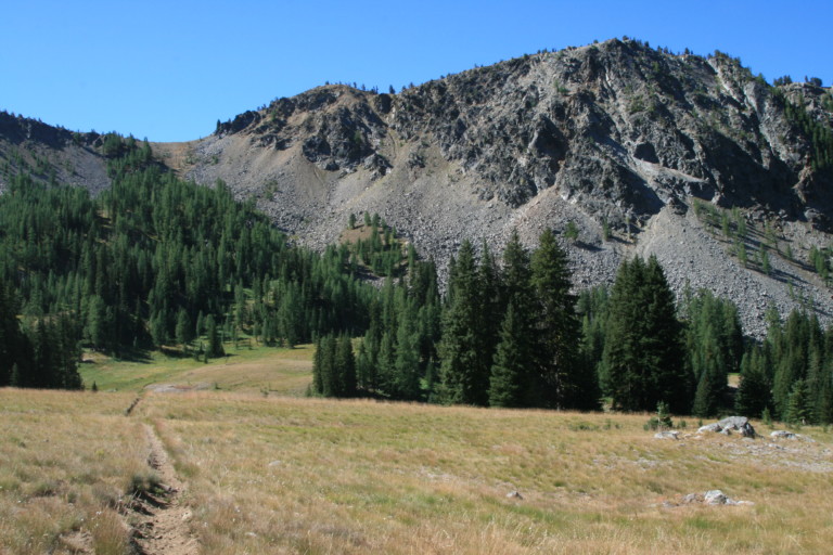
Quickly across the easy walking through the meadow, we start our climb up moderate grade switchbacks at the end of the meadow, into the tree line. A couple of minutes into our climb up, we hear the unmistakable sound of trail bikes heading our direction. Since these trails are multi-use, they are open to stock, mountain bikes, and motorcycles as well as the odd backpacker… We step off the trail as they catch us to let them pass, and we see them again at the top of this pass, called of all things, Deadmans Pass…Yep, after climbing up to the top of two passes now, it’s fair to say that I’m a little gassed, but dead??? “Bring out yer dead!!! I’m not dead yet!” The top of the pass is at 5.53 miles, and 7370ft elevation. Its about a 600ft climb in about .9 miles, so yeah, it gets up and over, without totally destroying you. Only one more big up and over…

The bikers had stopped at the top to rest and take in the view, and we chat for a few minutes, they ask us where we were headed and where we came from. I told them about going up and over the rim into Sunrise Lake. One of their trio told me that there used to be a trail there…Well, not anymore, I assured him. Now, its all just a scramble…
“Steal my horse, will ya? You’re a dead man!”
They turned right, and we headed left, the trail so faint it was hard to see, even though there was another old, weathered signpost marking the way to Summer Blossom. This trail skirts the ridge that sits above Horse thief Basin, (hmmm…Perhaps now Deadmans pass makes more sense…”Steal my horse, will ya? You’re a dead man!”) and it’s sandy and rocky along most of it. Small hillocks of grass dot this loose hillside, barely keeping it all together, and sometimes, the trail almost fades completely out in places. In .57 miles, we reach the ravine that we followed up to get to Sunrise Lake, and it’s really starting to get warm.
“…I thought my heart was gonna leap out of my chest!” Greg said…”Yeah…” is all I could get out…”
We’ve now been up and over 2 passes, and the mileage and ups we’ve already covered are starting to wear us down…Up and around the next ridge we go, dripping down into the next creek basin, before heading up along the next ridge and finally into some much needed shade for awhile, as we enter a treed patch. And, more grouse…Probably the same bunch that scared the crap out of us before, are now at it again…We try to see them in the trees before they have the chance to startle us, but it’s no use…A couple of times, they actually wait for us to go by before flapping off behind us…”You little jerks!”…Ok, maybe we might have used a bit more colorful language, but it’s always the same reaction…You’re just trudging away quietly suffering under the hot sun, and lack of enough O2 to keep the lungs happy, heart pounding, as it struggles to supply the body with enough oxygenated blood, then…”FLAP-FLAP-FLAP-FLAP!!!” From wings beating frantically…Additional stress on the ol’ ticker that really isn’t necessary at this point. “I thought my heart was gonna leap out of my chest!” Greg said…”Yeah…” is all I could get out…
Back in the meadows around 7.86 miles, and we really start paying attention to where the trail we missed the first day might come out at, and when we reached its’ supposed re-joining point, we could find no trail. There was a weak looking cairn comprised of about 3 rocks on the side of the trail, but no discernible trail. You’re going along the top of this ridge, so maybe it we had ventured over and looked down the other side, we could have seen it, but at this point, who has the extra energy? At least the way we came was still faint but doable, and out in the open, so you could see…This other way, according to the map, was mostly in the trees, so even though it was longer, we’re glad we made the decision to follow it instead. Across this wide open meadow, we start our last upward slog for the day to the gap between the two Navarre Peaks, and it seems relentless, we’re both hot, tired, and bodies weary from the miles and elevation gain already accumulated. So, this last push uphill seems especially brutish…WE focused on just putting one foot in front of the other until finally, we’re gasping, sweaty, and relieved to be setting foot on the small pass between…Catching our breath, we begin the final trudge downhill to return to the parking lot. It feels so good to get the pack and boots off!!! Now, we can’t wait to get to Rusty’s in Cashmere, outside of Wenatchee, for a well-deserved burger and shake.

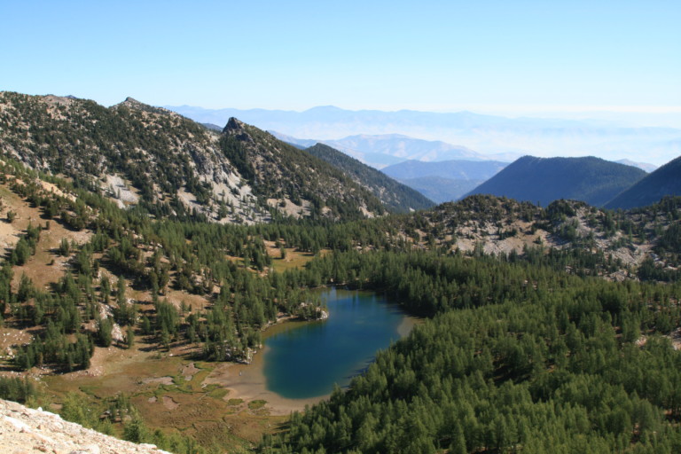
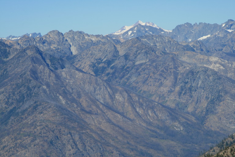
All in all?? Not a hike I could recommend, that’s for sure. A whole lot of effort to expend to get to a lake that was just above average. There were expansive meadows to walk through, and wide open vistas, but the only mountains of note were the snow covered peaks in the far distance to the north and west, beyond the several ridge lines that separated us. A lot of the trees here are dead, ghostly apparitions of the abundance that used to be here. We saw no large animals, just a lot of grouse, a few marmots, and squirrels. It was as if the place was deserted…