Day 2.
We vowed an earlier start today, so that we would have more time to negotiate the rugged terrain ahead of us. Waptus Lake was supposed to be our destination yesterday; we had not planned on the slow going to this point, so it was critical to our plans to get to the lake tonight.
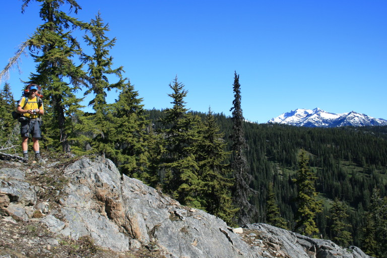
I have to admit, it was with some skepticism, after the first day’s foray tromping through trees, brush, and snow, that I eyed the map and the terrain ahead of us. We still had to climb the high point of Polallie ridge at 5381 ft, follow a ridgeline down to the Quick Creek junction, then more downhill to the lake, an 8.1 mile jaunt just to its shores.
We stayed along the ridge, as this made navigation a little easier, as did keeping Cone Mountain to our right shoulder. It was nice to have such a peak to use as a navigation aid that was relatively close, and remained in view for most of the way. Once we topped out on the ridge, even though the snow was deeper, the going got easier, and the views were magnificent! We had spectacular sweeping views of the surrounding snow capped mountains, under bright blue skies.
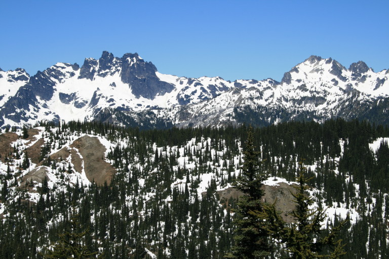
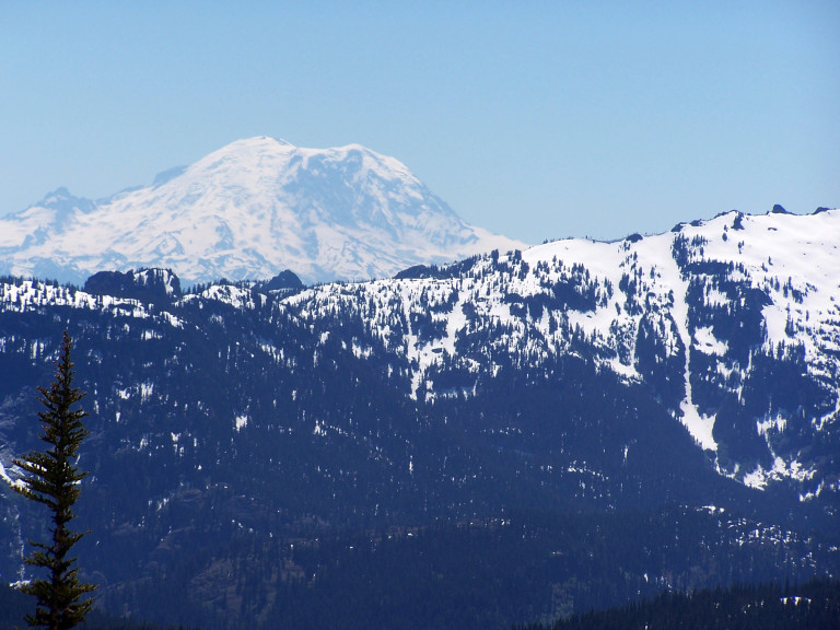
Looking west, to northwest, you could see in the distance, Mount Rainier, and in the foreground, the peaks in the Chikamin range, Chimney rock, Lemah Mountain, Summit Chief Mountain, Dutch Miller Gap, and Bears Breast Mountain.
It helped make up for the slog that we were enduring through the soft snow, which was melting under the midday sun. We stopped for lunch at an old deserted look out, all that remained of the tower were the concrete footings, and some scattered, rusting debris. You could see why they chose this spot, as it offered commanding views of the valley, and mountain ranges.
Looking west, to northwest, you could see in the distance, Mount Rainier, and in the foreground, the peaks in the Chikamin range, Chimney rock, Lemah Mountain, Summit Chief Mountain, Dutch Miller Gap, and Bears Breast Mountain. As we headed down the northern tip of Polallie Ridge, we were looking for the point where trail #1317 came up the ridge from Owhi Lake, and joined into our trail #1309.
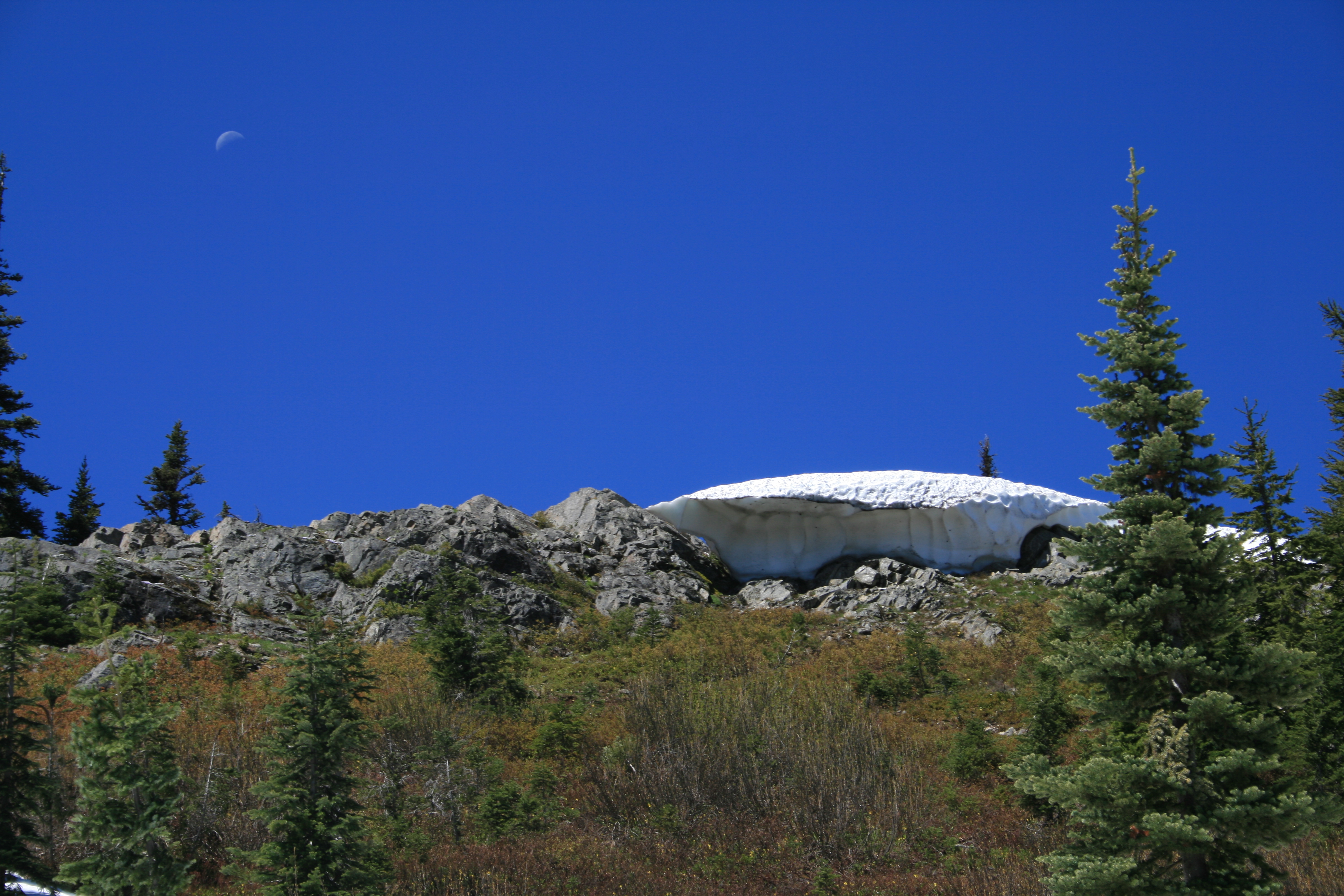
…Again, we were still in 3 feet of snow here, so finding the trail without x-ray vision was pretty unlikely…
We knew if we could find the signage for this, we would have another good point of reference for taking a bearing on. Again, we were still in 3 feet of snow here, so finding the trail without x-ray vision was pretty unlikely. As luck would have it, we must have been going in the right direction, for we did find the signs for the trail junction! Now, we would have a good point of reference!
Looking at the map, we could see that we needed to follow a ridge line, which would take us down hill to the Quick Creek drainage. Once there, we felt pretty confident that we could follow the creek all the way to Waptus Lake. Ok, that was the plan…Now, on to blunder #2…We set the map down, placed the compass on it, and took a heading, just like you’re supposed to, stood up, and, looking around, I quickly surmised that the compass, or the way that I was reading it, was wrong.
…We were following a ridgeline all right, just in the totally wrong direction! Sigh…So, once again, we had to backtrack to a known point, take a heading, and this time, follow the compass no matter how wrong it seemed…
We just couldn’t be going that way; it had to be this other way! Greg looked at his GPS, and sure enough, it agreed with the compass. No way, they were both wrong, we need to go this way! The map only shows one ridgeline here, and we’re following it! So we did, and it didn’t take long before, once again, we realized we were going the wrong direction! Hmm…Could it be that the compass and GPS were right, after all?
We were following a ridgeline all right, just in the totally wrong direction! Sigh…So, once again, we had to backtrack to a known point, take a heading, and this time, follow the compass no matter how wrong it seemed. And, you know what? It took us right down the ridge to the junction at Quick Creek! A valuable lesson was learned here…Compass trumps map, no matter how odd it may look to you at the time, especially when the map is in 1:100,000 scale.
It’s a really odd sensation to feel in your mind that you are going in one direction, then find out you were turned around. It was a relief to occasionally run across logs cut to clear the trail, and a three or four foot section of the trail uncovered from snow, that let us know we were finally on the right track.
Who knew that a Blueberry bush could feel like coiled steel concertina wire!
We were in heavy forest, so it was hard to really see any of the mountains to use as navigation aids, just keeping the bearing of the compass. As we ran the gauntlet of brush, and downed trees, the constant whipping on our already scarred legs was not met with a lot of enthusiasm, other than the occasional “Yeow!” at the instant dose of sharp pain, with every smack of cedar bough, or Blueberry bush. Who knew that a Blueberry bush could feel like coiled steel concertina wire!
I kept looking down, just to convince my mind that my legs were not being sliced and shredded to bits… Once to Quick Creek, we had to cross, so on went the sandals, and, after a quick ford across the icy cold creek, we followed the stream until we ran across the trail leading to the lake, a welcome relief to be sure!
…because having to be constantly on alert, looking, scanning, re-checking your heading, looking for signs, etc, can be mentally draining…Especially, when you don’t have that much brain power to begin with…
Now, we didn’t really have to think about finding our way, for now the trail was leading us onward. I say a relief, because having to be constantly on alert, looking, scanning, re-checking your heading, looking for signs, etc, can be mentally draining…Especially, when you don’t have that much brain power to begin with… Down, down, down we went, until we reached the banks of Waptus Lake!
…As the last patch of sunlight on our side of the lake faded away, we looked enviously across the lake to see other hikers on the north side, still sunning themselves…
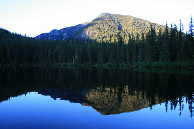
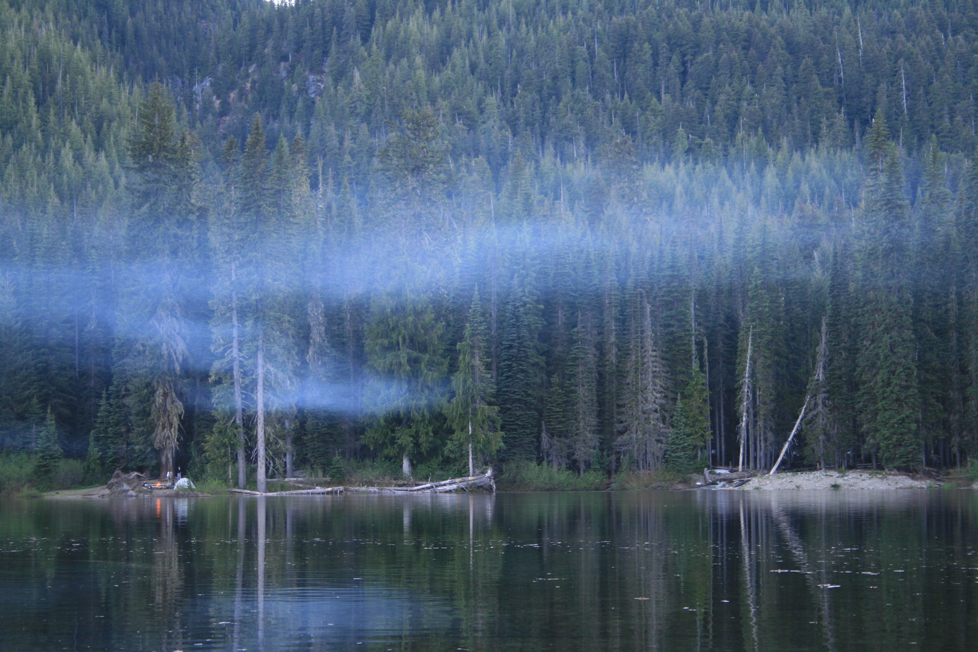
Amazingly, there were still large patches of snow here, at 2963ft, hidden in the shade of the large trees here on the southern side of the lake. Originally, we were going to cross the Waptus River, which runs out of the lake, and camp on the north shore, but…After our long trek, we only wanted to drop the packs, and plunge into the lake to wash the trail’s grime, and days of sweat from our tired bodies.
We found a nice, flat camp spot that suited our purposes, and after jettisoning the gear, and boots, made the icy dip, and got cleaned up! Refreshing, but cold enough that you didn’t want to stay in too long. Still, the cold water was a relief to our newly opened wounds on our legs. As the last patch of sunlight on our side of the lake faded away, we looked enviously across the lake to see other hikers on the north side, still sunning themselves.
We decided that we would have to rectify that situation in the morning, and move camp to the sunny side tomorrow…