Day 3.
Again, we rose early, packed, and made our way to the north shore, for our share of evening sun, and within 10 minutes, we reached the river crossing…The hikers bridge had been washed out two years prior, and as the trails here allow horses, and other pack animals, the best place to cross was at the horse crossing, a 40 to 50 foot stretch that was supposed to be shallow enough to cross…
With the week’s worth of hot sun, the lake and river were up, but, needing to get to the other side, we took the plunge. I went first, so that I could video tape Greg’s crossing, and the water was cold, hitting me about mid-thigh, with a pretty good current at the deepest part. Needless to say, it was a little deeper for Greg, and probably a little bit colder, too, as the water level reached areas a little more sensitive to cold water…After crossing the river, it was as if we had crossed into a completely different zone.
There was really no snow here, and the trees were completely different, as was the vegetation! Mostly Lodge pole pine, sparsely populated, with a minimum of vegetation, where just on the other side of the river, there were large old growth fir, and cedar, with lots and lots of underbrush. What a dramatic difference. I assume it was because the north side basked in the full on sun most of the day, as opposed to the south side of the lake.
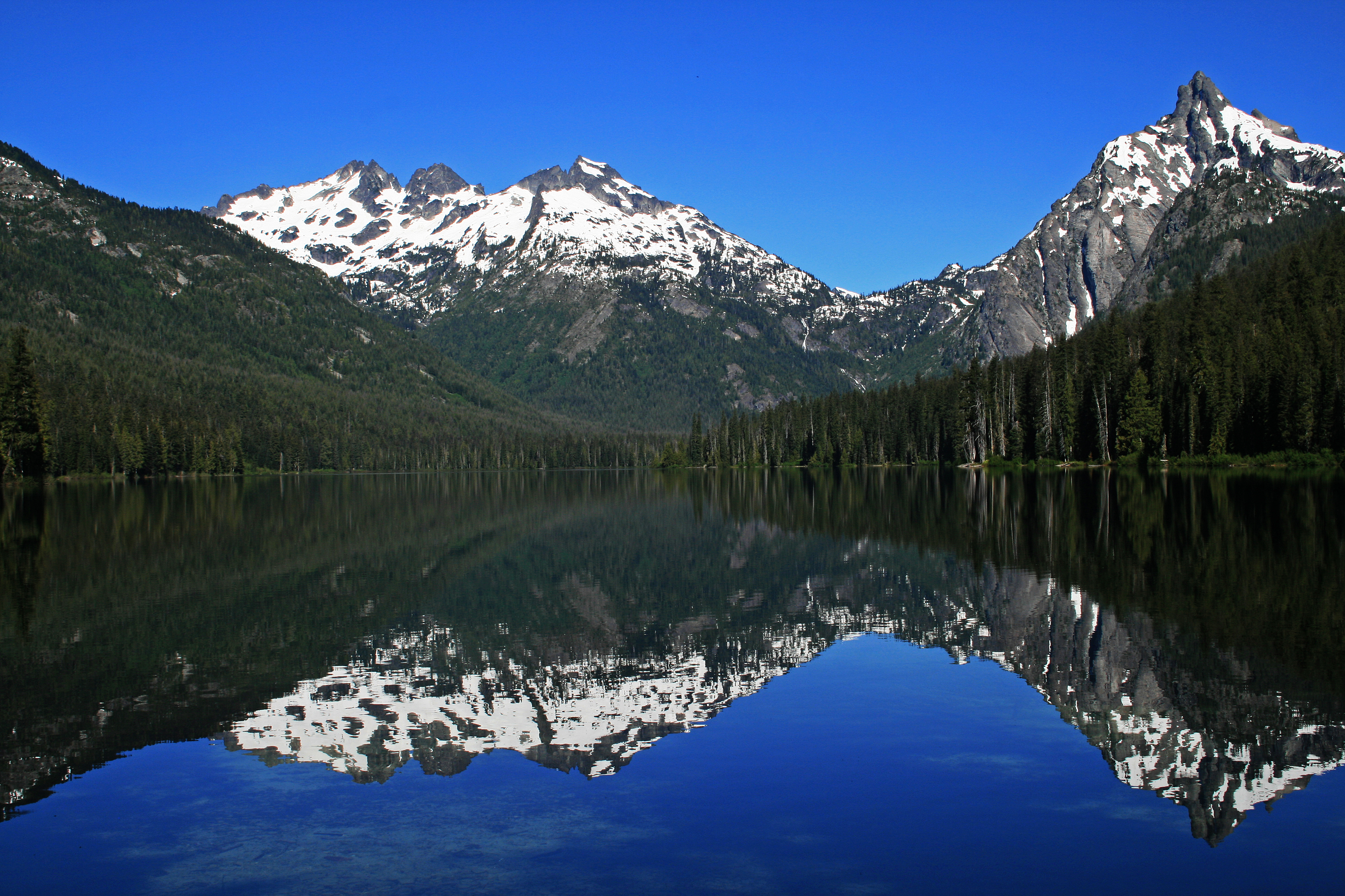
We found a great site that gave us unparalleled views of Summit Chief and Bears Breast mountains, and they cast their reflection on the stillness of Waptus Lake, giving us a perfect mirror image. Totally amazing! From our site on the other side of the lake, we were unable to see this view before. I can hardly believe this place exists so close to where we live. We manage to have camp set back up by 10:30am, and decide to hike up to Spade Lake, an alpine lake lying at 5200ft on the south slopes of Mount Daniel, 2600ft from the summit.
…I’m documenting my monumental mistakes in hopes that, if I’m ever tempted again to commit to these kinds of decisions again, these words will be here as a reminder as to why they are colossally bad ideas…
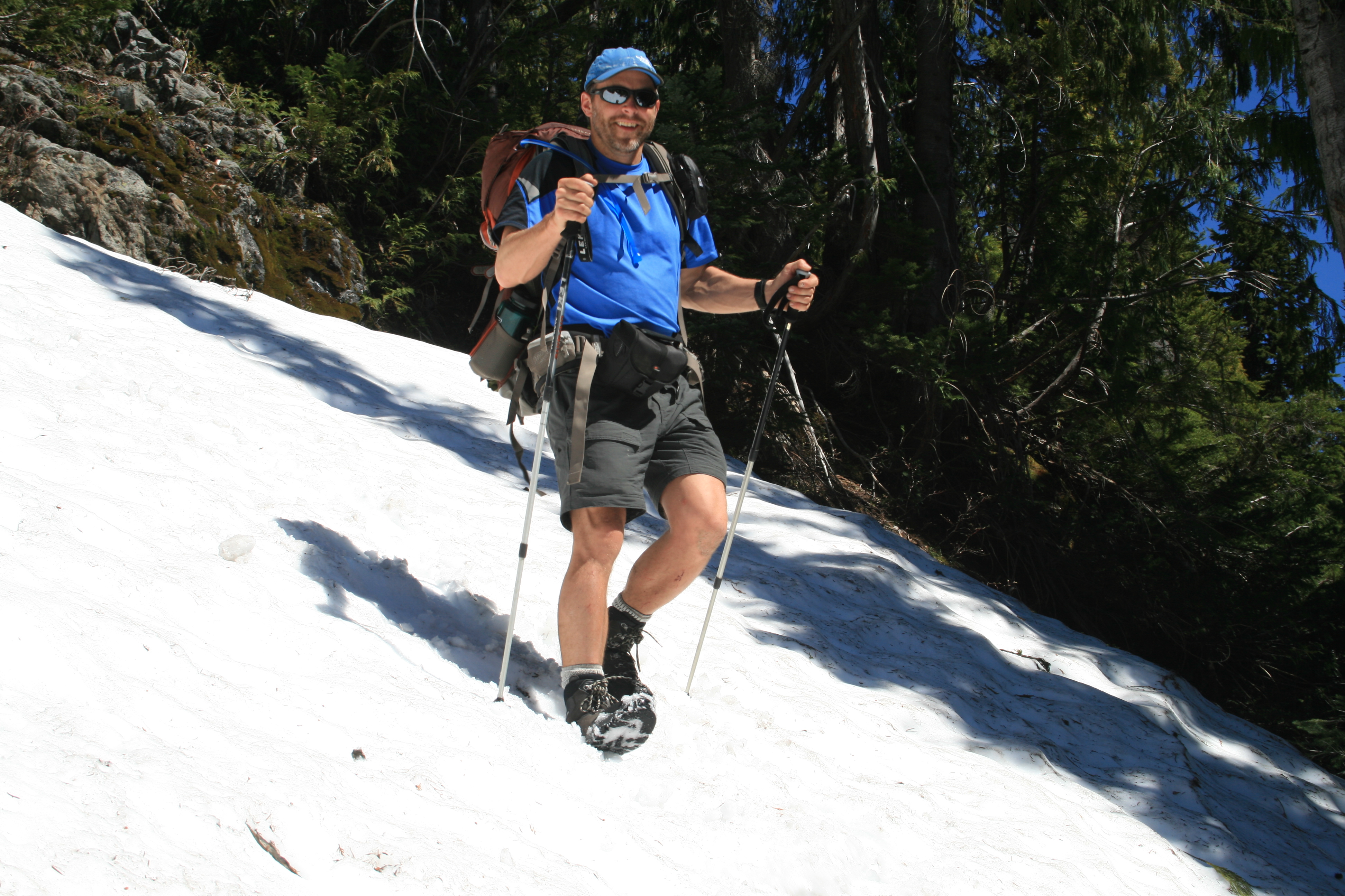
Once again, I commit what I will call here, another blunder…I’m documenting my monumental mistakes in hopes that, if I’m ever tempted again to commit to these kinds of decisions again, these words will be here as a reminder as to why they are colossally bad ideas…In infinite wisdom, I don my pair of Chaco’s sandals, since my feet can no longer take my boots, having developed blisters on both heels…Did I mention I don’t care for pain? Anyway, I remember buying these at REI, and the guy there told me that one of his customers only hikes in Chaco’s, because he no longer suffers from toe bang wearing them.
OK, sounded good at the time, and I know my feet felt much better after crossing the river wearing them…So we head for Spade lake, and the lower parts of the trail were great, relatively flat along the lake, and the trails were in good shape, but once we headed up the “goat trail” #1337 to the lake, I found out within the first 1000ft of elevation just what a bad idea it was to wear sandals on a trail like this. After several thorns, small branches, rocks, and anything else you could possibly imagine was jammed under my feet, and straps, causing more blisters to my already unhappy feet, I decided to pitch the sandals, and boot back up.
…You know, I’m getting to the point that I’m not ever going to utter these words again, for they have a tendency to come back and whack you in the face, not unlike tossing a sheet of plywood into gale force winds, and having it come back and say “hello, moron!”
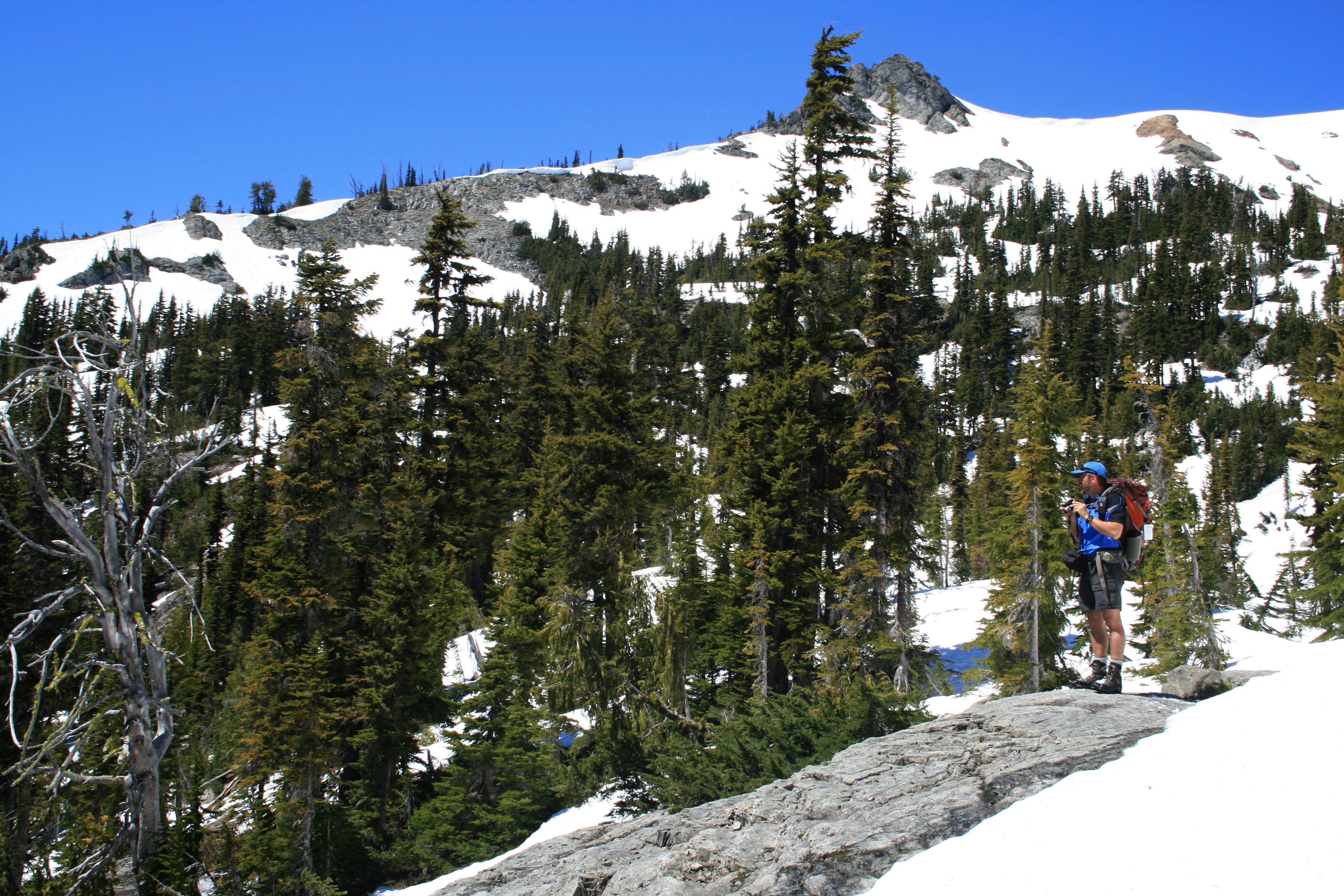
It’s just as well, because as we reached the 5100ft trail, we ran into snow again, and lost the trail. Sigh. More off trail trekking through snow and brush. But, we figured, “hey, the lake is at 5200 feet, how hard could it be?”…You know, I’m getting to the point that I’m not ever going to utter these words again, for they have a tendency to come back and whack you in the face, not unlike tossing a sheet of plywood into gale force winds, and having it come back and say “hello, moron!”
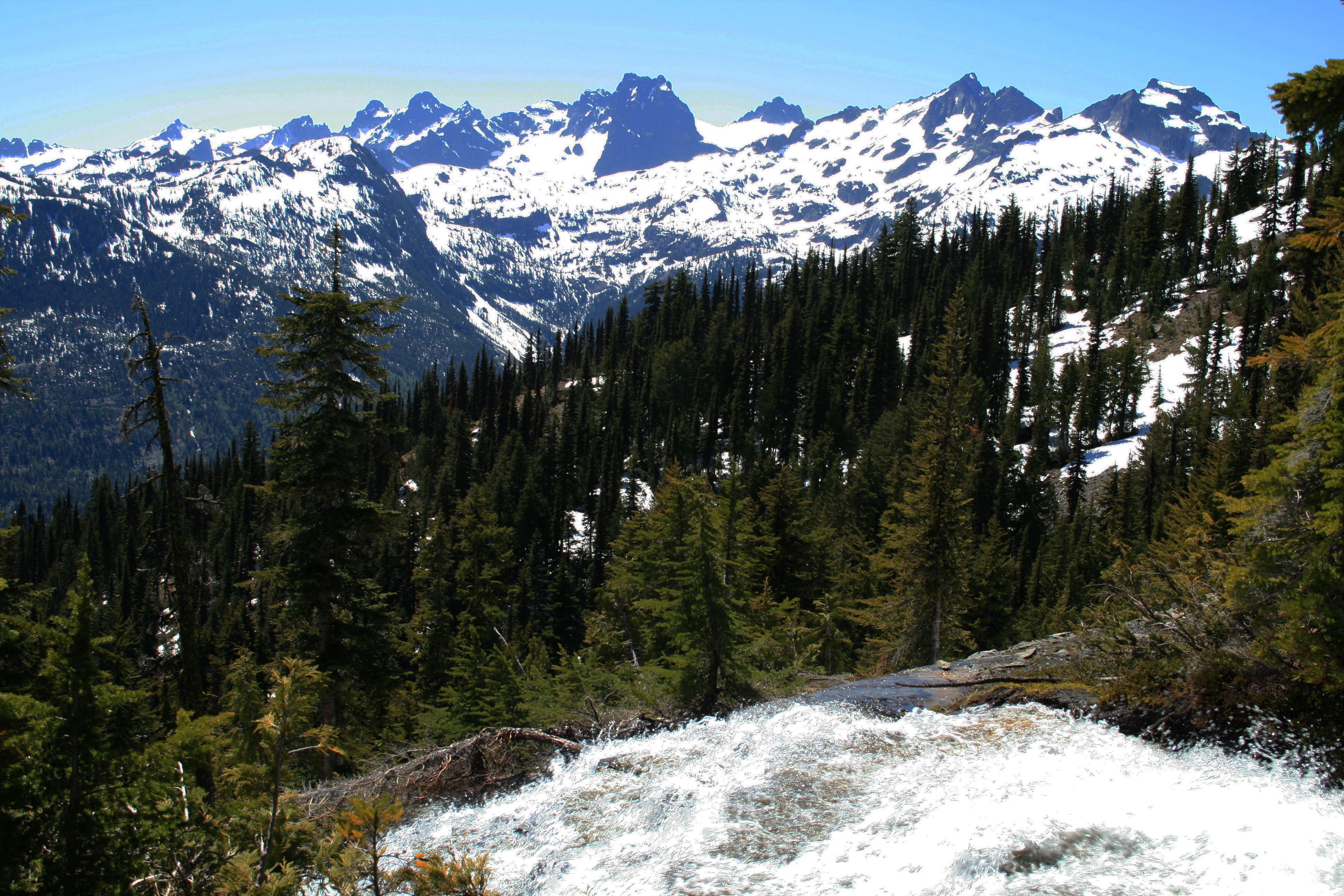
The map showed a stream coming out of the lake, and so we followed the stream uphill…To about 5600 feet, where we hit a shelf, which looked like it could be a snow covered lake…However, as we sat there, enjoying the stellar, clear views around us, the realization sunk in that we had missed the lake. No matter, it was hard to imagine the view from the lake being any better than where we were now.
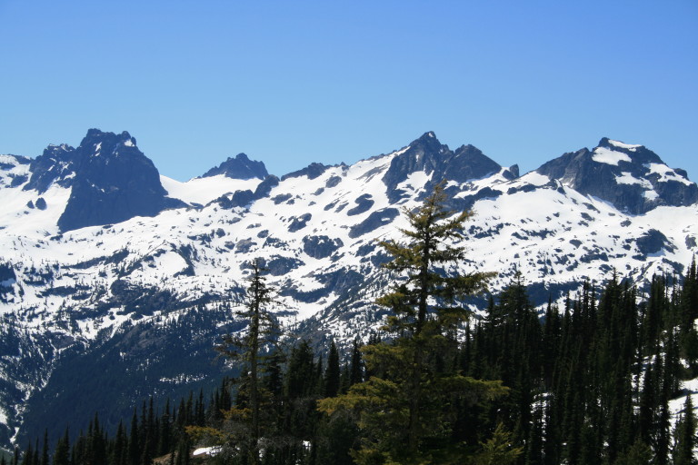
With Mount Rainier dominating the distant horizon, the rest of the mountains that we could see before from the lookout on Polallie ridge now sparkled like gems in the bright sunlight, a necklace of mountains strung out in a dazzling display. With reluctance, we headed back down the steep mountainside, carefully picking our path over rocks covered with streamlets of snowmelt runoff, and quickly softening snow.
…we counted trees that were down across the trail. At first, it was with some levity, with glee counting “one!”, “Two!” out loud. By the time we got to “Forty-eight”, it was with derision and despair…
To help pass the monotony of downhill, we counted trees that were down across the trail. At first, it was with some levity, with glee counting “one!”, “Two!” out loud. By the time we got to “Forty-eight”, it was with derision and despair… It was hot today, and by the time we had made our descent, I had drank over a gallon of fluids, and upon returning to camp, the first thing I did after removing the torture chambers from my feet, was to plunge them into the icy water, and greedily drink down another bottle of water.
We both enjoyed a quick swim in the lake, and then sunned ourselves on our own little private beach, complete with log benches to recline on in the full sun. It wasn’t long before we dried out, and repeated the process to cool off…A complete day, to be sure!